Search Results : ceredigion

Jun 252022


First published in: The Times Click here to view a map for this walk in a new window
view north along the Wales Coast Path stile on the Wales Coast Path looking downhill to the Wales Coast Path 1 looking down on Mynachdy’r Graig, ‘the monks’ house on the rocks’ crumbling cliffs beyond Ffos-lâs farm coastal pastures approaching Mynachdy’r Graig, ‘the monks’ house on the rocks’ view north along the Wales Coast Path 3 view north along the Wales Coast Path 2 looking downhill to the Wales Coast Path 2

A cool, showery day over the hills of mid Wales, but a strip of blue sky and an onshore breeze were forecast for the coast of Cardigan Bay.

Clouds like grey cannon smoke rolled across the hilltops inland of Blaenplwyf. The Friesian cattle at Rhosfawr farm stared moodily at us as we passed. One cow was wearing an e-bell on her collar, designed to warn her away from the electric fence around the pasture.

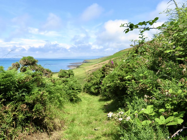
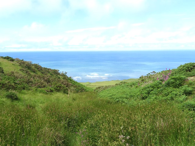
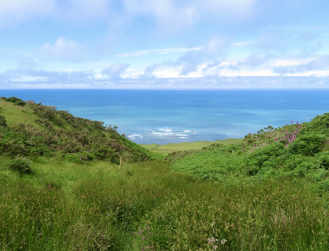
In the rushy fields approaching Pentre we spotted a hornet in the grass, its wings too soaked with the morning’s rain to allow it to fly. Two dogs came barking to the farm gate, soon retiring after making their point. We followed a stony lane over the ridge and down towards a royal blue sea.

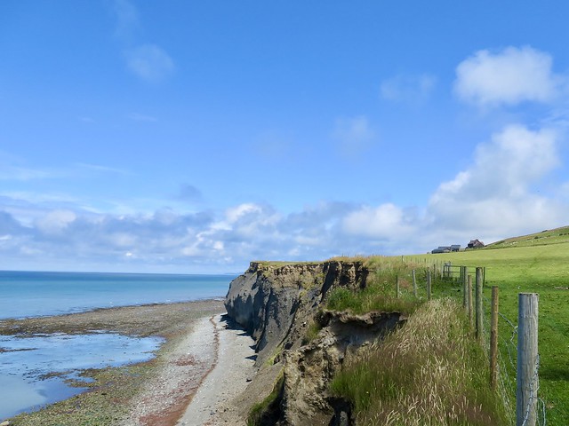
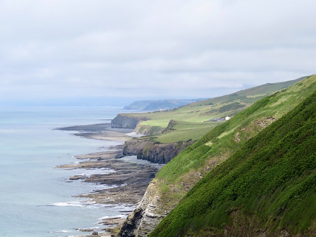
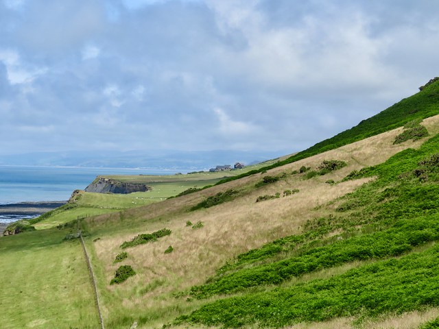
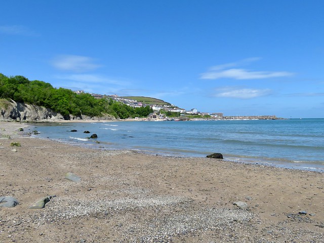
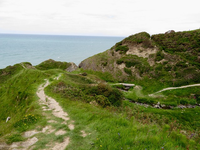
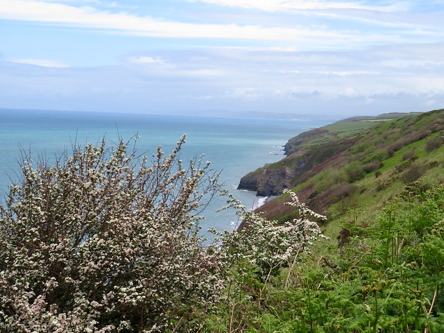
This section of the Wales Coast Path runs along cliffs of spectacular formation, undercut by the sea, bulging out in dark brittle rock topped with even more shaky clay. The string of coastal farms is threatened with ruin as the clifftops erode and crumple.

In medieval times this coast belonged to the rich and powerful Strata Florida abbey. Mynachdy’r Graig, ‘the monks’ house on the rocks’, was one of the abbey’s granges or outlying farms. Today, abandoned as a working farmhouse and less than forty metres from the ever-advancing cliff edge, its plain square dwelling and slate-roofed sheds are in the care of the National Trust.

Everything was utterly quiet and peaceful, the only sound the gentle wash of the sea on the rocky platform at the feet of the cliffs. A bevy of young choughs went cackling by, swooping like fighter planes. Outcrops beside the coast path were rock gardens of stonecrop, bell heather and wild thyme.

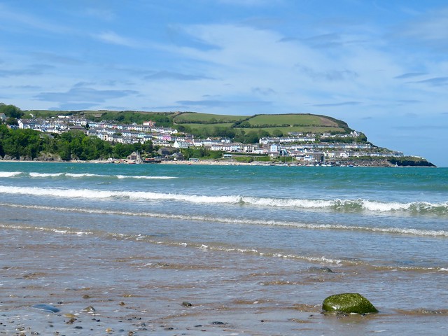
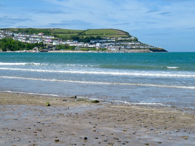
The path rose and fell for mile after mile, the cliffs and promontories of Cardigan Bay spread out from the Llŷn peninsula down to Pembrokeshire. As we stopped to admire the view, a big bird of prey came gliding by far below. Too bulky for a kite, too masterful in flight to be anything other than an osprey on a fishing expedition from its base up the coast at the Dyfi Osprey Project.

Its wingtips downturned, an arc of white feathers across its shoulders, it gave not a single flap, just cruised the wind, bigger and more powerful than anything else aloft. A most magnificent spectacle.

How hard is it? 7 miles, moderate one-way coast walk

Start: Blaenplwyf, near Aberystwyth, Ceredigion, Wales SY23 4DJ (OS ref SN 576755)
Finish: Llanrhystud, near Aberaeron SY23 5DQ (OS ref SN 539697)

Getting there: Bus T5 (Aberystwyth – Cardigan)
Road – Blaenplwyf is on A487 between Aberystwyth and Llanrhystud

Walk (OS Explorer 213): From bus stop south along A487. At end of houses, right (boulder, green cabinet) up lane. In 100m through gate on right (573754); keep right of Rhosfawr farm sheds, then right up field track to road (570755). Left; in 100m, right (stile, yellow arrow/YA) to road at Pentre (568753). Right; in 50m right up lane beside Llain Bach. In ½ mile, meet Wales Coast Path/WCP near Ffos-lâs farm (560755). Left on WCP. In 4½ miles, with caravan site in view ahead, descend long slope; through gate (535705), right (WCP) to kissing gate, then fingerpost (534703). Left off WCP here; follow YAs to Banc (539703). Down drive; in 50m right (gate, YA), anticlockwise round scrub patch to stile in corner (YA); down scrubby hillside with hedge on left. In 200m hedge turns right; left over stile in corner here (539701, YA); right down green lane to road (538699). Left to A487 and bus stop in Llanrhystud. Bus return to Blaenplwyf.

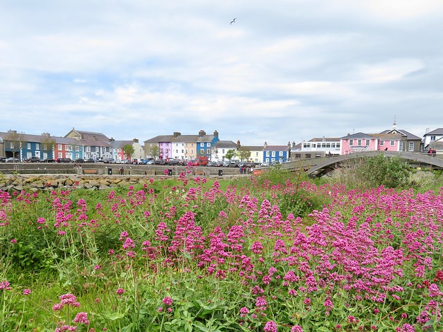
Lunch: Black Lion, Llanrhystud SY23 5DQ (01974-202338, @blacklion.llanrhystud.9) 

Accommodation: Aelybryn, Llangwyryfon, Aberystwyth SY23 4EX (01974-241744, aberystwythbedandbreakfast.co.uk)

Info: walescoastpath.gov.uk; visitwales.com; dyfiospreyproject.com
@somerville_c

 Posted by at 02:14
Sep 072019


First published in: The Times Click here to view a map for this walk in a new window
picture picture picture picture picture picture picture picture picture picture picture
Facebook Link:

We’d plotted the tides as well as we could, so it was a relief to descend New Quay’s steep streets to the harbour and find the beach section of the Wales Coast Path still passable. We skirted the slippery rock promontory that makes a barrier to walkers at high tide, and went on round the classic curve of sand that rims New Quay Bay.

Looking back from the far point, the prospect of New Quay was of parallel streets running across the lower slopes of a fine green hill. Those straight horizontal streets were once interleaved with ropewalks where cables for ships were laid and braided. The days are long gone when the little town on the southern curve of Cardigan Bay was a ship-building centre and a bustling port; these days it’s the holidaymakers who bring life and colour to these streets.

Pale grey cliffs banded with extravagantly squeezed and distorted strata formed a backdrop to the beach. Tiny fingernails of fractured shells paved the sand. Beyond the headland a stream trickled out of the woods, and we sat by the stepping stones to watch pied wagtails flitting and hovering above the water to snatch their insect feast mid-air.

Halfway along the stony beach of Little Quay Bay we found steps leading up from the shore. A glance back at the kayak paddlers in the shallows, and we climbed a shady lane through the woods. In a garden at the top lay a venerable railway carriage, now with a second lease of life as a summerhouse.

The Wales Coast Path ran through steep pastures with the sea sighing low on our left hand. Jackdaws swooped and played over the slopes, and in the woodland sections speckled wood butterflies basked on the path with open wings, milk chocolate in colour with pale lemon spots.

Ahead the great curve of Cardigan Bay was clouded and hazy, the distant finger of the Lleyn Peninsula lying on the sea like a bar of mist. Down in the cleft of Oernant a stream came sparkling down through falls and spillways it had carved in the rocks, Clumps of pink thrift and white sea campion danced alongside in the sharp wind.

Down to cross stream clefts by wooden bridges; up again to breast the next brackeny hill. Finally a view from a summit gate over Aberaeron, planned shipbuilding and trading port, laid out in Georgian elegance around its harbour on a grey stone shore. We dropped down the hill and crunched over the pebbles, making for a well-earned cup of tea.

Start: Church Road car park, New Quay, Ceredigion SA45 9PB (OS ref SN 387599)

Getting there: Bus T5 (Cardigan-Aberystwyth)
Road – New Quay is signed off A487 (Aberystwyth-Cardigan) between Llanarth and Plwmp.

Walk (6½ miles, moderate coast path, OS Explorer 198): Down Church Street to the harbour. If high tide means beach impassable, continue up Glanmor Terrace road to B4342 (388597). Left; in ¼ mile left down Brongwyn Lane (390596) to shore. If beach passable – walk round curve of New Quay Bay to the far point (405599). Continue along beach for 400m to Cei Bach road end (409597). Up steps; right up road; just past caravan park, left up drive (409595, ‘Coast Path’/CP. In 100m, left before farm building: through gate (‘CP’): follow well-marked CP along coast to Aberaeron.
Return by bus T5.

Lunch/Accommodation: Harbour Master Hotel, Pencei, Aberaeron, Ceredigion SA46 0BT (01545-570755, harbour-master.com) – stylish, friendly, bustling place.

Info: Aberaeron TIC (01545-570602, discoverceredigion.co.uk); visitwales.com; walescoastpath.gov.uk; satmap.com; ramblers.org.uk

 Posted by at 01:50