Search Results : cumbria

Aug 052017


First published in: The Times Click here to view a map for this walk in a new window
picture picture picture picture picture picture picture picture picture picture picture picture picture picture picture picture
Facebook Link:

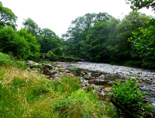
The Solway Plain, leading north to the vast tideway of the Solway Firth that separates England and Scotland, is a most extraordinary landscape. Squelching with juicy peat and water, teeming with wildlife, dotted with remote farmsteads and rimmed with giant saltmarshes, sands and mudflats, it is as lonely and windswept as any lover of wild places and enormous skies could want.

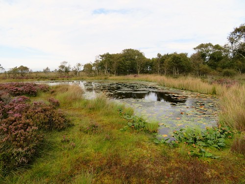
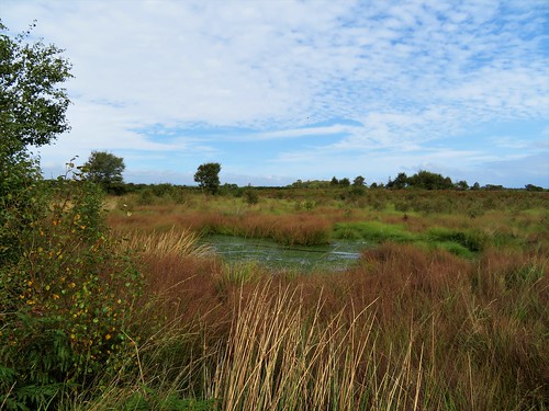
We set out from the Solway Wetlands Centre to follow the RSPB’s Red Trail around Campfield Marsh on the northern edge of the Solway Plain. Cumulus clouds blew around the blue sky like ships in a gale, and a beautiful rich smell of sun-warmed heather and spicy bog myrtle wafted to us from the moss, as Cumbrians call their bogs.

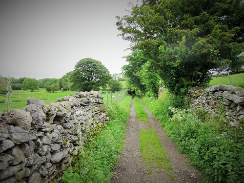
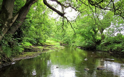
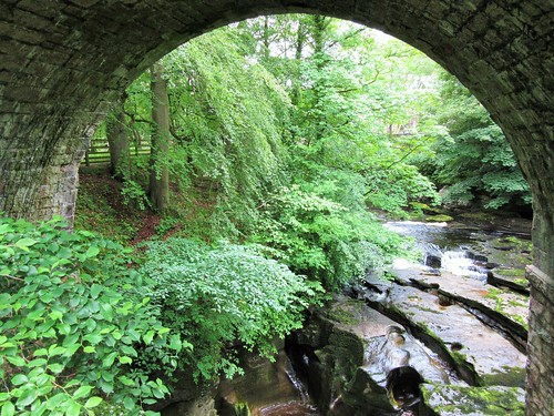
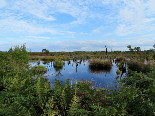
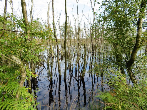
The trail led past a field of fodder radish, specially planted to attract butterflies and birds, the pink and white flowers fluttering with peacock, painted lady, large white and red admiral. Beyond the crop we traversed a piece of wet birchwood, the tree trunks rising from bog pools as still and black as looking-glass.

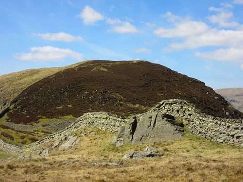
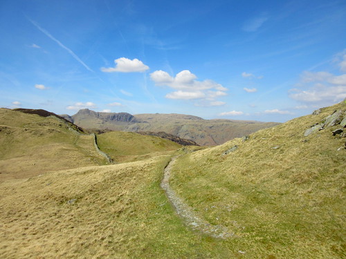
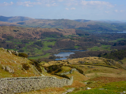
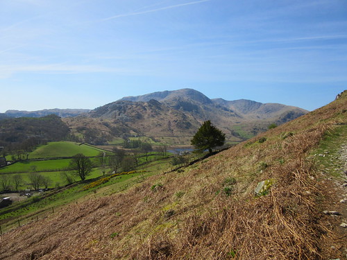
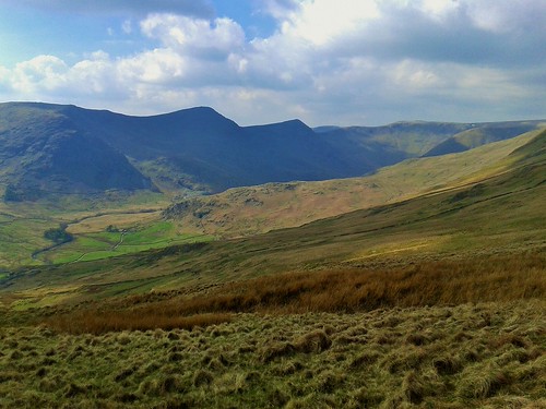
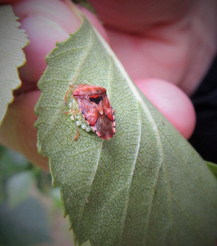
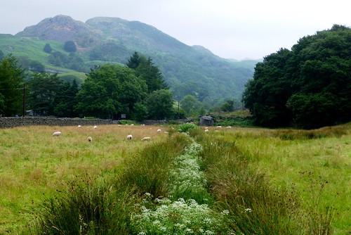
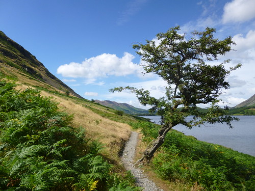
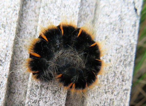
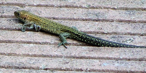
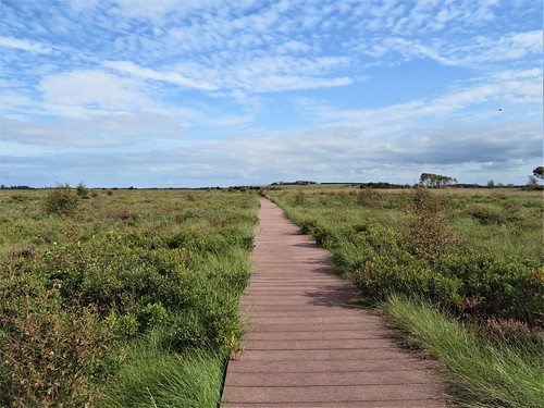
Out on the wild expanse of Bowness Common a duckboard trail led across the wet moss, aiming for the dramatic silhouettes of the Lake District’s northern fells outlined in pale grey on the southern horizon, Skiddaw rising like a king over all. Tiny green and gold lizards basked on the edge of the duckboards, flicking away and out of sight in the blink of an eye. We stopped to watch a wheatear on a post, laterally striped in brown and pale olive, its white tail flashing as it darted away across the bog.

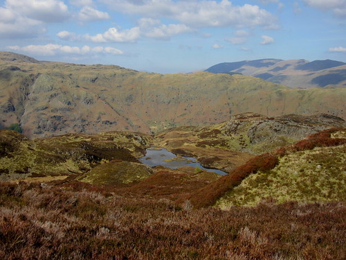
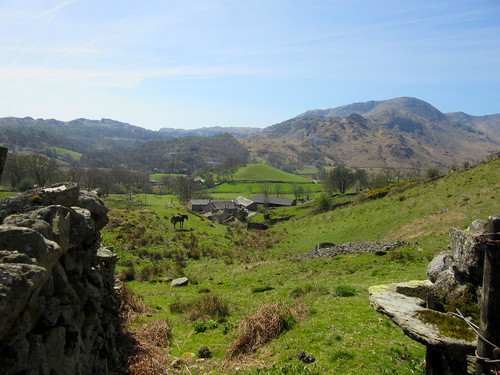
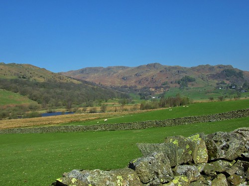
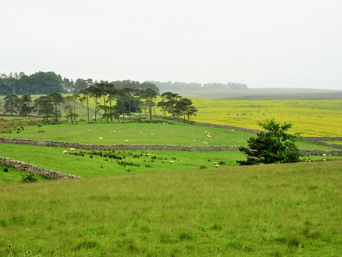
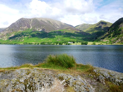
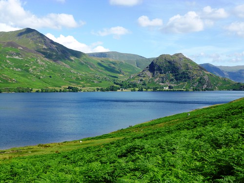
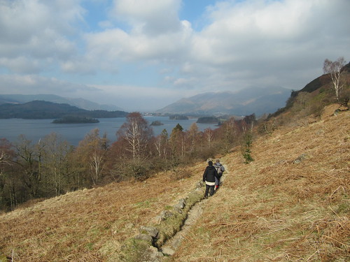
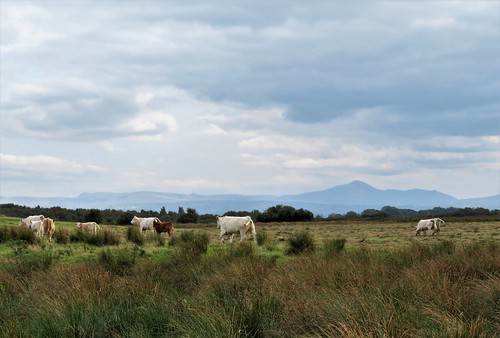
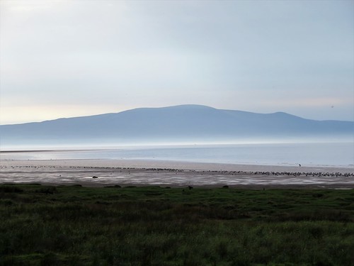
Turning off the trail, we made for the isolated farm buildings of Rogersceugh, perched conspicuously on a low drumlin mound. From here the view was sensational, out across a dozen miles of green and purple moss to the Lakeland fells, the southern Scottish hills across the Solway, and away in the east the big mountain hummock of Criffel.

Back at the Wetlands Centre, we took a stroll west along the coast road. A thousand oystercatchers stood head to wind on the strand, the fleets and sandbanks of the Solway lay in glinting lines, and across the firth Criffel rose from the Scottish shore in a stately curve, with evening light pouring from behind it.
Start: Solway Wetlands Centre, RSPB Campfield Marsh, North Plain Farm, Bowness-on-Solway, Cumbria CA7 5AG (OS ref NY 198615)

Getting there: M6 Jct 46; Bowness-on-Solway is signed from A689 western Carlisle bypass. From Bowness, minor coast road towards Cardurnock; Campfield Marsh RSPB is signposted on left in 1½ miles.

Walk (5½ miles, easy, OS Explorer 314; map/guide available at Solway Wetlands’ Centre. Online maps, more walks at christophersomerville.co.uk): From car park, walk between stone gateposts. Follow Discovery Zone path; turn right through gateway and follow Red Trail arrows clockwise. In 1⅓ miles, beside giant wooden compass carving and post with red ring (206600), turn left on boardwalk trail to Rogersceugh Farm viewpoint (214597). Back to compass carving; complete Red Trail. Through entrance onto road; left for ½ a mile to left bend for superb view across Solway Firth; return to car park.

Conditions: Boardwalk or damp grass paths; wear waterproof footwear.

Lunch: Picnic; hot drinks at Solway Wetlands Centre; or Highland Laddie PH, Glasson CA7 5DT (01697-341839; highlandladdieinnglasson.co.uk)

Accommodation: Midtown Farm, Easton, Drumburgh, Wigton CA7 5DL (01228-576550, midtown-farm.co.uk) – really friendly, excellent B&B.

Campfield Marsh RSPB Reserve (01697-351330, rspb.org.uk/campfieldmarsh) Always open. Solway Wetlands Centre open daily 10-4; manned at weekends.

visitengland.com; satmap.com; ramblers.org.uk

The January Man – A Year of Walking Britain by Christopher Somerville (Doubleday, £14.99).

 Posted by at 01:00
Mar 252017


First published in: The Times Click here to view a map for this walk in a new window
picture picture picture picture picture picture picture picture picture picture picture picture picture picture
Facebook Link:

The little sloping market town of Alston lies among the North Pennine hills. Stone-walled lanes lead away from the town across the fells, and I found one to follow southwards along the eastern flank of the River South Tyne.

In front of me jolted the postie in his red van, delivering letters to a string of farmsteads. At Fairhill, farmyard ducks waddled among superannuated tractors. The immensely solid walls of the house and byre at Annat Walls betrayed their origins as a pair of bastles, fortified farmhouses built when this was a lawless countryside where folk lived in fear of robbery and murder. The view today was a sublime Pennine prospect, down sheep pasture to the river, up the green inbye fields of the far slopes, squared off with a wriggle of stone walls, then further up to rough moor slopes with the dimples and velvet nap of former lead mining sites.

Big grey rain clouds were jostling up from the west. They sat fatly on the hilltops and glowered down, threatening an afternoon deluge. I got a hustle on, hurrying across the mossy cleft of Nattrass Gill and past Bleagate and Low Sillyhall, where the fellsides had been newly planted with thousands of trees – oak, rowan, hawthorn and alder. By contrast, conical lead-mine heaps stood like miniature alps above the empty house and byres of Low Craig.

The tiny settlement of Garrigill, tucked in round its village green, was once a loud and lively lead mining centre. Later it became a hub for walkers on the Pennine Way National Trail. Last time I was in Garrigill, the George and Dragon Inn had been bursting at the seams with wet, hungry and peat-plastered hikers. I was one myself, having got horribly lost in a pea-soup mist on the heights of Cross Fell.

Today, hardly a bird stirred in beautiful little Garrigill. The pub had given up the ghost. So where were all the walkers? ‘Too many trails to choose from nowadays,’ said the village postmaster. ‘The old Pennine Way’s a bit rough for most of ’em, you see.’

I fancied a bit of rough, as it happened. So I followed the old Pennine Way through quiet sheep pastures beside the River South Tyne back to Alston, with wind and rain and sunbursts competing to chase me all the way.

Start: Alston Market Place, Alston, Cumbria CA9 3HS (OS ref NY 719465)

Getting there: Bus 681 (Hexham-Haltwhistle-Alston).
Road – Alston is at junction of A686 and A689, signed from A69 (Newcastle-Carlisle)

Walk (8¾ miles, easy underfoot, OS Explorer OL31): Downhill, and follow A686 (Penrith). Just before river bridge, left (717462, ‘Pennine Way’/PW) through stile, up steps. Right (PW); in 200m, left (green arrow) up through cemetery and walled lane. Right at top (720460) along lane for 1 mile, following yellow arrows/YA past Fairhill (720456) and Annat Walls (720451) to High Nest drive (720444). Left to road; right to Bleagate (717437). Left through gate (PW); along wall; in next field aim for Low Sillyhall. At PW fingerpost (720433) fork left through gate (‘footpath to Garrigill’). Follow YAs. After 2nd stile, in 3rd field YA points right through wall (722432); don’t follow this, but keep wall on right. Follow YAs for 1¼ miles by Low Craig (727428) and burn crossing (737423) to road (740422). Right to Garrigill; right at village green; follow minor road out of Garrigill. In 500m, right (740418, PW); follow well-marked PW for 3¾ miles back to Alston.

Lunch: Picnic and flask

Accommodation: Alston House Hotel, Townfoot, Alston CA9 3RN (01434-382200, alstonhousehotel.co.uk)

Info: Alston TIC (01434-382244)

The January Man – A Year of Walking Britain by Christopher Somerville (Doubleday, £14.99).

visitengland.com; satmap.com; ramblers.org.uk

 Posted by at 01:38
Apr 302016


First published in: The Times Click here to view a map for this walk in a new window
picture picture picture picture picture picture picture picture picture picture picture picture picture picture picture picture picture picture picture picture picture picture picture picture
Facebook Link:

A beautiful day of blue sky over the Lake District, and Elterwater was already stirring with walkers as we climbed away up the stony old cart track that goes over from Great to Little Langdale. A big old pine by the track held out its branches like a cormorant drying its wings. Ahead the fells over Little Langdale Tarn rose as crinkled as old men’s faces, an ancient landscape looking sharp in the sunlight.

We turned off up a steep fellside path, snaking up the rocks of Bield Crag. A holly and a juniper clung together to a crack in the rocks, blown back on themselves by the winds of a century into a graceful concavity. At the top a stone wall rode the crest boldly and purposefully, a Lakeland Hadrian’s Wall that roller-coastered over crags and into gullies, leading us westward unerringly.

We sat on the short turf of Lingmoor to savour the absolute silence – absolute except for bee hum and wind whistle, the snick! snick! of a Herdwick ewe’s teeth in the grass, and the rattle and rush of a raven’s wings overhead as it flipped upside down and upright again in a joyful display.

At the cairn on Brown How a breath-stopping view opened northwards across the cleft of Mickleden to the Langdale Pikes, three-headed and magnificent, with the tiny crescent of a paraglider swooping round Loft Crag. Down beyond the summit we found the faintest of sheep paths running back east, suddenly cresting a shoulder to deposit us on the shore of lonely Lingmoor Tarn. The stems of horsetails and water lilies pimpled the surface of this beautiful little lake, and three tiny silver birches grew out of one of the flat circular islets.

A place to linger all afternoon, really. But shadows were beginning to lengthen. Back on the ridge path we scrambled down beside the dark cliffs of Side Pike, and got down to the Old Dungeon Ghyll Hotel just in time to catch the bus back to Elterwater in a crowd of reeking, tired but happy hikers.

Start: Elterwater car park, Elterwater, near Grasmere, Cumbria, LA22 9HP (OS ref NY 328048)

Getting there: Bus 516 (Ambleside-Dungeon Ghyll)
Road – B5343 from Skelwith Bridge (A593, Ambleside-Coniston)

Walk (5½ miles, strenuous, OS Explorers OL6, OL7. NB: online maps, more walks at christophersomerville.co.uk): Left across bridge. In 200m, opposite Eltermere Hotel, right (327045, ‘Coniston, Cycle Route 37’). In 200m, fork left (‘Little Langdale’ fingerpost) up stony track. In ½ mile, pass public bridleway on right, then through gate (321041). In ¼ mile, pass reservoir on right; in 100m, right through gate (318039) up fellside path. After nearly ½ mile, reach a col with little cairn (314041). Don’t turn left or right; keep ahead over col (cairns). Bear left on path parallel with wall, sometimes 100m away. In about half a mile wall bends right and becomes fence – follow it to summit of Brown How (302046).

Continue along ridge beside fence/wall. In 500m fence turns left and stops (299050); but continue on path beside wall parallel with ridge for ¼ mile to angle of two walls (297052). Detour – a faint path runs right from here and curves ESE for 500m to Lingmoor Tarn. Main walk: At angle of walls, left over stile; continue with wall on right. Just before wall meets cliff face of Side Pike, turn left (294053) and descend. Near road, right over stile/fence. Path runs parallel with road; then (288052) down fellside; through successive belts of trees to campsite car park (286058). Left to road; right to bus stop on B5343 (286060) with Old Dungeon Ghyll Hotel beyond.

Return to Elterwater by Bus 516.

Conditions: Rough and rocky underfoot, some short steep climbs – hill-walking clothing and boots.

Lunch: Picnic; or Old Dungeon Ghyll Hotel (01539-437272, odg.co.uk)

Accommodation: Eltermere Inn, Elterwater, Ambleside, Cumbria, Postcode (01539-437207, eltermere.co.uk) – comfortable hotel, fantastic views.

Information: Ambleside TIC (01539-432582)

visitengland.com; satmap.com; ramblers.org.uk

 Posted by at 07:22
Oct 032015


First published in: The Times Click here to view a map for this walk in a new window
picture picture picture picture picture picture picture picture picture picture picture picture picture picture picture picture
Facebook Link:

Looking back from the old fell path from Kentmere over to Long Sleddale, the Kentmere Valley on this gorgeous clear morning looked almost too good to be true. Church, houses and scattered farms lay in a dale bottom so richly and uniformly green it might have been stroked there with a painter’s brush.

A farmer went bouncing down the fields on her quad, shouting ‘C’m-aan!’ to the madly bleating sheep chasing her trailer with its load of feed. Near the crest of the path we were following, a tiny just-born black Herdwick lamb wobbled on splayed legs, sniffing along its mother’s blue-grey body to locate the bulging udder that awaited it.

We found the steep upward path to Wray Crag and set our boots to it, pushing upwards under lark song that poured out from invisible singers overhead. Wray Crag came and went. Up on Shipman Knotts beyond we sat to catch our breath, looking east to the long back of Sleddale Fell and a gleam of Windermere down in the south-west.

Now the rocks and crags gave way to a smooth saddle of moor grass, the dark stain of the path leading on and up the long nape of Kentmere Pike to the summit cairn at 730 metres. Up here the wind blew strong and cold. We huddled down and gazed our fill at the westward view – Coniston Old Man and Windermere, Great End and Bowfell beyond the breaking wave of Ill Bell – just about level with us now – and a shoulder of Helvellyn crusted with snow.

A long descent over bogs and crags, down to Hallow Bank and the walled and cobbled lane back to Green Quarter. We chatted with a farmer looking over the wall at his sheep – tales of winter storms, lost lambs, and ewes completely covered by snowdrifts. ‘We’d 40 lambs indoors being bottle fed,’ he said, ‘and 40 ewes looking for ’em once the snow went! But we got ’em all matched,’ and he smiled with satisfaction as though it had only happened yesterday.

Start: Green Quarter, Kentmere, near Staveley, Cumbria postcode (OS ref NY 461040)

Getting there: Staveley is signed off A591 (Windermere-Kendal). Follow road to Kentmere. Just before village, right (‘Hallow Bank, Green Quarter’). Limited parking at Green Quarter (4-car space on left just before triangular green). If none available, park in Kentmere and walk to Green Quarter.

Walk (6½ miles, strenuous, OS Explorer OL7): From triangular green, right up lane (‘Longsleddale’). At Old Forge gate, right through gate (yellow arrow, ‘Longsleddale’). Bear left; through gate at wall angle; follow track (public right of way) across fields NE for 1 mile. Through kissing gate (476050) onto Hallow Bank-Sadgill track. Left through gate; right up track, following wall on right steeply uphill northwards for 1¼ miles over Wray Crag (473054) and Shipman Knotts (472062) to ladder stile across wall (472067). From here, clear path up Kentmere Pike (fence soon coming in on right) to summit cairn (465078).

Return in poor weather/mist – back the way you came. Otherwise – return to where wall meets fence on left (468075). Fork a little right away from ascent path, following clear path. Cross ladder stile 250m NW of ascent stile (470069). Follow path (sometimes faint, but well trodden) SSW downhill for 1 mile to farm lane gate at Hallow Bank (466055). Through gate, down track; in 50m, left through gateway beside parking area; fork right down stony track. In 200m cross stream; next right (465052, ‘Mardale’), down road, through gate, and on to where farm buildings are in front of you. Bear left (not sharp left) past barn and on downhill. Track bends left; don’t bear right through gate (463053), but keep ahead along Low Lane. In ⅔ mile join road (461044); right to Green Quarter.

Conditions: A moderately hard fell walk; appropriate clothing and boots recommended.

Lunch: Picnic

Wainwright Book 2 – The Far Eastern Fells (Frances Lincoln)

Accommodation: Eagle & Child, Staveley, LA8 9LP (01539-821320; eaglechildinn.co.uk) – very cheerful, walker-friendly inn.

Information: Kendal TIC (01539-735891); golakes.co.uk

satmap.com; ramblers.org.uk; visitengland.com

 Posted by at 01:34
Jan 102015


First published in: The Times Click here to view a map for this walk in a new window
picture picture picture picture picture picture picture picture picture picture picture picture picture picture
Facebook Link:
We set off from Kirkby Stephen in a cheerful crowd – Heather and David Pitt, authors of splendidly illustrated walking books; Ann Sandell and Andy Bryan of Kirkby Stephen’s ‘Walkers Are Welcome’ scheme; and Chris and David Stewart, begetters of thousands of walks through their website walkingworld.com, along with their Parson Russell terrier Brough. It’s a lucky district that can boast such movers and shakers in the walking world.

Kirkby Stephen, a lively market town in eastern Cumbria where six walking trails meet, lies in fabulous hiking country carved by the River Eden and its tributary becks into dozens of fells and dales.

Today’s walk was a taster of the paths that surround the town itself. First off, a leisurely circuit of the Poetry Path with its hand-carved verses created ten years ago by poet Meg Peacocke and lettering artist Pip Hall. It was wonderful to see the rocks, stones and boulders carrying Meg’s pungent lines, ending with December’s haiku carved on three rock slabs beside the River Eden:

‘There sails the heron
Drawing behind him a long
Wake of solitude.’

Then we struck out westwards across the steeply dipping fields among mossy stone walls and staring sheep. The long, rising backs of the fells shouldered up into low cloud. A muted grey-green light lay over the land. We followed lanes narrowly walled in, talking of walking – the Pitts’ retracing of Alfred Wainwright’s long foot pilgrimages, the Stewarts’ amassing of vast numbers of expeditions on foot for less supercharged walkers to enjoy. What a splendour of walks these clouded hills contain, everyone agreed: a treasure-house to be unlocked with simple keys of GPS and internet, map and shoe leather.

We stopped to picnic by the Settle & Carlisle railway line. Brough turned up his nose at ginger parkin and Wensleydale cheese. After trying without success to dig his way to Australia, he settled for lying down and looking noble.

On the way back to Kirkby Stephen we found a red-brown shield bug in a bubble-bath of pale green eggs, a flock of sheep chin-deep in a golden wash of buttercups, a bulbous-bellied oak half a millennium old, and an emperor moth whose wings were camouflaged with the semblance of a scary, staring monster face. Not to mention the gold-and-blue parrots that flew up from the river as we approached Frank’s Bridge. Every day marvels, there for the looking in every field and holloway.

Start: Upper Eden Visitor Centre, Kirkby Stephen, Cumbria, CA17 4QN (OS NY 775087)

Getting there: Rail (thetrainline.com) to Kirkby Stephen (station 2 miles from town)
Bus – Service 563 (Penrith, Appleby)
Road – M6 Jct 38; A685 towards Brough

Walk (6 miles, easy, OS Explorer OL19): Walk south along A685. In 600m, right down alley beside No 2 (773082); left at end (‘Coast to Coast/CTC, Greenriggs’). Skirt Greenriggs farmyard (765078, arrows) and on. In 2nd field beyond farm, aim for far right corner (757075); follow CTC path to right to cross under railway (754074). Half right to field corner; bear right to road (749073). Left for 200m to T-jct; left for ¾ mile to A685 (757062).

Left; in 150m, right down A683. In 100 m, left (758061, ‘Nateby’). In 300m dogleg left and right through Easegill Head farmyard (761062). Through yard gate; bear right to gate in wall; across field and under railway (764062). Down field edge; in 300m, left across stile; down past lime kiln ruin and through gate to left of plantation (768066). At track, right; in 200m, left through gate (770064) to cross footbridge. Left round field edge; through kissing gate (772065, blue arrow/BA) and follow line of crags that trend away from the river. Up between fences to gate (BA); ahead to gate (BA) into green lane to B6259 (774069) in Nateby. Left; in 100m, fork right on walled lane (‘Bridleway’; ‘Pennine Journey’). In 450m path crosses disused railway (776074 – NB Poetry Path circuit can be made from here); in 450m ignore gate on left (778078, BA), and keep ahead for ¼ mile to descend to cross beck (780082). Follow River Eden along field edge; at field end, left (779087) on path to Frank’s Bridge (776087) and Kirkby Stephen.

Lunch: Nateby Inn, Nateby (01768-371588, nateby-inn.co.uk); many cafés/pubs in Kirkby Stephen.

Accommodation: King’s Head, Ravenstonedale, Kirkby Stephen, CA17 4NH (01539-623050, kings-head.com) – really comfortable, excellent stopover.

Poetry Path: Booklet guide available from Upper Eden Visitor Centre

Information: Upper Eden Visitor Centre (01768-371199); penninejourney.org.uk, walkeden.org, walkingworld.com

www.satmap.com; ramblers.org.uk; LogMyTrip.co.uk

 Posted by at 01:51
Jul 122014
 

The tiny narrow-gauge Ravenglass & Eskdale steam railway, known to all as ‘Ratty’, winds its way up from Ravenglass on the Cumbrian coast deep into Eskdale in the western flanks of the Lake District.
First published in: The Times Click here to view a map for this walk in a new window
picture picture picture picture picture picture picture picture
Facebook Link:
On a damp, steamy morning we set out from the Boot Inn to piece together three of the walks in Alfred Wainwright’s little booklet, ‘Walks from Ratty’, and make a good day in the hills.

St Catherine’s Church lay low and dusky pink beside the River Esk. In the churchyard we paid our respects to Tommy Dobson, Master of Eskdale and Ennerdale Foxhounds for 53 years until his death in 1910. His carved stone likeness, radiating humour and pugnacity, looked out from the graveslab, flanked by the heads of a fox and a hound.

We followed the glassy Esk through miniature gorges and past rocky rapids where grey wagtails bobbed rhythmically on the water-sculpted boulders, up to the graceful old packhorse span of Doctor Bridge. Above the nearby Woolpack Inn a gate led onto the brackeny hillside. High above, we found Eel Tarn spread under mats of water lilies and ruffles of wind – one of the quietest and loveliest spots in Lakeland.

The path led on over a wide upland of marshy ground and bracken. A pale smoky light lay on Eskdale. Ahead, Eskdale Fell hid its face in cloud. We squelched over wet ground full of golden stars of bog asphodel, and cross loud little Whillan Beck to come to Burnmoor Tarn, a steely oval in a hollow under great fells. We stripped off and went in, sliding over the pebbles into water full of peat-flecks, warm and silky on the skin.

We swam in lonely delight, before dressing on the tarn bank and making our way back down the old corpse road to Boot. Eskdale’s hay meadows gleamed pale green, and the shouts and whistles of the farmer at Gill Bank, busy training a young dog to muster the sheep, came faintly up to us from the fields around the farm.

Start: Dalegarth station, Ravenglass & Eskdale Railway, CA18 1TF (OS ref NY 174007)

Getting there: Rail – mainline service to Ravenglass (thetrainline.com); Ravenglass & Eskdale Railway (01229-717171; ravenglass-railway.co.uk) to Dalegarth station.

Road – Boot is signposted from Eskdale Green (minor roads from A595 at Duddon Bridge or Holmrook).

Walk (7 miles, moderate, OS Explorer OL6. NB: Online map, more walks at christophersomerville.co.uk): From Dalegarth station, left along road. At Brook House Inn (126008), right (‘St Catherine’s’) on stony lane to Eskdale Church (176003). Left along River Esk to Doctor Bridge (189007) and road (189009). Right for 200m; left before Woolpack Inn (yellow arrow, ‘Burnmoor, Wasdale Head’). Up track behind house, through gate (190011); up path through bracken with wall close on left. At gate/ladder stile (189014; ‘Boot, Woolpack’) don’t cross; continue uphill, leaving wall on left. By ruined house (188015) bear right and head north. Above house cross bog; bear right and go anti-clockwise round knoll, and on north. Skirt round left side of Eel Tarn (188019); right along north shore; at far side bear left/north (189021) towards Eskdale Fell, passing 2 lone trees. Cross Brockshaw Beck (190027); keep left of rock outcrops; descend to cross Lambford Bridge (188038). Bear right to Burnmoor Tarn (186043). Follow path back past (but not across) Lambford Bridge, down to Boot and Dalegarth Station.

Lunch/Accommodation: Boot Inn, Eskdale, CA19 1TG (01946-723711; bootinneskdale.co.uk); also Brook House Inn (01946-723288; brookhouseinn.co.uk), Woolpack Inn (01946-723230; woolpack.co.uk)

‘Walks from Ratty’ by A Wainwright – available from ‘Ratty”, £3

Info: Ravenglass TIC (01229-717278)
www.satmap.com www.LogMyTrip.co.uk visitengland.com

 Posted by at 01:39
Dec 212013
 

A warm and muggy morning in Borrowdale, with low cloud brushing the hilltops and the weatherman muttering of downpours and thunderstorms.
First published in: The Times Click here to view a map for this walk in a new window
picture picture picture picture picture picture picture picture picture picture picture picture picture picture picture picture
Facebook Link:

The side dale of Langstrath was full of the bleating of Herdwick sheep, white-faced with blue-grey coats, the black-coated and black-muzzled lambs stolidly chewing alongside their dams.

From the fellside above Stonethwaite we climbed steeply away through oakwoods, the stepped and stone-flagged path rising under trees mottled with gleams of sunshine, rags of blue and smears of grey sailing overhead among the branches. Willygrass Gill tinkled and rustled down a narrow channel of gleaming black rocks, the water falling in a succession of leaps, jumps and pauses for reflection in still pools. We sat to watch a jay hopping from branch to branch, roguish in chestnut, black and white with a flash of blue – a handsome and swaggering buccaneer of a bird.

At the treeline the view opened tremendously, a stand-and-gasp moment – the steep converging clefts of Greenup Gill and Langstrath under their twin crowns of Eagle Crag and Heron Crag, and away in the west the enormous eroded cliffs that hang ominously over Honister Hause and its slate mine workings, the old tramway running straight as a die up the hill behind and the road snaking steeply down into Borrowdale.

Dock Tarn lies sheltered in a ring of little craggy hills. The water lily blooms were out, white crowns scattered on green mats of leaves. The tarn lay perfectly still, emitting a faint shimmer as the wind crumpled the wavelets around a rocky islet crowned with a handful of rowans.

You could stay all day in such a place, searching for frogs and orchids, dreaming your dreams. Eventually the stony path called us on, through a pass and down over a broad rushy upland, gold-spotted with bog asphodel and heavy with the scent of wet peat and sun-warmed bog myrtle. We came down to Watendlath Farm along the shore of Watendlath Tarn where families were swimming and picnicking. We could have murdered a cuppa there, but the cosy-looking tearoom was cash only, no cards. Hellfire and damnation!

A rough and rocky old bridleway leads over from Watendlath to Borrowdale, with classic lakeland views ahead over the green meadows of the flat-bottomed dale to the heights of the Borrowdale Fells. Down in Rosthwaite, before setting back to Stonethwaite, we looked into the Royal Oak. I did my first ever Lake District walks from this little inn when I was fifteen. My boots bit into my heels, I was sulky with my Dad and sore-legged each morning, but it instilled a love of these enchanting hills that has never gone away.

Start: Langstrath Hotel, Stonethwaite, Borrowdale, Cumbria CA12 5XG (OS ref NY 263137)

Getting there: Stonethwaite is signed off B5289 Borrowdale road just south of Rosthwaite (Arriva Bus Service 77, 78).

Walk (6 miles, moderate/hard, OS Explorer OL4. NB: online map, more walks at christophersomerville.co.uk): From Langstrath Hotel, right along road. Right (‘Greenup Edge’) across beck; right (‘Greenup Edge’); in 200m, left (265137, post with yellow arrow) up slope. Cross stone stile in wall (268136); very steeply up through woods, then across moorland to Dock Tarn (274143). Continue north on good stony track for 1½ miles to Watendlath (274163). Right across bridge to tearoom, or left (‘Rosthwaite’), following signs to Rosthwaite. At bridge (259150), right into village, or forward (‘Stonethwaite’) to Stonethwaite.

NB – steep climb through woods below Dock Tarn!

Lunch/Accommodation: Watendlath tearoom (cash only!); Langstrath Hotel, Stonethwaite (01768-777239; thelangstrath.com) – lively, friendly country inn

Information: Keswick TIC (01768-772645)

www.ramblers.org.uk www.satmap.com www.LogMyTrip.co.uk visitengland.com

 Posted by at 07:40
Aug 312013
 

‘A grand hill in a beautiful situation with a character all its own and an arresting outline,’ says Alfred Wainwright of the fierce dark pyramid called Mellbreak.
First published in: The Times Click here to view a map for this walk in a new window
picture picture picture picture picture picture picture picture picture picture picture picture picture picture picture picture
Facebook Link:

That neatly sums up this formidable-looking but actually quite manageable hill that lowers like a grumpy, humped-backed monster over the western side of the long narrow lake of Crummock Water. Setting out from the Kirkstile Inn, the northern face of Mellbreak looked so dark, sheer and forbidding that we wondered how on earth we were to get up there. But once we’d reached the slippery screes that fan out down the mountain, it was easy enough – a bit of zig-zag, a lot of hard breathing and upwards effort, and we were standing proud at the northern summit cairn, 1300 feet higher and a lot sweatier than an hour before.

The view from the 1,668-ft northern peak of Mellbreak must be one of the best anywhere in the Lake District – back over Loweswater and north as far as the misty spread of the Solway Firth and the grey humps of Scotland’s Galloway hills; east across Crummock Water to the pink screes of towering Grasmoor; north to the great mountain spine of Red Pike, High Stile and High Crag; west to the long green ridge of Hen Comb and Loweswater Fell rising across the deep, unpopulated valley of Mosedale.

A steep, skeltering path dropped us into Mosedale. Down there a green track skirted the western flank of Mellbreak in wonderful isolation and silence. If Mosedale ever had farms, fields and folk, they are long forgotten. Here were swathes of bog grazed by Herdwick sheep, and watery dells full of orchids, sundews and flowering sedges, all caught in a cradle of shapely fells. ‘Dreary and wet’ was Wainwright’s sour summing-up of Mosedale. The Master wasn’t always right, was he?

Down on Crummock Water we turned north along the lake shore. What were the islet of Low Ling Crag and its tiny tombola beach of grey shaley stones created for, if not for swimming in the cool lake water on a hot summer afternoon? That’s what we did, and went on homeward with renewed springs to our heels.

On the grass verge outside the Kirkstile Inn sat a man with muddy hiking boots, a glass of beer and a very contented smile. ‘Oh,’ he winked as we went by, ‘it’s shocking, this is! Wish I was at work!’

Start: Kirkstile Inn, Loweswater, Cumbria CA13 0RU (OS ref NY 141209)

Getting there: Kirkstile Inn is signed from the Loweswater road, off B5289 (Buttermere-Cockermouth). Enquire at inn about local parking – official car parks at Maggie’s Bridge (134210) and Scalehill Bridge (149215).

Walk (6 miles, hard, OS Explorer OL4): From Kirkstile Inn fork right off left bend; immediately right (‘No Through Road’). Country lane south for ½ mile past Kirkgate farm. At gate, lane curves right (139202); ahead uphill between trees. On open fell, keep ahead to bottom of scree (141199). Bear left; zigzag up (steep, skiddy!) to north summit of Mellbreak (143195). Ahead into dip. In 500m path bears right to a fork, 50m before rock outcrop on main path (145190) Fork right here on faint path, steeply down to track in Mosedale (141186). Turn left (south) for 900m, to pass metal gate. Shortly afterwards track curves left and follows the lower line of the bracken; keep ahead here (144178), aiming for curved peak of Red Pike. In 350m, go through gate in fence on bank (146175); descend to turn left along track by Black Beck (146174). Pass 3 footbridges (152174; 155175; 156178) but don’t cross any of them. On reaching Crummock Water, bear left (north). Nearing north end of lake, in 1¼ miles, branch left (149197) up path through bracken which bisects angle with stone wall ahead. Reaching wall (148199), follow it to Highpark Farm. Turn right through gate in wall (145202); left through gate; on along stony lane. Cross Park Bridge (145205); fork left to Kirkstile Inn.

Refreshments: Kirkstile Inn (01900-85219; kirkstile.com)

Dinner/Accommodation: Bridge Hotel, Buttermere CA13 9UZ (01768-770252; bridge-hotel.com) – friendly, well-run family hotel

Guidebook: Family Walks In The Lake District by A Wainwright/Tom Holman, pub. Frances Lincoln

Info: Keswick TIC (01768-772645); lakedistrict.gov.uk
www.ramblers.org.uk www.satmap.com www.LogMyTrip.co.uk

 Posted by at 01:00
Dec 012012
 

On a still morning of clearing skies over east Cumbria, the fields around Lupton lay quiet and green, soaked in overnight rain.First published in: The Times Click here to view a map for this walk in a new window
picture picture picture picture picture picture picture picture picture picture picture picture picture picture picture picture
Facebook Link:
A shepherd was calling a high-pitched summons from Newbiggin Crags. We watched his flock with their nosebands of white wool scampering towards him up the dark gorsy flank of the big limestone hill that overlooks the valley.

Beyond the chattering ford of Lupton Beck we climbed a steep track into the Access Land of Newbiggin Crags. The limestone pavement of this gently domed upland is cracked into deep grykes or channels, interspersed with naked clints of palely grey rock as rough to the touch as elephant hide. We followed an old quarry track up beside a stone wall with grand views spreading on all sides – north to the green shoulder of Scout Hill, west to Whitbarrow and the fells of south Lakeland, east towards the bulky hills of the north Pennines, and south-west to a gleam of Morecambe Bay with Black Combe hanging over it like a recumbent giant.

You’re a bit of a fool if you rush past a prospect like this. We sat to admire it under a misshapen holly in a rock garden of pin mosses and crusty, pale green lichens. Then we followed a flock of meadow pipits, swooping ahead with thin little squeaks, down into a broad, breezy upland of grass where a pair of shepherds fed their sheep as their dogs circled warily – a scene from the Hungarian plains rather than anything particularly English in character.

Newbiggin Crags form one of a pair of limestone domes. Hutton Roof Crags rise immediately to the south, a sprawling hill with a dwarf forest of juniper bushes clothing its northern flank. We pinched the hard green juniper berries as we climbed, but they were holding back their gin-and-tonic scent for a summer season.

Two free-climbers were scaling the block-like cliffs of The Rakes as we went past and down through Blasterfoot Gap towards the neat grey line of Hutton Roof village. The homeward path led through a bluebell wood, past Pickle and Sealford farms, and back by square-built old Lupton Tower and across the Lupton Beck meadows, where tiny black-legged lambs in plastic thermal macs went tottering and bleating after their newly-delivered mothers.

START: Plough Inn, Lupton, Nr Kirkby Lonsdale LA6 1PJ (OS ref SD 554812)

GETTING THERE: M6, Jct 36; A65 towards Kirkby Lonsdale; Plough Inn on A65 in 1½ miles.

WALK (7 miles, moderate, OS Explorer OL7. NB: Detailed directions (highly recommended!), online maps, more walks: christophersomerville.co.uk):
From Plough Inn, right (Kirkby Lonsdale direction) for 50m; right (‘Lupton Beck’) down track to cross beck (552809). Stony lane to Puddlemire Lane (547809). Cross road; diagonally right up track by stone wall. In 150m, stony lane hairpins back to left from track (546809); climb steep path that bisects these two, to meet old quarry track (545809). Left for ½ mile to meet stone wall (548803); right uphill by wall for 300m to meet crossing wall; left through gate (546800). Follow grassy track south, then SW, keeping crags on your right, for ⅔ mile to meet wall again (548793). Bear left downhill with wall on right for ⅓ mile to meet Limestone Link (LL) footpath just before road, at gate on right (549789).

Left along LL to cross road (552789; ‘Hutton Roof’ fingerpost). Follow path (it diverges to right from LL) up over Hutton Roof Crags for 1¼ miles, descending Blasterfoot Crags to rejoin LL on outskirts of Hutton Roof village at crossing of tracks beside house marked ‘1874’ over the door (569784). Turn left uphill on LL, along wall past house. In 250m, right over stile (568785; yellow arrow/YA), through wood to lane by church (569788). Right to crossroads with road sign.

Through gate opposite; bear half left across field to Pickle farmhouse (571791). Left through gates (YAs); right along drive. Through gate by house, on over ladder stile (YA). Descend to Sealford Lane at Sealford Farm (573794). Over stile opposite (‘Lupton Bridge’ fingerpost; YA); bear left across field parallel to stream at bottom (crossing sheep wire halfway if in place). Keep curving left to cross stile by tree in far top corner of field (571798; YA). Cross next field, aiming for Badger Gate Farm; on by stiles and gates (YAs) to road by farm (565801). Right across bridge, follow road to Greenlane End. At sharp right bend (561806), left for 100m; right through stile (fingerpost) and follow YAs across fields to footbridge over Lupton Beck (552809). Right up lane to Plough Inn.

CONDITIONS: Paths can be muddy/slippery, especially on limestone pavement of crags.

REFRESHMENTS/ACCOMMODATION: Plough Inn, Lupton (01539-567700; theploughatlupton.co.uk) – comfortable, relaxed and welcoming.

INFORMATION: Kendal TIC (01539-735891); golakes.co.uk
www.ramblers.org.uk www.satmap.com www.LogMyTrip.co.uk

 Posted by at 01:56
Feb 252012
 

I hadn’t seen Fi since we were trainee teachers together, down in Somerset when Noah was a lad, but her energy and spirit were instantly familiar when we met up at Keswick’s Theatre by the Lake.
First published in: The Times Click here to view a map for this walk in a new window
picture picture picture picture picture picture picture picture
Facebook Link:
What a day for walking, as cold as anything, with high cloud over the Lake District and lemon-yellow sunlight streaming across the crumpled faces of Skiddaw and Blencathra. It was wonderful to be kicking up showers of leaves in Cockshot and Castlehead Woods like teenagers, chattering away as you do when you have a few decades to catch up on.

Up by Springs Farm the chaffinches were trying out short explosive phrases in the silver birch coppice. A stony lane led us up beside a loud little stream with the big dark bulge of Walla Crag looming ahead, its crown feathery with larches. “An eminence of intermingled rocks and trees,’ pronounced Wainwright (Book 3) in my hand, ‘of moderate elevation, yet steep, romantic, challenging.’ We passed Rakefoot Farm, its chimneys pushing up columns of woodsmoke behind a screen of leafless sycamores, and turned uphill and out onto the open fellside leading up towards Walla Crag. A ‘braided path’ as Fi described it, an in-and-out tangle of footways beside the wall, with a sensational view spreading behind us northward towards hollow-shouldered Blencathra and the rising waves of the Skiddaw range, the sun picking out the monoliths of Castlerigg stone circle in the foreground.

‘Dear thoughts are in my mind
And my soul soars enchanted,
As I hear the sweet lark sing
In the clear air of the day.’

So sang Fi as we crunched the ice in the puddles and followed the braided path along the edge of the crag. A quick stop in a sheltered hollow out of the clear (but bloody cold) air for oatcakes and mango chunks, and we were at the summit cairn admiring the deep glacial scratches in the rocks and looking out over the islands and bays of Derwent Water. Clouds went marching through the valleys beyond, but all the tops to the west were clear.

On along the escarpment with an incomparable view southward towards the jostling hills enclosing Borrowdale, the peaks of Great Gable, Scafell Pike and Glaramara dipping in and out of the cloud sea like so many dark topsails. Then a steep skelter down the fellside among juniper bushes, and we turned back along the stumbly path under Falcon Crag. It was a vigorous, noisy walk back to Keswick along the lake-shore with white horses pawing at the little pebbly bays, and a rising wind roaring in the pines and shivering the water of ditches jellied with frogspawn as if to blow the last of the winter clean away.

Start: Lakeside car park, Keswick, Cumbria CA12 5DJ (NY 265229)
Travel: Bus 554 (Carlisle), 555 and 556 (Lancaster, Carlisle) to Keswick (www.stagecoachbus.com);
Road: M6 to Jct 40, A66 to Keswick

Walk directions: (6½ miles; moderate; Explorer 0L4): Past theatre to lake; left; in 100 m, left (fingerpost) along path. Over path crossing, up through Cockshot Wood. Cross field, then B5289 (269226). Bear left, fork immediately right uphill. Up and over Castlehead Wood; path to road (272229). Right, past Springs Farm; follow signed path through Springs Wood (‘Castlerigg, Walla Crag’). In ½ mile, left over footbridge (283222) to road. Right; at Rakefoot fork right; follow path (‘Walla Crag’) over footbridge and steeply up beside wall. Near top, wall is broken by railings; right through gate here, left along crags to summit cairn (277213). Continue for 150 m; stile through wall; don’t turn right along wall, but head ‘inland’ on path heading for Bleaberry Fell. In 300 m, bear right across beck on path along edge of escarpment. Follow this over Falcon Crag for ⅔ mile to meet wall (272198). Right downhill to gate; right along path towards Keswick for ¾ mile. At wall of Great Wood (271210), right uphill; left on footbridge across beck and fork left downhill on woodland path. In 200 m, ahead over path crossing. Continue to car park (272214); follow slip road down to cross B5289; down steps; follow path. In 50 m, left at footbridge to lake shore (270213); right along shore path for 1½ miles to car park.
NB: Online maps, more walks: www.christophersomerville.co.uk

Lunch: Picnic; or Stalls Bar, Theatre by the Lake (01768-772282)
Accommodation: Littlefield, 32 Eskin Street, Keswick CA12 4DG (01768-772949; www.littlefield-keswick.co.uk) – quiet, welcoming, walker-friendly.
Guidebook: Wainwright’s Pictorial Guide to the Lakeland Fells, Book 3 (Frances Lincoln)
Information: Keswick TIC (01768-772645); www.golakes.co.uk)
www.ramblers.org.uk www.satmap.com www.LogMyTrip.co.uk

 Posted by at 01:47