Search Results : dorset

Nov 042023


First published in: The Times Click here to view a map for this walk in a new window
rustic waymark on the lane to Fishpond Bottom old crab apple tree, Lambert's Castle view over the Vale of Marshwood The Vale of Marshwood 1 The Vale of Marshwood 2 Holloway from Roughmoor ford Beechmast crunchers at Roughmoor

A grey and blowy day across the Dorset coast and the deep-sunk Vale of Marshwood. Up at Lambert’s Castle the beeches thrashed and hissed, shedding their leaves downwind like flocks of birds.

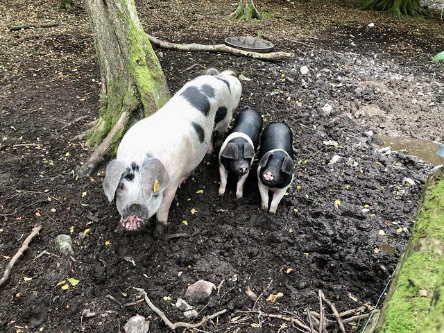
A steep path took me down the fields to Roughmoor, where a sow and her three pink-and-black piglets were blissfully crunching up the beechmast fallen from the trees. They snorted and grunted and raised their snouts hopefully as I leaned on their fence, but I had nothing in my pockets to add relish to their feast.

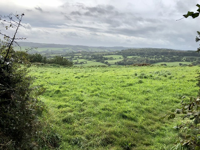
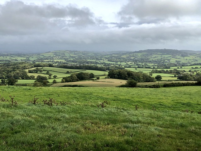
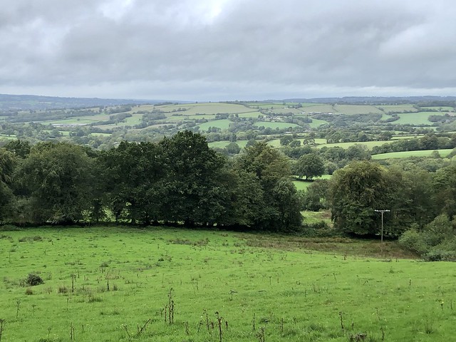
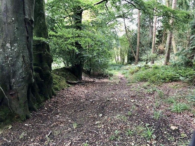
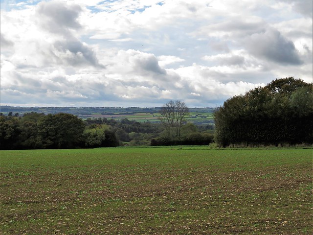
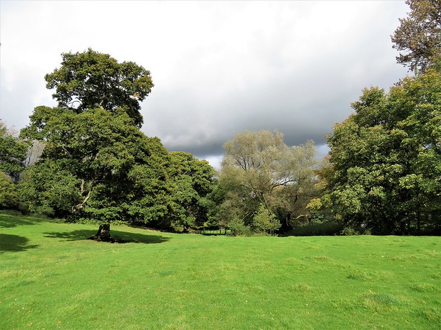
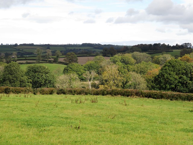
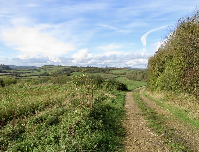
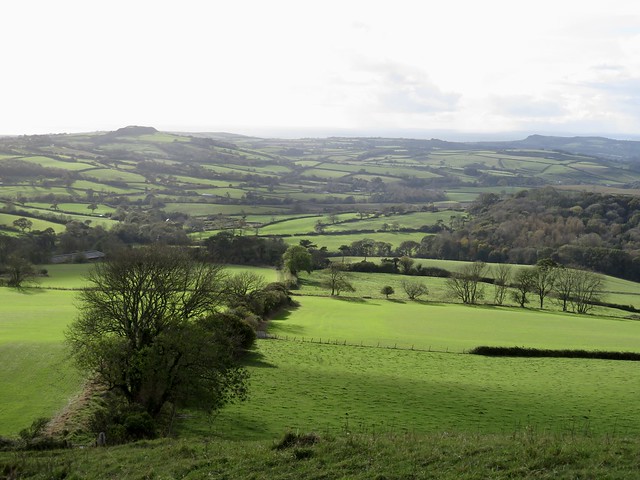
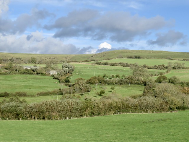
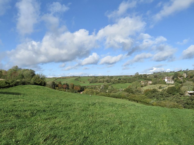
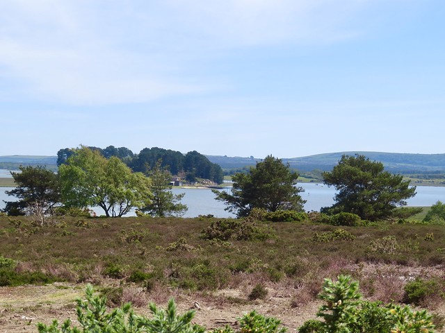
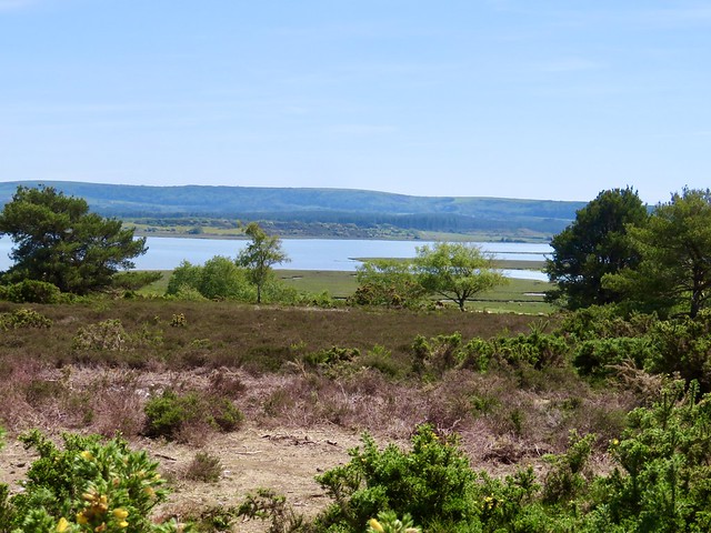
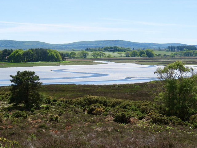
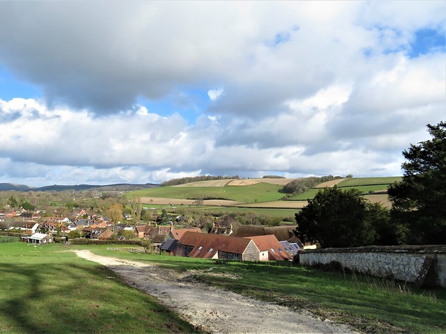
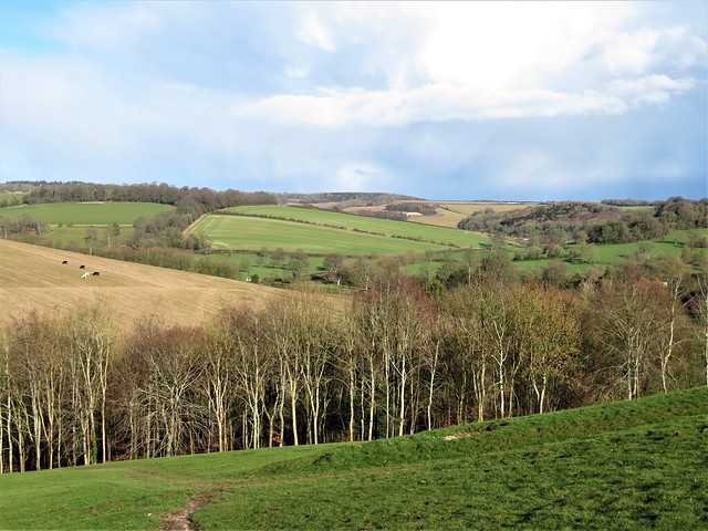
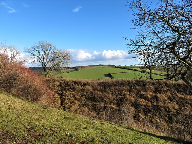
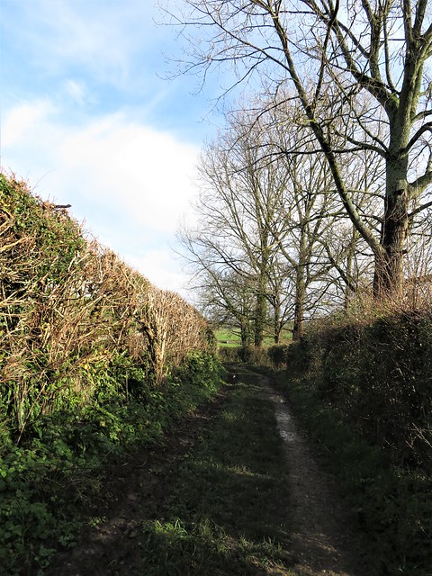
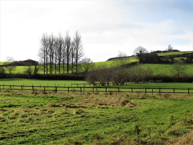
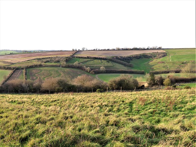
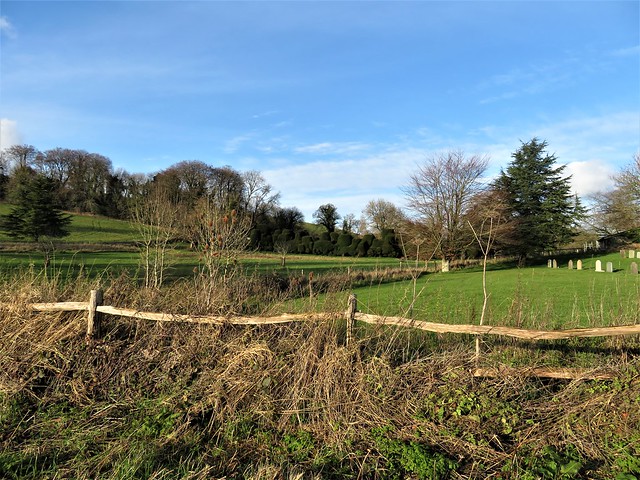
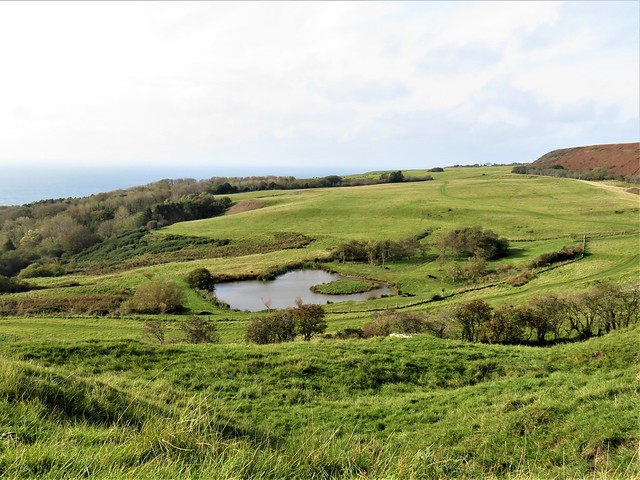
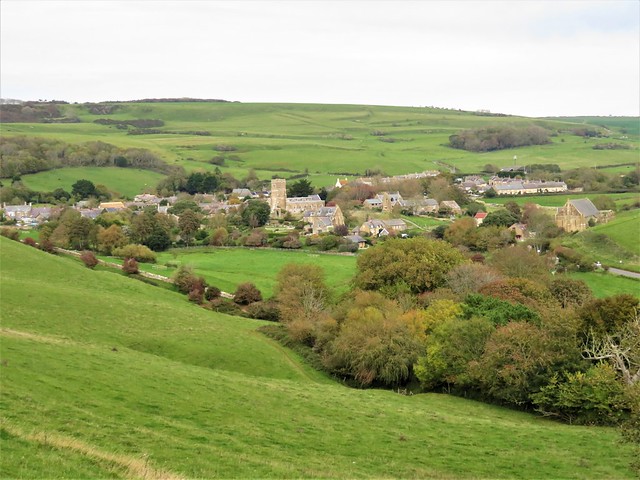
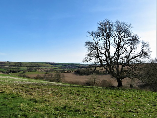
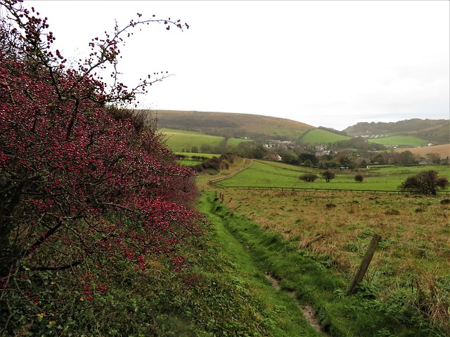
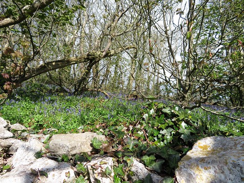
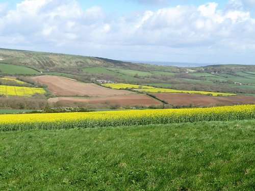
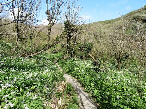
Marshwood gives the impression of great depth and remoteness, a green mosaic of woodland and sloping pastures that Thomas Hardy would recognise today. At Roughmoor Cottage a splashy ford led to a holloway rustling with bracken and hart’s tongue ferns.

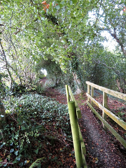
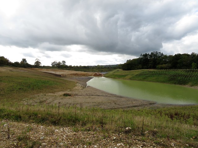
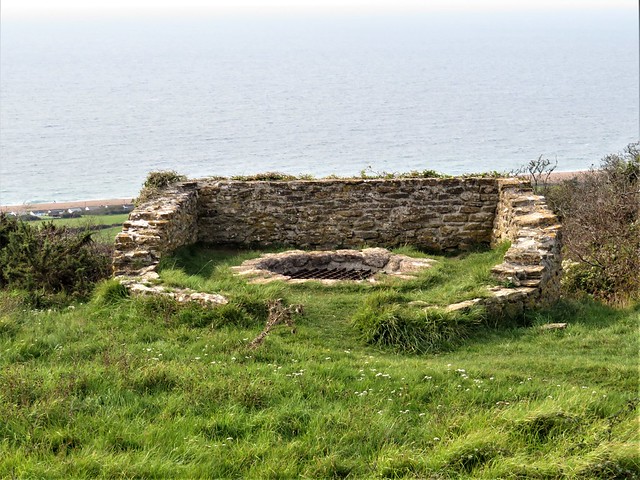
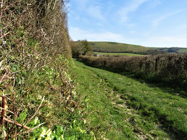
Up at Higher Stonebarrow the wind roared in the beeches that held the hedge-banks together with the grip of their root tangles. A basso profundo moan came from the high tension cables that crossed the valley. But once down in the squelchy green lane beyond Sheepwash Farm I was walking far beneath the rumpus of the gale. At the ford below Little Coombe the swollen stream gushed freely among horsetails and filled my boots, one of the myriad waters that once filled the carp pools dug by medieval monks at Fishpond Bottom.

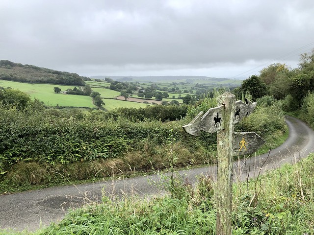
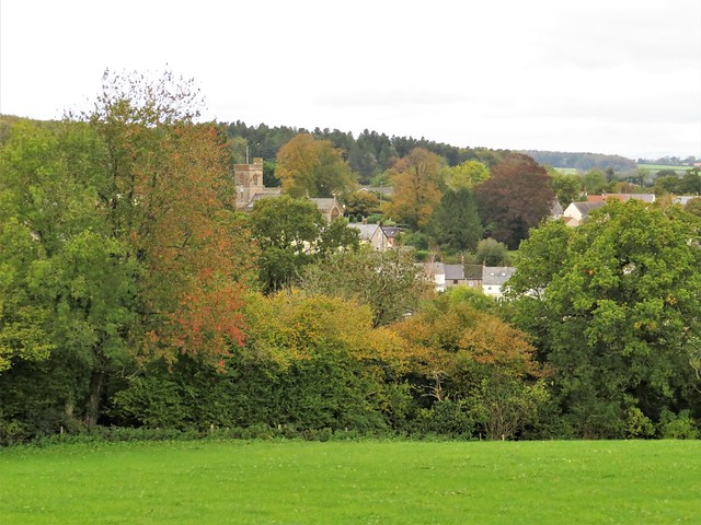
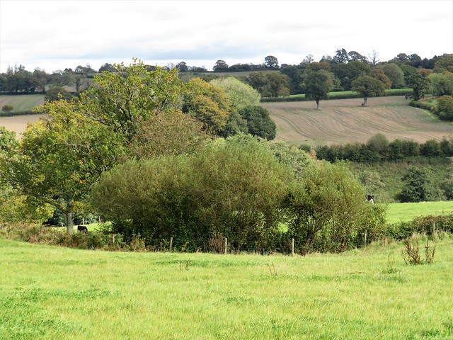
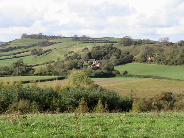
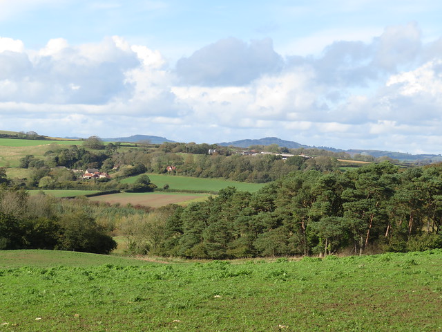
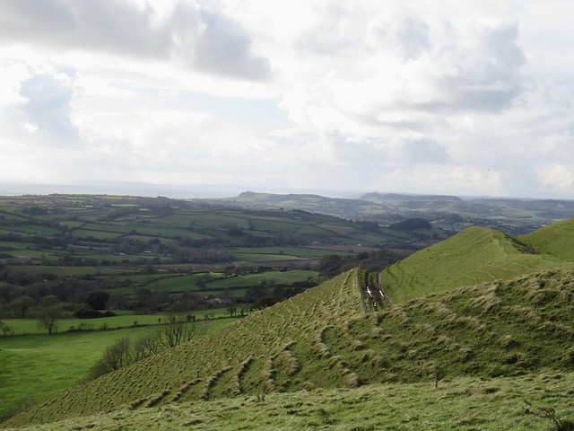
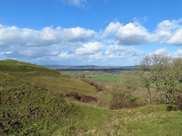
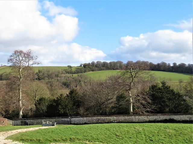
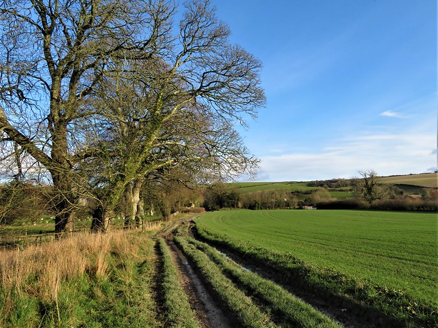
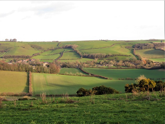
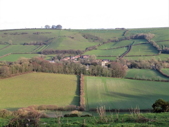
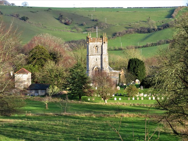
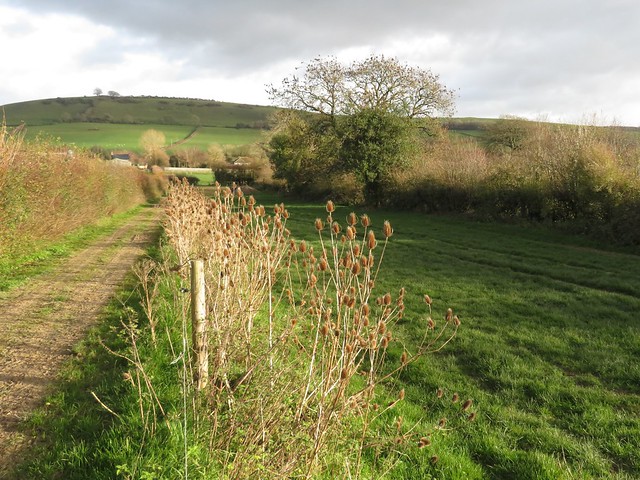
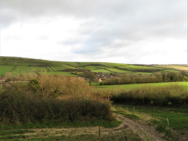
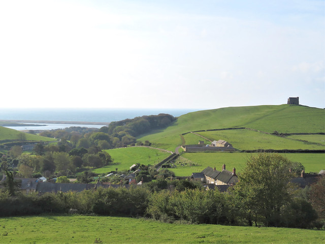
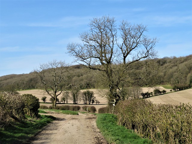
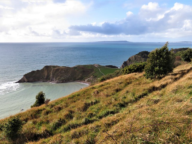
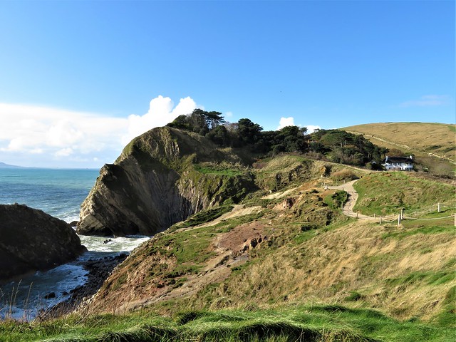
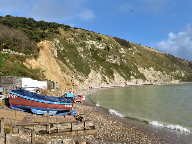
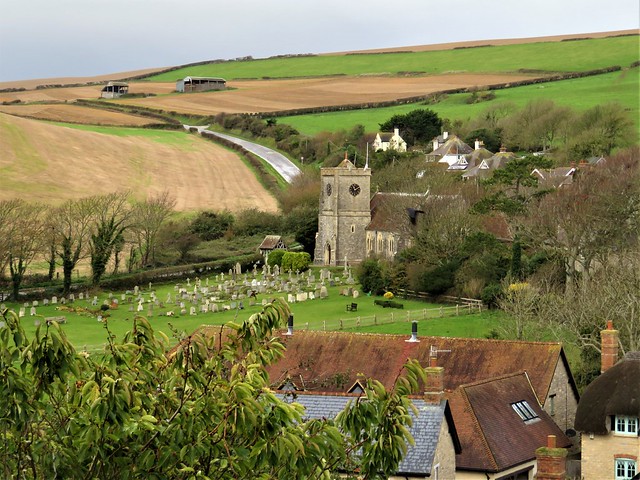
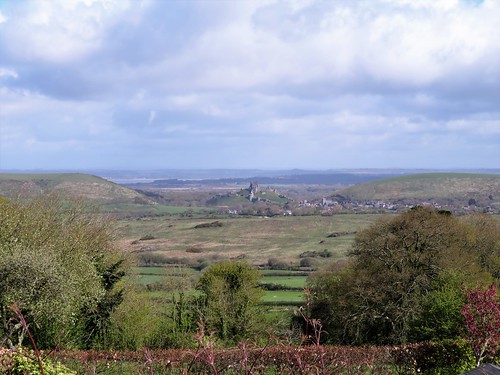
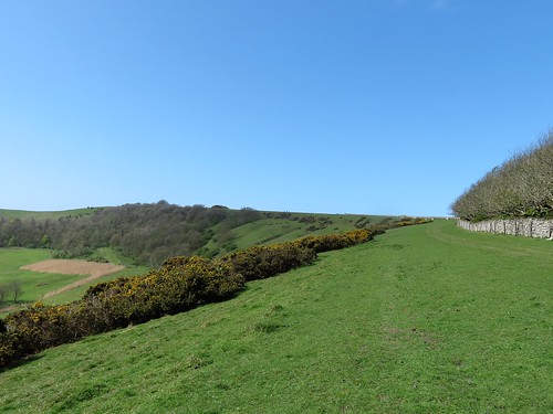
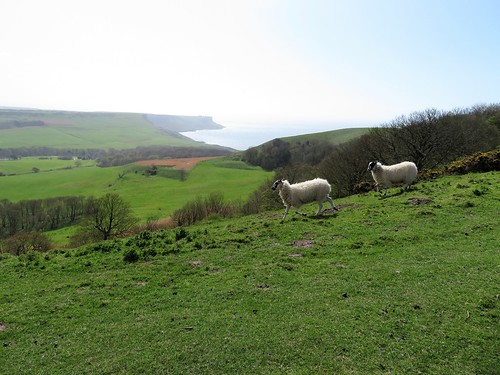
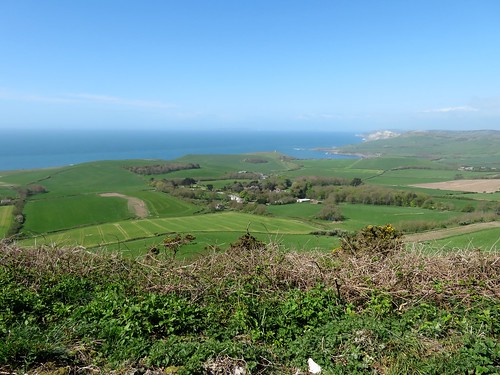
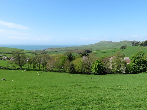
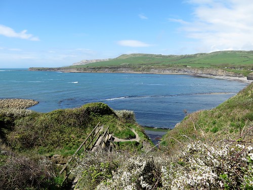
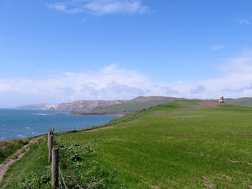
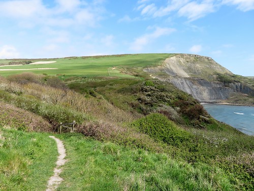
A network of old cart tracks threads through Marshwood Vale. I saw no-one as I followed the sunken path to Little Combe and Great Combe, isolated farmsteads on green slopes under the grey sky. A glimpse of the roofs of Charmouth lining their cliff gap to the south with a wedge of wind-whitened sea beyond. Then I turned up straggling Long Lane to cross the earthworks of Coney’s Castle.

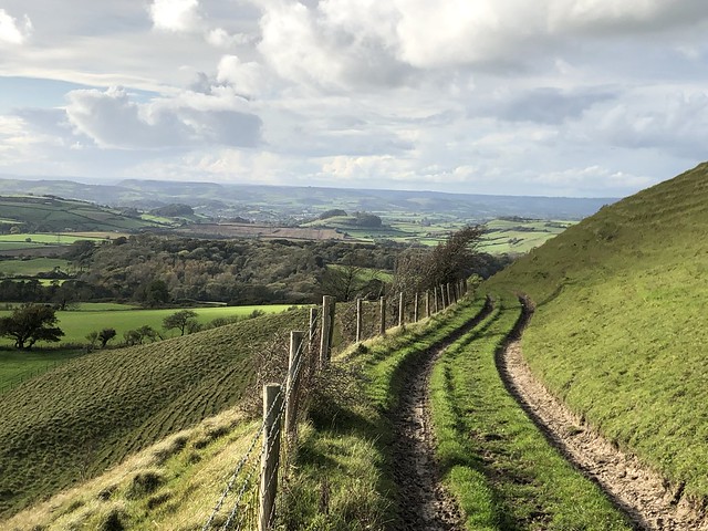
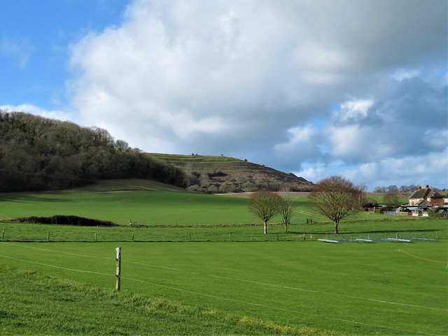
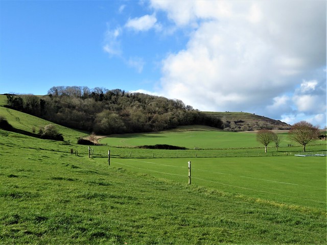
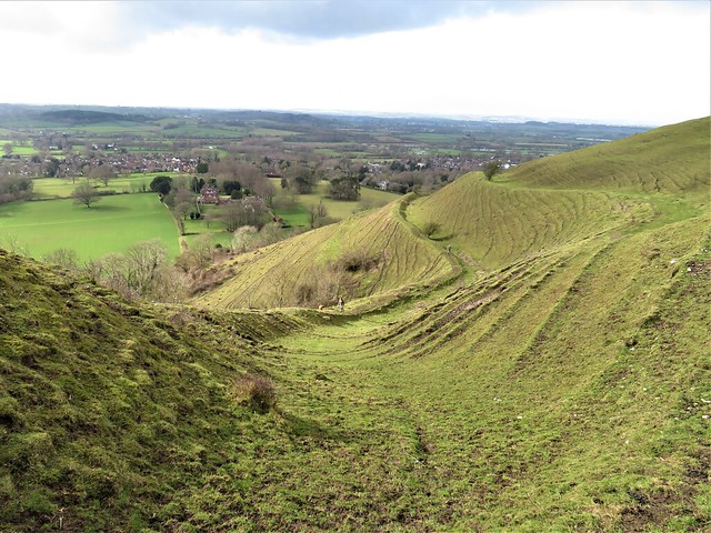
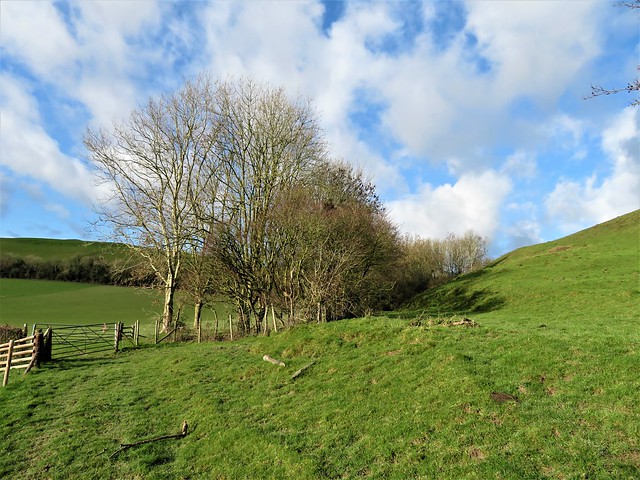
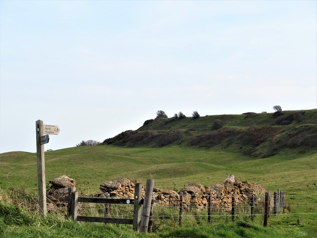
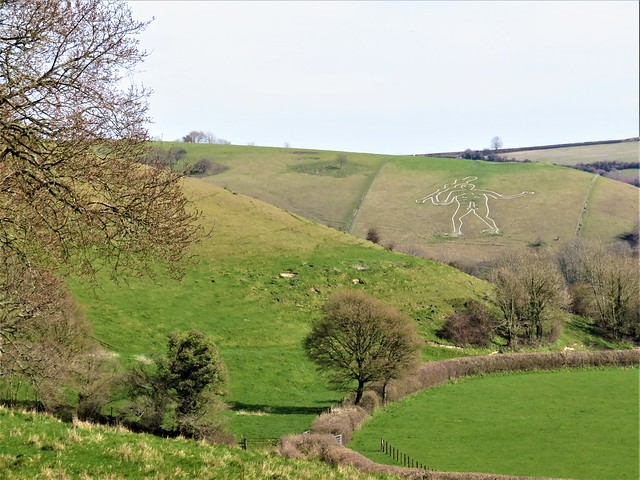
Two Iron Age hill forts, orientated south-north, dominate the eastern flank of Fishpond Bottom – the modest rise of Coney’s Castle, and to the north the bigger stronghold of Lambert’s Castle on its long slim promontory.

I’d just finished re-reading Bernard Cornwell’s sword-slashing King Arthur trilogy, ‘The Warlord Chronicles’. Romantic fantasy was irresistible here on the windy ramparts. I strode them like a warrior, wolfskin cloak flying free, sword in hand, as I prepared to repel the Saxon hordes massing in Marshwood Vale below.

How hard is it? 5¼ miles; moderate. Some boggy green lanes, fords.

Start: Lambert’s Castle car park, near Lyme Regis EX13 5XL (OS ref SY 367987)

Getting there: Off B3165 between Marshwood and Raymond’s Hill (A35)

Walk (OS Explorer 116): Back along drive. In 100m, opposite gate on left, right down path. Cross B3165 (366988); down steps; kissing gate; half left down to gate (365989). Right down drive. At Roughmoor Cottage cross ford (363991); up holloway to Higher Stonebarrow. Left up drive; at start of road, left (357990; gate with red dog notice). Bridleway bounded by hedge, then walls to cross B3165 (360987). Stile. Down right edge of field to cables; follow them left to green lane (363983). Right; in 50m, left (stile); right along upper edge of woodland on right. In 250m at telephone pole (363980), sharp left down through trees to road (364981); right. 50m past Sheepwash Cottage, left (364977) along wet green lane to Little Coombe Farm. 100m beyond, right (369975) for ⅔ mile past Higher Coombe and Great Coombe farms to Long Lane road (373968). Left for ¾ mile to Peter’s Gore crossroads (371981). Ahead (‘Marshwood’); in 20m, right past Lambert’s Castle/Wessex Ridgeway signs. North across Lambert’s Castle for ½ mile; at northern edge (372991) turn back along western rim to car park.

Lunch/Accommodation: Hunter’s Lodge, Raymond’s Hill EX13 5SZ (01297-33286, hunterslodgeinn.co.uk)

Info: marshwoodvale.com

 Posted by at 02:53
Dec 092022


First published in: The Times Click here to view a map for this walk in a new window
Thorncombe near Forde Abbey Farm footbridge over Stonelake Brook near Thorncombe fungi on the Monarch's Way near Thorncombe IMG_5264 flooded gravel workings at Westmills Plantation rain approaching parkland near Forde Abbey IMG_5255 bushy hollow near Thorncombe near Thorncombe

The old wool-trading and lace-making village of Thorncombe lies up and down its sloping street, a handsome huddle of old cottages in a steep, remote piece of countryside where Dorset tips over into Somerset.

The sun was finally groping its way through the clouds after days of miserable rain. The fresh wind and brilliant autumn colours of the woods put a spring in our step as we followed the rim of the deep ferny cleft of Stonelake Brook.

The Monarch’s Way led north through pastures where the wet grass polished our boots for us. Flints underfoot crunched and crackled. Off on our left side the church and houses of Thorncombe sloped down their hillside, framed by oaks and beech trees in wind-tattered gold and scarlet.

Down at Synderford bridge we picked up the Jubilee Trail and followed it north across the red mud squelch of rain-swollen brooks and the broad clover leys on Chitmoor. Devon Ruby cattle grazed the fields at Wheel House Lane, the sturdy little bull inspecting the females with close solicitude.

A screeching chorus of pheasants arose from a maize field as we neared Forde Abbey, where the last of the afternoon was slanting across the old monastic buildings. The view down the drive from the ornate gates was of a surf of pink, white and purple cyclamen along the lime avenue leading away to beautiful gardens and fountain pools.

Just beyond Forde Abbey the meanders of the River Axe mark the Dorset border. We crossed the bridge into Somerset and turned west through lush river meadows dotted with fine old cedars. Along the river, the pink blooms of Himalayan balsam opened their spotted throats to release a spicy fragrance. We edged round a deep gravel pit, pushed our way through an elephantine jungle of maize nine feet tall, and skirted the empty yards of Forde Abbey Farm.

Now the sun made a belated return, streaking the sky with patches of blue and fringing the clouds with a sharp lining of silver. Lemon yellow beech leaves scuffed under our boots as we came past Whistling Copse and turned for home.

A great view of rolling country to west and east, and we were crossing Thorncombe’s cricket field where goldfinches in a flicker of wings were gobbling up the grass seed laid on the pitch by the groundsman in hopes of a perfect surface for next summer’s opening match.

How hard is it? 6½ miles; easy; field paths. NB GPS and OS Explorer map are helpful for route-finding.

Start: St Mary’s Church car park, Thorncombe, Dorset TA20 4NE (OS ref ST376034)

Getting there: From Crewkerne (A30, Chard-Yeovil) follow ‘Forde Abbey’, then ‘Thorncombe’.

Walk (OS Explorer 116): Path through churchyard to road; left to junction at chapel (376032); right uphill. In 100m pass ‘Old Alley’; left (375032, fingerpost/FP). At stile, ahead (yellow arrow/YA); in 2nd field, stile (377027, ‘Liberty Trail’) through trees. In 200m, sharp left on Monarch’s Way/MW (377025) to pass Yew Tree Farm (383031, ‘Wessex Ridgeway’). At road, right (380035).

At Synderford sign, left (382037, FP, Jubilee Trail/JT), skirting water treatment plant. Cross brook; bear right up field slope with hedge on right to gap (380037, JT). On by hedge, following JT waymarks to cross brook in trees by stepping stones (376041). Left up hedge, left through hedge at top of bank (375043); right to kissing gate/KG. Follow right-hand hedge; in 200m, right (374045, KG); left up hedge. In 200m, left with hedge on left (374047); follow JT to Wheel House Lane (371048).

Left; opposite Thorncombe turning, right (366047, FP, JT) across fields to road (362053). Right past Forde Abbey gates, across River Axe. Left (362054, ‘Horseshoe Road’). In ½ mile, recross Axe (356051, YA). Follow Liberty Trail/LW and YAs clockwise round gravel excavation at Westmills Plantation (354050). Cross road (355046, ‘Forde Abbey Farm’) across field. Skirt to right round Forde Abbey Farm buildings (357042); follow farm drive. At fuel tank fork left (363037, blue arrow) across field to Horseshoe Road (366037). Right (LT). In 200m bear right along hedge (366036, FP). In 650m path descends and bends right; left here (368030, stile) to stile in conifer hedge (370030). Across recreation ground to cross road (371031), then more fields (YAs) to Thorncombe.

Lunch: Bell Inn, Winsham TA20 4HU (01460-30677)

Accommodation: Haymaker Inn, Wadeford, Chard TA20 3AP (01460-64161, thehaymakerinn.co.uk)

Info: Chard TIC (01460-260051); fordeabbey.co.uk

 Posted by at 16:52
Oct 152022


First published in: The Times Click here to view a map for this walk in a new window
IMG_4982 IMG_4983 Eggardon Dorset Eggardon Dorset Eggardon Dorset Eggardon Dorset Eggardon Dorset Eggardon Dorset Eggardon Dorset Eggardon Dorset Eggardon Dorset Eggardon Dorset

A sunny autumn morning over the Dorset hills, the grass in the pastures wet with dew. The stone-built cottages and church tower of Powerstock looked across a shadowed valley to Nettlecombe, sunlit on the ridge opposite.

From the fields beyond, we looked ahead to see Eggardon Hill rising on the south-west skyline, an upturned boat on a green sea of high ground. We crossed the old railway line below Nettlecombe, where a cheerful man with a car boot full of yapping terriers was whistling for a stray. It scampered up, frisking and unrepentant. ‘Getting his own back,’ said his owner, fondly, ‘because he didn’t get a walk yesterday.’

This is Thomas Hardy country, a landscape of knolls and chalky downland, promontories, dimpled ridges and hunting fences in the well-grown hedges. In the south-west a streak of gold showed where the cliffs of the Jurassic coast were crumbling. A late-hatched red admiral butterfly basked on the cobbles of the field track, where puddles from last night’s rain glinted in the strong low sunlight.

Down on Spyway Road we turned past a thatched longhouse and the lonely Spyway Inn before following a bridleway past South Eggardon Farm. Back in the 18th century Isaac Gulliver, King of the Dorset Smugglers, owned the farm. He planted a clump of pine trees on Eggardon Hill as a landmark for his fleet of fifteen luggers bringing silk, lace, tea and gin untaxed from the Continent. The trees were felled by order of the authorities, and Gulliver himself became a respectable citizen. He took up the banking trade, and when he died in 1822 he left an estate worth £5 million in today’s money.

Now the crumpled ramparts of the Iron Age hill fort on Eggardon Hill stood in full view, a little line of limestone outcrops at one end. We climbed through sheep pastures where mistle thrushes, newly arrived for winter, pattered and halted with heads held high as they surveyed us warily.

A fenced path led to the hilltop, its smooth flanks hollowed and velvety, seamed like corduroy with hundreds of erosion terraces. Handsome bronze and white cattle moved slowly off in front of us, as a superb prospect opened southward, the sea showing grey-blue in the dips of the cliffs.

A succession of green lanes brought us back to Powerstock, from where Eggardon Hill resumed its modest status as one bump among many in this steep green country.

How hard is it? 7 miles; moderate; field paths, hill tracks

Start: St Mary’s Church, Powerstock, Bridport DT6 3TD (OS ref SY517961)

Getting there: Powerstock is signed from A3066 (Bridport-Beaminster)

Walk (OS Explorer 117): Pass 3 Horseshoes pub. In 100m, right downhill (‘Nettlecombe’); path to road (517956). Left past inn; in 100m, right past No 3; in 50m, left across playing field. Cross road (520953); cross field to bench; down woodland path; cross old railway (520950). Field track for 1¼ miles to road (528933). Left past Spyway Inn. Left (530932) up drive. At South Eggardon House, right on bridleway up to road (545939). Left; in 350m left (546942) for circuit of Eggardon Hill. Back at ‘National Trust’ gate (544945), left (gate) across field to lane (546946); left. In ¾ mile, lane bends right (536952); ahead here (green lane). In ½ mile track bends left (529955); ahead (yellow arrow/YA) to cross old railway (523956). In 200m, right (522956, stile) downhill. At bottom dogleg left/right (521956) over footbridge. Streamside path, then lane up to road (520960). Left to Powerstock.

Lunch/Accommodation: Marquis of Lorne, Nettlecombe DT6 3SY (01308-485236, themarquisoflorne.co.uk); Three Horseshoes, Powerstock DT6 3TD (01308-485328, palmersbrewery.com)

Info: visit-dorset.com

 Posted by at 01:06
May 282022


First published in: The Times Click here to view a map for this walk in a new window
Path through Big Wood Arne Heath - view over Poole Harbour Out across Coombe Heath Sandy paths of Arne Heath Arne Heath - view over Poole Harbour 2 Arne NNR - mating dragonflies Arne NNR - emergent green-winged orchid Arne - (common?) darter at rest Arne Heath - sinuous windings of Middlebere Lake

A gorgeous afternoon of sun and blue sky over the Dorset coast – exactly the sort of day to be walking the sandy paths of Arne National Nature Reserve, a rare and precious example of conservation triumphant.

Almost all of Dorset’s lowland heaths, the landscapes that Thomas Hardy immortalised, have been lost to farming and housing encroachment since his day. If the RSBP hadn’t got hold of Arne’s 1,000-odd acres of lowland heath on the western shore of Poole Harbour, the chances are it would all have been ploughed up or built over. That would have been the end of the Dartford warblers, the nightjars, the marsh harriers and raft spiders, lizards and slow worms that inhabit this highly specialised marsh and seashore – not to mention the spoonbills and ospreys that have recently set up home here.

We followed the Red Trail through quiet woods of oak and beech between hay meadows streaked yellow with buttercups. Soon the pastoral scene had given way to gorsy heath of tall pine trees. As we crossed a clearing a small burst of bird of prey, dark and intent, went scurrying across the sky – a hobby, uttering a burst of sharp yelps like a woodpecker as it disappeared.

The hobby’s prey, red dragonflies and electric blue darters, were zipping about in mating pairs over a string of weedy ponds. Stout southern marsh orchids grew in a rank beside the path, now dull red with fallen pine needles, that led to a sandy little beach at Shipstal Point where olive green wavelets fell on the shore.

From the viewpoint hillock behind the beach we got a fine prospect over Poole Harbour, the thick wooded hump of Brownsea Island prominent among a flotilla of little islets. Common terns and oystercatchers overflew the tidal waters. The millionaires’ paradise of Sandbanks lay hidden by the bulk of Brownsea, out of sight and a whole world away.

Back at the car park we set out on the second half of the walk, the Coombe Heath trail across a windy, sombre-coloured heather upland. Hidden in the scrub were Dartford warblers, rare little songsters with blood-red eyes. Camouflaged in sandy hollows lay ash-coloured nightjars, and I recalled a midsummer evening at Arne when they came out at dusk to perform their churring mating calls and wing-clapping flight.

Down in the inaccessible marshland beyond the tip of the heath, a tall pole held a sturdy platform. A large white bird of prey sat there, and looking through binoculars we realised with a thrill it was an osprey. As though intuiting it had been spotted, it slowly rose and flapped away. A memorable sight, this beautiful rare fish eagle, in a most remarkable place.

How hard is it? 4½ miles; easy; woodland and heathland paths

Start: Arne RSPB car park, Arne, Wareham BH20 5BJ (OS ref SY 971877)

Walk (OS Explorer OL15; downloadable trail map at rspb.org.uk/arne): From Visitor Centre follow ‘Shipstal Trails’. Red Trail for 1½ miles to 4-finger post (982884). Left to Shipstal Point beach. Returning, left up steps to viewpoint. Right down steps to 4-finger post. Left (‘Car Park’) back to car park. Through gate at far end; follow ‘Coombe Heath Trail’ (white arrows) anticlockwise via viewpoint (975868) back to car park.

Getting there: Arne RSPB is signed off B3075 at Stoborough, just south of Wareham.
Summer shuttle bus service, June-August (2RN) from Wareham bus/train station.

Lunch: Arne RSPB café (closes 4 pm)

Accommodation: The Bear, 14 South Street, Wareham BH20 4LT (01929-288150, thebearwareham.co.uk)

Info: rspb.org.uk/arne; 01929-553360

 Posted by at 01:30
Feb 192022


First published in: The Times Click here to view a map for this walk in a new window
neolithic ramparts of Hambledon Hill Hambledon Hill from the valley at Shroton 1 Hambledon Hill from the valley at Shroton 2 looking back over Shroton from the path to Hambledon Hill looking back to the walled track from Hambledon Hill the ramparts of Hambledon Hill 1 the ramparts of Hambledon Hill 2 walking up onto Hod Hill ramparts of Hod Hill looking into the valley from the ramparts of Hod Hill

Some call it Shroton, others Iwerne Courtney. Whatever about the name, it’s a pretty little village of chalk, flint and thatch that lies among the undulating downland of Blackmore Vale.

Snowdrops spattered the hedge roots and daffodils were still hiding their waxy yellow petal heads as we set out from the village up a white chalk track streaming with the morning’s rainfall. Huge gunpowder clouds came rolling up from the southwest across a sky of pure blue.

A yellowhammer with a sulphurous head was practising his spring flirting with a drab female in a bramble bush, and larks went up singing from the sheep pastures. There was a hint of spring in the air, though not in the wind, still wintry enough to bring tears to our eyes.

Soon the massive ramparts of Hambledon Hill came over the skyline. Neolithic people mounded them round the long L-shaped crest of the hill, and crossed them with linking causeways, a vast undertaking 5,000 years ago. Human skulls were ceremonially laid at the bottom of the ditches.

We walked the circuit of the ramparts among sheep remarkably white and healthy-looking after a winter on the hilltops. Through smooth green pastures far below curved the River Stour, its course marked by patches of flooding.

A hailstorm came pattering across as we turned south along a field track, the ice pellets bouncing off the grass and piling up in the ruts. We ducked into a barn and waited out the shower among bales of straw, then followed a rollercoaster path steeply down and sharply up again to the heights of Hod Hill.

It was the Durotriges tribe that walled in this hilltop, some two thousand years after the earthworks were raised on Hambledon Hill across the valley. The invading Romans chased the Durotriges away in 43 AD after a brief bombardment with ballistae – several of these iron catapult bolts have been found up here.

We crossed the plateau through Roman and British ramparts, both sets of fortifications still prominent on the ground. Beside the path at the far side of the hill grew hazels heavy with catkins, and scarlet shoots of dogwood.

Down in the valley below we turned for home along a rutted track, walled with brick, flint and hard chalky clunch. A buzzard wheeled overhead, the edges of its wings silvered by a sun already sunk behind the rim of the western hills.

How hard is it? 6 miles; moderate hill walk; downland tracks and field paths
Start: St Mary’s Church car park, Shroton, near Blandford Forum, Dorset DT11 8RF (OS ref ST 860124) – £1 honesty box for parking
Getting there: Bus X3 (Shaftesbury – Blandford Forum)
Road – Shroton/Iwerne Courtney signposted off A350 (Shaftesbury to Blandford)
Walk (OS Explorer 118): Right along road; left (‘Child Okeford’); in 100m, left (859126, stile, ‘White Hart Link’ /WHL, ‘Wessex Ridgeway’/WR). Track uphill; at gate, right (WR). In ⅔ mile at trig pillar, right (848123), anticlockwise round Hambledon Hill ramparts. Back at trig pillar, ahead; in 250m, ahead at fingerpost (849120, ‘Steepleton Iwerne’). In 900m right at barn (855116); down to cross road (855112). Through gates opposite; up track; in 150m fork right (855111) up to gate (NT- ‘Hod Hill’), Half left across Hod Hill for 700m. Through outer ramparts (858103); left on lower path. In 250m, right through gate (860105, NT); left on track down to road (861111). Follow WHL for 1 mile back to Shroton.
Lunch: The Cricketers, Shroton DT11 8QD (01258-268107, thecricketersshroton.co.uk)
Accommodation: The Fontmell, Fontmell Magna, Shaftesbury SP7 0PA (01747-811441, thefontmell.co.uk)
Info: shroton.org; visit-dorset.com

 Posted by at 04:32
Dec 042021


First published in: The Times Click here to view a map for this walk in a new window
leaving Sydling St Nicholas along the rutted path of the Wessex Ridgeway Norden Hill from the River Frome valley 2 winter shadows in the lane near Cattistock Norden Hill from the River Frome valley 1 wintry fields near Maiden Newton view west from Wessex Ridgeway toward Frome Valley looking back east over Sydling St Nicholas 2 looking back east over Sydling St Nicholas 1 Sydling St Nicholas church rustic fence by Sydling St Nicholas churchyard teasels by the path to Sydling St Nicholas muddy lane to Sydling St Nicholas path up Middle Hill Lankham Bottom and the flank of Middle Hill 1

Sunk deep in the green downland valley of the River Frome lies Maiden Newton, a sprawling village, with its church tower upstanding yet far below the skyline. Dorset dialect poet William Barnes caught the scene in his poem ‘The Fancy Feäir’:

‘The Frome, wi’ ever-water’d brink
Do run where sholvèn hills do zink,
Wi’ housen all a’cluster’d roun’
The parish tow’rs below the down.’

We found the brink of the shallow, gravel-bottomed River Frome well watered, and well muddied too. It was a squelch and a splosh up the riverside path to Cattistock. Sir George Gilbert Scott designed Cattistock’s church with a remarkable tall tower. It beckons you into the crooked street of the village that William Barnes called ‘elbow-streeted Catt’stock.’

Cattistock has kept its village amenities intact – church, post office, cricket field, Fox & Hounds inn, and an active pack of fox hounds. We heard them give tongue from their kennels as we headed east up the chalk grassland slopes of Lankham Bottom.

The low angle of the winter sun made relief models of the field boundaries on the downs, their shadows stark against the green slopes. The tattered old hawthorns that marked out the path were in full crimson berry, and mistle thrushes dashed among them like busy Christmas shoppers, never pausing for more than a moment.

Up at Stagg’s Cross we braved the rushing traffic tide of the A37, then sauntered along a forgotten old strip of road where moss grew through the tarmac and down across the pastures to where Sydling St Nichols unravelled along its watercress stream.

Ancient Court House Farm and tithe barn lay together alongside a church guarded by fat-cheeked gargoyles choking on their waterspouts. As we sat in the church porch a terrier came wriggling up, very keen to find out what was in our sandwiches (it was ham and mustard).

The Wessex Ridgeway hurdled us back across the downs, a broad and muddy old track in a sunny green tunnel of trees that rose to the ridge and fell away west towards Maiden Newton. The western sun turned all the clipped hedges to gold, and over the invisible sea beyond the hills to the south a strong clear coastal light silvered the base of clouds slowly building out there.

How hard is it? 8½ miles; easy downland tracks; some muddy and puddled stretches.

Start: Maiden Newton railway station, Dorchester DT2 0AE (SY 598979)

Getting there: Rail to Maiden Newton; Bus 212 (Dorchester-Yeovil)
Road: Maiden Newton is on A386 (Crewkerne-Dorchester)

Walk (OS Explorer 117): Down Station Road; left at junction. In 100m, right past church; left (597979, ‘Wessex Ridgeway’/WR, ‘Frome Valley Trail’ fish arrow waymark). In ¾ mile, right at road (590988); in 650m under railway; left at junction (592993). In 100m, left (‘Macmillan Way’); fork left in Cattistock churchyard; ahead up street. Just beyond Post Office, right by Rose Cottage (591998, ‘Staggs Cross’); follow bridleway to pass Manor Farm. On up Lankham Bottom; in 700m by metal gate on right, half left (604000) past post, up slope to gate (606002). On to gate onto road (612005); right to cross A37 (613004). Follow old road; left at junction (620002); in 600m, right (626001, gate with shackle) across 2 fields; left along farm track (628998). In 200m, right (630998, stile) to junction (630994); keep ahead; in 100m, right (kissing gate, ‘Breakheart Hill’). Left down east end of church; cross stile; right on track for 550m to meet Wessex Ridgeway (627993). Left; follow WR for 2 miles back to Maiden Newton.

Lunch/Accommodation: Fox & Hounds, Cattistock DT2 0JH (01300-320444, foxandhoundsinn.com)

Info: Dorchester TIC (01305-267992)

 Posted by at 01:52
Oct 162021


First published in: The Times Click here to view a map for this walk in a new window
St Catherine's Chapel from the hill above Abbotsbury 1 St Catherine's Chapel from the hill above Abbotsbury 2 Iris foetidissima or Stinking Iris What a gem! A Devon Red Ruby cow on the ridge above Abbotsbury. view from the ridge looking north from the ridge path ramparts of Abbotsbury hill fort field mushroom near the hill fort old limekiln above West Bexington Abbotsbury from the hill near St Catherine's Chapel 1 St Catherine's Chapel Abbotsbury from the hill near St Catherine's Chapel 2

Under a clearing sky and a brisk wind we set out among the cottages of Abbotsbury with their walls of deep golden stone under grey-green thatch. Chicken, duck and goose eggs were for sale at the farm in Rosemary Lane.

Stony, sunken Blind Lane led away uphill between horse pastures. From here we looked back over Abbotsbury and its steep guardian hill topped by St Catherine’s Chapel, the shingle bar of Chesil Beach enclosing the long inlet of The Fleet, and the leonine form of the Isle of Portland with its long back and tail sloping down into the dull sea. Half a dozen dark lumps lay beyond, giant container ships at anchor off Weymouth.

Up over the corrugations of medieval strip lynchets to the ridge, where the South Dorset Ridgeway ran out west along a bracken-brown bar of downland parallel to the sea. An ancient ceremonial landscape where Neolithic long barrows and Bronze Age round barrows lay side by side. The tribal leaders of 3,000 years were laid to rest on this high eminence overlooking land and sea.

On the ramparts of Abbotsbury hillfort a female stonechat sat on a gorse tip, her breast a soft buff pink, a bold dark stripe through her eye. Looking west from here we had a grand prospect of the Jurassic Coast all round the great curve of Lyme Bay, with the crumbling cliffs of Golden Cap shining a rich gold in the muted late-year light.

A cobbled green lane descended to West Bexington between hedges bright with fruit – hard red blackberries, shiny black dogwood berries, the burnished scarlet of hawthorn peggles, and old man’s beard draped over the stone walls.

The single street of West Bexington sloped down to the seafront, where beach fishermen cast their heavy leads in hopes of bass or codling. We turned east into the wind and crunched along a beach of pebbles almost as small as sand. Pale leaves of sea kale like elephant ears grew on the scrubby maritime sward, along with thrift flowers now dry and silvery.

On the seaward side of Abbotsbury we climbed steeply across strip lynchets to reach St Catherine’s Chapel, massively buttressed in thick dark gold stone on its hilltop. In medieval times the maturer maidens of Abbotsbury would make an annual pilgrimage to offer a fervent prayer in the chapel on the hill:
‘A man, St Catherine,
Please, St Catherine,
Soon, St Catherine!’
… following that with: ‘Arn-a-one’s better than narn-a-one, St Catherine!’

Flora: blackberries, dogwood berries, hawthorn peggles (berries), old man’s beard
Birds: female stonechat

How hard is it? 8½ miles; moderate; downland tracks, shore path, short steep climb to chapel

Start: Abbotsbury car park, Rodden Row, Abbotsbury DT3 4JL (OS ref SY 578853) – £1 per hour, signposted in village.

Getting there: Bus X53 (Weymouth-Axminster)
Road: Abbotsbury is on B3157 (Weymouth-Bridport)

Walk (OS Explorer OL15): Cross B3157; up Rosemary lane; left on Back Lane. In 150m, right beside Spar House up Blind Lane (578854, ‘Hill Fort’). In 600m, through gate (574859, yellow arrow), then another (blue horse). At ridge, left (571863, gate, ‘West Bexington’). Follow ‘South Dorset Ridgeway’ and ‘Bexington’ signs for 2¾ miles to West Bexington seafront (531864). Left along shore path, then road for 2¼ miles to road end (560846). Ahead along lower edge of car park. Follow ‘Coast Path’ signs for ⅔ mile to 3-finger post; right (568847, ‘Swannery’). In ½ mile, left at stone marker (575845, ‘St Catherine’s Church’). Steeply uphill to chapel (572848); downhill into Abbotsbury.

Lunch/Accommodation: Manor House, West Bexington, Bridport DT2 9DF (01308-897660, manorhousedorset.com).

Info: Bridport TIC (01308-424901)

 Posted by at 01:47
Mar 132021


First published in: The Times Click here to view a map for this walk in a new window
picture picture picture picture picture picture picture picture picture picture picture picture picture picture
Facebook Link:

The Cerne giant looked particularly rampant this morning, the low sun of early spring lighting up every detail of his splendid physique. No-one knows when this phallic wild man, brandishing a fearsome club and very clearly ‘pleased to see you,’ was cut into the chalk hillside above Cerne Abbas.

Plenty of fun has been had with the Cerne Giant over the centuries. Childless couples would couple on his mighty member to quicken their seed. Advertising agencies have clad him in jeans and a condom; he has been paired with a giant Homer Simpson wielding a doughnut, and has sprouted an outsize grass handlebar moustache during Movember. Unadorned, though, he emanates the wildness, dignity and menace that his originators must have intended.

We set out west from Cerne Abbas, blown by an icy east wind along banks already thick with primroses. Bees were bumbling there, and we spotted a great black oil beetle in jointed armour labouring up through the grasses. The wind whistled in the leafless hawthorn hedges and trembled the green spear-blade leaves of wild garlic up in Weam Coppice.

At the ridge we passed the medieval earth-and-flint bank of Park Pale, constructed to keep the hunted deer in Cerne Park. Beyond ran the Wessex Ridgeway, an ancient track, broad and green, hurdling the downs. We followed it north past holly and elder hissing with wind, looking west to where hedges and field shapes undulated together across the chalk valleys under a clear-cut skyline.

From Redpost Hill we cut east across big open fields jingling with flints, under the first lark song of the year sounding sweet and silvery in the upper air. A view opened ahead over the valley of the River Cerne, with the thatched cottages and old gabled manor at Up Cerne far below. South over the distant, unseen sea a long cloud bar formed, streaming slowly to the west.

In the hedge-banks along the lane to Cerne Abbas, violets made splashes of contrasting colour to the predominant yellow of celandines, primroses, dandelions and daffodils. Back at the village we climbed Giant Hill, circling round the great chalk man before returning by way of Cerne Abbey – abbot’s hall, tithe barn, guest house, and a tall porch hidden in a thicket, with an oriel window exquisitely carved.

Start: Giant View car park, Cerne Abbas DT2 7JX (ST 662016)

Getting there: Bus: X11 (Dorchester – Yeovil)
Road: Car park is signed off A352 (Yeovil-Dorchester)

Walk (6½ miles, easy, OS Explorer 117): Cross A352; right around field edge to green lane; left. In 50m fork left; follow lane, then path (yellow arrow; fingerposts ‘Cerne Park,’ then ‘Weam Coppice’) up valley, into wood by gate (650013). In 50m fork right uphill. At top of trees (647013) dogleg right/left (‘Sydling Drove’), past radio mast and sarsen stone to Wessex Ridgeway (645013). Right; in 1¼ miles pass ‘Up Cerne’ fingerpost (639032); in 100m fork right, then right (fingerpost ‘Wether Hill’). Cross field; pass ‘Up Cerne’ fingerpost (642033); on, soon downhill to T-junction (653035). Right to pass Great Pond (655031); in 150m round left bend; in 50m right (655029) past end of trees to cross road by white gate (656027). On across field (fingerpost) to road (659023); ahead to A352 (661018); ahead to car park.

Giant Hill climb (strenuous): Ahead from car park (‘Picnic Area’); left on Kettlebridge Lane (663015); follow ‘Giant Hill’ and yellow arrows to climb wooden steps. Clockwise up and around Giant’s enclosure; returning, follow ‘Abbey’ signs to Cerne Abbey; back around to car park.

Info: Dorchester TIC (01305-267992)
satmap.com; ramblers.org.uk
More walks info: @somerville_c

 Posted by at 01:50
Jan 112020


First published in: The Times Click here to view a map for this walk in a new window
picture picture picture picture picture picture picture picture picture picture picture
Facebook Link:

From a viewpoint high above Lulworth Cove we got a Jurassic Coast geology lesson in a million. To the east lay the almost-perfect circle of the cove, where the sea has broken through the hard Portland limestone and is busy nibbling away the soft chalk at the back of the bay. To the west, Stair Hole opened at our feet, the sea sloshing through rock arches to devour the clay of the cliffs and expose strata of limestone fantastically folded and contorted by subterranean convulsions hundreds of millions of years ago.

We climbed away up the stone-paved coast path to the crest of Hambury Tout and another remarkable view, west along a Dorset coast of sheer white cliffs, walls of chalk and freestone sculpted by wind, weather, frost and the sea. Beyond these the Isle of Portland lay skirted by rainstorms, a grey wedge sloping south to a jumble of white tide races off the narrow snout of Portland Bill.

The next ‘big reveal’ stayed concealed until we were almost on top of it – the great rock arch of Durdle Door, tall enough to sail a ship through. The good old Dorset word ‘durdle’ has its origin in Old English: the arch is a door that the sea has ‘thirled’ or pierced out of the Purbeck stone of the cliff.

Just to the west, the promontory of Bat’s Head is being durdled, too, the nascent arch of Bat’s Hole showing as a tiny blob of pale luminescence where the rainy light shone through.

Down in Scratchy Bottom we turned inland up a green chalk cleft. Under a twisted old elder we sat to have our picnic in a spattering shower. A solitary walker traversed the ridge across the valley beneath a slate grey sky on which a brilliant double rainbow slowly shaped itself.

Up on the ridge we followed a puddled track east, then dropped down among the thatched roofs and pale stone cottages of West Lulworth. A trudge across the hill, a steep descent on slippery steps, and we were crunching round the pebbly curve of Lulworth Cove between the wave-burrowed cliffs and the circle of sea eternally reaching for them.

Start: Lulworth Cove car park, near Wareham, BH20 5RQ (OS ref SY 820801). £8 fee for 4-6 hours.

Getting there: Bus X54 (Weymouth-Poole)
Road: Lulworth Cove is signed from A352 (Wareham-Dorchester) at Wool.

Walk (8 miles, strenuous, OS Explorer OL15): Coast Path (CP) west, passing Durdle Door (806803). In another ¼ mile, opposite ‘Scratchy Bottom’ sign, right through gate (802804); follow fence on left; in 750m, through gate, then another (806809). Half left up field; left at top (809811) through gate. Follow path for ⅔ mile; right on bridleway (800811) for ¾ mile to Daggers Gate (811814). Cross road; follow track past West Down Farm (820815); in 400m, right (824816, yellow arrow/YA) on path to West Lulworth. Left at road (825807); left at bus shelter; opposite Castle Inn, right along School Lane (827808). In 100m, right (arrow) up paddock to upper path; right for 400m to T-junction (824805). Dog left/right (‘Coast Path’); fork right (‘Lulworth Cove’); follow path east above Lulworth Cove. On far side, right (828801, ‘Fossil Forest’) down steep steps to cove; right along shore to car park.

Conditions: Lulworth Cove shore path walkable except at very high tide (tidetimes.org.uk). Some steep steps.

Lunch/accommodation: Castle Inn, West Lulworth BH20 5RN (01929-400311, castleinn-lulworth.co.uk) – cosy, characterful village inn.

Info: Lulworth Visitor Centre (01929-400587, lulworth.com);
Tide times: https://www.tideschart.com/United-Kingdom/England/Dorset/Lulworth-Cove/
satmap.com; ramblers.org.uk

 Posted by at 03:31
Apr 132019


First published in: The Times Click here to view a map for this walk in a new window
picture picture picture picture picture picture picture picture picture picture picture picture picture picture picture picture
Facebook Link:

A brisk windy day across the Isle of Purbeck. From high-perched Kingston we looked north across the valley to a gap in the long ridge of the Purbeck Hills, neatly plugged by the ruins of Corfe Castle. It seemed against the laws of gravity that such tall slender fragments of wall would not have tumbled long ago.

We followed the road west out of Kingston between neat grey stone cottages. Guns thudded from the military ranges beyond the downs, as though a sulky giant were banging a lambeg drum. Larks sang over stony plough and spring wheat. Bluebells and wild garlic contended for mastery of the woods, a springtime splash of blue and white.

We followed a track up through pastures of fat lambs. Walls of thinly sliced stone curled away to reach the tumulus on Swyre Head, highest eminence of Purbeck. Here was a viewing point over downs, farmlands and a dramatic coast of crumbling chalk and freestone cliffs running westward to where the Isle of Portland, Thomas Hardy’s ‘Gibraltar of Wessex’, stretched its low wedge shape into the sea.

The path bent inland along a ridge of grass polished to a shimmer by the sun. The strong sea wind hissed in the gorse bushes, bringing scents of coconut. A trail of smoke arose from the trees around Kimmeridge, and when we got down there it was to find the cottages of the old quarrying village now primped to a sheen of perfection.

We passed the immaculate new Museum of Jurassic Marine Life and followed the road round the knoll of Metherhills to the shores of Kimmeridge Bay. These tilted strata of dark shale yield a harvest of oil, sucked up from nearly a mile underground by a nodding donkey pump on the cliffs.

We sniffed the metallic tang of the oil on the wind, then climbed to the curious Tuscan folly of Clavell Tower. The tower, built by a 19th-century rectorial squire, was moved back bodily from the cliff edge in 2008, a costly and complicated operation.

From here the coast path led east, crumbly and cracked, at the very rim of ash-grey cliffs footed on flat rock pavements among a litter of fallen stones. The wind battered and shoved us, the sea creamed in lines of breakers, and we swooped homeward up and down the cliffs in breathless exhilaration.

Start: Houns-Tout car park, West Street, Kingston, Corfe, Dorset BH20 5LH (OS ref SY 953794)

Getting there: Bus 40 (Corfe-Swanage). Road – Kingston is signposted off A351 (Corfe-Swanage); right at Scott Arms along West Street to car park.

Walk (9½ miles, steep climbs on coast path, OS Explorer OL15): Left (west) along road. At next car park (943793), left through gates on track (‘Swyre Head’). At Swyre Head (934784), hairpin right through gate; ridge path for 1½ miles, descending to road (919801). Left; at junction, cross road; signed path opposite down to Kimmeridge (917799). Ahead past Fossil Museum on road to coast. At end of road (911787), right past WC. In 200m, left up steps (‘Chapman’s Pool’); follow coast path east for 3 miles. At top of Houns-Tout cliff by stone seat (950773), left (stile, yellow arrow, ‘Hardy Way’) inland on path for 1½ miles to Kingston.

Conditions: Steep climb to Houns-Tout cliff; unguarded, crumbly cliff edge path.

Lunch/Accommodation: Scott Arms, Kingston (01929-480270, thescottarms.com) – cheerful, lively pub with rooms – sensational views.

Info: Swanage TIC (01929-766018); visit-dorset.com.
4-19 May: isleofwightwalkingfestival.co.uk

satmap.com; ramblers.org.uk

* Christopher’s latest book, Ships of Heaven, The Private Life of Britain’s Cathedrals, published 11 April

 Posted by at 01:00