Search Results : isle of wight

Oct 202018


First published in: The Times Click here to view a map for this walk in a new window
picture picture picture picture picture picture picture picture picture picture picture
Facebook Link:

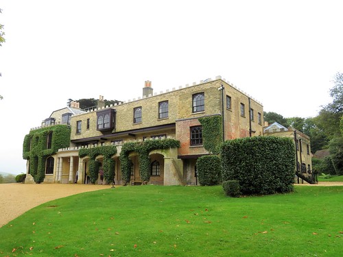
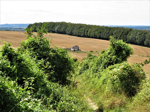
Approaching Farringford along the footpath from Tennyson Down, my first reaction was ‘What an ugly house!’ Farringford in its yellow brick bulk, all castellations and creepers, looks as forbiddingly Victorian as can be. It’s only when I was immersed in the dark red and blue rooms, the study and drawing room, the schoolroom and bedrooms where the Tennyson family led their intensely interwoven lives, that I began to appreciate what a haven this Gothic pile became for Alfred Lord Tennyson, Victorian England’s favourite celebrity Poet Laureate.

At Farringford, Alfred and his ailing wife Emma could put up the shutters on the clamorous outside world. They entertained a selection of the great and good; they dressed their beloved sons Hallam and Lionel in lace collars and long hair, and didn’t care if the boys would rather play the bugle or ride their rocking horse than do maths. Tennyson was a genial man, not at all inclined to stand on ceremony.

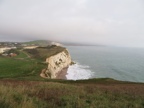
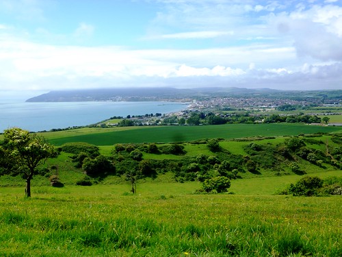
Above all, Tennyson in his great cloak and wideawake hat was a Poet, a very visible one. He came to the Isle of Wight to escape his celebrity, but became the island’s most famous figure, striding the long down beyond Farringford and mouthing half-created lines to the four winds at the edge of the great chalk cliffs.

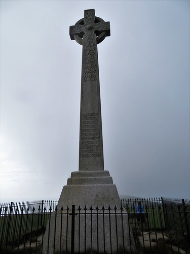
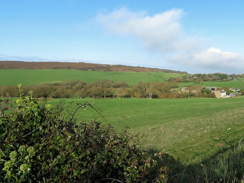
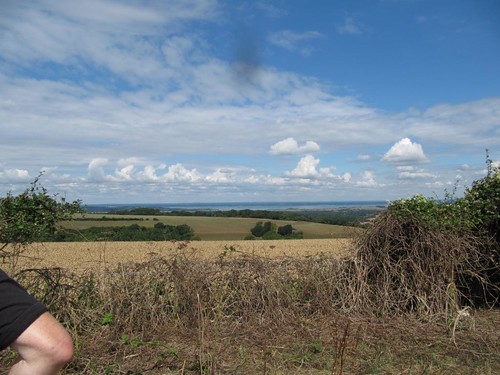
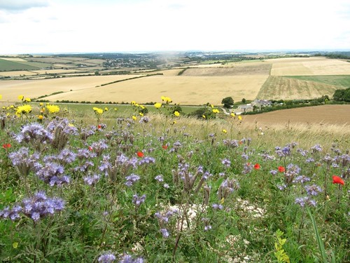
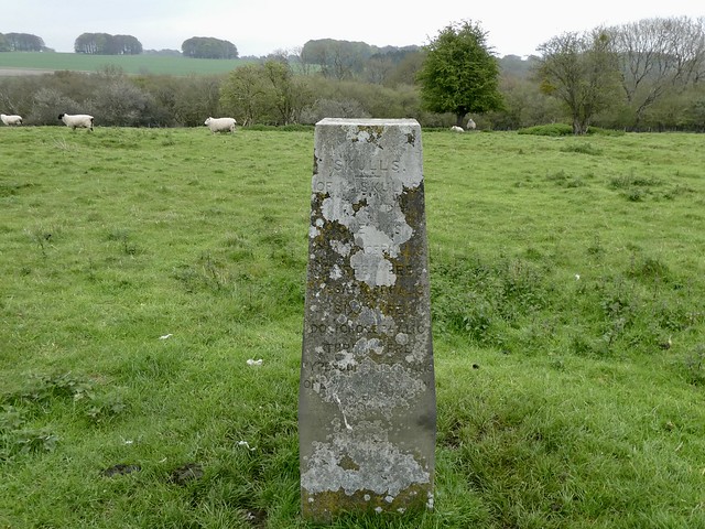
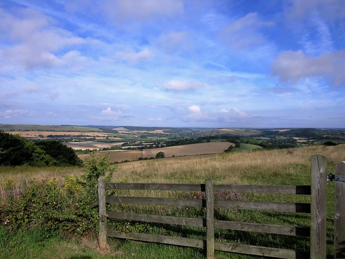
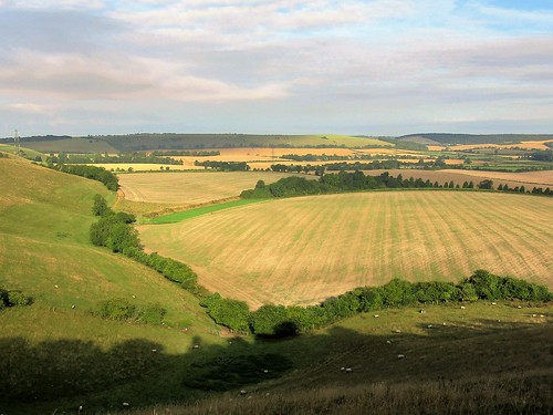
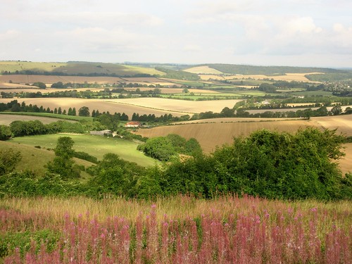
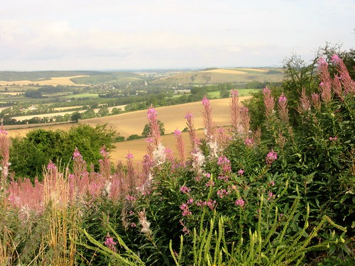
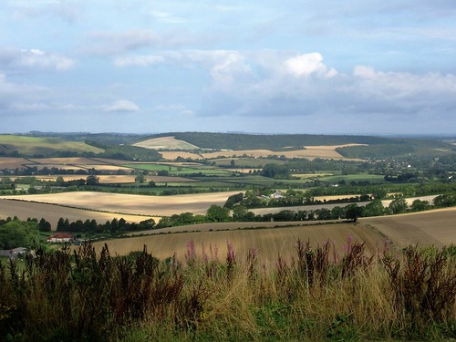
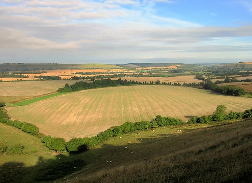
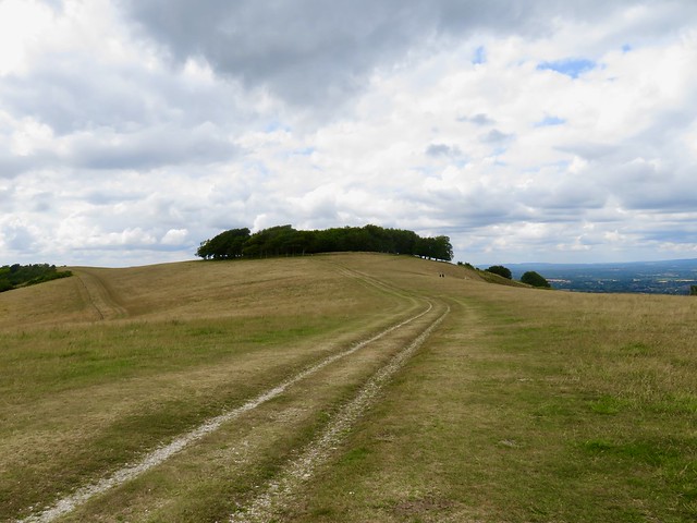
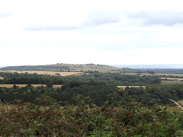
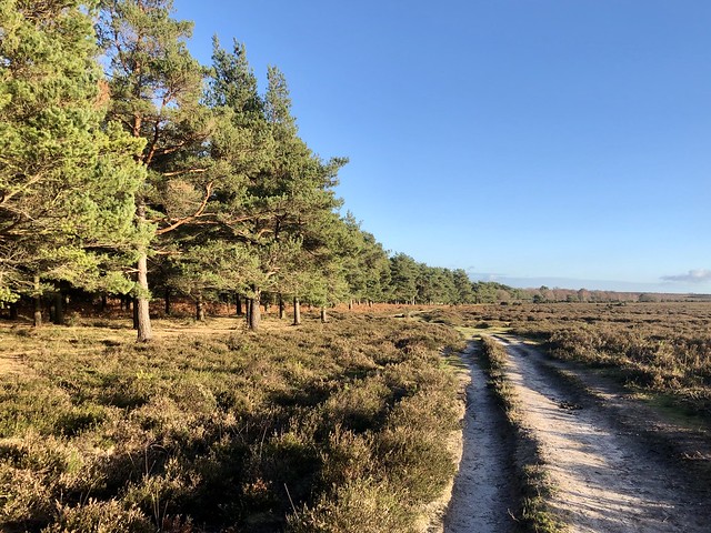
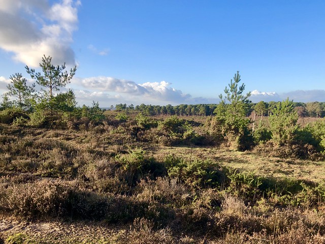
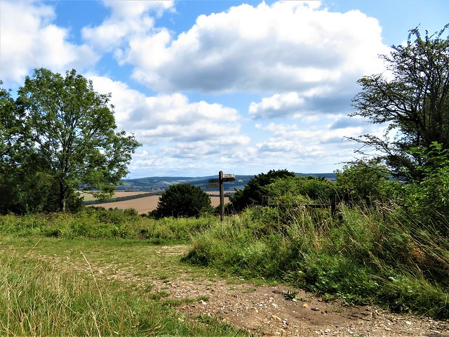
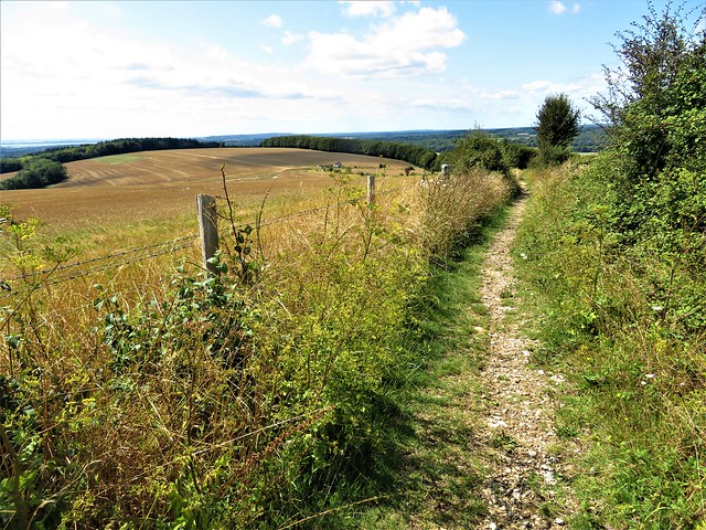
Up on the back of Tennyson Down I strode, too, heading west past the big Celtic cross memorial to the poet, out to where the down narrows to a precarious blade of chalk.

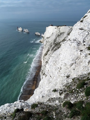
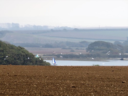
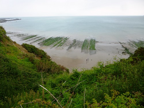
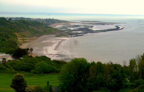
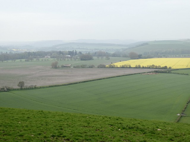
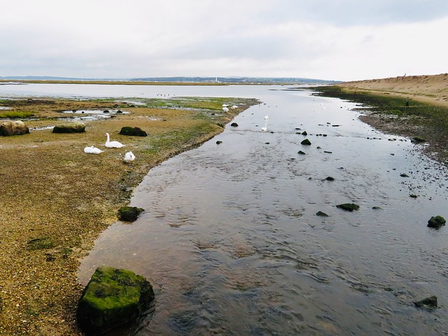
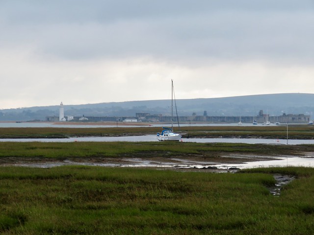
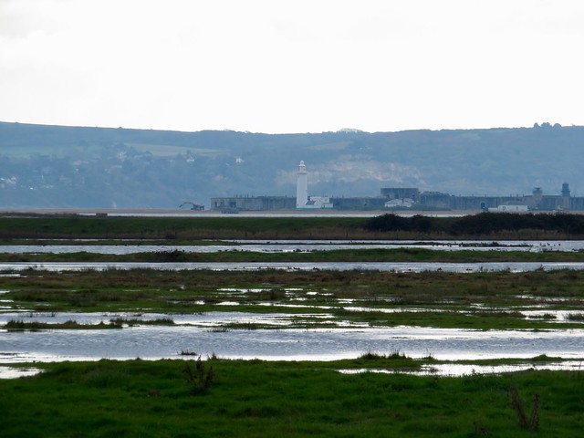
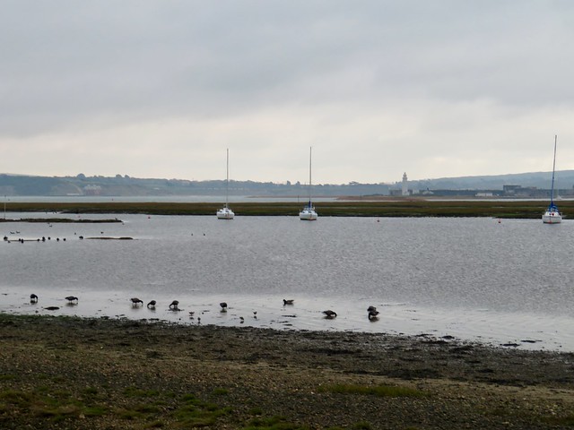
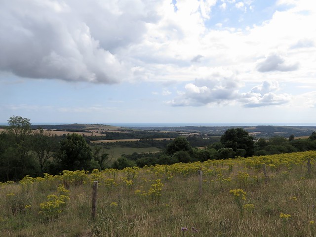
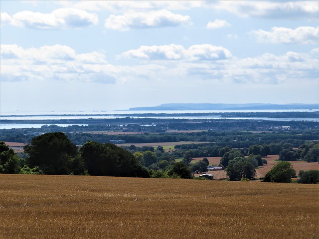
A fenced eyrie overlooks a most tremendous view, a flint-scored wall of chalk nearly 400 feet high, the waves mumbling its feet, running out to where the three white blades of The Needles rise from the water. A salt-stained striped lighthouse clings to the outermost stack, and gulls wheel far below.

In Tennyson’s time they built a battery out here to ward off the threat of a French invasion. A century later, scientists and engineers used the promontory as a test ground for Black Knight and Black Arrow, rockets that tried and failed to make Britain a credible player in the Great Space Race.

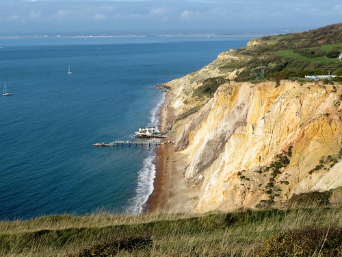
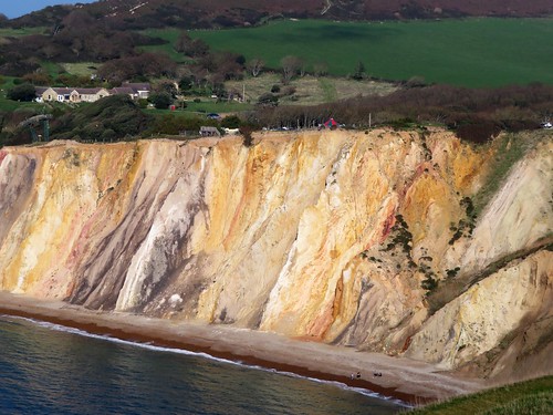
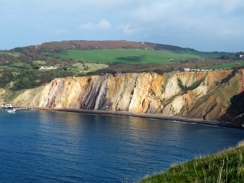
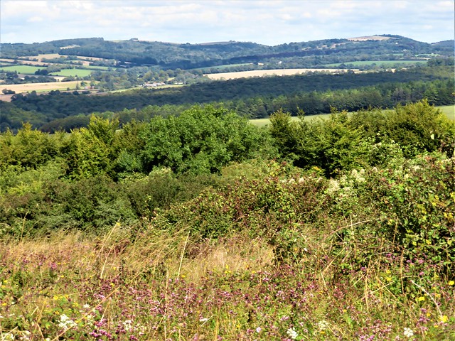
Afternoon sun struck glowing colours – rose, peach, white, crimson and dove grey – out of the deeply fissured cliffs of Alum Bay. Beyond them I followed a field path back towards Farringford, glancing every now and then up at the skyline for a glimpse of a genial ghost in flowing cloak and broad-brimmed hat, still striding and declaiming to the winds.
Start: High Down Chalk Pit car park, 1 mile south of Totland, PO39 0HY approx. (OS ref SQ 324855)

Getting there: Red Funnel ferries (redfunnel.co.uk), Southampton-East Cowes. Bus 5 (East Cowes-Newport), 7 (Newport-Alum Bay).
Road – A3021, A3054 to Newport; B3401 Carisbrooke and Freshwater Bay. Follow ‘Needles, Alum Bay’; in 1¾ miles, left beside Highdown Inn to car park.

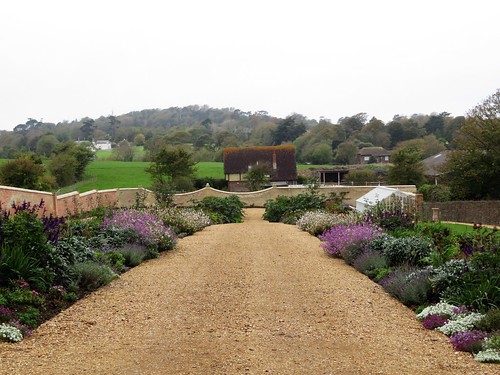
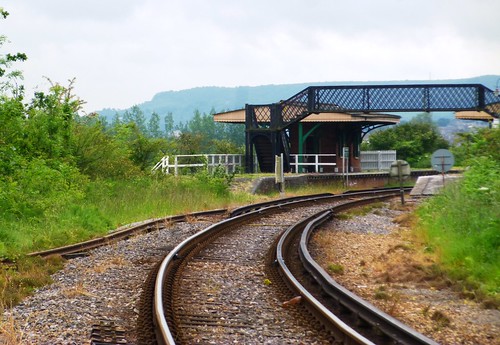
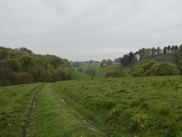
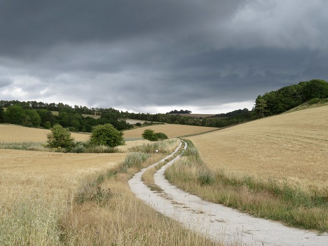
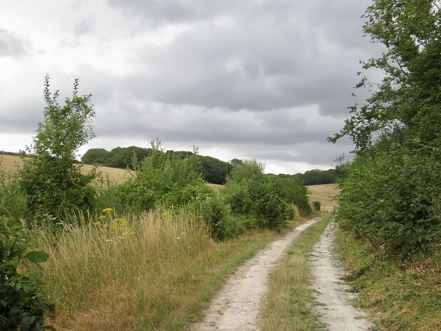
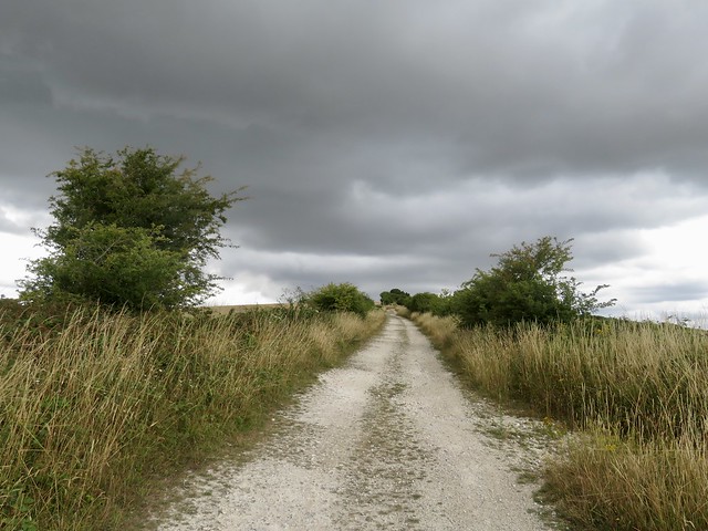
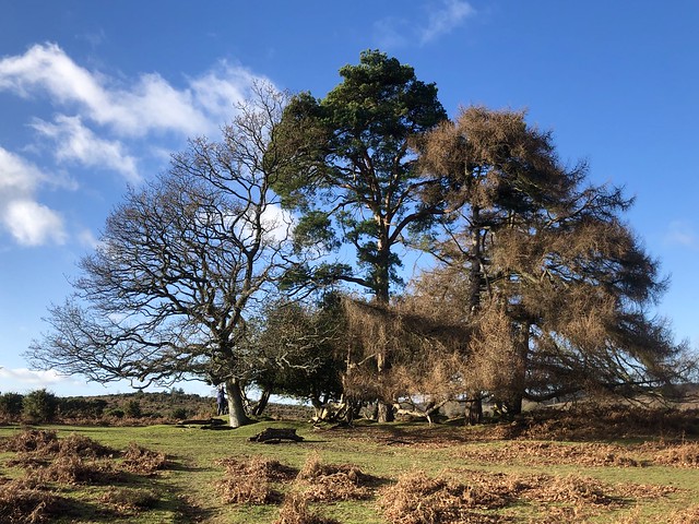
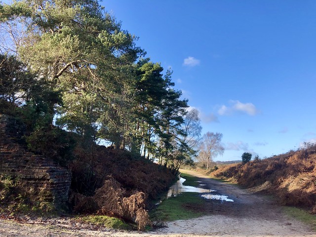
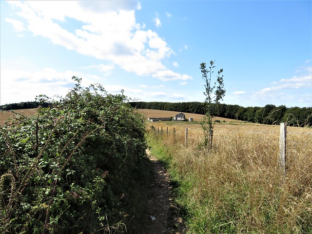
Walk (6½ miles; moderate, one short steep climb; OS Explorer OL29): From car park, east along foot of Tennyson Down. In 650m pass gate/path on left (331857) and leave trees. In another 150m, with chalk pit on right and drinking trough on left, path forks right (333858), but bear left and continue on path along lower hedge. Through gate; in 100m, left on fenced path. At 3-finger post (334861), right towards Farringford House and walled garden.

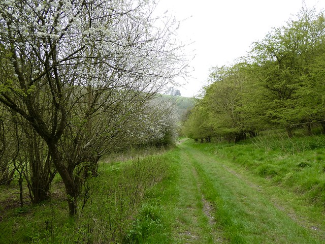
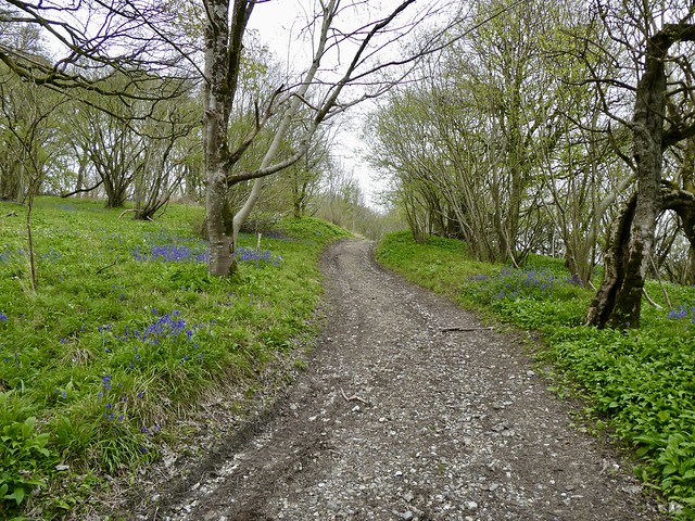
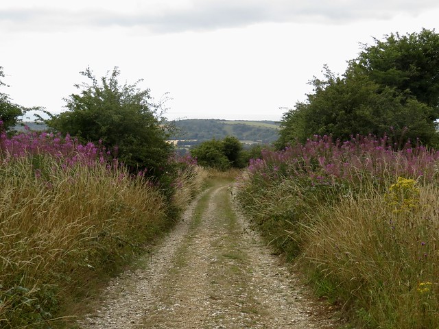
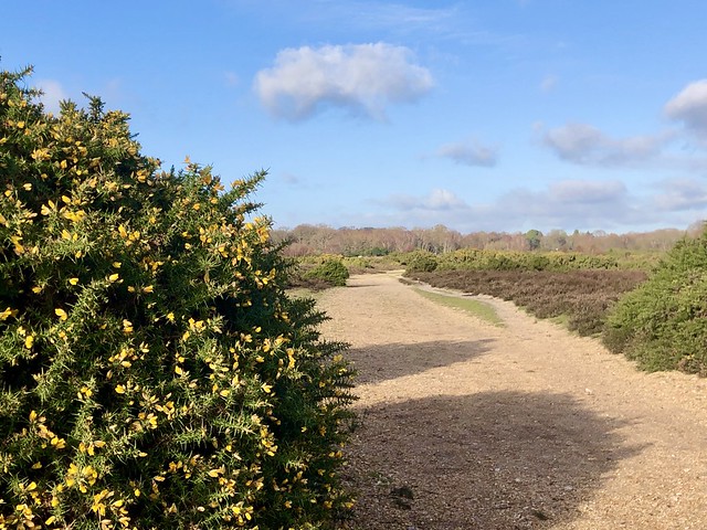
Ahead up Gate Lane (fingerpost). In 200m, at ‘Private’ garden door on left, turn right (338861) down Green Lane. In 300m through gate (337857); cross path; straight ahead, steeply up through trees. Cross summit of down to Tennyson Trail (337855); right (west) for 2½ miles to coastguard cottages (301848), Needles viewpoint (298847) and Old Battery (296849).

Back along lower roadway. In ¾ mile, at left bend to Alum Bay, keep ahead (308852, ‘Tennyson Down’) on field path. In ¾ mile at Nodes Beacon cresset (319853), fork left for 600m to car park.

Lunch/Accommodation: Highdown Inn, Highdown Lane, Totland PO39 0HY (01983-752450, highdowninn.com)

Farringford House: Guided tours, opening times etc – 01983-752500, farringford.co.uk

Tourist and walking info: visitisleofwight.com

Isle of Wight Walking Festival: 4-19 May 2019 (isleofwightwalkingfestival.co.uk)

satmap.com; ramblers.org.uk

 Posted by at 01:04
Dec 092017


First published in: The Times Click here to view a map for this walk in a new window
picture picture picture picture picture picture picture picture picture picture picture picture picture picture picture picture
Facebook Link:

The red squirrel sat on the garden wall at The Medlars B&B, nibbling nuts, his tail like a puff of ginger smoke held tightly to the curve of his back. The Isle of Wight is full of red squirrels (it has no grey intruders to out-compete and infect our native species), but I’d never seen one so bold and so willing to hold a charming pose for my delight.

We could have crouched all morning at the window watching the squirrel, but the early morning held the promise of a walk inland from the salty old port of Yarmouth. First, though, a wander along the sandy narrows of Norton Spit among prickly leaves of sea holly and fleshy spears of glasswort, out to the harbour pontoon where moored yachts bobbed.

The Yar estuary curves north through tremendous reedbeds to Yarmouth, a brackish tideway that all but isolates Wight’s western tip into an island of its own. Isle of Wight footpaths are beautifully waymarked and maintained, an exemplary network. The Freshwater Way carried us unerringly south through Saltern Wood and up to a wonderful view, east across reedbeds and river to folded downlands muted by the wintry light to shades of apricot and grey.

Along the margins of thick clay ploughland, oak leaves were beginning to turn brown and crisp. At King’s Manor Farm a donkey grazed the paddocks, gulping and chewing with noisy relish. Birds were forming the flocks that herald winter – pigeons busily pecking in the newly sprung wheat, crows reducing the farmers’ insect enemies as fast as they could gobble them.

In All Saints Church at Freshwater, morning service had just come to an end. ‘Ah, walkers! Come in, welcome! A cup of coffee? Yes, the church is a bit of a Saxon-Norman mishmash, but we love it!’

Beyond All Saints we crossed a broad bridge over the River Yar and followed an old railway path as it curved back to Yarmouth. Black-tailed godwit and ringed plover stalked the river shallows above their own rippled reflections.

Back on the north coast we made our way down to the shore and followed a sea-stained promenade back into town. A Lymington-bound ferry rumbled away out of Yarmouth, red and white sails scudded in the Solent, and the mainland lay grey and misty on the horizon, no more than a cloudy dream on the edge of sight.

Start: River Road car park, Yarmouth, Isle of Wight PO41 0RA (SZ 354895)
Getting there: Red Funnel Ferries (redfunnel.co.uk), Southampton-East Cowes. Bus 5, Cowes-Newport; bus 7, Newport-Yarmouth.
Road – A3021, A3054 to Newport and Yarmouth.
Walk: (6 miles, easy, OS Explorer OL29): From car park, A3054 to cross bridge. On left bend, right (347896, ‘Coastal Path, Fort Victoria’). At seafront, right along Norton Spit, then along pontoons to end. Return to coast road; left towards bridge; in 50m, right and follow ‘Freshwater Way/FW’. In 400m bear right (348892) through Saltern Wood. In another 1¼ miles, left at All Saints Church (347873) along road. Cross River Yar; left (349871) along railway path. In 1½ miles pass ‘Off the Rails’ café (358894); in another ½ mile, left (364896) along B3401 to cross A3054 (363898). Down steps (‘Yarmouth’ fingerpost) to shore; left into Yarmouth.
Lunch: Off the Rails Café, Yarmouth PO41 0QX (01983-761600, offtherailsyarmouth.co.uk) – bright and quirky; or Red Lion Inn, Freshwater PO40 9BP (01983-754925; redlion-freshwater.co.uk)
Accommodation: Medlars B&B, Halletts Shute, Yarmouth PO41 0RH (01983-761541, medlars-bnb.com) – immaculate B&B
Info: visitisleofwight.co.uk
Isle of Wight Walking Festival 2018: 28 April – 13 May
visitengland.com; satmap.com; ramblers.org.uk

 Posted by at 01:17
Aug 162014
 

‘Have you by any chance seen any elderflowers out?’ briskly enquired the elderly gentleman we met on the road under Bembridge Down.
First published in: The Times Click here to view a map for this walk in a new window
picture picture picture picture picture picture picture picture
Facebook Link:
‘I just need another twenty-six, you see,’ he said, as though that explained everything. Twenty-six? For what? Elderflower wine, a witchcraft potion, a very precise table decoration? All seemed possible on this afternoon of wonders in the Isle of Wight, with superannuated London tube trains clacking through the fields on the island’s beautiful old railway network, seldom-seen Cetti’s warblers shouting from the bushes on Brading Marshes, and botanical rarities jewelling the slopes of Bembridge Down.

Those bee orchids! How many had I seen in my life – half a dozen at the most? And here they were by the hundred in small selective patches, their prominent sepals like lipstick-pink propeller blades, their lower lips stamped with the semblance of a bumblebee’s large round bottom. We walked the secret valley below the down, reciting the flowers we saw like a litany: eyebright and yellow-wort, field madder and lady’s bedstraw, bird’s-foot trefoil and salad burnet – tiny blooms as striking to the eye as their names fell sweetly on the ear.

Up on top of the down the flint-and-brick stronghold of Bembridge Fort crouched low and hunchbacked behind grassy ramparts that might have been those of an Iron Age hill fort. Like the blocky grey gun emplacements out at sea in the Solent, the fort was one of ‘Palmerston’s Follies’, constructed at gigantic expense in the 1860s to deter the French from an invasion they never seriously intended to mount.

We strolled the cliff path among white campion flowers at the brink of Culver Cliff, taking in the view west over the sprawl of Sandown and the varicoloured crumbling cliffs beyond. Then it was down to the flint-speckled beach of Whitecliff Bay to explore the rock pools under tottering cliffs so unstable they seemed half molten.

High above Bembridge we passed an old windmill standing foursquare, sails to the wind, under its weather-boarded cap. Then the homeward path towards nightfall across the lagoon-streaked flatlands of Brading Marshes, where buttercups in their millions gilded the meadows and a sweetly whistling blackcap sanctified the willows of Centurion’s Copse as beautifully as any vespers ever sung.

Start: Brading station, Isle of Wight, PO36 0EB (OS ref SZ 609869)

Getting there: Red Funnel Ferry (0844-844-9988; redfunnel.co.uk), Southampton-Cowes. Rail or Buses (Routes 2, 3) to Brading station
Road: Station is signed off A3055 Ryde-Sandown road in Brading. Car park £1.50 all day.

Walk (7½ miles, easy, OS Explorer OL29): Back up road; in 50m, right (fingerpost/FP, ‘B1’). Through guardrails; in 50m, right (FP ‘B36’) to cross railway (610870). Ahead across Brading Marsh RSPB Reserve. In 300m, left (613868) along River Yar. Right across footbridge (616870). In 200m, right at T-junction of paths (615869), through kissing gate/KG and bear left along hedge. In 400m, at end of field, through KG; ahead to cross B3395 (616862; take great care! – bend!). Follow path (FPJ ‘BB44-Bembridge Down’) along valley, with fence on your right. In 700m, fence turns right (622859); keep ahead, and in 150m, bear left through bushes and up to Bembridge Fort.

Cross road (624860); walk circuit of fort ramparts; return down slope and bear left to cliff fence. Left along coast path to reach Yarborough Monument (633857 – Culver Haven Inn is adjacent). Follow Coast Path, keeping left of NT ‘Culver Down’ gate and notice, downhill and along Whitecliff Bay cliffs past chalet park. In 500m, turn right down steep access road (640863) to explore beach and rock pools and visit Tuppenny Café.

Back on Coast Path, continue for 300m; turn left inland (642865, FP) past Bembridge School info board. Follow yellow arrows/YAs and FP to Hillway Road (641868). Left; in 100m, right (FP ‘BB22’, ‘Bembridge Windmill’). In 300m, cross B3395 (639871, FP); keep ahead. In 150m, right at T-junction of paths, uphill to pass Bembridge Windmill (640875). In 30m, left through gate (FP ‘BB21, Brading’). Follow path west (stiles, YAs) for 1½ miles. In Centurion’s Copse, at 620869, follow main, well-trodden track as it turns right between old wooden gateposts and in 100m, turn right at ‘Woodland Secrets’ signboard (FP ‘BB23, Brading’ on your left). Cross River Yar footbridge (616870); retrace steps to Brading station.

Lunch: Culver Haven Inn, Culver Down (01983-406107); Tuppenny Café, Whitecliff Bay

Accommodation: Crab & Lobster Inn, 32 Forelands Field Road, Bembridge PO35 5TR (01983-872244, crabandlobsterinn.co.uk) – popular, lively, bustling place.

150 Years of IoW Railways: Celebrations 30 August 2014. Tickets (vintage transport, 1950s Day, etc.) from hovertravel.co.uk, iwsteamrailway.co.uk, local outlets

Info: visitisleofwight.co.uk www.satmap.com www.LogMyTrip.co.uk visitengland.com

 Posted by at 01:13
Oct 302010
 

When King Charles I arrived in the Isle of Wight in November 1647, he was on the run after comprehensive defeat in the English Civil War. The king believed that the newly-appointed governor of Carisbrooke Castle, Robert Hammond, would help him escape to France.
First published in: The Times Click here to view a map for this walk in a new window
picture picture picture picture picture picture picture
Facebook Link:
But Hammond, reporting Charles’s every move to Oliver Cromwell, held him securely in the old Norman stronghold like a pearl in a snapped-shut oyster. A year of royal incarceration, of farcical escape attempts and botched deals, ended with the inevitable humiliating journey under guard to London and to public execution in Whitehall on a cold Tuesday in January 1649.

High and handsome on its wooded knoll, its pale stone walls splashed with late year sunshine, Carisbrooke looked this morning like a romantic’s dream of a fairytale castle. In the car park a cheerful lady steering a black labrador told us, ‘Get up on the downs, you’ll have a beautiful walk.’ She couldn’t have given us better advice. The Tennyson Trail, a flinty lane in a tunnel of trees, took us up onto the roof of Bowcombe Down, where chalkhill and common blue butterflies were flitting with crazy energy over the last sprigs of wild marjoram and knapweed.

Views back to the curtain walls, great gatehouse and sloping motte of Carisbrooke Castle were breathtaking. And so were the prospects from the ridge track, out across a landscape of corn stubbles squared by hedges, hilltop spinneys, the roll and dip of the island’s wide chalk downs, and a northward glimpse of corresponding hills away on the mainland beyond the gleam of the sky-blue Solent.

A shady green lane dipped down from the ridgeway to cross a valley, with a wonderful view ahead of the flank of Dukem Down quilted with silvery stubbles, green and gold trees, pale crops of new grass and olive-coloured herby sward. Long streamers of chalk dust trailed after the farm tractors as they harrowed the stubbles. Up on the crest of Garstons Down buzzards wheeled, the sun struck warm, and jewelled beetles lurched through the close-nibbled turf among a million rabbit pellets.

Dropping down the slopes towards distant Carisbrooke, I pictured the captive king’s frustration and misery. Charles saw himself as God’s anointed representative on earth. It hadn’t done him any good. Pacing the quarter-mile circuit of his prison walls and looking out over the downs, how he must have longed for everyman’s simple freedom to go for a walk in the country.

Start & finish: Carisbrooke Castle car park PO31 1PE (OS ref SZ 485876)

Getting there: Ferry: Red Funnel (023-8024-8500; www.redfunnel.co.uk) Southampton to East Cowes (vehicles) or West Cowes (foot passengers). Bus service 1 (West Cowes) or 5 (East Cowes) to Newport; 6, 7 or 38 to Carisbrooke. Road: A3020 (West Cowes) or A3021/3054 (East Cowes) to Newport; B3341 ‘Carisbrooke Castle’.

Walk (7 miles, moderate, OS Explorer OL29): From car park, Public Footpath 88 (‘Miller’s Lane’). Right at Miller’s Lane, left along Clatterford Shute (483876); cross ford; cross B3323 Clatterford Lane; up Nodgham Lane and over crest. Hairpin left by ‘Little Hill’ up Tennyson Trail (481881; fingerpost) across Bowcombe Down for 2¼ miles. At gate, left (455860; ‘bridleway N135, Bowcombe Road’). In 250 yards lane swings right; ahead here and down to cross B3323 Bowcombe Road (465859; fingerpost ‘Froglands and The Downs’) near Idlecombe Farm. Up field edge left of triangular copse; 100 yards into next field, right through hedge, left up green lane, over ridge, down to corner of Frogland Copse (471862). Follow stony lane to right; climb field edge; in 50 yards, ahead up hedged path (‘N146 Gatcombe, Shorwell’) to Dukem Down. At crest (472852) you’ll find a stile with Access Land logo on left, wooden horse jump fence ahead, and a metal rider’s gate to the right. Go through this, on among trees. In 400 yards, left (475850; ‘Gatcombe’ fingerpost) out of trees; follow fence on left past dewpond on Garstons Down. In 200 yards, left through gate (478850; ‘bridleway G7 Garstons’) and down to Garstons farmhouse (479858). Bear right in front of house (‘Byway’) along stony lane; in 250 yards, fork left along narrow green lane between hedges. In ⅓ mile, ahead (486864; ‘bridleway N108, Whitcombe Road, Carisbrooke’) along Shepherds Trail for ½ mile to Whitcombe Cross (487874). Left for 100 yards; right (‘Carisbrooke Castle’) along field edge. At top, left to car park.

NB – Online map, more walks: www.christophersomerville.co.uk

Lunch: Picnic

Carisbrooke Castle: 01983-522107;

http://www.english-heritage.org.uk/daysout/properties/carisbrooke-castle/

More IoW info: 01983-813813; www.islandbreaks.co.uk

www.ramblers.org.uk; www.satmap.com

 Posted by at 00:00
Apr 062024


First published in: The Times Click here to view a map for this walk in a new window
Oak and bluebells, Rotherley Wood apple blossom, Tollard Royal track above Munday's Pond spring greenery and blossom above Tollard Royal Skulls information pillar by General Pitt-Rivers's excavations, Rotherley Down view from Ox Drove Track descending to Ashcombe Bottom Track descending through bluebell woods to Ashcombe Bottom Bluebells by the track to Ashcombe Bottom King John Inn, Tollard Royal track in Ashcombe Bottom

A cloudy, murky morning over Cranborne Chase. The views from Win Green were all melted into muted greys. The topograph on the saddle of high ground hinted at the prospect: fifteen miles northeast to Salisbury, twice that to the Isle of Wight down in the southeast.

Children skipped and tumbled down the steep slope towards the wooded Ashcombe valley. The sharp spring wind was soon shut away, and calm descended on the deep green cleft where the path ran edged with primroses, violets and pungent wild garlic in full flower.

These woods of the Ashcombe Estate are a prime example of careful management and discreet signage. The vast hunting forest of Cranborne Chase, on whose borders they lie, was once a different affair – a tangled tract of deep forest where outlaws skulked and wild locals in straw helmets beat up gamekeepers and poached the deer.

Down in Tollard Royal all was peachy, the snugly thatched cottages of flint and clunch, the gossipers on the benches round the village pond, all in a Sunday morning peace under steep valley slopes.

We climbed over a ridge where spring lambs were busy butting milk out of their mothers’ udders. In the cleft below the rains of late winter were drying, leaving Munday’s Pond a soggy circle of nettles.

Our path lay uphill, breasting a slope beside the old hazel coppice of Rotherley Wood. A marvellous sentinel oak, twisted, split and bow-backed, stood with its feet in a flood of bluebells, and the hazel stools themselves were circled by the sharp evergreen leaves of butcher’s broom, another indicator of ancient woodland.

Up on the back of Rotherley Down lumps and bumps in the turf showed where a Romano-British settlement was excavated in 1886-7 by local landowner General Augustus Pitt Rivers. ‘Skulls’, says the inscription on a modest pillar. ‘1 was brachycephalic, 3 were mesaticephalic, 6 were dolichocephalic, 3 were hyperdoliocephalic, one was uncertain’. The General, father of modern British archaeology, remained an educator to his fingertips.

Beyond the settlement site we turned along the chalky white track of the old Ox Drove ridge road towards Win Green. The clouds had cleared, and the Isle of Wight lay blue and humped on an invisible sea far in the southeast, a view familiar to those residents of Rotherley Down two thousand years ago.

How hard is it? 7¼ miles; easy; downland and woodland tracks

Start: Win Green car park, near Tollard Royal, SP7 0ES (OS ref ST 924204)

Getting there: Tollard Royal (B3081) signed from A350 (Shaftesbury-Blandford Forum). At top of hill before Tollard Royal, follow ‘Donheads’, then ‘Win Green’.

Walk: Through gate at top of car park; follow path along fence and downhill. Follow ‘Wessex Ridgeway’/WR and ‘Footpath’ signs through Ashcombe valley. In 1¾ miles, hairpin back left (937185, ‘Tollard Royal’ fingerpost); in 50m right through 2 gates (WR); follow path with fence on right. In ¾ mile, just before Tollard Royal pond (945178), left over stile. (NB for King John Inn, right at road). From stile climb bank, at top, on through gate (arrow) along fenced path to stile (949181). Diagonally left down to gate (940184, Munday’s Pond on left). Ahead on grassy track up slope beside Rotherley Wood. In ⅔ mile track enters wood; ahead through gate onto open down; Pitt-Rivers information pillar and excavations to right (950194). Opposite pillar, left through gate; right up middle of fields (arrows) to Ox Drove road (949205). Left; in ½ mile fork left (938206, ‘Cranborne Droves Way’), then right on chalk trackway. In ¾ mile, beside NT ‘Win Green’ sign, left (928207) up grass path to car park.

Lunch/Accommodation: King John Inn, Tollard Royal SP5 5PS (01725-516207, kingjohninn.co.uk)

Info: cranbornechase.org.uk

 Posted by at 01:16
Feb 152020


First published in: The Times Click here to view a map for this walk in a new window
picture picture picture picture picture picture picture picture picture picture picture picture picture picture
Facebook Link:

Keyhaven means ‘the harbour from which cows are shipped,’ and looking south from the little tidal port to the Isle of Wight you can see just how convenient it was for transporting boatloads of cattle across the Solent. The nearest point on Wight is less than a mile away, and the whole southern skyline is filled with the long, humpbacked loom of the island.

Keyhaven Marshes used to be salterns, or salt pans. There were oyster beds here, too. There’s still a flavour of former workings about this gravelly Hampshire shoreline with its black wooden stakes and marsh walls, though nowadays Keyhaven Marshes nature reserve is better known for the thousands of wildfowl and waders it hosts for feeding, breeding and winter roosting.

In a moody half light over land and sea I set off along the Brent Trail, a loop that took me east along the seawall. Something close to a hundred thousand birds see out the winter here. Today, dark-bellied brent geese creaked and grumbled as they fed along the tideline. Sandpipers and turnstones ran among them, light-footed scamperers in counterpoint to the heavy-legged plodding of the brents through the murky wavelets of the Solent.

Softly gleaming creeks threaded their way seaward through broad mudbanks coated with brilliant green algae. A pair of egrets, white as ice, landed on the mud and went stalking after crustaceans on spindly black legs, as intent and sharp-eyed as any fox after a chicken.

I turned inland between waterlogged marshes where shelduck made bold blobs of chestnut and white. Flocks of dark little teal went speeding across the grey sky. Shaggy cows grazed the bramble banks, and a pair of swans came in to land on the water with sawing noises and maximum hubbub.

The return path led back to Keyhaven car park, then on west to where a great shingle spit turned south into the Solent. This was an utterly different world, with waves splashing on the seaward margin of the spit and a view across the windy Solent to the downs of the Isle of Wight, backlit by peach-coloured light over the unseen coast of France.

Out at the end of the spit lay Hurst Castle, an uncompromising block of a fortress. Built by King Henry VIII to ward off the French, reinforced in the 19th century against the threat of the same enemy, it squats like a grey, salt-streaked toad, looking across the Solent to the great blockhouse of Fort Albert on the Wight coast.

Crunching back towards the mainland I pictured King Charles I, pacing this shingle spit daily to while away his period of incarceration at Hurst Castle in the cold Christmastide of 1648. There would be no Icarus wings for poor Charles Stuart to escape upon. The beheading block awaited him in London, and he knelt there for execution before January was out.

Start: Keyhaven car park, near Lymington SO41 0TP (OS ref SZ 307915)

Getting there: Keyhaven is signed from B3058 in Milford-on-Sea (A337, Lymington-Christchurch)

Walk (7¼ miles, easy, OS Explorer OL22): From car park, right across inlet; on far side, right through gates; follow Brent Trail (red arrows). In 1¾ miles, opposite jetty with red and yellow markers, left inland (325924); follow Brent Trail back to car park. Left along road (‘Hurst Castle Ferry’); footpath to sea wall (308913); right (‘Solent Way’) to spit (299908). Left to Hurst Castle, and return.

Lunch: Gun Inn, Keyhaven SO41 0TP (01590-642391)

Accommodation: Mayflower Inn, King’s Saltern Rd, Lymington SO41 3QD (01590-672160, themayflowerlymington.co.uk)

Info: Lymington TIC (01590-689000); visit-hampshire.co.uk; satmap.com; ramblers.org.uk

 Posted by at 01:27
Sep 032016


First published in: The Times Click here to view a map for this walk in a new window
picture picture picture picture picture picture picture picture picture picture
Facebook Link:

On this bright windy day the view from the triangulation pillar on Butser Hill was at its very best – the South Downs billowing east and west, Portsmouth and Southampton sprawled far in the south, while out to sea the matt blue bar of the Isle of Wight stretched along the horizon. To the north-east the great hollow of the Devil’s Punchbowl took a bite out of the shoulder of the Surrey Hills.

Dog walkers trotted by, one couple watching their six sheepdogs fan out across the grass. The hilltop was bright with golden bird’s-foot trefoil, sky-blue harebells, bright yellow heads of wild parsnip, and tall plants of marjoram whose flowerheads we crushed between our fingers to savour their pungent smell.

This southwest corner of Hampshire is a tangle of quiet lanes. At the foot of the hill we followed a white chalk holloway, the breathy roar of a harvester percolating through the trees from the cornfields beyond. Oxenbourne Lane was spattered with fallen hazelnuts, their flesh pale green and milky. The scarlet berry clusters of lords-and-ladies grew along Cumber’s Lane, a favourite with off-road drivers. A temporary ban on their activities had resulted in the smoothing out of boggy tyre ruts and a thickening of greenery along the smashed-up verges.

The bald head of Butser Hill loomed on the eastern skyline as we crossed the infant River Meon, dried to nothing in a pebbly bed. Lower Farm and South Farm lay silent, all thatched sheds, flint walls and Dutch barns packed with round straw bales. We passed a run of olive brown ponds, the source of the Meon, and leaned on the bridge to savour twin smells – the tang of mint flourishing in the trickling water, and the sweet aroma of jam in the making that wafted seductively from the open windows of Springhole Cottage.

A flinty track shaded by a magnificent avenue of beech trees brought us south to Tegdown Bottom, where sheep and lambs were crying to one another. At the crest the South Downs Way made east for Butser Hill. The broad old track flickered with the shadows of low-flying swallows fuelling up for their long flight south to Africa – a tiny frisson from the oncoming autumn.
Start: Butser Hill car park, near Clanfield, Hants GU31 5SP (OS ref SU 712201)

Getting there: Butser Hill is signed from A3 between Horndean and Petersfield.

Walk (6¾ miles, easy, field paths and lanes; OS Explorer 120. Detailed directions are downloadable with online maps, more walks at christophersomerville.co.uk). Pass kiosk hut; through metal gate; follow grass path past radio station to pass trig pillar at summit of Butser Hill (717203). Keep ahead down far slope till you meet wide grass track; left along it (717204; occasional red-topped marker posts), through gate and on, keeping fence close below you. In ¼ mile pass a group of tumuli (714208); go through a belt of scrub and begin descending a ridge. Halfway down fork right, aiming for distant church spire. At foot of slope, into trees; in 50m fork left downhill to kissing gate at bottom (706212). Right along chalk holloway lane to Oxenbourne Lane (706217).

Left along lane; in 200m, right; in 175m, left along trackway. In ½ mile, at junction of six lanes in a grassy circle, turn left (696220) along Cumber’s Lane to cross road (696214). Take lane opposite past Fishpond Cottages to road (694211). Right for ⅔ mile past Parsonage Farm to T-junction; left (685210, ‘Clanfield, Horndean’) past Lower Farm. In 250m, left over stile (fingerpost); across paddock, through gate (yellow arrow/YA); left up South Farm drive. Bear right through farmyard and on along lane to cross bridge over ponds (685205; source of River Meon). Follow drive to Upper Barnes (685196); on up green track (YA, fingerpost) for ½ mile to meet South Downs Way/SDW (693190). Left on SDW to road (706191); left to car park.

Lunch: Rising Sun PH, North Lane, Clanfield, PO8 0RN (023-9259-6975, therisingsunclanfield.co.uk)

Accommodation: Upper Parsonage Farm, Harvesting Lane, East Meon, Petersfield GU32 1QR (01730-823490, upperparsonagefarm.co.uk)

Info: Petersfield TIC (01730-268829)

www.visitengland.com; satmap.com; ramblers.org.uk

 Posted by at 01:40
Jul 152023


First published in: The Times Click here to view a map for this walk in a new window
in Buddington Bottom looking seaward from the track to Buddington Bottom in Buddington Bottom 2 Chanctonbury Chanctonbury Ring looking across wild parsnip to Cissbury Ring and the sea Chanctonbury Ring 2 upland track near Chanctonbury Ring chalk hill blue butterfly view to Cissbury Ring hill fort round-headed rampion

The blackcap that scribbled out its song from an ash tree by the South Downs Way was singing for a perfect summer’s day. I couldn’t believe the profusion of wild flowers and blue butterflies that bordered the ancient ridgeway as it climbed towards the roof of the West Sussex downs.

Wild marjoram, thyme and spearmint scented my fingers. Kidney vetch and knapweed vied for the attention of common and chalkhill blue butterflies that had congregated after a spectacular hatch. Yellow froth of lady’s bedstraw, nail-polish pink of centaury, harebells and hawkbit, St John’s Wort and yellowwort, and the rich blue globular flowerheads of round-headed rampion, the ‘Pride of Sussex’, a nationally scarce flower of this chalk grassland habitat.

The South Downs Way rose as the view opened northwards across a patchwork of pale gold, unharvested cornfields and dark summer woods, south to where the bird’s beak of the Isle of Wight dipped to the sea. Soon another flinty track swung off southwest, a long and gradual descent between fields of wheat and barley, flanked by brilliant yellow sprigs of wild parsnip. Out of the crop fields ahead rose the multiple ramparts of Cissbury Ring, one of the Iron Age hill forts that command this countryside.

Down in the valley bottom I passed the Pest House, a modest cottage of brick and flint with an ominous name. In this lonely place in medieval times stood an isolation house where sufferers from plague, cholera, smallpox and other deadly communicable diseases were banged up to recover or die, one or the other.

A grassy track led up the wooded valley of Buddington Bottom, to reach the South Downs Way. Just west the early Iron Age hill fort of Chanctonbury Ring topped the hill, the circular rampart reinforced with a fine double circle of beech trees. The space under them is as dark as night. This is a place with enormous atmosphere, the world spread out at your feet from the sea to the Sussex Weald.

The Ring was made by the Devil, local stories say, and he will appear to you if you run thrice widdershins around the rampart. There’s a fiendish bargain on offer, of course: a bowl of demonic soup in exchange for your soul. Don’t run round the Ring when you’re feeling hungry, is my advice.

How hard is it? 5½ miles, easy, downland tracks.

Start: Chanctonbury car park, near Washington BN44 3DR (OS ref TQ 125121)

Getting there: Bus 23 (Worthing – Crawley)
Road: At Washington Roundabout on A24 (Worthing-Horsham), take A283. Right down Washington Bostal past Frankland Arms. In ¾ mile, just before A24, sharp left up rough road to car park.

Walk (OS Explorer 121): Uphill on South Downs Way/SDW. In ¾ mile at large grass triangle, right (130117, ‘Restricted Byway’) downhill. In 1 mile at cross-tracks, left (121104, 4-finger post, ‘Wiston Estate Winery’ notice). In ⅔ mile, opposite barns at New Barn, fork left, then immediately right (130100). In 150 m, where track meets lane, fork left through gate (fingerpost, blue arrow/BA); immediately left (BA). In 400m at far corner of vineyard, through gate (133104); on up path through Buddington Bottom valley for 1 mile. At top of climb, left on SDW (145113) past Chanctonbury Ring (139120). In 500m at cattle grid, fork right (134119, gate, BA) on path past dewpond. In 500m descend to gate (129121); down through old chalk pit (slippery!) to rejoin SDW (125121); right to car park.

Lunch: Frankland Arms, Washington RH20 4AL (01903-891405, thefranklandarms.com)

Accommodation: Village House Coaching Inn, Findon BN14 0TE (01903-873350, villagehousefindon.co.uk)

Info: westsussex.info

 Posted by at 01:43
Feb 132021


First published in: The Times Click here to view a map for this walk in a new window
picture picture picture picture picture picture picture picture picture picture picture
Facebook Link:

Notwithstanding its name, the New Forest is not a monolithic block of trees. These 150 square miles of ancient royal hunting ground comprise woodland, wetland, heathland, water and farmland, a wonderful patchwork of accessible countryside from which to tease out a walk for a short winter’s day.

Waymarks are thin on the ground in the New Forest, but the patch of open heath that stretches south of Burley is crisscrossed with good clear paths. We set out on a cold sunny morning along a gravelly track that ran between flowering gorse, sombre winter-dark heather and individual silver birch trees whose slim trunks and dusky red twigs glowed in the clear light.

New Forest ponies cropped the grass by the path, delicately snipping off precise bites with their strong grey teeth. From Turf Hill the southern skyline was spiky with ranks of conifers. We caught a glimpse of a pale blue whaleback hill on the distant Isle of Wight. Between hill and trees rose the slender rocket shape of Sway Tower, a Victorian folly 218 feet tall, built entirely of concrete and still standing proud in the landscape.

It’s easy to get the impression that these heaths form a flat tableland, but in fact they are burrowed with surprisingly steep valleys known as ‘bottoms’. We dropped down into Shappen Bottom past the tufted mire of Holmsley Bog, and crossed the long disused track of the Southampton-Dorchester railway, savouring the smell of bog myrtle cones that we pinched and rubbed to release their spicy fragrance.

Up on Holmsley Ridge beyond we strode west into the sun and wind, buoyed up on exercise and exhilaration. Three ponies had caught the same mood; they came cantering across the path, hooves drumming, tails flying, the leading pony neighing wildly and kicking up his heels as he frisked along.

Down in the hollow of Whitten Bottom streams, pools and flooded ruts led to Whitten Pond, the wind-ruffled water steel blue, the grassy margins a brilliant green in the low afternoon sun. A broad track beyond climbed the gently domed nape of Dur Hill Down, before looping off across the heath towards the old railway.

It’s a shame that Slap Bottom signifies nothing more exciting than ‘sloping valley’. There we steered around a group of ponies grazing the bank of a stream, and sauntered back to Burley in the cold bright sunlight.

How hard is it? 5¼ miles; easy; heathland tracks, wet in parts.

Start: Burley Cricket car park, Cott Lane, Burley, Ringwood BH24 4AP (OS ref SU 214029)

Getting there: Bus 125 (Ringwood)
Road – Burley is signed off A35 (Christchurch-Lyndhurst) and A31 (Ringwood-Southampton)

Walk (OS Explorer OL22): Cross road; down track (‘Forestry Commission Burley’). In 50m left on gravel track. In nearly 1 mile cross old railway (219015); in 200m fork right (219013). In ¾ mile keep ahead (right) at fork (209010) to Whitten Bottom. Cross stream by outlet at Whitten Pond (203012); ahead to cross road at barrier (201013). On along track over Dur Hill Down. In ½ mile at post, right (194013) along line of trees, on track curving right across heath to road (201017). Left across old railway; right into Burbush car park. Aim left towards power lines; in 50m, right on path between trees, across stream into open. Ahead up slope; in 500m, left (206018) on clear track. In ½ mile at Goat’s Pen Cottage join gravel drive (212025); at tarred road, right to car park.

Info: Ringwood Gateway (01425-473883, thenewforest.co.uk); satmap.com; ramblers.org.uk

 Posted by at 01:25
Sep 192020


First published in: The Times Click here to view a map for this walk in a new window
picture picture picture picture picture picture picture picture
Facebook Link:

After days of wild weather and whitened seas along the Sussex coast, a quieter morning dawned over the South Downs. In the hamlet of Walderton, master thatcher Chris Tomkins had his straw bundles and pegs laid out along the gutters of a flint and brick cottage, all handy for the day’s work.

Small clouds went jostling like sheep along the wooded skyline. Our path led east beside stubble fields, sheltered in that characteristic Sussex Downs landscape of dip and rise, every curve of the chalky land pleasing to the eye and heart.

We scanned the furrows as we walked, looking for the bevelled edges and teardrop shapes of Neolithic flint tools lost or left behind by our distant ancestors.

Down behind the neat cottages and carefully tended gardens of Stoughton stood St Mary’s Church, already here when the Normans landed, a blocky building with narrow windows high up. Inside under a simple beam roof a tapestry round the walls depicted the thousand-year story of the downland village in its cradle of woods and slopes.

Beside the flinty lane that led away from Stoughton stood a plain granite pillar. In the adjacent field 23-year-old Pilot Officer Boleslaw Własnowolski – ‘Vodka’ to the other chaps in the mess of 213 Squadron at Tangmere – died in November 1940 when his Hurricane fighter was shot down by a Messerschmitt Me-109. The Polish flag that swathes the pillar, and the poppy wreaths at its foot, show how this young foreign flyer is still remembered here.

The lane ran up to the crest of the downs, where the little grassy domes of the Devil’s Humps lay in line astern. From these Bronze Age burial mounds we had a stunning view south over the glinting inlets of Chichester Harbour, where the spire of Chichester Cathedral lanced into the cloudy sky against a backdrop of trees, creeks and the dull silver plain of the sea.

Flint-cobbled tracks led us south, skirting the scrubby slopes of Kingley Vale National Nature Reserve, a marjoram-scented heaven of wild flowers and butterflies.

We turned for home along a downland highway past the brooding wreck of a great flint barn, and on through woods of oak and beech where the wind whistled and loose leaves pattered earthwards like multi-coloured rain.

Start: Barley Mow Inn, Walderton, Chichester PO18 9ED (OS ref SU 790106). Open again. Please ask permission to park, and give pub your custom!

Getting there: Bus 54 (Chichester-Petersfield)
Road – Walderton is on B2146 (signed from Westbourne, off A27 Portsmouth-Chichester)

Walk (7½ miles, easy, OS Explorer OL8): Right along road. In 50m, right across bridges; grass path to road. Right; in 50m, left (788107, fingerpost); right along field edges. Cross road (792110); on (occasional ‘Monarch’s Way’/MW signs). In 400m, path forks (796113); keep ahead across field to trees (796116). Inside trees, right (MW, ‘bridleway’/BW); immediately keep ahead downhill to road in Stoughton (801114).

Sharp left to church; return to road; right for 150m. By Tythe Barn House, left (801113, BW) up lane. In 350m pass war memorial (804111); on up to top of rise. Forward to 3-finger post (812106, BW); left along track. In ½ mile pass Devil’s Humps (819110); in another ½ mile, right (824115, white arrow in blue circle/WABC) up path; in 150m, right (blue arrow/BA) up stony bridleway.

In 250m cross bridleway (825113, 4-finger post); on downhill. In 550m pass Kingley Vale signs (827108, KV); on down for 500m, right at 4-finger post (828103). In 550m pass KV gate (824100) and on (BW). In 150m, fork right uphill at edge of trees. In 650m, at KV gate on right, fork left (819102, WABC). In ¼ mile, entering yew grow, fork left at 3-finger BW post (815104).

In 650m, at edge of trees, don’t fork left downhill, but keep ahead (809104) into open. In ½ mile, right at ruined barn (800104); inside trees, left along track. In 650m, fork right (794105) downhill past Walderton Down notice to road (792107); left to pub.

Lunch: Barley Mow, Walderton (02393-631321, thebarleymow.pub) – booking advised. Take-away service also available.

Accommodation: Coach & Horses, Compton PO18 9HA (02392-631228, coachandhorsescompton.co.uk) – open and Covid-compliant.

Info: Chichester TIC (01243-775888, visitsoutheastengland.com); satmap.com; ramblers.org.uk

 Posted by at 01:10