First published in: The Times Click here to view a map for this walk in a new window


Facebook Link:

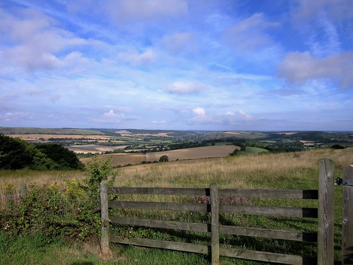
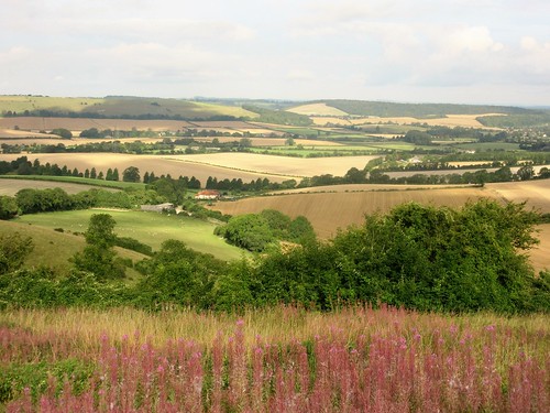
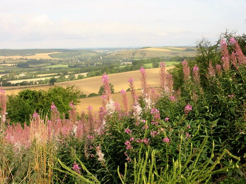
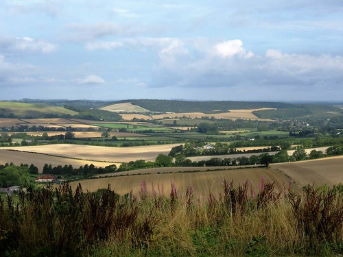
On this bright windy day the view from the triangulation pillar on Butser Hill was at its very best – the South Downs billowing east and west, Portsmouth and Southampton sprawled far in the south, while out to sea the matt blue bar of the Isle of Wight stretched along the horizon. To the north-east the great hollow of the Devil’s Punchbowl took a bite out of the shoulder of the Surrey Hills.
Dog walkers trotted by, one couple watching their six sheepdogs fan out across the grass. The hilltop was bright with golden bird’s-foot trefoil, sky-blue harebells, bright yellow heads of wild parsnip, and tall plants of marjoram whose flowerheads we crushed between our fingers to savour their pungent smell.
This southwest corner of Hampshire is a tangle of quiet lanes. At the foot of the hill we followed a white chalk holloway, the breathy roar of a harvester percolating through the trees from the cornfields beyond. Oxenbourne Lane was spattered with fallen hazelnuts, their flesh pale green and milky. The scarlet berry clusters of lords-and-ladies grew along Cumber’s Lane, a favourite with off-road drivers. A temporary ban on their activities had resulted in the smoothing out of boggy tyre ruts and a thickening of greenery along the smashed-up verges.
The bald head of Butser Hill loomed on the eastern skyline as we crossed the infant River Meon, dried to nothing in a pebbly bed. Lower Farm and South Farm lay silent, all thatched sheds, flint walls and Dutch barns packed with round straw bales. We passed a run of olive brown ponds, the source of the Meon, and leaned on the bridge to savour twin smells – the tang of mint flourishing in the trickling water, and the sweet aroma of jam in the making that wafted seductively from the open windows of Springhole Cottage.
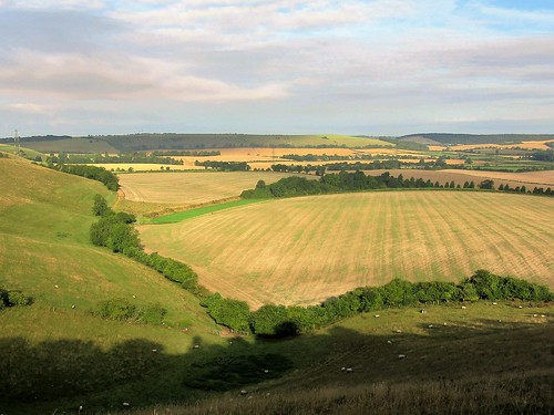
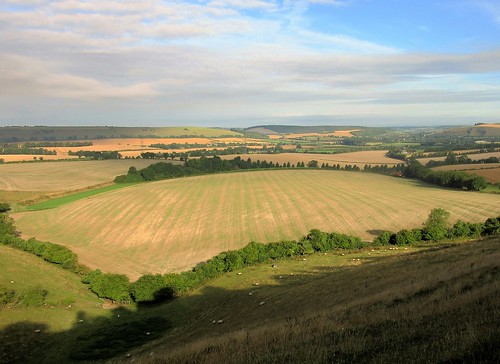
A flinty track shaded by a magnificent avenue of beech trees brought us south to Tegdown Bottom, where sheep and lambs were crying to one another. At the crest the South Downs Way made east for Butser Hill. The broad old track flickered with the shadows of low-flying swallows fuelling up for their long flight south to Africa – a tiny frisson from the oncoming autumn.
Start: Butser Hill car park, near Clanfield, Hants GU31 5SP (OS ref SU 712201)
Getting there: Butser Hill is signed from A3 between Horndean and Petersfield.
Walk (6¾ miles, easy, field paths and lanes; OS Explorer 120. Detailed directions are downloadable with online maps, more walks at christophersomerville.co.uk). Pass kiosk hut; through metal gate; follow grass path past radio station to pass trig pillar at summit of Butser Hill (717203). Keep ahead down far slope till you meet wide grass track; left along it (717204; occasional red-topped marker posts), through gate and on, keeping fence close below you. In ¼ mile pass a group of tumuli (714208); go through a belt of scrub and begin descending a ridge. Halfway down fork right, aiming for distant church spire. At foot of slope, into trees; in 50m fork left downhill to kissing gate at bottom (706212). Right along chalk holloway lane to Oxenbourne Lane (706217).
Left along lane; in 200m, right; in 175m, left along trackway. In ½ mile, at junction of six lanes in a grassy circle, turn left (696220) along Cumber’s Lane to cross road (696214). Take lane opposite past Fishpond Cottages to road (694211). Right for ⅔ mile past Parsonage Farm to T-junction; left (685210, ‘Clanfield, Horndean’) past Lower Farm. In 250m, left over stile (fingerpost); across paddock, through gate (yellow arrow/YA); left up South Farm drive. Bear right through farmyard and on along lane to cross bridge over ponds (685205; source of River Meon). Follow drive to Upper Barnes (685196); on up green track (YA, fingerpost) for ½ mile to meet South Downs Way/SDW (693190). Left on SDW to road (706191); left to car park.
Lunch: Rising Sun PH, North Lane, Clanfield, PO8 0RN (023-9259-6975, therisingsunclanfield.co.uk)
Accommodation: Upper Parsonage Farm, Harvesting Lane, East Meon, Petersfield GU32 1QR (01730-823490, upperparsonagefarm.co.uk)
Info: Petersfield TIC (01730-268829)