Search Results : sussex

Dec 072013
 

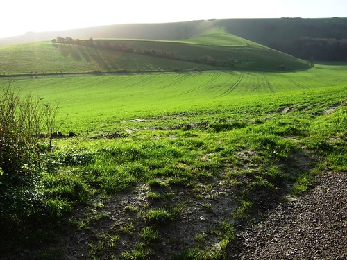
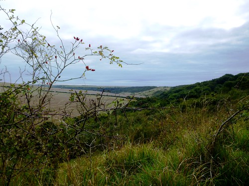
A brisk and cloudy morning over East Sussex, with the sun running its fingers capriciously along the spine of the South Downs where they made their final eastward roll before smoothing out into the coastal plains beyond Eastbourne.
First published in: The Times Click here to view a map for this walk in a new window
picture picture picture picture picture picture picture picture picture picture picture picture picture picture picture picture
Facebook Link:
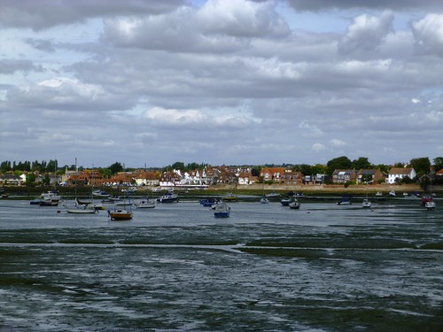
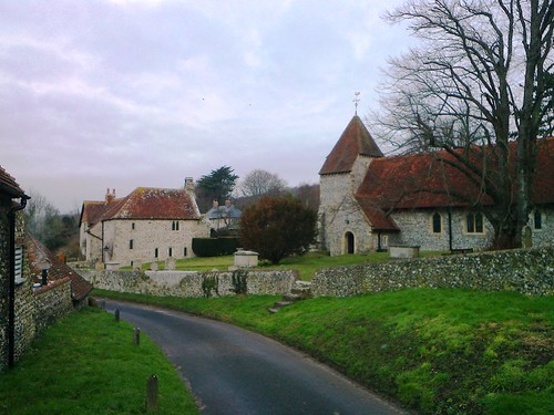
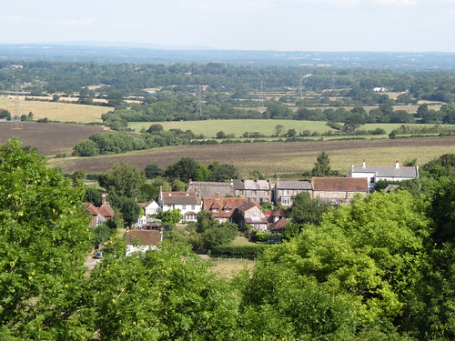
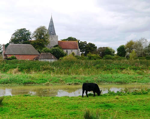
Here Alfriston sits in a gap carved by the snaking Cuckmere River in the chalk wall of the downs, a natural gathering place for travellers going east-west along the ridge, or north-south between the fertile lowlands of the Sussex Weald and the pebbly coastline with its mighty white cliffs.

We gathered on the outskirts of Alfriston, a mixed bag of siblings, cousins and friends, and set off through the streets of the postcard-pretty village, all brick and flint, cheery red tiles and half-timbered houses. Not that everything hereabouts has always been this cosy. Back in the 18th century the Collins gang ran a ferocious and ruthless smuggling ring in Alfriston, and woe betide anyone who dared cross the ‘night-walking gentlemen’ or peach on them to the excise officers.

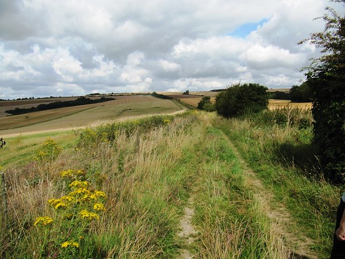
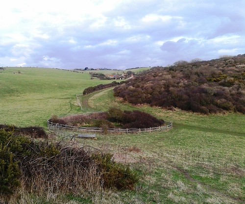
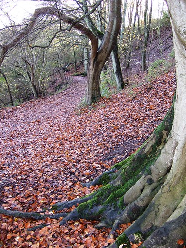
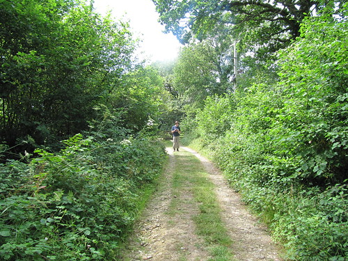
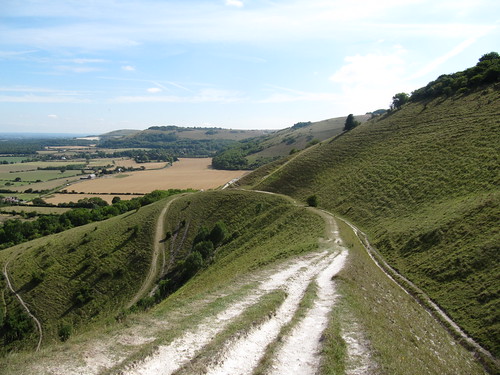
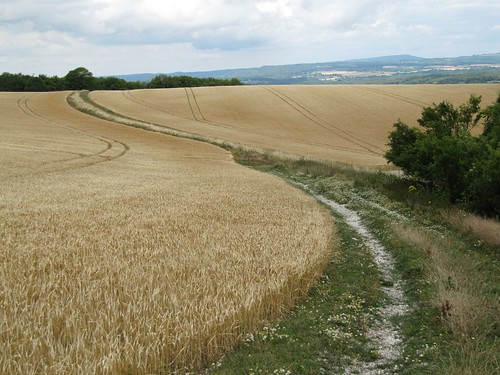
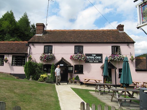
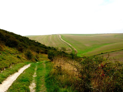
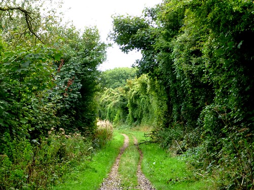
We passed the extravagantly carved and painted old Star Inn (a secret tunnel connects it to the beach at Cuckmere Haven, local stories say), and followed the wide chalk-and-flint trackway of the South Downs Way north-west, steeply up and out of Alfriston between thick hedges. Up on the back of the downs we had the wind in our faces and a broad track unrolling ahead, sheer exhilaration and a great stimulus for chatter.

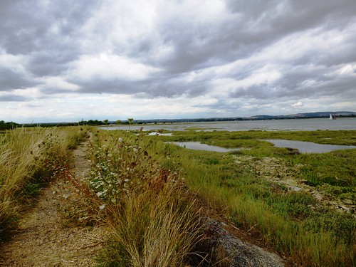
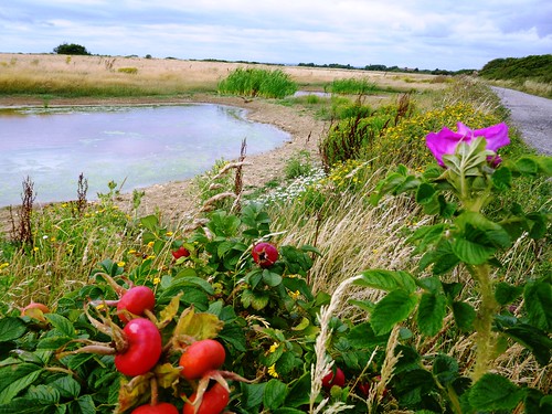
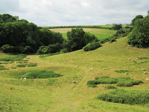
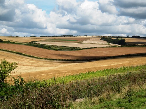
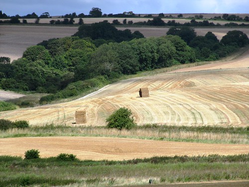
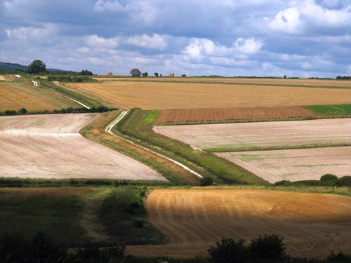
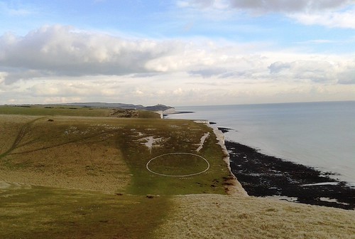
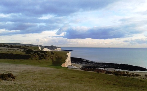
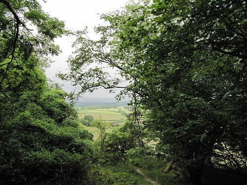
Gilbert White, the naturalist curate of Selborne, speculated in the late 18th century as to whether the downs might have risen like bread from some yeast-like primordial dough. On a day like this you could see what he was getting at, with sun and cloud accentuating the soft elastic curves of the chalk, so that the whole range appeared to be straining skyward like a wind-bulged sail. Even under the bruise-coloured clouds the clefts of the downs held their characteristic allure, an invitation to explore enhanced by their status as Access Land open to all comers.

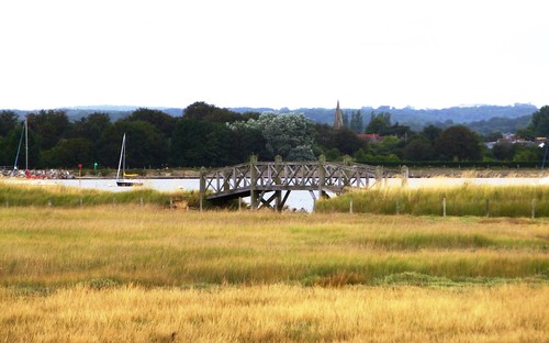
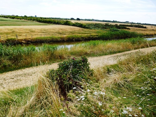
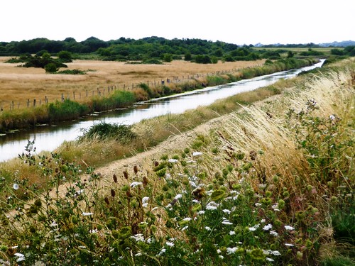
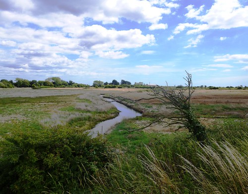
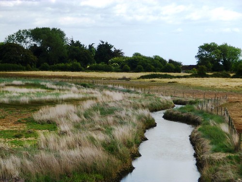
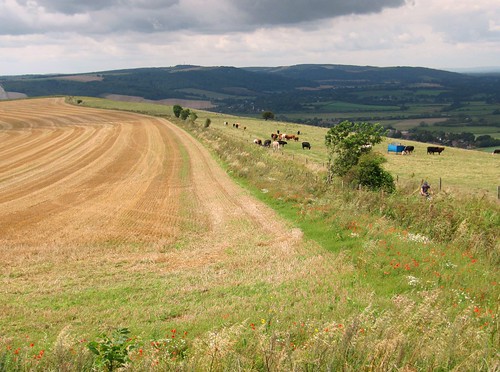
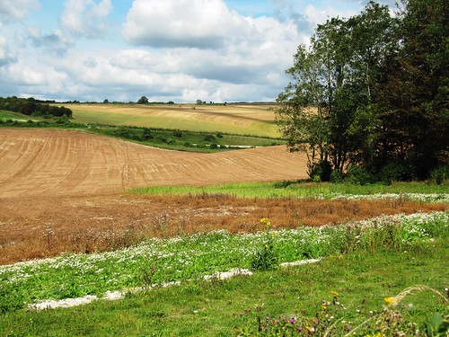
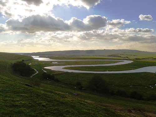
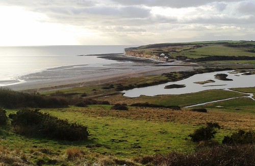
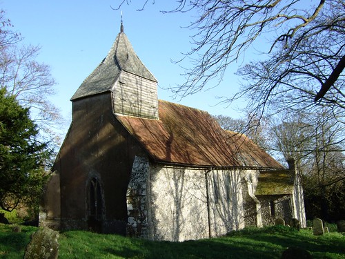
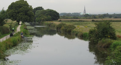
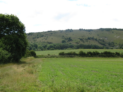
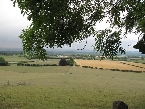
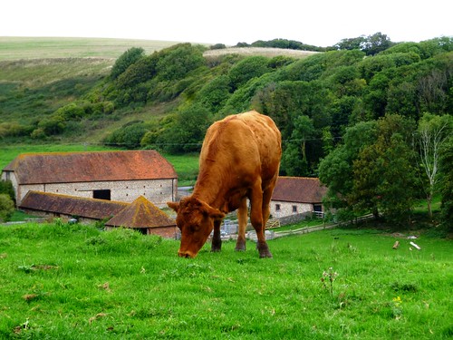
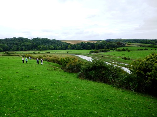
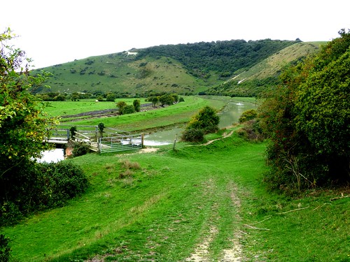
A great inner curve of south-facing downland shields Alfriston from the coast. We rounded its ridge and came down towards the meanders of the Cuckmere River through meadows where black and cream cattle grazed contentedly, scarcely troubling to lift their noses from the grass as we passed by. Glancing back, I saw the white chalk horse on High and Over Down, its muzzle sharpened by perspective to a crocodile profile, overseeing our homeward stroll by the olive-green and chalk-thickened waters of the Cuckmere River.

Start: The Willows car park, Alfriston, East Sussex, BN26 5UQ (OS ref TQ 521033)

Getting there: Bus service 126 (cuckmerebuses.org.uk), Seaford-Eastbourne
Road – Alfriston is signposted off A27 between Lewes and Eastbourne.

Walk (7½ miles, moderate, OS Explorer 123. NB: online map, more walks at christophersomerville.co.uk): Left into Alfriston; right up Star Lane beside Star Inn (‘South Downs Way’/SDW). Follow SDW for 2 miles. At 4-finger post (499045, blue arrow/BA), left on Green Way track for 1½ miles. At top of steep path, 5 ways meet (489024); take first left (bridleway). In 50m, keep ahead (not left downhill). In almost 1 mile, left through gate (498014, BA), following bridleway to cross road (512014). Descend fields to river; cross New Bridge (517014); left along east bank of Cuckmere River for 1¾ miles. Just past Alfriston Church, left across river (521031) to car park.

Lunch: Star Inn, Alfriston (01323-870495; thestaralfriston.co.uk)

Accommodation: Beachy Head Cottages, East Dean (01323-423878; beachyhead.org.uk) – immaculately run and very comfortable

Info: Eastbourne TIC (01323-415450); visitsussex.org
www.ramblers.org.uk www.satmap.com www.LogMyTrip.co.uk

 Posted by at 11:15
Oct 122013
 

Wild plums, green and purple, hung heavy above the path as Jane and I began our circuit of Thorney Island, a narrow-necked peninsula suspended like a bulbous fruit from the inner shoreline of Chichester Harbour.
First published in: The Times Click here to view a map for this walk in a new window
picture picture picture picture picture picture picture picture picture picture picture picture picture picture picture picture
Facebook Link:
A memorable feature of my wife’s childhood in this low-lying coastal country had been the vee-shaped bomber planes from Thorney Island’s RAF base – long since closed – that would rumble overhead, low and dark in the sky.

Black-headed gulls screamed peevishly from the mud banks exposed at low water; oystercatchers piped, and curlews made their melancholy bubbling cry. Salt, mud, seaweed – the smells were of tidal country under a drying wind. As for the views, they widened over mud flats green with algae and weed, seamed with wriggling creeks known locally as rithes, out west to the low wooded coastline of Hayling Island. Inland, hissing beds of reeds lined the waters of the broad ditch romantically named Great Deep.

Sea lavender lay in purple mats on the salt marshes. Leopard-spotted comma butterflies alighted on fleabane flowers and opened their scalloped wings to the sun. From the seawall path, the army establishment that replaced Thorney’s RAF base in 1984 was so well hidden among the trees it might not have been there. The only clue as to where those great triangular bombers had taken to the skies was a grey smear of runway tarmac, long disused.

We watched a lovely old wooden sailing boat scudding down Sweare Deep under a white bulge of jib, the mainsail rattling up as the boat heeled into Emsworth Channel. By the time we had reached Longmere Point at the nethermost tip of Thorney, the tide had crept in to cover mud flats, shell banks and rithes in a rippling world of water that spread south towards the open mouth of Chichester Harbour.

St Nicholas’s Church at West Thorney, ‘the least known and altogether uttermost church in Sussex’, has stood here on the remote eastern coast of the island for 800 years. Wartime Allied and German servicemen share the graveyard, foes in life, brothers in death.

Under the seawall an unseen fish hunted the flood-tide shallows, dorsal fin and tail cutting the surface. Far to the east the spire of Chichester Cathedral glowed ghostly white in the evening sun, the South Downs ran in black and gold along the northern skyline, and from the marina moorings came the music of halyards blown by the wind against yacht masts, chinking and chiming like miniature bells.

Start: Sussex Brewers PH, 36 Main Rd, Hermitage, West Sussex PO10 8AU (OS ref SU 755057)

Getting there: A27/A259 to Emsworth. Park in village; follow A259 to Sussex Brewery PH

Walk (9 miles, easy, OS Explorer 120. NB: Online maps, more walks at christophersomerville.co.uk): Follow footpath down side of pub (fingerpost), then field edges south to boatyard. Right (755053, fingerpost) through Emsworth Yacht Harbour to sea wall. Left (753052, fingerpost) anti-clockwise round Thorney Island for 7 miles, passing Little Deep (752047), Great Deep (749040), Marker Point (746023), Longmere Point (768011), West Thorney Church (770025), Stanbury Point (770031) and Prinsted Point (766042). At foot of road above Thornham Marina (766051), turn left inland along Sussex Border Path past Thornham Farm for half a mile to cross Thorney Road (756051). Over stile (fingerpost), across field and opposite stile. Right (fingerpost) past stilt houses, and retrace path to Sussex Brewery PH.

Lunch: Sussex Brewery PH, Hermitage (01243-371533; sussexbrewery.com) – a really friendly, clean and welcoming pub.

Chichester Harbour Conservancy (01243-512301; conservancy.co.uk) – walks, information and much more.

Information: Chichester TIC (01243-775888; visitsussex.org)
yorkshire.com visitengland.com www.ramblers.org.uk www.satmap.com www.LogMyTrip.co.uk

 Posted by at 01:33
Aug 102013
 

A perfect summer’s morning over West Sussex – blue heavens with huge white cumulonimbus clouds reaching up from the South Downs skyline, warm sunshine spreading across the countryside like butter, and wood pigeons sleepily cooing in the beech trees around Burpham.
First published in: The Times Click here to view a map for this walk in a new window
picture picture picture picture picture picture picture picture picture picture picture picture picture picture picture picture
Facebook Link:
‘Good morning!’ quoth a man in a pink and white striped shirt, with that very British crispness that means, ‘Glad to see you in our beautiful village, but don’t drop any sweet papers, will you? Thank you so much!’

The old valley track of Coombe Lane brought us up from the village to the downs, its elder bushes and guelder rose and spindle all beginning to come into fruit. The sun released warm, spicy wafts from tuffets of wild marjoram where meadow brown butterflies staggered, half drunk on the smell. A clump of thistles seethed with hungry goldfinches. Glimmering chalkhill blue butterflies clung to the nettles that grew along the chalky banks of pale grey soil, burrowed into a powdery tissue by rabbits. Two marsh harriers had come up from the marshy banks of the River Arun, and we watched them making long slow passes through the valley on their long dark wings.

The downland slopes were a maze of pale gold stubble fields where big straw bales lay doubled over like blankets in a giant’s linen cupboard. The view widened back south from Wepham Down to a flat gleam of the distant sea, the Isle of Wight lying long in a grey haze on the south-west horizon. Up on the roof of the downs the ramparts of Rackham Banks – a Bronze Age cross dyke, probably a boundary marker, and a hill settlement in a hollow – were spattered with scabious, knapweed and poppies. We sat idling there, the chalk-white South Downs Way ribboning east and west, the ground plunging away north to the Arun snaking through the Sussex lowlands among woods and pastures.

The ancient ridge track dipped to Downs Farm, a pretty old farmhouse marooned in a monstrous muddle of harsh modern barns and silos. Here we turn off south, dropping into a steep, silent and nameless valley where sheep nibbled the turf and red kites turned on the thermals with crooked wings and subtly balancing tails. Then a last stretch beside the Arun, past an old tree-grown moated site that might well be part of the burh or fortified village established here by Alfred the Great eleven hundred years ago. A timeless walk, where now and then join hands seamlessly.

Start & finish: Burpham village car park, West Sussex, BN18 9RR approx. (OS ref TQ 039089)
Getting there: Train (thetrainline.com; railcard.co.uk) to Arundel (2½ miles). Road: Burpham is signed off A27 just east of Arundel station
Walk (7 miles, moderate, OS Explorer 121): From car park pass George & Dragon Inn; right along village street. Follow it out of Burpham for ⅓ mile, round right bend; left up Coombe Lane (044090; fingerpost, blue arrow/BA). Keep to bridleway along valley bottom, climbing gently for 1½ miles to T-junction of tracks (061106). Two tracks diverge to left; take right-hand one of these, at right-angles to direction you’ve been walking, heading north. In just over 1 mile, at T-junction of tracks (056122, ‘Restricted Bridleway’), right for 20m, then left (‘bridleway’ fingerpost in right-hand hedge) on chalk track between hedges. In 300m, at 3-finger post (053123) fork right (BA) to South Downs Way at Rackham Banks (051125).

Left for ¾ mile. Just before Downs Farm, left (038125, ‘Restricted Byway’). In 100m fork right (‘bridleway’ fingerpost, BA). Keep fence on right. In ⅓ mile, through gate (041119, BA) and on, with fence on right, into valley. At bottom, right through gate (BA); bear left up path, climbing slope; through gate at top and on over track crossing (044114, yellow arrow/YA). Ahead through corner of wood (044110, YA), then right (BA) down track with wood on right, and on for ½ mile. Look out for gateway with BAs on right (040102), and take footpath just to right of it (YA) between fences, then steeply down to bottom of steps (039103). Left (BA). In ⅓ mile pass old quarry on left; in another 50m, right over stile (035099, YA); turn left, and follow fence on your left (stiles, YAs). In ¼ mile skirt right of old moat with trees (033094, YA). Ahead along river; in ⅓ mile climb left up bank (038089) into Burpham.
Click on Facebook “Like” link to share this walk with Facebook friends.

Lunch: George Inn, Burpham (01903-883131; gdinn.co.uk)
Info: Arundel TIC (01903-737838)

visitsussex.org; visitengland.com; www.ramblers.org.uk www.satmap.com www.LogMyTrip.co.uk

 Posted by at 06:22
Mar 162013
 

It’s a rare pleasure to find a place as well set up for four-seasons walking as East Dean. First published in: The Times Click here to view a map for this walk in a new window
picture picture picture picture picture picture picture picture
Facebook Link:
The immaculately kept East Sussex village lies just inland of the Seven Sisters cliffs at the heart of superb coast-and-countryside landscape. Walkers know they’ll be welcome at the cosy old Tiger Inn and the Hiker’s Rest teashop on the village green, the hub of a network of footpaths. I chose a circuit that would thread woodland, downs and cliffs together, and set out early from the Tiger into a red dawn.

‘Morning!’ said a woman by Friston duckpond, her breath smoking in the cold air. ‘Saw you yesterday up on the downs, didn’t I? Hope you enjoy your walk.’ Down in the valley below, ancient Friston Place lay low, pink-faced and many-gabled among beech trees where rooks were cawing lustily. Building low, I noticed, portent of a rainy summer.

Friston Forest sighed gently in the morning wind. A great spotted woodpecker rattled a hollow tree, a pair of racehorses went drumming by like ghosts in the mist on Friston Hill. Sunk in the woods, the medieval rectory and church at West Dean gleamed in dew-wet flint. A long flight of steps, the crest of a hill, and I was looking down over one of England’s classic views – the extravagant snake bends of the Cuckmere River sinuating its way seaward through a dead flat littoral between great curves of downland. Coastguard cottages stood isolated at the brink of the Cuckmere Haven cliffs, their tall chimneys silhouetted against a pale wintry sea.

Foxhole Farm, all flint walls and brick-red roofs, lay tucked into a fold of the downs. Beyond the farm the South Downs Way ribboned east along the furrowed brows of the Seven Sisters. Far ahead, the promontory cliff of Belle Tout displayed an elliptical grimace of white chalk like the baleen plates in the mouth of a right whale. At the feet of the cliffs fresh falls of chalk lay scattered, staining the shallows a milky white.

It was hard to tear myself away from this captivating stretch of coast, but my way lay inland, funnelling up Gap Bottom past the old farming hamlet of Crowlink. A last trudge over the downs through a stolid crowd of curly-faced sheep, and I was dipping down the steep slope towards East Dean with a pint of Tiger’s Claw in my sights and a head full of wonders to sort through.

Start: Tiger Inn, East Dean, near Eastbourne, East Sussex BN20 0DA (OS ref TV 556978).

Getting there: Bus 12, 12A (buses.co.uk), Eastbourne-Brighton.
Road: East Dean village is signposted off A259 Eastbourne-Seaford.

Walk (8 miles, easy/moderate, OS Explorer 123):
From Tiger Inn, right up side of village green; cross road, up path opposite (556979, fingerpost). At Friston church (551982) cross A259; take path just to left of Jevington road (yellow arrow); cross stile; right (‘footpath’ post) along woodland edge. Cross field (551985); cross lane by stile and gate (550987); cross next field, into woodland (550989). Left on path parallel to lane (‘West Dean’ post). Follow lane where it bends left around Friston Place (548990). In 100m, opposite entrance to Friston Place, right (547989; blue arrow; ‘West Dean’) on bridleway through woods. Keep straight ahead, following red arrow posts for a while, then cycleway signs, but always in same direction, ignoring all side tracks. In just over a mile, cycleway turns left (531996), but keep ahead down slope, past white house and on to West Dean. Right past church (525997) to T-junction; left along South Downs Way (SDW), over track, up 200+ steps to cross wall stile at top (521996; superb view over Cuckmere Haven!). Follow SDW down to cross A259 by Visitor Centre (520995).

Through gate (SDW); bear left up slope through another gate (SDW). Follow SDW for 2½ miles along cliffs. By National Trust sign ‘Crowlink’ (538968) bear inland to pass Crowlink hamlet. Opposite laneway on left, go right through open gateway (545975). Up to cross stile; keep same line up to brow of hill; pass clump of thorn trees, then on (car park 200m on your left) to go through kissing gate (551976). Aim down right side of triangular woodland; keep ahead (not right!) across stone wall stile (554977); down field slope to path by wall; left down to field; right through gate by NT ‘Crowlink’ sign into East Dean.

Lunch: Tiger Inn, East Dean; Golden Galleon, Exceat (01323-892247)

Accommodation: Tiger Inn B&B, (01323-423209; beachyhead.org.uk) or Beachy Head Cottages (01323-423878; beachyhead.org.uk). Superb country pub; classy self-catering

Information: Eastbourne TIC (01323-415450); visitsussex.org
www.ramblers.org.uk www.satmap.com www.LogMyTrip.co.uk
Click on Facebook “Like” link to share this walk with Facebook friends.

 Posted by at 01:18
Jan 122013
 

The long, high waves of the East Sussex Weald lay under smoky rolls of grey cloud, through which a pale penumbra of sun came gleaming like a half-dissolved pearl. First published in: The Times Click here to view a map for this walk in a new window
picture picture picture picture picture picture picture picture
Facebook Link:
‘Wild boar, ostrich!’ promised the sales board at the entrance to Birdbrook Farm. ‘Bison, zebra, wildebeest!’ There were no signs of such exotic creatures in the small-scale hedged fields around Witherenden Farm – just cattle bellowing in the farmyard as they were passed across the scales in a welter of men and dogs before heading out for market.

We squelched along a track of sticky Wealden clay and came into Newbridge Wood, one of the coppice woods that have been tended in these parts since medieval times, when this now quiet and all-but-empty landscape was England’s ironmaking centre. The only hint that remains of the smoky, noisy, fiery industry is the large number of woodland ponds – they stored and released the water for the wheels that drove the ironmasters’ bellows and drop-hammers – and the woods themselves, harvested to produce the charcoal for the blast-furnaces.

Newbridge Wood, and Batt’s Wood and Dens Wood beyond, were thick with hornbeams, the smooth poles of their overshot coppice sprouts seamed with long runnels like withered and witchy arms reaching for the light. Each tree seemed lit from below by the millions of acid green and rich gold leaves that carpeted the forest floor. From the gaps among the woods we had wonderful views across the Weald – the sun-reflecting oasts at Bivelham Farm, thatched roofs among the trees, long low meadows, dark hedges and woods rising to high ridges like green ocean billows.

On the lane into Batt’s Wood, seven inkcap fungi rose in a ring beside the hedge, like pixie hats with upturned brims. Dens Wood and the landscaped slopes by Wadhurst Park Lake were full of deer – red stags chasing hinds, roe deer delicately bounding out of the trees, a big pale fallow stag stock still under the silver birches, giving us the wary eye. We shuffled hornbeam leaves in the lane to Dens Farm, and sniffed the sweet scent of applewood fires as we made back across the fields towards Witherenden Farm in the half-light of evening.

Start: Stonegate Station, East Sussex, TN5 7ER (OS ref TQ 659272). All day parking £4.50

Travel: Rail (thetrainline.co.uk; railcard.co.uk) to Stonegate.
Road: Stonegate station is off A265 Heathfield – Hurst Green road, just north of Burwash

Walk (6½ miles, easy, OS Explorer 136):
From station entrance, left to cross railway line; continue down verge of road for 400m. Right up Witherenden Farm drive (655270; fingerpost, ‘bridleway’). Bear left through farmyard, on down muddy track, through metal gate (651271), right round field edge. Where trees start, right into Newbridge Wood (649272, blue arrow/BA). In ⅔ mile pass Bivelham Forge Farm (640267); in 100 m fork left (BA) to road (637266). Left; in 80 m, right over stile (yellow arrow/YA), across 2 fields to cross road at Pound Bridge (633265).

Keep ahead along track (BA); in ¼ mile it turns right (629266) up hill past Gold’s Farm. At top of hill, opposite cottage with ornate porch on left, keep ahead by fence (630274) to cross stile (YA) into Batt’s Wood. At interpretive board turn left (YA), then immediately right (YA) along grassy track. In 50 m, left at T-junction (631275). Descent ride (can be slippery!) for 350 m to gate near Wadhurst Park Lake (633278). Right along track (boggy!). In 400 m pass sluice (636277); in another 150 m, fork left (YA) along path. In 400 m, left at junction (641277) for 20 m; at next junction, left to cross stile (YA) and stream.

At 3-finger post, left (YA) up inside edge of Dens Wood. At top of rise pass Flattenden Farm (640282) and descend track. At junction by ‘Weir Cottage’ sign (641286), right for ⅓ mile to Dens Farm (646283). Right through farm gate/stile (YA); fork right between sheds and down stony lane. In 50 m, left (YA) through gate, along fence on your right. In 200 m cross stile; across next field, through one wicket gate (YA), then another. Cross stream by footbridge (648279) to gate; don’t go through, but turn right along hedge. Follow path for ½ mile by YAs across 4 fields to track below Witherenden Farm (651271); left through farm and back to Stonegate Station.

NB: Paths in Batt’s Wood often slippery/boggy!

Refreshments: Picnic

Hastings TIC: 01424-451111; visitsussex.org.uk
www.ramblers.org.uk www.satmap.com www.LogMyTrip.co.uk

 Posted by at 02:05
Mar 032012
 

Some walks just grab you so hard that you know you’ll be back to enjoy them again, if not sooner then later.
First published in: The Times Click here to view a map for this walk in a new window
picture picture picture picture picture picture picture picture
Facebook Link:
It was a good five years since I’d last set off from Alfriston, but nothing had changed in this lovely corner of East Sussex. The same clear-cut line of the South Downs above the village, running down to their final embrace of the coastal flatland; the same eccentric old carvings in the Star Inn’s frontage; even identical late winter weather, a cold blue sky arched over Alfriston, calling me up to the hills.

A covey of partridges burst whirring out of the root crops as I went up the flinty, half-frozen path onto the roof of the downs. Views were wide and wonderful – the North Downs a grey-blue line 30 miles to the north, the green billows of the South Downs riding up and away into the west, Alfriston lying with its stumpy church spire and tiled roofs like a village in a Brian Cook book jacket, all flat angles in bright brick reds, acid greens and indigos. The cold air stung my nostrils and smoked my breath. Descending to pass below the Long Man of Wilmington, I saw that spiders had strewn the ancient chalk-cut giant with a maze of cobwebs, so that the 200-ft figure sparkled as though encased in diamonds on its steep hillside.

Frost clung in tight curls to the muddy ruts of the path that led through the woods to Folkington. Elizabeth David lies in the churchyard under a gravestone carved with aubergines, peppers and cloves of garlic. Celebrity chefs are twenty to the teaspoonful nowadays, but she was the first, a post-war culinary pioneer who introduced beige British tastebuds to snazzy foreign flavours, a shock from which we’ve never recovered.

A snaking old track brought me south to Jevington with its cheerful Eight Bells pub and thousand-year-old church tower built like a fortress against Viking marauders. A Saxon Christ adorns the wall, victorious over a puny, wriggling serpent. Crossing the downs on the homeward stretch, I marvelled at how a corner of countryside with such a vigorous and bloody history – Viking and French raids, coastguard battles with the smuggling gangs, Second World War bombs and doodlebugs – has settled to a tranquillity as smooth as the applewood smoke rising from Alfriston’s chimneys into the blue Sussex sky.

Start & finish: The Willows car park, Alfriston, East Sussex BN26 5UQ (OS ref TQ 521033)
Getting there: Train (www.thetrainline.com; www.railcard.co.uk) to Eastbourne; bus 126 to Alfriston. Road: Alfriston signed off A27 (Brighton-Eastbourne), 5½ miles after A26 Newhaven roundabout.

PLEASE NOTE: The Wealdway Path between Folkington and Jevington will be closed for six months from 1 April 2012 for work by the Water Authority

Walk (8½ miles, moderate, OS Explorer 123):
From The Willows car park (521033), follow footpath by wall on right of coach park. Cross stile; right to cross another; right along river bank; left across White Bridge (522031) to road. Cross road; take footpath on right of house. In 20 yards up steps; on up hedged path. In 100 yards, left through hedge (525031 – South Downs Way/SDW marker post); diagonally right on path across field; through hedge; across next field to cross stile onto SDW (532033).

Right to cross road; follow SDW uphill past Windover Reservoir to go through gate into Access Land (538035). SDW continues ahead, but turn left along fence over ridge; in 30 yards, right along track, through gate and on for a mile, passing Long Man of Wilmington (542034) where you join the Wealdway path. At The Holt, through gate into wood (551040); right along track for ½ mile to St Peter’s Church, Folkington (559038). Bear right (as you approach church) along Wealdway for just over a mile to T-junction of track; left (561021 – ‘Wealdway’ arrow) to road; right through Jevington, passing Eight Bells pub (563017).

Continue for 100 yards to left bend; take path on right of road to St Andrew’s Church (562015). On up SDW for 2/3 of a mile to Holt Brow (553019). SDW turns right here, but keep ahead for one and a quarter miles through Lullington Heath NNR, passing Winchester’s Pond (540020), to fork (533020). Keep ahead (‘Litlington’), down to road (523021). Left past Litlington church. Just before Plough & Harrow pub, right (523017 – ‘Vanguard Way’) to Cuckmere River; right along bank for 1 mile to Alfriston.

Click on Facebook “Like” link to share this walk with Facebook friends.
Lunch: Eight Bells, Jevington (01323-484442; 8bellsonline.co.uk); Plough & Harrow, Litlington (01323-870632; www.ploughandharrowlitlington.co.uk)
More info: Eastbourne TIC (01323-415450); www.visitsussex.org
Family Support Work sponsored walk: Alfriston-Wilmington-Alfriston (7 miles), Easter Monday, 9 April – info 01273-425699; www.familysupportwork.org.uk
www.ramblers.org.uk www.satmap.com www.LogMyTrip.co.uk

 Posted by at 02:59
Jan 212012
 

The world has changed its bearings a bit since JMW Turner’s day, but the artist’s wonderful smeary 1828 painting of Chichester Canal records a scene almost unchanged in nearly two centuries.First published in: The Times Click here to view a map for this walk in a new window
picture picture picture picture picture picture picture picture
Facebook Link:
Turner depicts the setting sun about to touch the western horizon, a fabulous orb providing a dreamy, lemon-yellow backlight for Chichester Cathedral’s landmark spire. A spectral schooner, black and skeletal, lies anchored on the newly-completed canal, a broad silver highway linking sea to city.

It was Turner light today, wintry and indistinct, as we set out from Chichester, seawards along the canal into the flatlands of the Selsey peninsula. We strolled slowly, at first against the tide of Selsey’s commuters jogging and cycling along the towpath towards the city, then in backwaters of post-rush-hour calm. A grey heron stood stock still among the reeds, allowing us to inch forward to within touching distance before it shook its umbrella wings open with a clap and hauled heavily off upstream.

A century has passed since the last barge brought goods to Chichester up the canal. The waterway lies quiet now, a haunt of solitary fishermen intent on their long roach poles. A sharp right-angle bend at Hunston bridge where Turner perched to make his painting, and the canal made purposefully west through low-lying pastures and ploughlands towards the convoluted shores of Chichester Harbour. This muddy, meandering inland sea has many snaking creeks and widely separated peninsulas; silting and land reclamation had choked off the channel that led to Chichester long before the canal was cut as a remedy.

Down in Chichester Marina, boats with aspirational names lay snugged down for winter: Glowing Jade, One Life, Day Dreamer, Flight of Fancy. Between the white walls of the yachts a pair of young Swallows (or Amazons) scudded round in a rubber dinghy. We turned inland, walking the muddy shore path through Salterns Copse. The name stands as a memorial to the salt-making industry that flourished here in the 18th century. The shallow salterns – manmade pools with clay bottoms – held seawater, reduced to brine by the sun, then boiled and dredged for the precious salt crystals. The high cost of coal, taxes and transport put an end to the salterns just before the opening of the Chichester Canal, which might have saved them.

Halyards chinked in the morning breeze, and black-backed gulls screeched like fishwives over their tideline pickings. A quick sandwich in the dappled river light of the dark-panelled bar in the Crown & Anchor at Dell Quay, and we followed the winding Fishbourne Channel towards the distant line of the downs, with Chichester spire pricking the low grey sky away in the east.

Start: Chichester station, Chichester PO19 8DL (OS ref SU 859043)
Finish: Fishbourne station (835050)
Getting there: Train (www.thetrainline.com; www.railcard.co.uk) to Chichester. Road: A27 from Southampton or Brighton
Walk (7 miles, easy grade, OS Explorer 120): From Chichester station head out of town along A286. In 100m, left (‘Chichester Canal’); cross canal (859041) and follow towpath for 1¼ miles to Poyntz Bridge at Hunston (865023). Follow path to road; right; in 50 m, right again along left bank of canal. In ⅔ mile keep ahead at Crosbie Bridge (854019); in another mile at Cutfield Bridge (842013), right across canal; left along road on right bank to Chichester Marina. Right here along Salterns Way footpath (835010, fingerpost), keeping marina on left to reach open water (829014). Right (fingerpost); immediately left on permissive path through Salterns Copse and on along harbour edge to Dell Quay Road. Left to Crown & Anchor PH (836028). Right along Fishbourne Channel, keeping close to shore. After nearly 1 mile cross sluice to 3-way fingerpost (841041). Left along harbour. In 300 m, take left of 2 kissing gates; cross stream; boardwalk, then left (fingerpost) along stream. In 100 m, right past pond (838045) up Mill Lane to A259 in Fishbourne. Left for 300 m; cross road, and right up Salthill Road (835047) to Fishbourne station.

Click on Facebook “Like” link to share this walk with Facebook friends.

Lunch: Crown & Anchor, Dell Quay (log fires, wood-panelled bar, superb estuary views): 01243-781712; www.crownandanchorchichester.com)
More info: Chichester TIC (01243-775888);
www.ramblers.org.uk www.satmap.com www.LogMyTrip.co.uk

 Posted by at 02:55
Sep 172011
 

A gorgeous sunny day, and a jolly crowd leaving the Onslow Arms at Loxwood to embark in the good ship Zacharaiah Keppel for a cruise on the Wey & Arun Canal.
First published in: The Times Click here to view a map for this walk in a new window
picture picture picture picture picture picture picture
Facebook Link:

What a transformation! Only a few years ago this 23-mile rural waterway, built in the early 19th century to provide the missing transport link between London and the South Coast, lay tangled and forgotten among the woods and fields of the Sussex/Surrey border.

I set off along the towpath beside the olive-green canal, picturing its sleepy working life. The railways stole its modest trade – coal, lime fertiliser, timber, horse dung, corn – and in 1871 a rather mournful-sounding Act of Abandonment closed it. A century of slow decay ensued, of leaking water and encroaching vegetation. Then in the 1970s, local enthusiasts began to unearth and restore London’s lost route to the sea. It has taken 40 years and untold sweat, but the dream is coming true – you can boat three miles of the Wey & Arun already, from Drungewick Lock past Loxwood to the fabulously named Devil’s Hole.

A shady path under the willows, with few birds singing in the noon heat. Triffid-like, towering umbrella leaves of giant hogweed, green reeds whispering, a soporific midday trance over the still canal. I left the Wey & Arun, turning north past the big creamy cattle at Drungewick Hill Farm into a stretch of cool woodland, then across wide clover fields full of drowsily buzzing bees. There was time for a pint in the Sir Roger Tichborne pub at Alfold Bars, and a read of the extraordinary story, displayed on the pub wall, of Arthur Orton, the Tichborne Claimant, This 19th-century chancer almost got his hands on the Tichborne baronetcy, and the land and money that went with it, before he was unmasked and thrown in prison.

Out into a rolling landscape. The donkey at Tokens Farm came up to the gate to have his dusty muzzle patted. Woods, cornfields and a shady bridlepath where a big dog fox went trotting before me, swinging his black-tipped brush. In Gennet’s Wood I picked up the old canal once more, choked with a pink froth of Himalayan balsam, and followed it until water began to gleam in the bottom of its overgrown channel. A scurry of concrete-pouring contractors at Southland Lock, a burst of purple loosestrife around the Devil’s Hole, and I was spinning out the final half-mile along the Wey & Arun in the sunshine of a sleepy afternoon.

Start & finish: Onslow Arms PH, Loxwood, W. Sussex RH14 0RD (OS ref TQ 041311)
Getting there: Bus (www.arrivabus.co.uk) Service 44 Guildford-Cranleigh
Road: Loxwood is on B2133 between Alfold Crossways (A281 Guildford-Horsham) and Wisborough Green (A272 Petworth-Billingshurst). Car park down track beyond Onslow Arms car park.
Walk (7½ miles, easy grade, OS Explorer 134): Follow canal towpath east for 1½ miles; cross Drungewick Aqueduct (060309). Left over bridge; along road; at top of hill, left (060312, fingerpost), skirting right of Drungewick Hill Farm. Farm track into trees, where path forks (058312); ahead (not right) here. In 150 m, right (fingerpost) past pond. In 150 m, keep ahead (not left) at fingerpost (056312). In 100 m, left (fingerpost) along wood edge track. In 150 m, track curves left (056314), but keep ahead (fingerpost) for 400 m to cross Loxwood Road (055318).
On along bridleway (fingerpost) for ½ mile. At wood edge, left (056326); in 100 m, right off bridleway on footpath (fingerpost) into fields. In 300 m pass pond; left along stony track; in 50 m, right (054329, fingerpost) along fenced path. In 200 m, through gate; cross field and on (053332; gate, fingerpost) into trees. In 100 m cross track, and on (fingerpost). In another 100 m you reach a 4-way crossing (052334, 4-finger post). Here you cross a north-south bridleway and continue south-west along the Sussex Border Path (SBP). To do this, go left for 5 m, then right along SBP.
Follow SBP for 1 mile to Alfold Bars and Sir Roger Tichborne PH. Left at B2133 (037333); in 100 m, right down Oakhurst lane. Follow SBP for ¾ mile past Oakhurst Farm (033328) into Gennets Wood. At track crossing by a pond (028325), left off SBP (bridleway fingerpost) to follow towpath of overgrown Wey & Arun Canal for 1⅓ miles back to Onslow Arms.
NB – Online map, more walks: www.christophersomerville.co.uk. Click on Facebook “Like” link to share this walk with Facebook friends.

Lunch: Onslow Arms, Loxwood (01403-752452; www.onslowarmsloxwood.com) or Sir Roger Tichborne PH, Alfold Bars (01403-751873; www.thetichborne.co.uk)
More info: Horsham TIC (01403-211661); www.visitsussex.org
Wey & Arun Canal Trust: 01403-752403; www.weyandarun.co.uk
www.LogMyTrip.co.uk
www.ramblers.org.uk www.satmap.com

 Posted by at 02:46
Aug 132011
 

A dip in the sea not long after dawn, an early morning drive into the South Downs, and I was away from Fulking as the newly risen sun cast an oblique light along the downland escarpment behind the village.
First published in: The Times Click here to view a map for this walk in a new window
picture picture picture picture picture picture picture picture
Facebook Link:
Beans rattled dry and black on their stalks, and the soil lay pale and cracked in this drought summer. To the north rose the downs, a 300-ft rampart of turf facing the agricultural lowlands, dull olive patched with white chalk scrapes and dark green scrub. Near at hand a yellowhammer in the hedge wheedled for ‘a-little-bit-of-bread-and-no-cheeeese!’

The fields stretched breathless and still in an early morning already gathering heat. Up on the downs, though, something was in motion. I stopped and stared as a crowd of bullocks went thundering down the slope, kicking up clouds of powdery chalk dust, mad with delight at the headlong sensation.

In Longlands Wood, a green wilderness of beech and oak, the swearing of a discontented jay broke the stillness. The pastures around Tottington Manor were full of dark chocolate cattle, cows and bull calves slowly grazing together, every muzzle a quivering maze of flies. I leaned over the gate, scratching a couple of handy backs, and then made for the downs. Steeply up through the trees on Tottington Mount, until at the crest I could stop and look back across the flatlands 300 feet below – downland slopes and woods leading out to the matt steel eyes of gravel pits and the great flood plain of the River Adur. A few more minutes and I was at the crest of the downs, looking south through beautiful curving valleys to the hazy grey vee of the sea.

Three young sparrowhawks hung in the air in line abreast, hunting the downs under the tutelage of their parent birds. I turned east along the ancient track of the South Downs Way, a white chalk thread drawn snaking through the turf. What fantastic elation, heading into the penumbra of the sun in this high place among drifts of scrambled-egg toadflax and white campion, passing broad headlands full of poppies and moon daisies left by the farmer around the margins of his barley fields. By the time I got to Perching Hill the sky ahead over Devil’s Dyke was already dotted with hang gliders, and before I dropped back down the escarpment to Fulking I stood and watched them circling like mythical heroes near the sun.

Start & finish: Shepherd & Dog PH, Fulking BN5 9LU (OS ref TQ 247113)
Getting there: Fulking signposted from A281 (Henfield-Brighton) and A2037 (Henfield-Upper Beeding)
Walk (6 miles, moderate/hard grade, OS Explorer 122): Leaving Shepherd & Dog, right along road; in 50 m, by fountain, left through gate (fingerpost); right along hedge. Through kissing gate; diagonally left across 2 fields by stiles. At gate, over stile (245116); left along stony lane. In 20m at left bend, bear right (fingerpost) diagonally over field, under power lines. Cross track to Perching Manor (yellow arrow/YA) and on. At far corner, cross footbridge (241120, YA post); left along edge of woodland. Cross footbridge, stile; on over 2 fields with hedge on left. At end of 2nd field, over stile and footbridge, and on. At track junction (234121, fingerpost), dogleg left, then right; follow field edge with hedge on left. At field end, left across footbridge (fingerpost). Through thicket; emerge to skirt house (231119). At end of trees, left across footplank (fingerpost); right along hedge. Cross track (225120); over stile (fingerpost) and follow hedge to stile into Longlands Wood (fingerpost). Follow path for 400m to path crossroads at 4-way fingerpost (219122). Left for 250m to leave trees (gate); follow track to Tottington Manor. Just before barn, left through gate (fingerpost). Right to cross road (215115). Right for 30m; left up track into trees (‘bridleway’; blue arrow/BA). Up path between fences to gate; continue uphill, curving right round Tottington Mount. At top of climb, aim for post on skyline; left here (217106, BA) to road. Left on South Downs Way (SDW) for 1½ miles, passing Youth Hostel and communications masts and continuing to pass under power lines (242109). In another ¼ mile, in a dip, through a gate (246109); left down cleft (YA post). In 250m, sharp left (249111, YA post); steeply down to Fulking.

Lunch: Shepherd & Dog PH, Fulking (01273-857382; www.shepherdanddogpub.co.uk) – lovely old walker-friendly pub
More info: Brighton TIC (01273-290337); www.visitsussex.org
www.ramblers.org.uk www.satmap.com www.LogMyTrip.co.uk
Click on Facebook “Like” link to share this walk with Facebook friends.

 Posted by at 01:54
Apr 092011
 

The Royal Oak sits snug, tucked down out of sight in a steep cleft of the Sussex Downs a few miles north of Chichester.
First published in: The Times Click here to view a map for this walk in a new window
picture picture picture picture picture picture picture picture
Facebook Link:
It’s hard to prise the regulars out of this delightful walker-friendly pub, especially Shagger Shepherd. Old Shagger hasn’t left the place since 1680, when he was shot dead in the bar for stealing sheep. He’s been seen by many since then, and photographed by landlord Dave Jeffery. If you should meet Shagger, don’t offer your hand – it’ll go straight through him.

On a steamy, showery morning we set out from the Royal Oak up a broad flinty track through woods of yew and fern beech on Philliswood Down. The pale sun struck gold out of the grass hummocks of the Devil’s Jumps – five Bronze Age bell barrows in a row, lined up with the rising sun at midsummer solstice. Out of the trees on the open downs, the ancient track of the South Downs Way stretched into the distance along the ridge, a ribbon of pale grass and rutted chalk. The view opened out dramatically, pastoral lowlands stretching away north from the foot of the downs escarpment, and a southward prospect of snaky cornfields and woods dipping to a hazy hint of sea.

We turned off the South Downs Way with its hurtling cyclists, and dipped steeply down a woodland path through the yews on Didling Hill. There are still enough sheep in the pastures below to get Shagger Shepherd shot all over again, but long gone are the great days of Sussex Downs sheep farming. Back then the shepherds in broad-brimmed hats and thick cloaks would give thanks in the little chapel of St Andrew, known far and wide as the Shepherds’ Church, in its lonely stance by the lane to Didling.

In one of the diminutive, iron-hard oak pews we sat out a quiet ten minutes, overseen by the fiercely moustached Green Man carved on the pulpit. Then we walked on through timeless farming landscape, from mellow, red-tiled Didling to neat little Treyford. Back up a stiff old track round Mount Sinai to the roof of the downs under clearing skies, and on through rolling barley fields. Obliterated by the green and gold corn lies the herb-rich sward where Sussex Downs shepherds once stood in all weathers, solitary men with their chins on their crooks, ever alert for bloat and scab, rough winds and rustlers.

Start & finish: Royal Oak Inn, Hooksway, near Chichester PO18 9JZ (OS ref SU 815162)
Getting there: Hooksway is signed off B2141 between Petersfield and Chichester. Park at Royal Oak – but please ask permission, and give them your custom!
Walk (6 miles, moderate grade, OS Explorer 120): From Royal Oak turn north-east up broad track, the middle one of 3 (red arrow/RA, ‘Restricted Byway’). At crossing of tracks on Philliswood Down, keep ahead on South Downs Way (824169). In ¾ mile, leave the trees; in 300m turn left (837174; ‘bridleway’, blue arrow/BA) to descend Didling Hill. In ¼ mile, on left curve, turn right up bank (833177; yellow arrow/YA on post) to descend steep woodland path. On down road to pass Didling church (835181). In Didling, keep ahead (‘Ingrams Green’); in 150m, left (837185; YA, fingerpost) through Manor Farm farmyard. Cross stile; follow YAs through hunting gates and along hedges for ½ mile. Cross stile; down through trees, over stream (827187); keep ahead (fingerpost, YA) to road on bend in Treyford. Right (ahead) to T-junction (824188). Left; on left bend, ahead through farmyard (fingerpost). Follow stiles and YAs into field with earthworks. At bottom left corner, cross stile; right (823185; ‘bridleway, BA) along bridleway between fences for ½ mile. At crossing of bridleways, ahead (BA); at next hedge crossing, left (815188; ‘Public right of way’; purple arrow/PA on fingerpost in bush); up trackway between hedges. In 150m, left (PA) up steep track through Mount Sinai wood. In 250m, ahead across track (PA); at top of incline, ahead (816183; ‘Restricted Byway’, PA). In 350m, at junction of paths, cross wide chalk track (815179) and keep ahead on grassy path through trees. In 600m, descend to trackway (816173). Ahead (‘Public right of way’, fingerpost). In 50m, ahead through gate (‘bridleway’, BA); cross field and follow bridleway to Hooksway.

Lunch: Royal Oak, Hooksway (roaring fires, resident spectre, good beer and food): 01243-535257; www.royaloakhooksway.co.uk
More info: Tourist Information Centre, 29a South Street, Chichester (01243-775888, www.visitchichester.org);
www.ramblers.org.uk www.satmap.com www.LogMyTrip.co.uk

 Posted by at 05:12