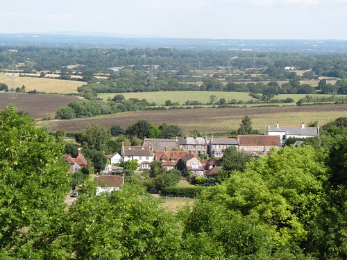
A dip in the sea not long after dawn, an early morning drive into the South Downs, and I was away from Fulking as the newly risen sun cast an oblique light along the downland escarpment behind the village.
First published in: The Times Click here to view a map for this walk in a new window

Facebook Link:
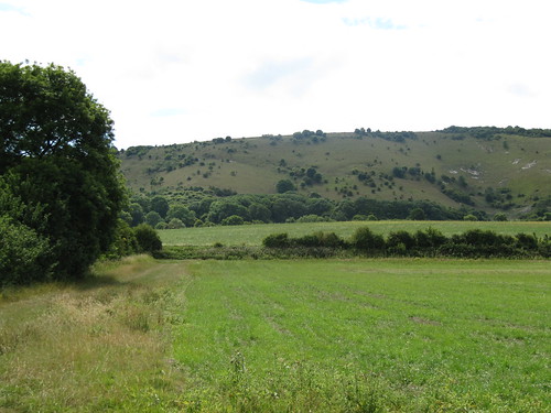
Beans rattled dry and black on their stalks, and the soil lay pale and cracked in this drought summer. To the north rose the downs, a 300-ft rampart of turf facing the agricultural lowlands, dull olive patched with white chalk scrapes and dark green scrub. Near at hand a yellowhammer in the hedge wheedled for ‘a-little-bit-of-bread-and-no-cheeeese!’
The fields stretched breathless and still in an early morning already gathering heat. Up on the downs, though, something was in motion. I stopped and stared as a crowd of bullocks went thundering down the slope, kicking up clouds of powdery chalk dust, mad with delight at the headlong sensation.
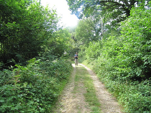
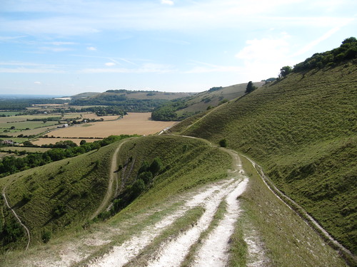
In Longlands Wood, a green wilderness of beech and oak, the swearing of a discontented jay broke the stillness. The pastures around Tottington Manor were full of dark chocolate cattle, cows and bull calves slowly grazing together, every muzzle a quivering maze of flies. I leaned over the gate, scratching a couple of handy backs, and then made for the downs. Steeply up through the trees on Tottington Mount, until at the crest I could stop and look back across the flatlands 300 feet below – downland slopes and woods leading out to the matt steel eyes of gravel pits and the great flood plain of the River Adur. A few more minutes and I was at the crest of the downs, looking south through beautiful curving valleys to the hazy grey vee of the sea.
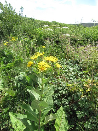
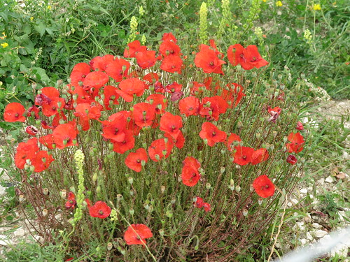
Three young sparrowhawks hung in the air in line abreast, hunting the downs under the tutelage of their parent birds. I turned east along the ancient track of the South Downs Way, a white chalk thread drawn snaking through the turf. What fantastic elation, heading into the penumbra of the sun in this high place among drifts of scrambled-egg toadflax and white campion, passing broad headlands full of poppies and moon daisies left by the farmer around the margins of his barley fields. By the time I got to Perching Hill the sky ahead over Devil’s Dyke was already dotted with hang gliders, and before I dropped back down the escarpment to Fulking I stood and watched them circling like mythical heroes near the sun.
Start & finish: Shepherd & Dog PH, Fulking BN5 9LU (OS ref TQ 247113)
Getting there: Fulking signposted from A281 (Henfield-Brighton) and A2037 (Henfield-Upper Beeding)
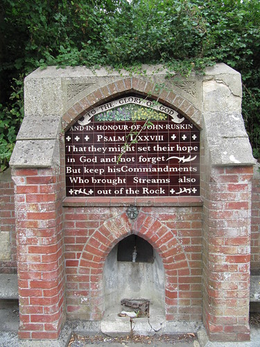
Walk (6 miles, moderate/hard grade, OS Explorer 122): Leaving Shepherd & Dog, right along road; in 50 m, by fountain, left through gate (fingerpost); right along hedge. Through kissing gate; diagonally left across 2 fields by stiles. At gate, over stile (245116); left along stony lane. In 20m at left bend, bear right (fingerpost) diagonally over field, under power lines. Cross track to Perching Manor (yellow arrow/YA) and on. At far corner, cross footbridge (241120, YA post); left along edge of woodland. Cross footbridge, stile; on over 2 fields with hedge on left. At end of 2nd field, over stile and footbridge, and on. At track junction (234121, fingerpost), dogleg left, then right; follow field edge with hedge on left. At field end, left across footbridge (fingerpost). Through thicket; emerge to skirt house (231119). At end of trees, left across footplank (fingerpost); right along hedge. Cross track (225120); over stile (fingerpost) and follow hedge to stile into Longlands Wood (fingerpost). Follow path for 400m to path crossroads at 4-way fingerpost (219122). Left for 250m to leave trees (gate); follow track to Tottington Manor. Just before barn, left through gate (fingerpost). Right to cross road (215115). Right for 30m; left up track into trees (‘bridleway’; blue arrow/BA). Up path between fences to gate; continue uphill, curving right round Tottington Mount. At top of climb, aim for post on skyline; left here (217106, BA) to road. Left on South Downs Way (SDW) for 1½ miles, passing Youth Hostel and communications masts and continuing to pass under power lines (242109). In another ¼ mile, in a dip, through a gate (246109); left down cleft (YA post). In 250m, sharp left (249111, YA post); steeply down to Fulking.
Lunch: Shepherd & Dog PH, Fulking (01273-857382; www.shepherdanddogpub.co.uk) – lovely old walker-friendly pub
More info: Brighton TIC (01273-290337); www.visitsussex.org
www.ramblers.org.uk www.satmap.com www.LogMyTrip.co.uk
Click on Facebook “Like” link to share this walk with Facebook friends.
Hi Christopher
I just wanted to say thank you so much for sharing your walks! We stumbled across your site last weekend when looking for somewhere new to take the dog in West Sussex. Last week we did the Fulking walk starting from the Shepherd and Dog and on Saturday we did the 7 mile Burpham walk. You’re so kind to share your routes and maps and it’s astounding to know there are so many incredible places on our doorstep that i just didn’t know about or think to visit! So thank you thank you! Have a brilliant week and happy walking! Anna x
Dear Anna,
What an absolutely charming email – thank you so much for taking the trouble to send it. I’m delighted you enjoyed those two walks, and you’ll find one or two more in Sussex on the website.
Do let me know how you get on.
With good wishes, and thanks again,
Christopher