Search Results : sussex

Sep 162023


First published in: The Times Click here to view a map for this walk in a new window
view north from top of Warningore Bostal 1 the ridgeway track 1 the ridgeway track 2 looking back from the top of Plumpton Bostal 1 looking back from the top of Plumpton Bostal 2 curves of the downs from Warningore Bostal looking back from the top of Plumpton Bostal 3 near Warningore Farm scene near Warningore Farm

The white rails of Plumpton Racecourse curved away, pointing southward like skeletal fingers towards the olive-coloured rampart of the South Downs. A brisk cold wind blew from those hills, with a hint of silver underbelly on the clouds beyond from the gleam of the invisible sea.

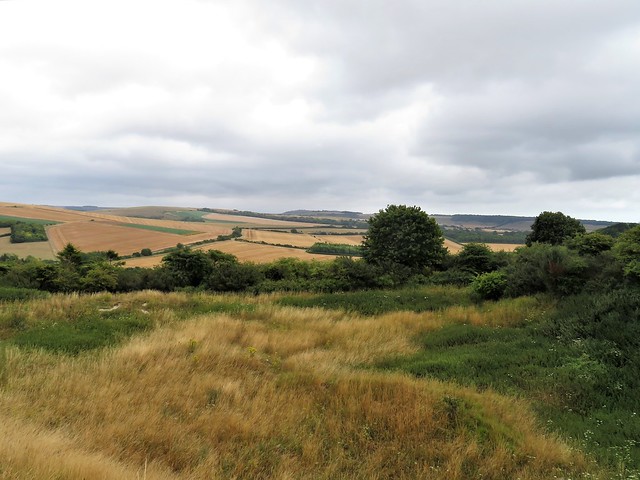
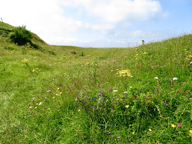
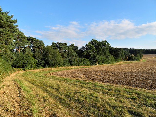
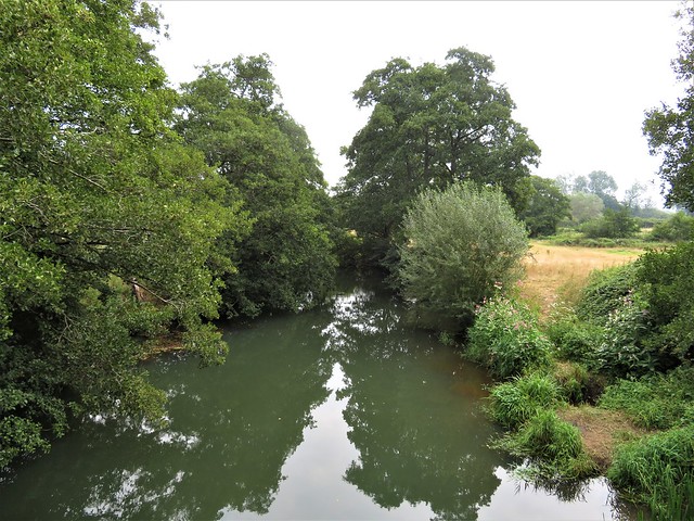
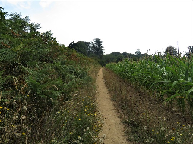
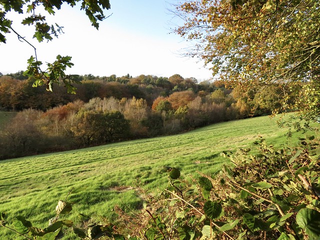
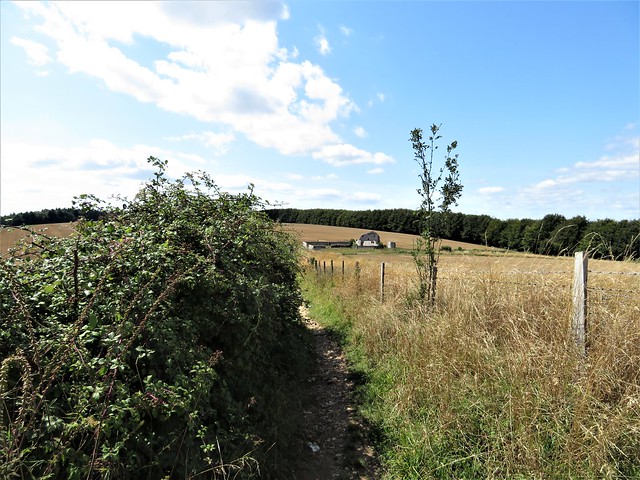
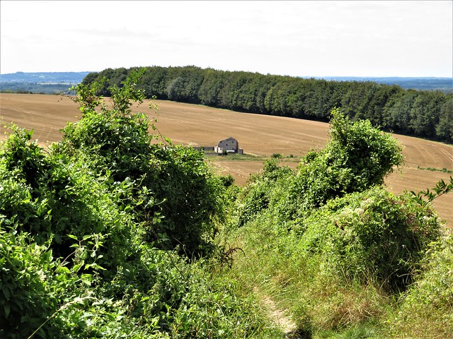
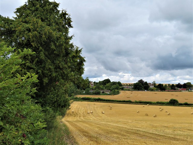
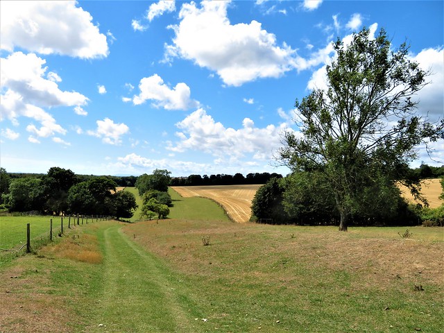
A long straight path led between pasture and crops, crossing rain-swollen brooks in tangled dells, drawing ever nearer to the downs. This is horse country. A white mare poked her nose over a fence to have it stroked by a couple of passing girls. Suddenly she took a sly nip, provoking shrieks and cascades of giggles.

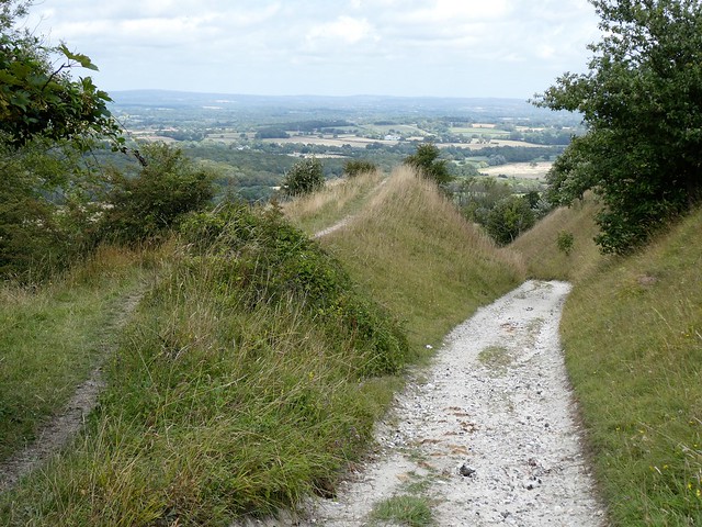
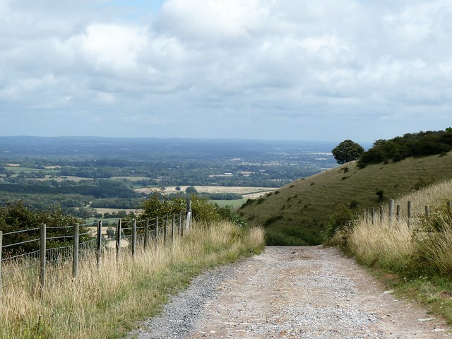
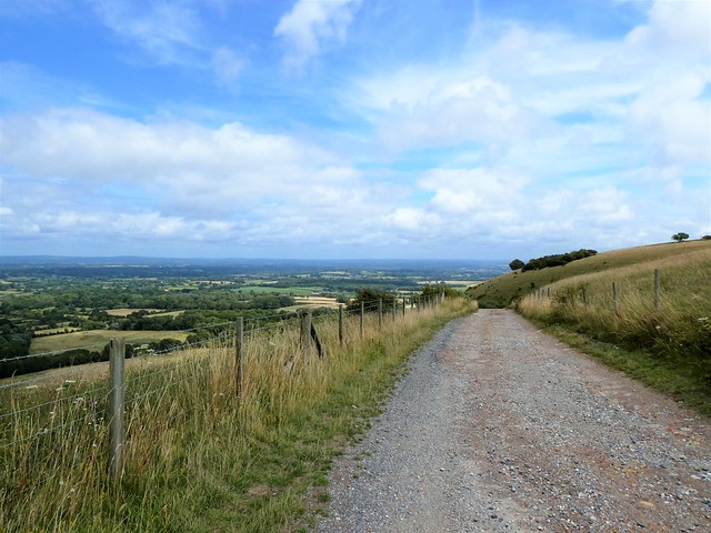
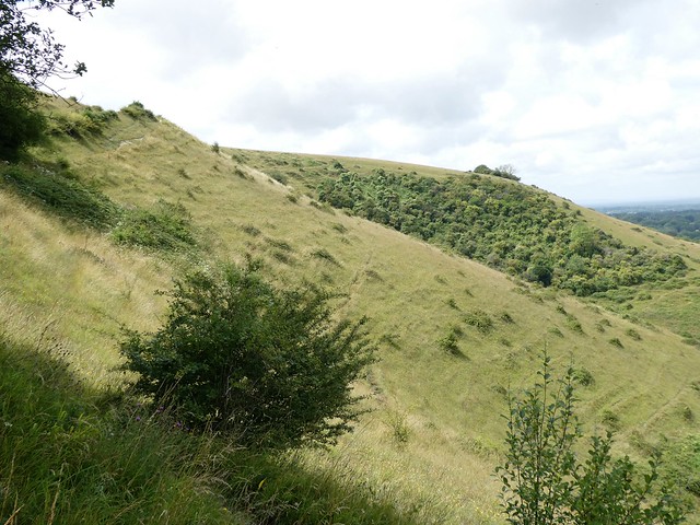
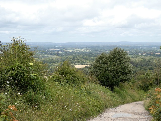
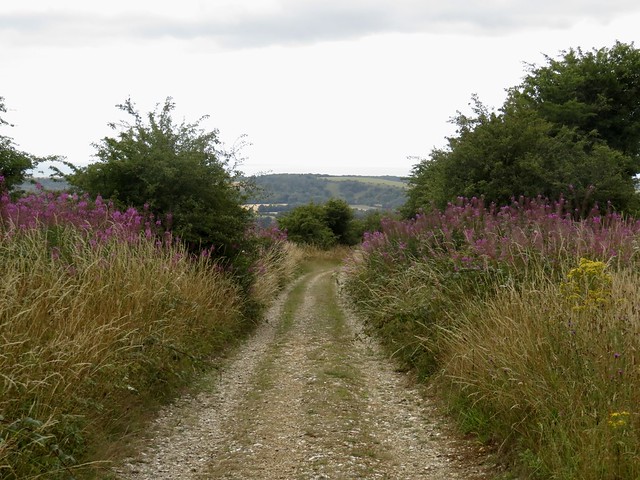
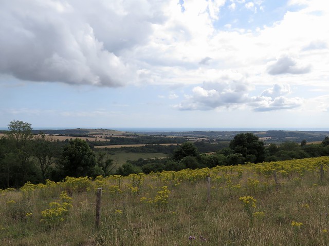
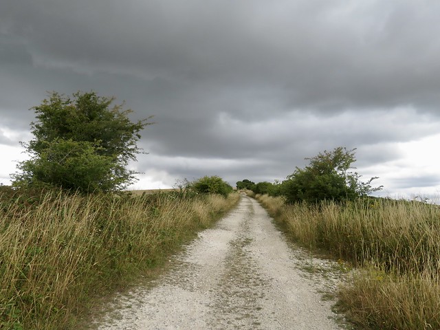
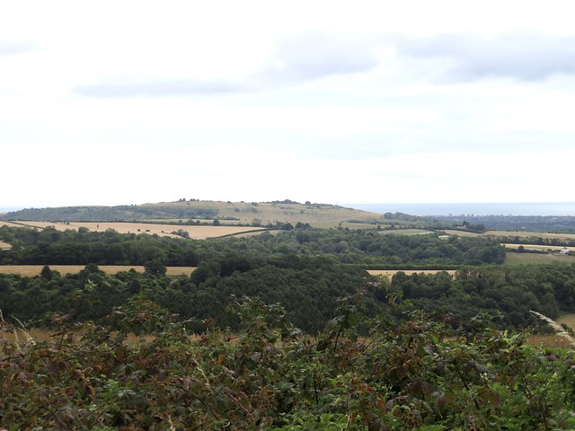
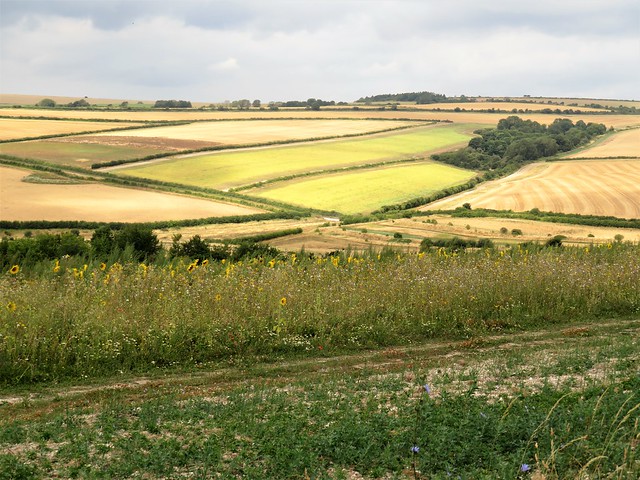
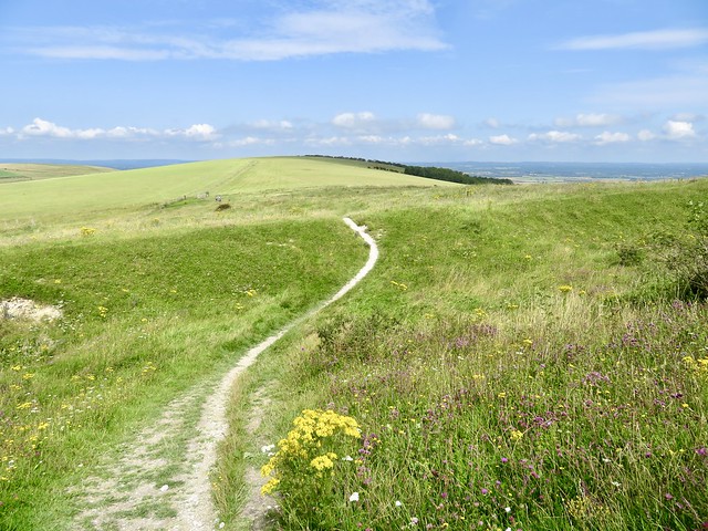
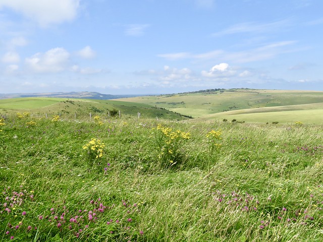
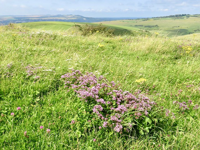
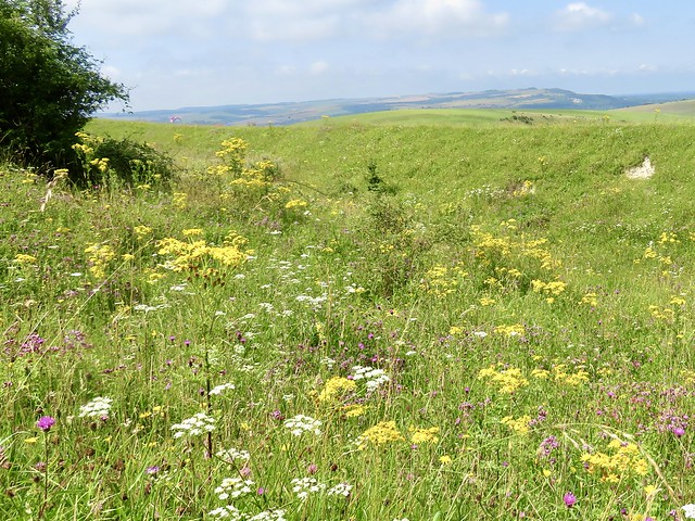
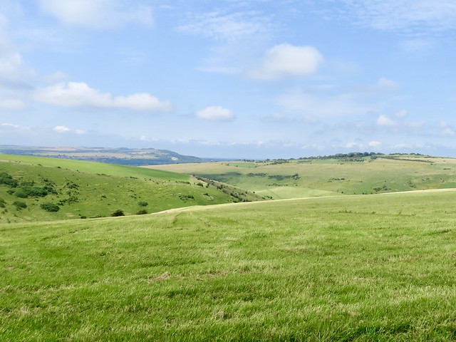
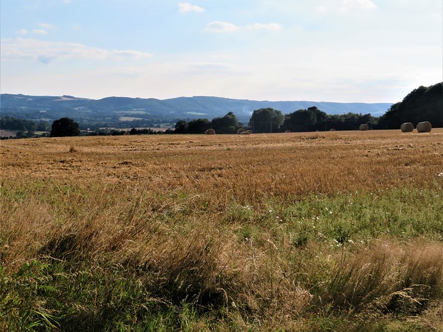
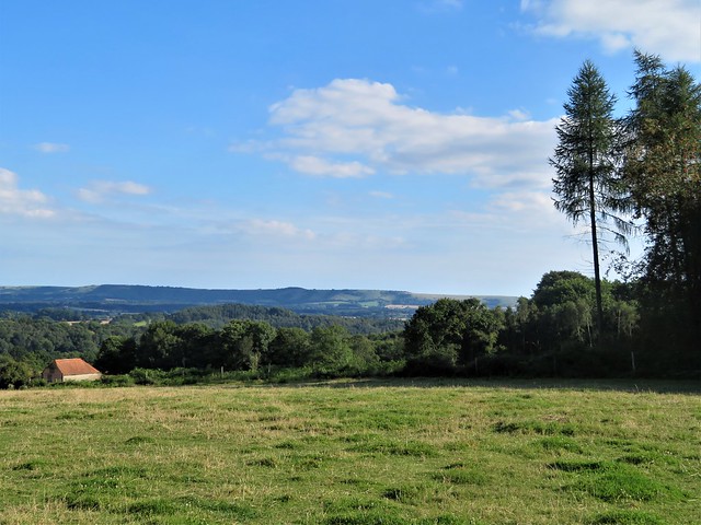
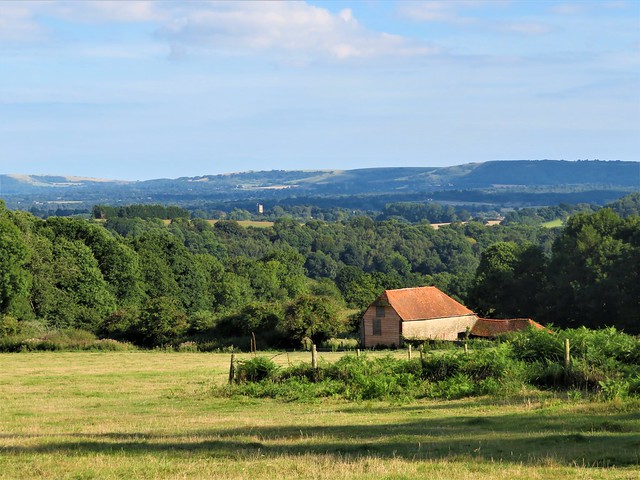
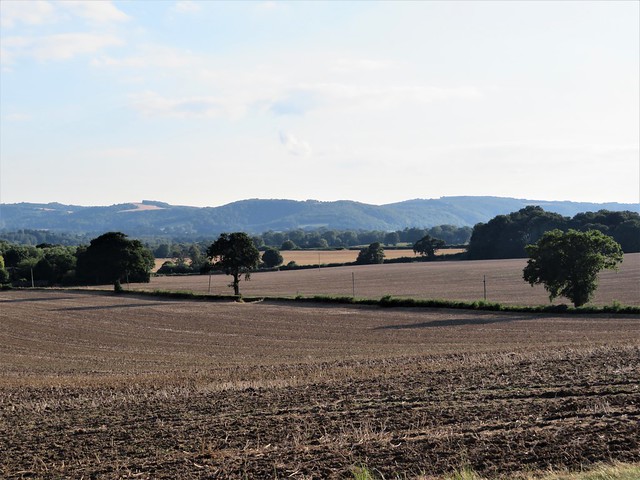
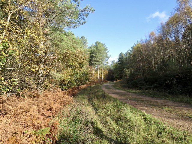
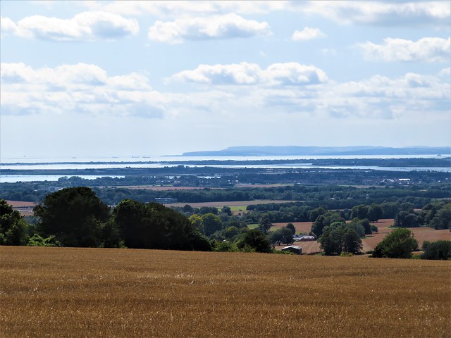
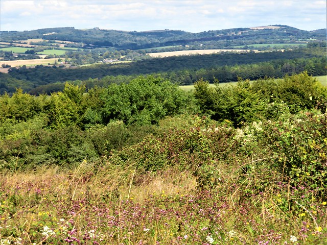
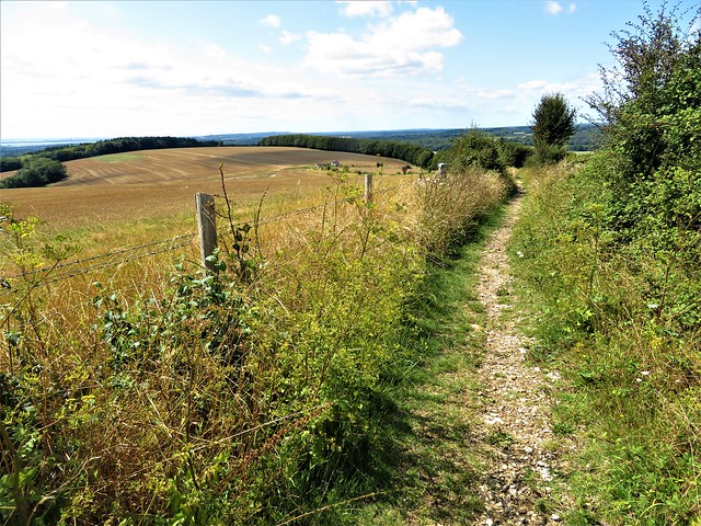
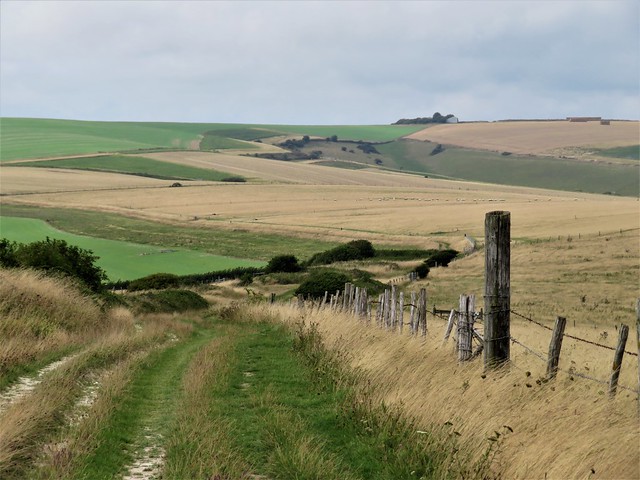
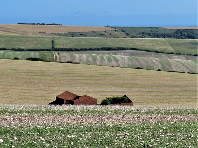
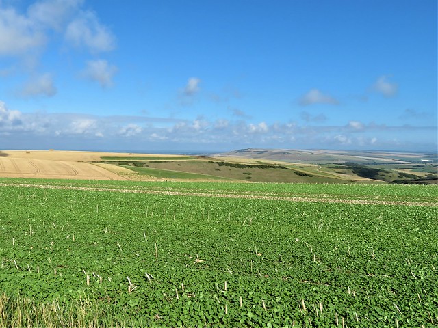
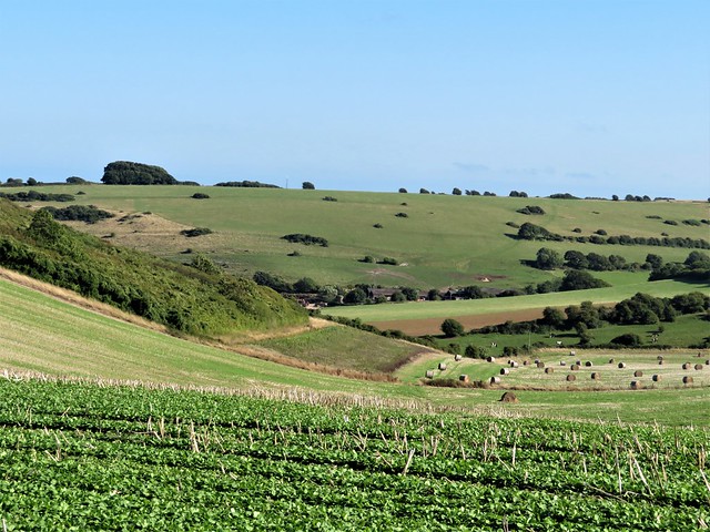
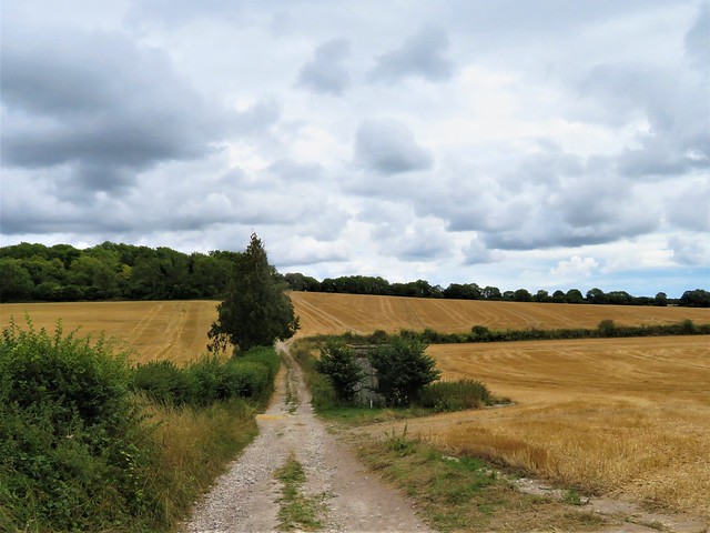
Cheerful chatter and tempting cooking smells came wafting from the Half Moon Inn as I crossed the Ditchling road and started up the steep downland track called Plumpton Bostal – a name reminiscent of fictional correspondents to Private Eye. The rubbly old track curved and climbed to the ridgeway along the crest of the hills. Wonderful views opened out, northwards across the wooded Sussex Weald toward the loom of the far-off North Downs, south across deep chalk valleys to the snub-nosed Seven Sisters cliffs and the ice-blue sea.

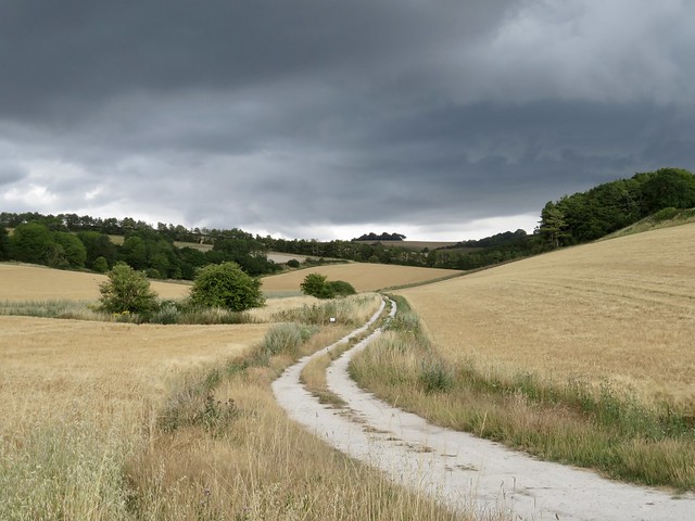
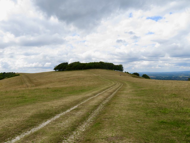
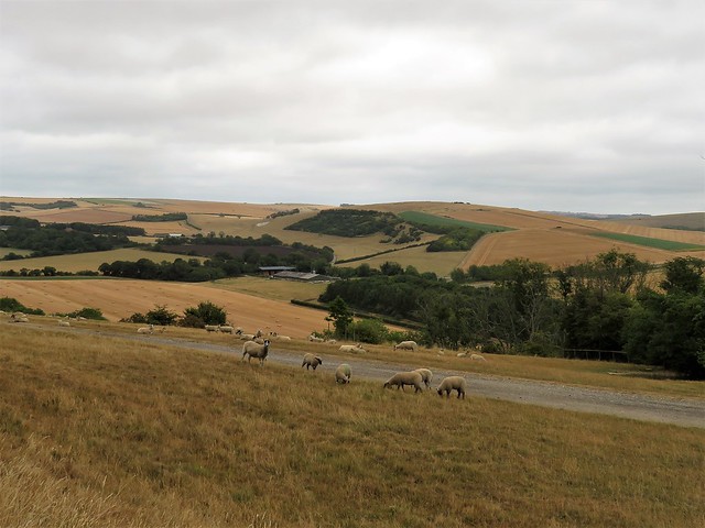
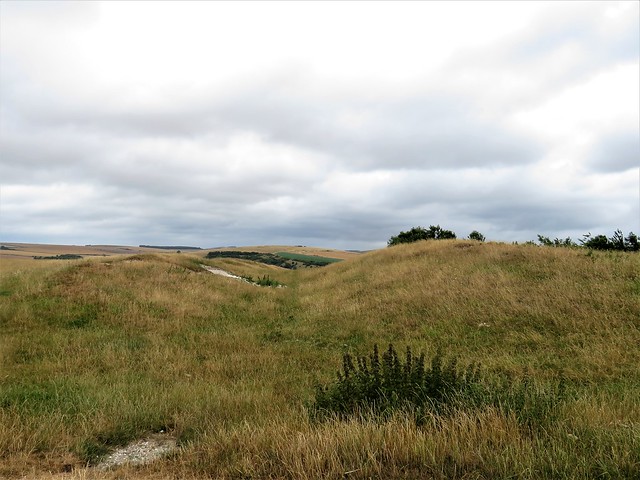
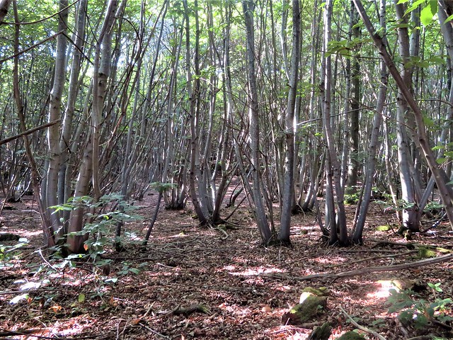
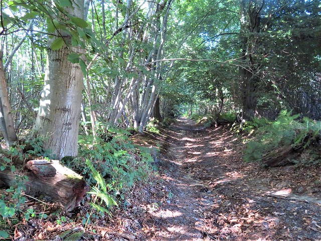
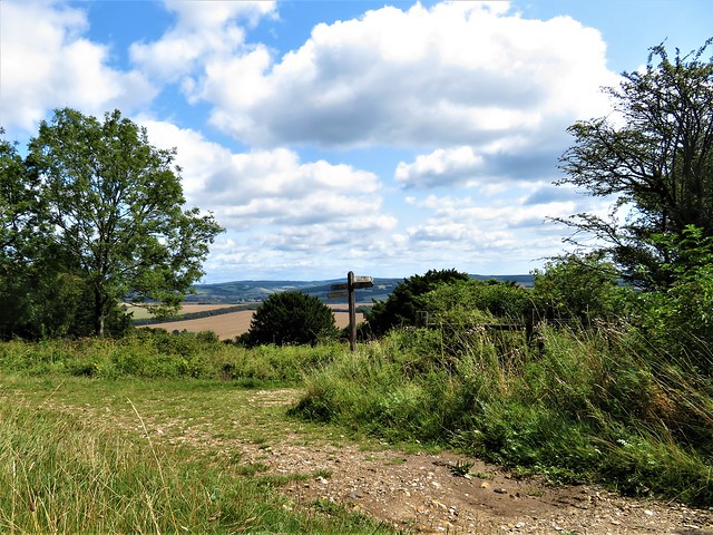
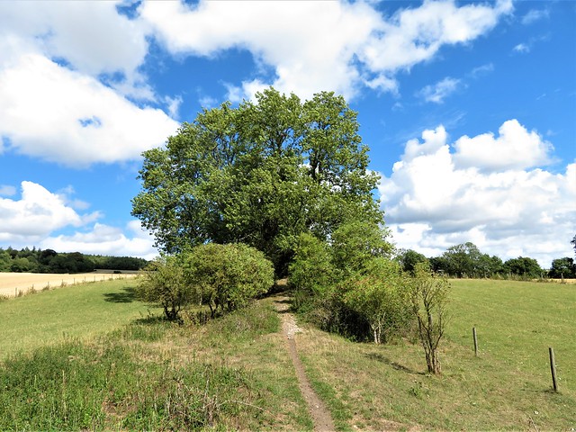
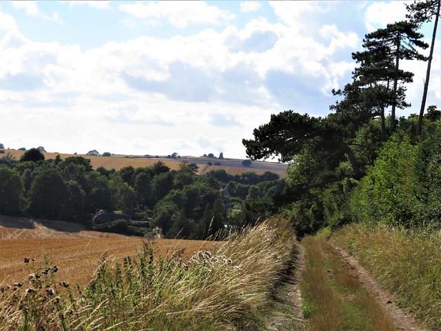
A kestrel rode the wind, head down, eyes fixed, sideslipping along above the almost imperceptible hummocks of Bronze Age bowl barrows. Soon another old holloway, Warningore Bostal, left the ridge track and slalomed down the hillside. The steady push of the south wind, now blocked by the wall of downland at my back, vanished as though a fan had been clicked off. I skittered down the rain-glazed chalk that floored the bostal, and set out north across pasture and arable ground once more.

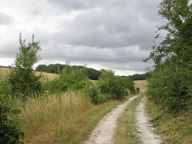
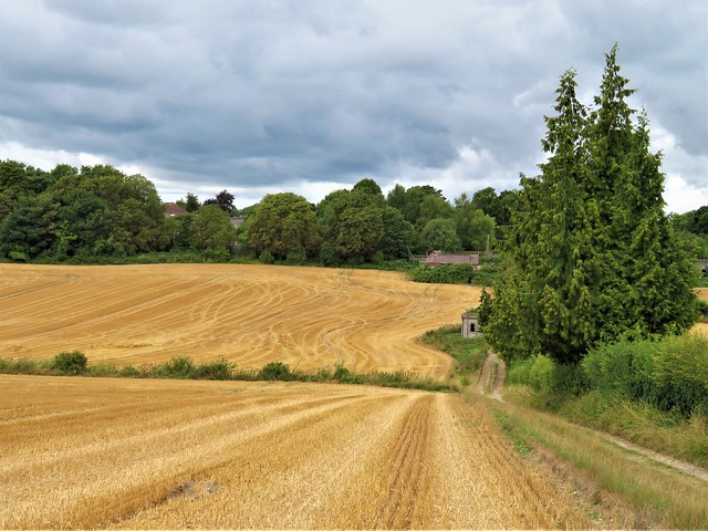
At Warningore Farm the farmer was digging silage out of the clamp for his cattle. I passed the shed where they stood patiently in an emanation of sweet breath and a gentle rustle of movement.

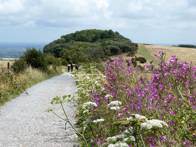
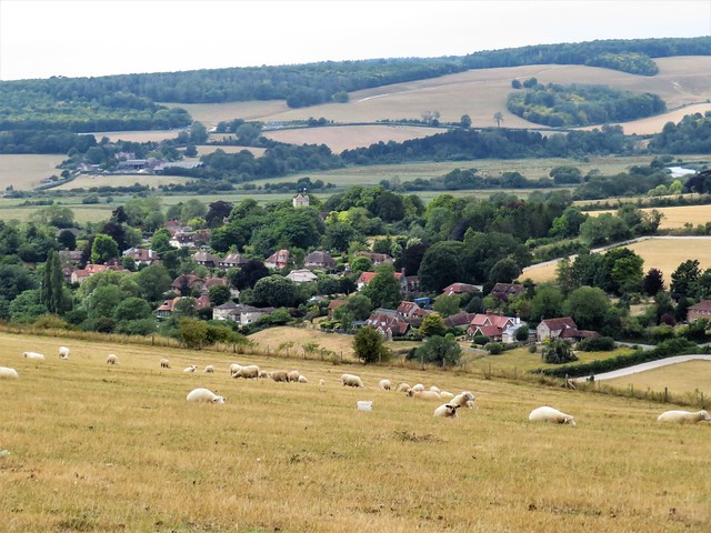
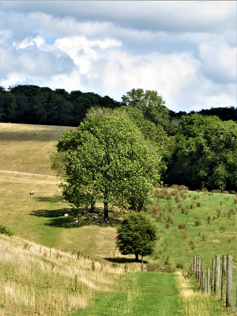
On across the fields where horses in heavy tarpaulin raincoats were cropping the grass. A pint of delicious dark Bluebell Best in the Jolly Sportsman at East Chiltington, and then the homeward stretch by the hamlet’s ancient flint church, beautiful in its simplicity, too obscure even to have a dedication to its name.

How hard is it? 7¾ miles starting at station, 6½ miles starting at Plumpton; moderate.

Start: Train – Plumpton Station (NB no parking)
Road: Half Moon PH, Ditchling Road, Plumpton BN7 3AF (364132). Please ask permission, and give pub your custom! In addition, parking for 6-7 cars in lane above car park.

Getting there: Bus: 166 (Lewes-Haywards Heath)
Road: Plumpton is on B2116

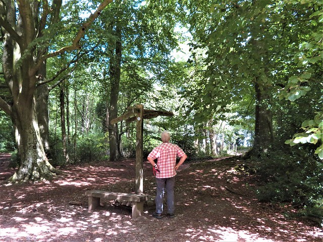
Walk (OS Explorer 122): From station, path south besides racecourse. At south end, right (362153); in 40m, left down lane. In 1¼ miles, pass Agricultural College; 150m past last buildings, left (360133, gates); half right over field into trees. At B2116, left past Half Moon PH (364132). (NB Directions starting from PH begin here). Cross B2116; Plumpton Bostal (‘Bridleway’), steeply up. At top (357126), left; in 1 mile, through gate (370125); left down holloway. In ½ mile at path crossing, left (376127, arrow post). Cross B2116 (374130); bridleway opposite. Keep right of Warningore Farm Cottages (376137); on (north) along bridleway. In ¾ mile, gate into green lane (381147); in 50m, left (fingerpost, yellow arrow/YA) across 2 fields to lane (378150). Left; cross road by postbox (375150, stile, YA). Fork right across field to lane (373152). Left past Jolly Sportsman. At church, right down stony bridleway (371151). Cross Plumpton Lane (364153); in 150m, at racecourse entrance, right (362153) to Plumpton station.

Lunch: Half Moon, Plumpton (01273-890253, thehalfmoonplumpton.co.uk)

Accommodation: Jolly Sportsman, East Chiltington BN7 3BA (01273-890400, thejollysportsman.com)

Info: visitsoutheastengland.com

Walking the Bones of Britain – a 3 Billion Year Journey by Christopher Somerville is published by Doubleday.

 Posted by at 04:27
Jul 152023


First published in: The Times Click here to view a map for this walk in a new window
in Buddington Bottom looking seaward from the track to Buddington Bottom in Buddington Bottom 2 Chanctonbury Chanctonbury Ring looking across wild parsnip to Cissbury Ring and the sea Chanctonbury Ring 2 upland track near Chanctonbury Ring chalk hill blue butterfly view to Cissbury Ring hill fort round-headed rampion

The blackcap that scribbled out its song from an ash tree by the South Downs Way was singing for a perfect summer’s day. I couldn’t believe the profusion of wild flowers and blue butterflies that bordered the ancient ridgeway as it climbed towards the roof of the West Sussex downs.

Wild marjoram, thyme and spearmint scented my fingers. Kidney vetch and knapweed vied for the attention of common and chalkhill blue butterflies that had congregated after a spectacular hatch. Yellow froth of lady’s bedstraw, nail-polish pink of centaury, harebells and hawkbit, St John’s Wort and yellowwort, and the rich blue globular flowerheads of round-headed rampion, the ‘Pride of Sussex’, a nationally scarce flower of this chalk grassland habitat.

The South Downs Way rose as the view opened northwards across a patchwork of pale gold, unharvested cornfields and dark summer woods, south to where the bird’s beak of the Isle of Wight dipped to the sea. Soon another flinty track swung off southwest, a long and gradual descent between fields of wheat and barley, flanked by brilliant yellow sprigs of wild parsnip. Out of the crop fields ahead rose the multiple ramparts of Cissbury Ring, one of the Iron Age hill forts that command this countryside.

Down in the valley bottom I passed the Pest House, a modest cottage of brick and flint with an ominous name. In this lonely place in medieval times stood an isolation house where sufferers from plague, cholera, smallpox and other deadly communicable diseases were banged up to recover or die, one or the other.

A grassy track led up the wooded valley of Buddington Bottom, to reach the South Downs Way. Just west the early Iron Age hill fort of Chanctonbury Ring topped the hill, the circular rampart reinforced with a fine double circle of beech trees. The space under them is as dark as night. This is a place with enormous atmosphere, the world spread out at your feet from the sea to the Sussex Weald.

The Ring was made by the Devil, local stories say, and he will appear to you if you run thrice widdershins around the rampart. There’s a fiendish bargain on offer, of course: a bowl of demonic soup in exchange for your soul. Don’t run round the Ring when you’re feeling hungry, is my advice.

How hard is it? 5½ miles, easy, downland tracks.

Start: Chanctonbury car park, near Washington BN44 3DR (OS ref TQ 125121)

Getting there: Bus 23 (Worthing – Crawley)
Road: At Washington Roundabout on A24 (Worthing-Horsham), take A283. Right down Washington Bostal past Frankland Arms. In ¾ mile, just before A24, sharp left up rough road to car park.

Walk (OS Explorer 121): Uphill on South Downs Way/SDW. In ¾ mile at large grass triangle, right (130117, ‘Restricted Byway’) downhill. In 1 mile at cross-tracks, left (121104, 4-finger post, ‘Wiston Estate Winery’ notice). In ⅔ mile, opposite barns at New Barn, fork left, then immediately right (130100). In 150 m, where track meets lane, fork left through gate (fingerpost, blue arrow/BA); immediately left (BA). In 400m at far corner of vineyard, through gate (133104); on up path through Buddington Bottom valley for 1 mile. At top of climb, left on SDW (145113) past Chanctonbury Ring (139120). In 500m at cattle grid, fork right (134119, gate, BA) on path past dewpond. In 500m descend to gate (129121); down through old chalk pit (slippery!) to rejoin SDW (125121); right to car park.

Lunch: Frankland Arms, Washington RH20 4AL (01903-891405, thefranklandarms.com)

Accommodation: Village House Coaching Inn, Findon BN14 0TE (01903-873350, villagehousefindon.co.uk)

Info: westsussex.info

 Posted by at 01:43
Dec 242022


First published in: The Times Click here to view a map for this walk in a new window
Burpham from the downs Downland view near Upper Barpham farm 2 Downland view near Upper Barpham farm 3 Downland view near Upper Barpham farm 1 Downland view near Norfolk Clump Downland view near Norfolk Clump Downland view near Norfolk Clump 3 earthworks on Wepham Down

Writers love Burpham. Hawk-faced poet and novelist John Cowper Powys lived here early in the 20th century; Mervyn Peake, author of bizarre fantasy Gormenghast, between the wars. Their Gothic imaginings ran free over the green ramparts of the Saxon burh or fortified settlement beside the River Arun, the leper’s squint in the ancient church of St Mary, and the place high on The Knell beyond where a highwayman’s corpse was gibbeted in 1771.

The reedy sound of the church organ followed us away from St Mary’s on this cloudy Sunday morning. We found the old track that led over a rise towards The Knoll with a fine view westward towards Arundel Castle, huge and solid against its trees.

Handsome beechwoods have grown on the downs since Jack Upperton met his comeuppance. This wretched man, a landless labourer well into his sixties, robbed the local postman, but made two stupid mistakes – he was recognised through his disguise, and he spent the proceeds conspicuously. The total take? One pound. For this paltry sum Upperton was hanged, his body tarred and displayed in chains on the down till it rotted away.

Among the beeches of Upper Wepham Wood two youngsters were playing chase round an Eeyore house of sticks. A brace of well-seasoned riders went trotting by with ramrod backs and leathery weather-beaten faces. Conifers scented the cold air with a bracing pinch of resin as we turned along the track to Upper Barpham farm with its large old thatched barn.

In the neighbouring pasture donkeys cropped the grass over the furrows and bumps of the medieval manor and church that once stood here. From the track beyond there was a beautiful view into a deep downland cleft where the farmstead of Lower Barpham lay beside its own field of lumps and hollows. Dispossessed by the change from arable to sheep farming in Plantagenet times, most of the villagers of Barpham had already quit the settlement when the Black Death arrived in 1348 and wiped out those that remained.

A high ridge track, creamy white with chalk, brought us back towards Burpham with superb views towards Arundel Castle and the sea. A pair of red kites scoured the downs, and goldfinches flitted before us through the hedge along the way.

How hard is it? 5½ miles; easy; woodland, downland tracks.

Start: Burpham car park, near Arundel BN18 9RR (OS ref TQ 040088)

Getting there: Rail to Arundel (2 miles)
Road – Burpham is signed off A27 at Arundel railway station. Car park behind George Inn.

Walk (OS Explorer 121): Left past village hall; along fenced path; in 200m left across field, steps to road (040086); right. Right at road (044085); in 40m left (blue arrow/BA) up track. In 500m ahead at junction (048082, gates). In dip, left (049077, fingerpost); in 25m right (BA, Monarch’s Way/MW) uphill. At top over track crossing; on to road (051077); left (BA, MW) through woodland. In ¾ mile, left in dip (062081, BA); in ⅔ mile pass Upper Barpham (067088) to cattle grid (view over Lower Barpham to right). Left at cattle grid(BA); fork right through gate on broad stony track across downs. In ¾ mile at crossroads, right pass metal post (062012) on track which bends left. In ⅔ mile beside Norfolk Clump, ahead (055093, yellow arrow) for 1 mile down to road (044085). Right; in 100m, left (‘Wepham Green’). At West Barn, right to stile; left to gate, steps and road (041088). Right to car park.

Lunch: George Inn, Burpham BN18 9RR (01903-883131, georgeatburpham.co.uk)

Accommodation: The Town House, High Street, Arundel BN18 9AJ (01903-883847, thetownhouse.co.uk)

Info: burphamvillage.co.uk

 Posted by at 00:38
Jul 302022


First published in: The Times Click here to view a map for this walk in a new window
flowery ditch of The Caburn hill fort 1 chalk track leading to The Caburn hill fort flowery ditch of The Caburn hill fort 2 flowery ditch of The Caburn hill fort 3 at the top of Caburn Bottom flowery ditch of The Caburn hill fort 4 wild marjoram growing in Bible Bottom looking down towards Oxteddle Bottom and Bible Bottom Wall butterfly

On a warm midday the half-moon shapes of paraglider sails – green, pink, yellow and rainbow – were wheeling in cloudy air off Mount Caburn. Looking south from the summit of the Iron Age ceremonial enclosure, we watched the paragliders swooping this way and that against a backdrop of the silvery sinuation of the River Ouse as it carved its way seaward through the chalk rampart of the South Downs.

The diminutive brick-and-flint estate cottages of Glynde lay neatly stretched below. A tufted path, jumping with grasshoppers, had led us up from the village, a straight course between fields of dusty ripe barley, the bearded seed heads hanging low. In a tin cattle trough a meadow pipit was bathing ecstatically, throwing up sparkling showers of water drops.

Wild flowers dotted the chalk grasslands of Mount Caburn – eyebright, tall yellow spikes of agrimony, red bartsia, and masses of wild marjoram where wall butterflies with dark spots and bars on their yellow wings were basking in the sun.

The 2,500-year-old ditch round the hilltop enclosure was spattered with blue flowers – scabious, harebells and viper’s bugloss – among which flitted blue butterflies. The same theme of chalk grassland flowers and butterflies continued all along the path that dropped down a slope of Access Land into a tangle of dry flat-bottomed valleys.

In Oxteddle Bottom faint foundations in the grass showed where winter sheds for plough oxen stood in medieval times. Bible Bottom’s enclosure was too well camouflaged under grass and wild vegetation to make out. We picnicked on a bank of marjoram, the bushy pink flowers exuding an oily pungency.

It was a scene straight out of an Eric Ravilious painting. Sheep were grazing these valleys as they have done for centuries. Although a Sussex shepherd of past times might have blinked at the sight of the farmer puttering up the slope of Bible Bottom on a quad, little else has changed here over the years.

Up on the nape of the downs we turned for home as views opened up to the north over the broad hedged lowlands of the Sussex Weald, a vista in total contrast to the billowing downs to the south. We threaded between Bronze Age burial mounds and old chalk quarries before turning off down the long path to Glynde, with the dimpled green wall of the South Downs beyond.

How hard is it? 5½ miles; easy; downland footpaths

Start: Glynde railway station, Lewes, East Sussex BN8 6RU (SO ref TQ458087)

Getting there: Rail to Glynde; bus 125 (Lewes – Eastbourne)
Road: Glynde is signed off A27 Lewes-Eastbourne

Walk (OS Explorer OL25): From station, left; in 300m left (457090, Ranscombe Lane); in 40m, right (gate, yellow arrow/YA) on field path for ¾ mile to ridge. At gate in ridge fence (445093), left to The Caburn (444089). Return towards gate; 100m past outer ditch of hillfort, left (444091) on path down Caburn Bottom. At bottom, ahead (440097) along Oxteddle Bottom. At pond, right-hand gate (437099, permissive path); in 300m bear left; cross stile (437101). Follow fence on left; in 400m, chalk path (433101) up to gate (431101). Ahead (YA) to post (430100, YA); right. In ¾ mile at Southerham Farm notice, kissing gate (442105); past waymark post, then wood on left. In 200m pass dewpond; before stile, right along fence (447105). In 300m fork left (466103), up to stile; on with fence on right. In ½ mile, left at gate on right (445093); retrace steps to Glynde.

Lunch: Little Cottage Tea Rooms, Ranscombe Lane, Glynde BN8 6ST (01273-858215, littlecottagetearooms.co.uk)

Accommodation: Ram Inn, Firle BN8 6NS (01273-858222, raminn.co.uk)

Info: glynde.co.uk
@somerville_c

 Posted by at 02:40
Nov 062021


First published in: The Times Click here to view a map for this walk in a new window
Sweet chestnut coppice, Fittleworth Wood classic West Sussex countryside near Fittleworth, looking to the South Downs 3 classic West Sussex countryside near Fittleworth, looking to the South Downs 2 classic West Sussex countryside near Fittleworth, looking to the South Downs sweet chestnut, hazel and holly flank the lane to Fittleworth Wood rough grassland near Limbourne Farm ploughed fields near Fittleworth, with South Downs beyond 3 field path between Little Bognor and Fittleworth ploughed fields near Fittleworth, with South Downs beyond harvest fields near Fittleworth, with South Downs beyond 2 harvest fields near Fittleworth, with South Downs beyond

A warm afternoon still gilding the backs of the South Downs, but growing cool in the shade of the trees of Hesworth Common. The downs hung halfway up the southern sky, a long and gradually undulating spine of tar-black woodland and dull gold fields. Baby rabbits were playing ‘statues’ in the verges of the stony lane that led past the back gardens of Fittleworth and on among the sweet chestnuts of Fittleworth Common. 
 
A green lane zigzagged north through the bracken undergrowth of Walters Plantation. Approaching Limbourne Farm the hedges were thick with the white bugle mouths of convolvulus and netted over with hop bines. We squeezed the sticky hop buds as we passed, and carried their pungent oily smell away at our finger ends.
 
Beyond the farm we entered the dense plantation of Fittleworth Wood. Properly maintained coppice of sweet chestnut is rare enough; there’s little call these days for the laths and battens, the hurdles and staves for which country craftsmen once harvested the chestnuts. But here in Fittleworth Wood the path ran between coppiced trees at every stage from tender new growth to mighty poles fifty feet tall – a beautiful sight with the sun filtering in thick bars of watery green light between the saw-edged leaves.
 
Near the edge of the wood a tiny Jack Russell pattered up to press its cold nose against my fingers, savouring the hop aromas as appreciatively as any real ale connoisseur. Beyond the trees lay hay meadows and the mellow red roofs and brick walls of Springs Farm, its peeping windows framed in sprays of buddleia.
 
If chestnut coppices are generally neglected nowadays, the commons where local folk once grazed their pigs and cattle have largely become overgrown with trees. We turned west through the luxuriant ash, oak and holly of Lithersgate Common, and south on a path that edged Bognor Common’s thickets of silver birch and rowan.
 
Down through Little Bognor, another picture-book straggle of beautifully kept old houses along a millpond stream, then on south through open fields. The powdery pink soil smoked in our wake, water-smoothed pebbles from some ancient river rolled under our boots, and the long arm of the downs stretched ahead as though to fence off the valley from the outside world.
 
How hard is it? 5½ miles; easy underfoot; careful navigation needed in woods
 
Start: Hesworth Common car park, Fittleworth, West Sussex RH20 1EW (OS ref TQ 007193)
 
Getting there: Bus Service 1 (Worthing-Midhurst)
Road – Car park signed off B2138 on west outskirts of Fittleworth.
 
Walk (OS Explorers 121, 134): Left/southeast (Serpent Trail/ST), parallel with B2138. In 200m, left to B2138 (009192). Right; in 50m, left past wooden barrier. Fork left on path. In 300m cross road (011191); on to Fittleworth Common. At wooden post bear right (014190), parallel with and then alongside northern boundary fence, to cross A283 (018190 – take care!).  By pond, right (fingerpost/FP); in 50m, left up bank (black arrow/BLA) on path through pinewood. 
 
In 150m bend right; in 150m, left (020191, bridleway fingerpost/BF) on broad bridleway. Pass Limbourne Farm sheds and silo (020193); in ½ mile, enter Fittleworth Wood (022201). In 100m pass footpath turning on left (FP); in another 100m take 2nd turning on right (022203, unmarked fork). Continue uphill. In 300m turn right (024206, blue arrow/BA). In 50m, left (BF); in 150m, right (BF, bench), steeply down bank. At bottom, follow BA uphill and on for 250m to top of wood (027210). Out of wood through gate; on to top left corner of field (027212); left (4-finger post) through gate; half left down across field. Follow lower edge of field below Springs Farm to drive (025213); follow it for 400m to road (021213).
 
Left; pass track to Warren Barn; in 15m, right (FP, stile) on path through trees of Lithersgate Common. Pass 3-finger post; in 200m, at next 3-finger post, right (019211). In 15m fork left down past pond. Follow ST for 550m to enter Mitfords Copse (013211); in 200m, descend to path crossing (011211). ST turns right; you go left/south-west (FP). In 300m, cross road (009209); down road opposite through Little Bognor. At far end of village pass ‘The Potting Shed’ on right; in 100m, left over stile (004204, FP, ‘Dyers Cottage’).
 
Follow YA past Dyer’s Cottage and on. Follow field edge downhill; in 100m, left (BLA, 006202) into wood. At end of trees, keep ahead to 3-finger post (005200); left to corner of hedge; half left across field past lone tree with FP to enter trees (008197). At kissing gate, half right across paddock to gate (BLA). Follow path to road; right to A283 (009194).
 
Right round bend (take care!); cross into Church Lane; right up path (FP) beside A283. At Scout hut, up left side of building; keep ahead to B2138 (008192); right to car park

Lunch/Accommodation: Angel Inn, Petworth GU32 0BG (01798-344445, angelinnpetworth.co.uk)

Information: Arundel TIC (01903-737838)

 Posted by at 01:53
Jul 172021


First published in: The Times Click here to view a map for this walk in a new window
picture picture picture picture picture picture picture picture picture picture picture picture
Facebook Link:

A beautiful hot day in Cowdray Park, the last in a string of them, with thunder and brimstone forecast for tomorrow across the Sussex countryside. Under the gale-tattered old chestnut trees that lined The Race avenue, the humid air was stirred by the slightest of breezes.

Woodpigeons cooed throatily among the chestnut leaves, and the shady avenue was tiger-striped with bars of fierce sunlight as we stepped from cool to hot and back to cool.

Smatterings of Capability Brown’s landscaping subtleties showed in Cowdray Park’s curves and falls of perspective. A side path led up across a dusty harrowed wheat field, out over the lush shaven fairway of a golf course, and down a sandy path through a valley of bracken between huge plane trees with patchwork bark.

Modestly hidden behind Steward’s Pond (itself well camouflaged by bushes) we found a mighty veteran tree, The Queen Elizabeth oak might well have been standing here since before the Normans came to Britain. Its girth, 41 ft, is nearly twice its storm-truncated height. Warty and scaly, split and hollowed by lightning strikes and age, the tree had donned a green crown of leaves and acorns for the summer, as for every summer past for a thousand years.

By contrast the lime trees of the avenue that led us onward, planted for our own queen’s Diamond Jubilee in 2012, were slim striplings scarcely six inches round the middle. How many of them will flourish till the next millennium?

In the shade of the coppiced hazels and sweet chestnuts of Heathend Copse we went south to cross the River Rother and enter the heath country of Todham Rough. Here conifer plantations alternated with broom and gorse. Labyrinth spiders had built funnels of webbing under the overhangs of the path margins. Our footsteps crunched on the stony tracks, and pheasant poults went racing ahead in panic, raising puffs of dust.

We crossed wheat stubbles and passed the tree-smothered mound of Midhurst’s Norman castle. A path over rough ground to reach the great ruin of Cowdray House, burned out long ago, and a final stretch beside the polo fields of Cowdray Park where teams of well drilled groundsmen were preparing for next Saturday’s match.

How hard is it? 7½ miles; easy; parkland and woodland paths

Start: Cowdray Park café car park, Easebourne, Midhurst GU29 0AJ (OS ref SU 895224)

Getting there: Bus 1 (Midhurst–Petworth)
Road: Signed off A272 at Easebourne

Walk (OS Explorer 133): Cross A272; follow Midhurst Way/MW (‘Permissive Footpath’) up The Race avenue. In 800m, opposite gate on left (902229) turn right (fingerpost/FP) across field, wood, and golf course (black arrows); follow direction of fingerposts. In ¾ mile, at bottom of dip, left through kissing gate (912226, yellow arrow/YA, MW). Past Steward Pond (Queen Elizabeth oak is behind pond at 913227); on up young lime avenue.

Through kissing gate (917228); bear left (YA) clockwise round top of field. Into trees; right (919229, FP, blue arrow/BA) for 600m to road (919223). Right; in 150m, ahead (919221, Restricted Byway’) to cross A272 (take care!). On down lane; in 700m cross River Rother (916212); right (FP) along river, then over field to road (912206). Left; at corner, right (913205, ‘Bridleway’). In 200m pass cottage (912204); in 250m, right (910201, BA). In 650m, left (905204, ‘Bridleway’ FP); in 250m, bend right onto New Lipchis Way/NLW (903202, ‘Bridleway’ FP) on broad forest road.

Follow NLW (waymarked arrows; if absent, follow ‘bridleway’ arrows) for ¾ mile to Selham Road (900211). Left across Costers brook; at crossroads, ahead (‘Kennels, Dairy’), following NLW. In ¾ mile bend right to cross bridge (890213). NLW goes left, but keep ahead (FP) and bear right (YA) between castle mound and river. Follow path across rough ground to cross river by castle ruins (890217). Left; in 150m, fork right on track to car park.

Lunch: Cowdray Park Café (01730-815152)

Accommodation: Angel Inn, North Street, Midhurst GU29 9DN (01730-812421, theangelmidhurst.co.uk)

Info: cowdray.co.uk

 Posted by at 01:31
Nov 142020


First published in: The Times Click here to view a map for this walk in a new window
picture picture picture picture picture picture picture
Facebook Link:

If I could just bottle a day like this and sell it, I’d be a millionaire and the lucky purchaser need never fear the onset of winter again. A sky of enamel blue lay over the Sussex Weald, and the views from the hilly lanes around Chelwood Common were twenty-mile prospects, out across the green and gold of the Wealden woods to the soft grey line of the South Downs clamped against the southern horizon.

Cyclamen made delicate pink half moons in the verges at Aggons Farm, and the holly hedges were thick with crimson berries and hung with scarlet necklaces of bryony.

The woods of Chelwood Common were running with water, their paths sodden, their rain-carved dells loud with the chatter of streams. Out in the open we passed Chelwood Farm, all red brick gables and tall chimney stacks, and in the fields beyond disturbed a herd of twenty-five roe deer feeding by Maskett’s Wood. They turned and fled into the trees, each animal’s movements mirrored by its companions as though one hundred-legged creature were scampering away.

Not so long ago Sheffield Forest was a hubbub of rural activities – charcoal burning, clay digging, coppicing, iron smelting in primitive bloomeries. If tree trunks were too heavy for horses to drag away to the sawmill, they’d be cut into planks on the spot in a hand-dug sawpit. A pair of sawyers would work with a great long saw between them, the upper man known as the ‘top dog,’ his colleague down in the sawpit as the ‘underdog.’ Searching for these old sawpits and bloomery hearths, we found only bumps and hollows – the forest had long swallowed them.

A snaking track led us down and across a damp valley, where the Annwood Brook flowed through a string of beautiful lakes.

Before taking the soft and squelchy homeward path we lingered under the trees at Sheffield Mill pond, watching the wind ripple the reflections of beech trees burnished gold and acid green by the declining sun of this perfect day.

Start: Coach & Horses Inn, School Lane, Danehill RH17 7JF (OS ref TQ 411287). Please ask permission to park, and give the pub your custom!

Getting there: Bus 270 (East Grinstead – Brighton)
Road: Coach & Horses is signed from Danehill on A275 (between Sheffield Park and Chelwood Gate)

Walk (7½ miles, woodland and field paths, OS Explorer 135): Up Coach Lane; cross road, on between gateposts. At Willowlands (418285) ahead through trees (yellow arrows/YA). In 400m, nearing Chelwood Farm, left (422286, stile, ‘Public Footpath’) across paddock. Follow YAs to lane (425286). Left; in 250m, just before road, right (electricity pole on left) across footbridge (427287), then through trees. In 200m, leave wood by stile (428286); left to cross stile without footboard. In 450m, opposite Maskett’s Farm, right on green lane (431283, stile, fingerpost). Follow YAs for ¾ mile to Bell Lane (430272).

Right; in 300m, right past barrier and ‘Sheffield Forest’ sign (429269). Follow forest road. In nearly 1 mile cross stream (421265); in 400m, cross another in valley bottom (421262); right at junction. In 250m on left bend, right downhill (419262) on grassy path. In 500m, fork right (416258, 3-finger post) across Sheffield Mill dam; up lane to road (409259). Right; in 250m fork right at Portmansford pond (409262); through gate to right of Rose Cottage. Follow squelchy path (YAs). In 600m pass between lakes (412267, YAs).

In 100m fork left; duckboard across stream; right to cross stile (422268). Keep right (YAs) along fence for 2 fields into wood (414271, stile, YA). Right to stile out of wood; left along field edge (YA) to stile next to gate (417272). At junction, ahead. In 200m at pond, ahead through gate (418274, YA) and on. In 600m pass Allins Farm (419278); in 700m, left over stile (419284, fingerpost, YA, ‘Paths to Progress’). Follow YAs across stream, up to lane (418285); left to Coach & Horses.

Conditions: Wet, muddy walk

Lunch: Coach & Horses (01825-740369, coachandhorses.co). Booking advised. – currently closed due to Covid

Accommodation: Griffin Inn, Fletching TN22 3SS (01825-722890, thegriffininn.co.uk) – fully Covid compliant

Info: Ashdown Forest Centre (01342-823583, ashdownforest.org)
satmap.com; ramblers.org.uk

 Posted by at 01:03
Sep 192020


First published in: The Times Click here to view a map for this walk in a new window
picture picture picture picture picture picture picture picture
Facebook Link:

After days of wild weather and whitened seas along the Sussex coast, a quieter morning dawned over the South Downs. In the hamlet of Walderton, master thatcher Chris Tomkins had his straw bundles and pegs laid out along the gutters of a flint and brick cottage, all handy for the day’s work.

Small clouds went jostling like sheep along the wooded skyline. Our path led east beside stubble fields, sheltered in that characteristic Sussex Downs landscape of dip and rise, every curve of the chalky land pleasing to the eye and heart.

We scanned the furrows as we walked, looking for the bevelled edges and teardrop shapes of Neolithic flint tools lost or left behind by our distant ancestors.

Down behind the neat cottages and carefully tended gardens of Stoughton stood St Mary’s Church, already here when the Normans landed, a blocky building with narrow windows high up. Inside under a simple beam roof a tapestry round the walls depicted the thousand-year story of the downland village in its cradle of woods and slopes.

Beside the flinty lane that led away from Stoughton stood a plain granite pillar. In the adjacent field 23-year-old Pilot Officer Boleslaw Własnowolski – ‘Vodka’ to the other chaps in the mess of 213 Squadron at Tangmere – died in November 1940 when his Hurricane fighter was shot down by a Messerschmitt Me-109. The Polish flag that swathes the pillar, and the poppy wreaths at its foot, show how this young foreign flyer is still remembered here.

The lane ran up to the crest of the downs, where the little grassy domes of the Devil’s Humps lay in line astern. From these Bronze Age burial mounds we had a stunning view south over the glinting inlets of Chichester Harbour, where the spire of Chichester Cathedral lanced into the cloudy sky against a backdrop of trees, creeks and the dull silver plain of the sea.

Flint-cobbled tracks led us south, skirting the scrubby slopes of Kingley Vale National Nature Reserve, a marjoram-scented heaven of wild flowers and butterflies.

We turned for home along a downland highway past the brooding wreck of a great flint barn, and on through woods of oak and beech where the wind whistled and loose leaves pattered earthwards like multi-coloured rain.

Start: Barley Mow Inn, Walderton, Chichester PO18 9ED (OS ref SU 790106). Open again. Please ask permission to park, and give pub your custom!

Getting there: Bus 54 (Chichester-Petersfield)
Road – Walderton is on B2146 (signed from Westbourne, off A27 Portsmouth-Chichester)

Walk (7½ miles, easy, OS Explorer OL8): Right along road. In 50m, right across bridges; grass path to road. Right; in 50m, left (788107, fingerpost); right along field edges. Cross road (792110); on (occasional ‘Monarch’s Way’/MW signs). In 400m, path forks (796113); keep ahead across field to trees (796116). Inside trees, right (MW, ‘bridleway’/BW); immediately keep ahead downhill to road in Stoughton (801114).

Sharp left to church; return to road; right for 150m. By Tythe Barn House, left (801113, BW) up lane. In 350m pass war memorial (804111); on up to top of rise. Forward to 3-finger post (812106, BW); left along track. In ½ mile pass Devil’s Humps (819110); in another ½ mile, right (824115, white arrow in blue circle/WABC) up path; in 150m, right (blue arrow/BA) up stony bridleway.

In 250m cross bridleway (825113, 4-finger post); on downhill. In 550m pass Kingley Vale signs (827108, KV); on down for 500m, right at 4-finger post (828103). In 550m pass KV gate (824100) and on (BW). In 150m, fork right uphill at edge of trees. In 650m, at KV gate on right, fork left (819102, WABC). In ¼ mile, entering yew grow, fork left at 3-finger BW post (815104).

In 650m, at edge of trees, don’t fork left downhill, but keep ahead (809104) into open. In ½ mile, right at ruined barn (800104); inside trees, left along track. In 650m, fork right (794105) downhill past Walderton Down notice to road (792107); left to pub.

Lunch: Barley Mow, Walderton (02393-631321, thebarleymow.pub) – booking advised. Take-away service also available.

Accommodation: Coach & Horses, Compton PO18 9HA (02392-631228, coachandhorsescompton.co.uk) – open and Covid-compliant.

Info: Chichester TIC (01243-775888, visitsoutheastengland.com); satmap.com; ramblers.org.uk

 Posted by at 01:10
Jul 042020


First published in: The Times Click here to view a map for this walk in a new window
picture picture picture picture picture picture picture picture picture picture picture picture
Facebook Link:

A cool, windy morning over the South Downs, with the village of Rodmell dreamlike in muted colours, its flint and weather-boarded houses lining the lane down to the River Ouse.

Looking out on the lane is Monk’s House, a modest building of weatherboard and brick, bought by Leonard and Virginia Woolf in 1911 and loved by them as a country retreat for themselves and their Bloomsbury friends. Virginia composed most of her best-known novels – Mrs Dalloway, To The Lighthouse, Orlando, The Waves – in her writing lodge in the garden.

From Monk’s House we followed a stony lane across a flat floodplain of rough cattle pasture to the banks of the River Ouse. Here Virginia came on 28 March 1941, distraught at a recurrence of her mental illness, to drown herself in the river, having filled her coat pockets with heavy stones to weigh her down.

Melancholy overhangs the spot, but we felt it lift with the clouds and the landscape as we passed the church at Southease with its Saxon round tower and climbed into the higher countryside of the downs.

It’s all Bottoms around here, dry valleys that wriggle into the flanks of the chalk downs. A rushing mighty wind blew through Cricketing Bottom, where a ramshackle farm displayed a hundred and one varieties of ancient cars, buses, tractors, lorries and harvesters. Looking back from the far ridge, it was a pure Eric Ravilious scene – white chalky tracks, a twisted thorn tree, long curves of dark flinty ploughlands and green corn.

Through tiny, tucked-away Telscombe where the hedges were a-twitter with sparrows, then up and away on breezy downland tracks. Up here the lonely marble monument of Harvey’s Cross marks the spot where John Harvey of Bedfordshire was killed in a fall from his horse on a June day in 1819.

A kestrel went flapping over a cornfield, struggling to rise against the wind and the weight of the prey it had pounced on. At last the raptor let go its prize – a partridge poult, one of a trio that had been scuttering along the South Downs Way ahead of us. We stepped out the last blustery mile, under a blue sky scoured of clouds, to Mill Hill and the sloping lane to Rodmell.

Start: Abergavenny Arms, Newhaven Rd, Rodmell, BN7 3EZ (OS ref TQ 418060)

Getting there: Southease station (500m from walk); Bus 123 (Newhaven-Lewes)
Road – Rodmell is signed off A27 at Lewes

Walk (10½ miles, easy, OS Explorer OL11): Left down lane (‘Monk’s House’). Beyond Monk’s House (421063), follow stony lane to River Ouse (432068). Right to Southease Bridge (427053). NB For Southease railway station, left across bridge. To continue walk: Right from Southease bridge past Southease Church to road (422053). Right (‘South Downs Way’/SDW); in 50m, cross road (take care!); up Gorham’s Lane. Immediately right through gate; follow SDW. At foot of slope, left (421055, SDW). In ⅔ mile SDW turns right(413049), but keep ahead past farm. In ⅔ dogleg left/right across Cricketing Bottom (407042); up slope to road (406038); right through Telscombe. Where road ends at cattle grid, right on track (403031, ‘St Michael’s Landour’). At cattle grid by fancy gate posts, right (399033); in 50m, through gate and on. In 1½ miles, pass Harvey’s Cross monument (386052); in 200m fork right for 1¼ miles to SDW (391067). Right for 1½ miles to Mill Hill (413053); left (‘To the Pub’) to Rodmell.

Picnic: Above Cricketing Bottom.

Monk’s House: 01273-474760, nationaltrust.org.uk (phone for opening update)

Info: Lewes TIC (01273-483448), satmap.com; ramblers.org.uk

 Posted by at 01:21
Sep 282019


First published in: The Times Click here to view a map for this walk in a new window
picture picture picture picture picture picture picture picture picture picture picture picture picture
Facebook Link:

A cock crowed from a farmyard and wood pigeons cooed in The Rookery as we walked out of Eartham. The distant calls bestowed a sense of peace on this breezy midday after weeks of summer heat.

This corner of West Sussex countryside dips and rolls from cornfields to woods. The clouds in a grey and silver sky pressed down, sealing in pockets of heat among the recently harvested fields. I followed the outer row of stubbles for the pleasure of hearing the dry stems swish and crackle against my boots.

A path in the cool shade of Nore Wood led north in a subaqueous green light to Stane Street, one flinty holloway among many converging under the beeches. Out across the open landscape of the downs we followed this 2,000-year-old way, built by the Romans soon after their invasion as a thoroughfare between their coast port of Noviomagus (Chichester) and Londinium. The raised ridge of the agger or road embankment, metalled with flints and mounded between ditches, still stood man-height, a seam of rabbit-burrowed earth and stones running northeast in a ruler-straight line.

We walked in the shelter of a clump of whitebeam, their green fruits swelling among the crinkly leaves. Some of these old trees were huge; I stepped out round the skirt of one enormous low-growing veteran and reckoned a circumference of at least 200 feet.

From Gumber Corner, another meeting place of ancient tracks, we went south over Great Down on a ridged, grassy path between fields of dark Zwartble lambs sporting white tail tufts. The Sussex coast spread out ahead, from the snout of the Isle of Wight on a blue-grey sea to the white miniature alps of the sunshades at Bognor’s Butlins.

Shady green Butt Lane was floating with thistledown parachutes. We passed derelict Downe’s Barn, a handsome old brick and flint building for which the National Trust have great plans after repair – bat and owl boxes, wildlife ponds and outdoor adventures.

Past Courthill Farm, where writer Hilaire Belloc found escape from his high-pressure London life in the early 1900s, and past a large triumphal arch perched on Nore Hill, a folly conceived as a picnic shelter by Anne, Countess of Newburgh, to give employment to local men out of work after the Peninsular Wars.

We came down to Eartham towards evening, the declining sun polishing the harvest patterns in the stubble fields and turning the empty flower cups of knapweed into a sprinkle of reciprocal suns among the grasses.

Start: George Inn, Eartham, West Sussex PO18 0LT (OS ref SU 939094) – please ask permission to park, and give The George your custom.

Getting there: Bus 99 (Petworth-Chichester)
Road – Eartham is signed off A285 (Petworth-Chichester)

Walk (8 miles, easy, OS Explorer 121): From inn, right along road; round left bend (‘Slindon’); on next right bend, fork left down lane (fingerpost/FP; yellow arrow/YA; pink arrow/PA). In 700m, ahead across field (947094); inside wood, left (949095, FP ‘bridleway’/BW). North through Nore Wood, following PA and blue arrows/BA. In ⅔ mile, at post with YA and BA (952102), sharp left (BA) downhill. At bottom of slope, The Plain, go across track (951105; ignore BAs pointing left and right). Ahead up forest ride for ⅔ mile to 6-way meeting of tracks at bench (952114, 6-finger post).

Follow Stane Street/Monarch’s Way/MW (3rd right, ‘Bignor’) NE for 1¼ miles. At bench and 4-finger post, go through gate (967126); right (MW, PA, BW); in 150m, right at Gumber Corner (BW) to follow BW south across Great Down. In 1⅔ miles, just before gate, right (967101, FP, BA); in 40m, through gate; left (FP) along track. In 700m pass BW turning on right (965095); in another 250m fork right (965092, FP); in 30m, FP points left, but fork right to pass Downe’s Barn in 100m (965091).

In ½ mile, right at road (960086); in 100m, right (‘Bignor Hill’); just before Courthill Farm buildings, left up stony lane (960088). In ½ mile pass Row’s Barn (953091); in 200m, round right bend; in 30m, left along edge of trees (951092). At top of slope, enter trees (949092); right up green lane (BA); in 200m, left (FP) across field and back to Eartham.

Lunch: George Inn, Eartham (01249-814340, thegeorgeeartham.com)

Accommodation: Blackmill Spinney, Blackmill Lane, Norton, Nr Chichester PO18 0JU (01243-543603, blackmillspinney.co.uk).

Info: Chichester TIC (01243-775888); visitchichester.org; satmap.com; ramblers.org.uk

 Posted by at 01:40