First published in: The Times Click here to view a map for this walk in a new window

Facebook Link:

A gloriously sunny morning in late June, with the low-rolling cornlands of north Essex looking an absolute picture. Just the day for 18-month-old Bertie to bring his dad Justin and his granny Patsie (long-term friend of Jane and me) out for a walk.
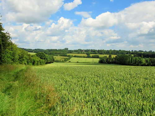
A mighty prospect into Cambridgeshire opened ahead as we walked the field path from Chrishall to Elmdon, a gradual landscape quilted in black and cream under the sun. This is wheat and horse country, the cornfields just flushing from pale green to pale gold. A pair of beautiful chestnut colts, skittish as schoolchildren, teased each other in a paddock under the red brick garden wall at Lofts Hall.
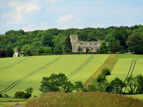
The hedges hung heavy with hard green fruit – plump bullace and sloes, vestigial cherries and hazelnuts. ‘Aaaaahh!’ said Bertie in his buggy, by way of approval. On the well-mown lawn of the Hamlet Church at Duddenhoe End we let him out to teeter across the grass. This thatch-roofed church is a modest wonder, a barn converted to a chapel by a mid-Victorian squire parson, Rev Robert Wilkes of Lofts Hall. Simple beams, an alabaster font, sturdy pews of oak and pine, the whole atmosphere very peaceful and still in the midday sunshine.
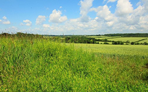
Bertie collected all the coins we had and clattered them into the offertory box. He ate our lunch for us, redistributed a couple of molehills, and gave the church wall mosses a thorough scrub before being removed by dad to enjoy a well-earned nap. Patsie, Jane and I went through the ripening wheat, and turned along the old Roman road now known as Beard’s Lane between hedges of frothy meadowsweet. The level sunlight had reduced all far-off things to a simple palette of colours – milky green corn, green-black woods, burnt orange pantile roofs, washed blue sky, tarnished silver clouds – the unemphatic beauty of an English summer’s day.
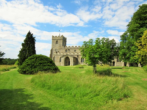
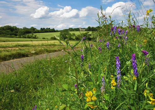
In a puddled dip we left the old lane and turned north again along field paths, past Chiswick Hall where the driveway lay lined with big blue heads of scabious, yellow and purple vetches and hard-packed globular seedheads of wild alium. Chrishall’s isolated Holy Trinity Church stood ahead on a ridge, knapped flints in its walls, chequerboard flushwork round its tower top. We sat a while in the cool of the church porch, looking forward to a cup of tea, yet reluctant to close the circle of this lovely walk through the Essex cornfields.
Start: Red Cow PH, Chrishall, Essex SG8 8RN (OS ref TL 446393)
Getting there: Buses from Cambridge, Saffron Walden, Bishops Stortford, Royston – see chrishallpc.org.uk
Road – Chrishall is signed off B1039 Wendens Ambo to Royston road (M11, Jct 9)
Walk (9½ miles, easy, OS Explorer 194):
Right to crossroads; down Loveday Close (‘Icknield Way’/IW, yellow arrow/YA). Pass Marchpayne House on right, turn right (IW, YA) down alley, and follow footpath east through fields for ½ mile into wood (454397). At multiple arrow post, right; at T-junction (455395), left to road (458397); right into Elmdon. Follow village street south (‘Wendens Ambo’); right through gate (462392, ‘footpath’/FP) along side of recreation field. On south (YAs) for ½ mile to B1039 (462379). Dogleg right/left; on in tunnel of trees (FP) to cross School Lane (463372 – NB Hamlet Church is 100m to right). On south for 600m to road at Duddenhoe End (463367).
Left and over crossroad (‘Bridleway’). In 100m, just beyond house on right, bear left (465367, blue arrow/BA) between paddocks. In 250m, ahead through hedge (467367), right along hedge for 300m to road (470364). Left to T-junction; right along lane. In 500m, at Cooper’s End (465360), ahead (‘Cosh Farm Only’). In ½ mile, at drive to Cosh Farm (461354), keep ahead (‘Byway’, red arrow/RA). In another 300m, pass footpath on left (459351, arrow). Keep ahead (RA); in another 50m, turn right along hedge (YA), following Harcamlow Way (unmarked on ground, marked on Explorer map). In 600m, at crossing of hedges (452350), bear right (YA) round hedge end, left through hedge gap, and right (YA) with hedge on right for 500m to road in Langley (448353).
Left for 100m; right past ‘The Gables’ along right side of village green. In top right corner of green, bear right along green lane (446353). In 20m fork left (YA) and on along field edges. In 500m, at three-arrow post, right (443356) along field edge, following YAs. In 500m, bear right through thicket (443362, YA – ignore ‘CLA Welcome’ arrow pointing ahead here). Head NNE for almost 1 mile to Chiswick Hall (450375). Dogleg left/right round house (YAs); follow path between paddock fence and hedge, then on down drive to B1039 (451382). Left for 20m; right across footbridge (FP), up field path to church gate (452386). Diagonally across churchyard; through kissing gate by tower; on to cross Bury Lane (450387). On (FP) between paddocks and on, following field edge path (YAs) to cross Chalky Lane (448389). On (FP) along field edge. In 400m, at top left/NW corner (446391), right through hedge (FP) along lane to road at Red Cow PH.
Lunch: Red Cow PH, Chrishall (01763-838792, theredcow.com). NB Closed Mondays
Accommodation: Crown House, Great Chesterford, Saffron Walden (01799-530515, crownhousehotel.com)
Info: Saffron Walden TIC (01799-524002)
Footbridge closed off on footpath leading from the B1032 towards Chrishall church. My wife and I very much enjoyed this walk last week and hope to do a part of it again tomorrow. The directions were spot on but the best bit was to discover many freshly fallen plums that tasted excellent. Thanks for another great walk and only ten miles from home.
Keith Bennett notes that he found the footbridge at OS ref TL 451382 closed, presumably for repairs – no date for re-opening given. This is the bridge by which one crosses a stream immediately after crossing the B1039 while approaching Chrishall’s church. You can detour by turning left along B1039 when you reach it; in 200m, right along Bury Lane; and in 350m, right (450386) on a footpath to the church.
Thanks very much for this update, Keith – and for the note on the delicious taste of the freshly fallen plums along the route!