First published in: The Times Click here to view a map for this walk in a new window


Facebook Link:

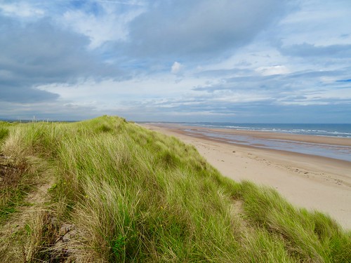
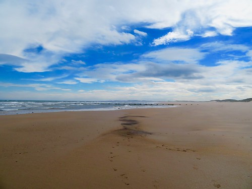
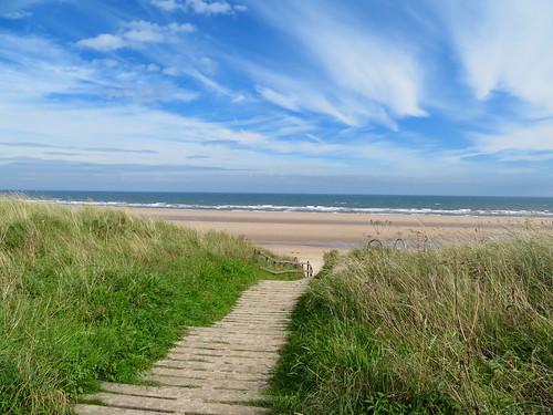
Walking through the pine trees towards the sandhills of Hadston Links, we could hear the sea pounding the sands of Druridge Bay. A big roaring wind was building in the south, and once we were through the dunes and heading down the beach we had a half gale in our faces and the whole enormous bay – give or take a handful of dog ball throwers – to ourselves.
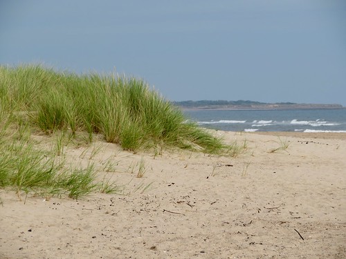
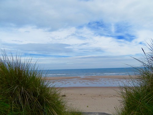
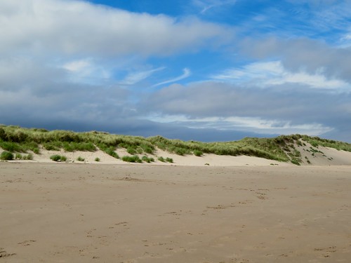
Druridge Bay is designated a Heritage Coast and a Site of Special Scientific Interest. This seven-mile curve of beach from Amble to Cresswell is totally unspoiled, a simple and grand arc of dull gold sand backed by flowery dunes, with crashing steel-grey waves coming in off the North Sea under huge overarching skies.
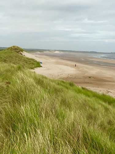
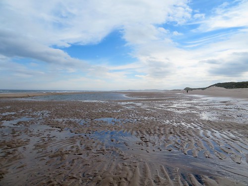
This is a beach for runners and kite-fliers, joggers and diggers, idlers and strollers. Black matchstick figures of men, women and dogs pushed hard into the wind. The sea rolled in, roaring softly on the sand and hissing up the beach in diminishing flounces of white foam. The air over the bay was laced with spray, lending a diffused pearly glow to the sky.
A flight of ringed plover went twinkling in black and white across the ribbed pools that had collected in the sands. On the landward side of each sandy ridge in every pool, a skin of gritty black had collected – tiny flecks of coal, sifted out of the low-lying hinterland behind the beach and filtered through the dunes by the trickling flow of tiny burns. The richness of the bird and flower life here, the windy solitude of the beach, make it easy to forget that this is coal-bearing country.
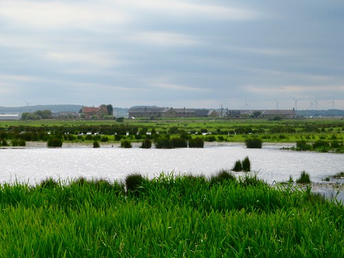
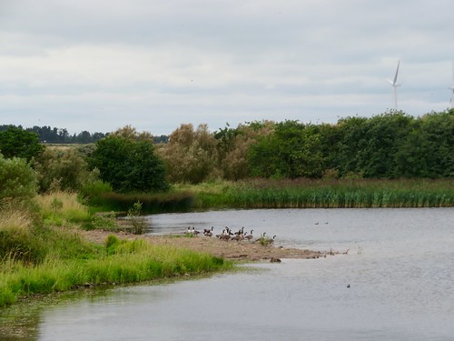
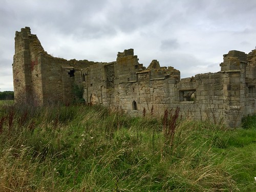
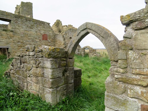
A couple of miles along the beach we cut inland through the dunes and past the wetlands and wildfowl lakes of Druridge Pools. Isolated in the fields beyond stands the lonely ruin of Low Chibburn Preceptory, a medieval chapel and hospital of the Knights of St John built on the ancient pilgrim route to Holy Island. The Hospitallers’ refuge has done duty in its time as a grand dower house, a cattle shed and a Second World War pillbox.
Before setting back for the beach and the return walk, we wandered slowly round the ruin, admiring its finely carved piscina, its arched windows and handsome stonework, survivors of changing fortunes over the course of seven hundred years in this remote corner of the Northumbrian coast.
Start: Druridge Bay Visitor Centre, near Amble, Northumberland NE61 5BX (OS ref NZ 272998)
Getting there: Visitor Centre signed off A1068, 2 miles south of Amble
Walk (6½ miles, easy, OS Explorer 325. Online maps, more walks at christophersomerville.co.uk): From car park, follow ‘Beach’. Path through trees, then dunes; down steps onto beach (273996). Turn right/south for 1½ miles. Where the dunes dip to a pool and Dunbar Burn, pass a pipe (broken in two) across the beach (277972). Continue along beach for 500m, then turn inland between tank blocks through gap in dunes (277965), past concrete blockhouse. Through fence gap (North Sea Trail ‘N’ waymark); right along road; in 200m, left between boulders (275966) on path (yellow arrow/YA) past Druridge Pools and on across 2 fields (YAs) to Low Chibburn Preceptory ruin (266965). Return same way. Nearing Visitor Centre, look for wooden steps up through dunes.
Lunch: Snacks at Visitor Centre café (open daily summer, weekends winter)
Accommodation: The Bridges B&B, 3 Togston Crescent, North Broomhill, near Amble NE65 9TP (01670-761989).
Druridge Info: northumberland.gov.uk, 01670-760968
visitengland.com; satmap.com; ramblers.org.uk
Britain’s Best Walks: 200 Classic Walks from The Times by Christopher Somerville (HarperCollins, £30). To receive 30 per cent off plus free p&p visit harpercollins.co.uk and enter code TIMES30, or call 0844 5768122