First published in: The Times Click here to view a map for this walk in a new window


Facebook Link:

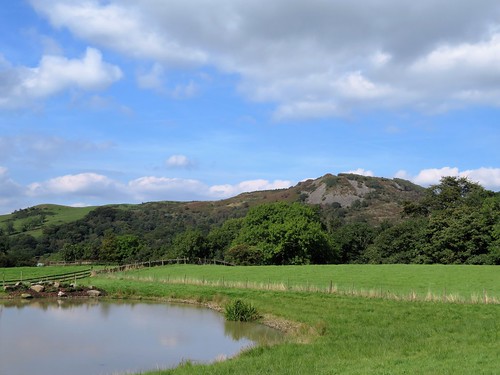
The Crag Inn at Wildboarclough lies tucked down in a quiet valley of easternmost Cheshire. The wild gritstone hills and moors of the Peak District rise all around. The farm buildings of the district are dark and solid, but the field walls sparkle with chips of mica on sunny afternoons such as this. Old stories say that the last wild boar in these hills was hunted down to death in this steep little valley. That might not be strictly true – but when were local legends ever the better for being plain, provable fact?
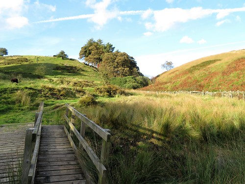
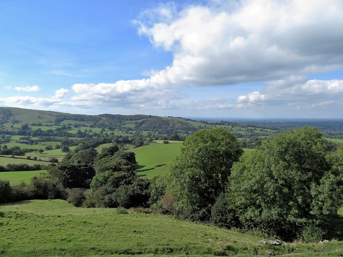
I followed a field path west along the flanks of the Clough Brook, then up the cleft below Oakenclough. Stopping to listen, I could not hear a single sound but the trickle of the brook. Over the damp shoulder of High Moor and down to the Hanging Gate Inn on its escarpment edge, with a most tremendous view out west over tumbled farmlands to the Cheshire plain stretching into misty distance.
The bare stone bluff of Tegg’s Nose lifted its dark grey hump ahead as I walked north along the waymarked Gritstone Trail that knits together a fine string of these coarse sandstone hills. Hawthorns were thick with scarlet berries, or ‘peggles’ as the great naturalist Richard Jefferies used to call them. I tested them with a squeeze of the fingers: still hard as rock, so that I wondered how the fieldfares and redwings of winter were going to gobble them down.
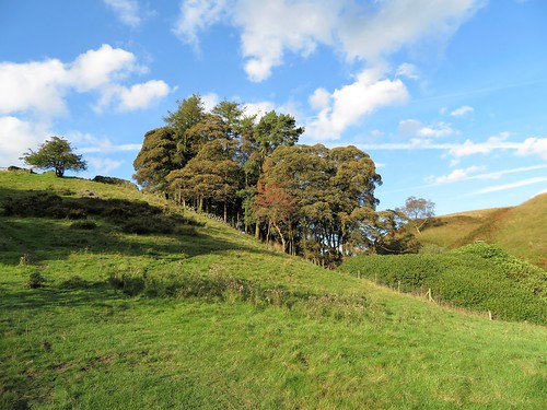
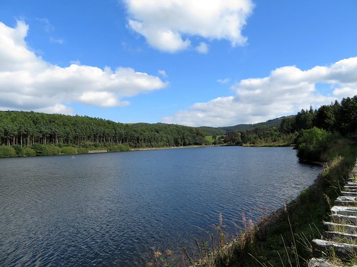
Ridgegate and Trentabank reservoirs gleamed dully between their pines and silver birch trees. A tremendously cheery party of U3A walkers met me on the way up to the moors, their cheerful chatter and rosy cheeks the perfect advertisement for the benefits of walking in one’s riper years.
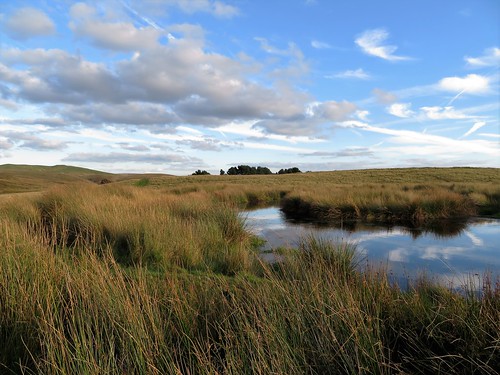
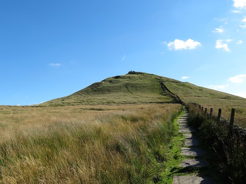
I forged ahead across the sedgy uplands on a pitched path that led to a scramble up to the gritstone peak of Shutlingsloe, the ‘Matterhorn of Cheshire’. At the summit of this mini-mountain I was lord of a hundred-mile view from the Pennines to the Trent, the Long Mynd to the Clwydian Hills of Wales. A few minutes to stand and stare, and I was scrambling down for the homeward path to Wildboarclough.
Start: Craig Inn, Wildboarclough, Macclesfield, Cheshire SK11 0BD (OS ref SJ 981685)
Getting there: Wildboarclough is signed from A54 Congleton-Buxton road at Allgreave.
Walk (7½ miles, moderate, OS Explorer OL24):
From Crag Inn car park, right along road. Immediately right through wicket gate (yellow arrow/YA). Bear left, parallel with road, and follow grassy path across 7 fields (gates, YAs, coloured circles). 2 fields beyond High Nabbs farm, path rises to angle of wall (970681). Right across stile (circles, YA); left along lane. In 600m, right at road (964685). In 300m at Greenway Bridge, right (963687, YA) along river. In 300m, cross Highmoor Brook by footbridge (963690). Follow YAs, then permissive path below Oakenclough house. Cross drive (961695); left through gate (YA), up by wall. Through gate at top; ahead on grassy track to corner of wall (959696). Ahead with wall on right; at end, right through gap; left over stile, down fenced track to cross road at Hanging Gate Inn (952696).
Down side of pub; right through kissing gate on path down to road (951698). Left for 150m; right over stile and follow Gritstone Trail/GT markers north for ¾ mile. Approaching Greenbarn, fork left (952710); in 100m, right through gate (GT). Skirt to left of house; through gate onto drive. Left; in 50m, GT on telephone pole points left, but fork right down through wicket gate. Left (YA) to cross footbridge; on up steps to path junction at Ridgegate Reservoir (952713).
Right (‘Shutlingsloe’); follow path along south edge of reservoir, then through woods to road (959711). Turn right on ‘Walkers Only’ path on right of road. In 200m pass Macclesfield Forest info board; in another 150m, bear right (963711, ‘Shutlingsloe’). In 100m fork right uphill. Follow ‘Shutlingsloe’ for 1½ miles through trees, then across moor to Shutlingsloe summit (977696 – short steep climb to top). Follow path to south end of summit; short steep scramble down and bear left; path across moor down to farm road (983691). Right to Crag Inn.
Conditions: Some boggy bits; steep ascent/descent of Shutlingsloe peak.
Lunch: Crag Inn, Wildboarclough (01260-227239, thecraginn.co.uk) or Hanging Gate Inn, Potlords (01260-400756, thehanginggate.co.uk) – both closed Mon/Tues
Accommodation: Stanley Arms, Bottom of the Oven, Macclesfield Forest SK11 0AR (01260-252414, stanleyarms.com) – warm, cheerful place; good food and welcome
Info: Macclesfield TIC (01625-378123); visitengland.com; satmap.com; ramblers.org.uk