First published in: The Times Click here to view a map for this walk in a new window


Facebook Link:

The Surrey Weald, a great thickly wooded lens of land, lies on a band of ironstone in the shadow of the North Downs. Once it was a smoky, noisy, clangorous industrial hub, part of the medieval iron-making centre of England. You’d never know it now, though, so snug and quiet lie the villages tucked into valley bottoms along the tortuously winding lanes that thread the woods.
Coldharbour is no more than a scatter of cottages loosely based on the Plough Inn. We started off north along Wolvens Lane, a sun-dappled holloway under sweet chestnuts and knobbly pollarded beeches whose roots hung at the rim of the lane, half in earth, and half in air. Flickers of grey and tan betrayed the movement of horse riders down parallel tracks, moving quietly and all but unseen through the woods.
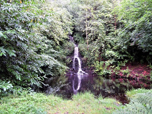
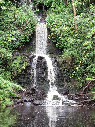
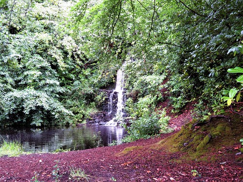
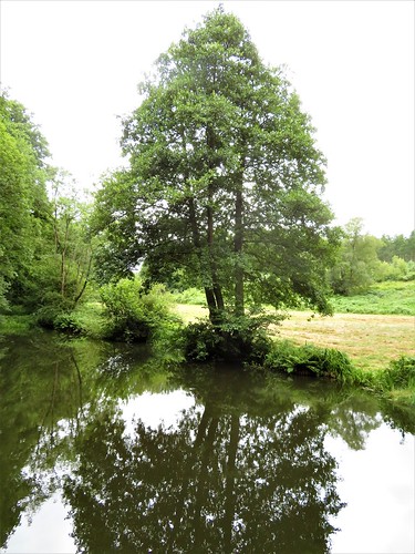
A path dark with hollies and yews led west, down to the fast water race of the Tilling Bourne in its valley-bottom bed, and to the beautiful mill pond at Friday Street. In the quiet beech woods along Abinger Bottom the tree roots grasped the earth like many-knuckled grey fingers.
A quick sandwich in the Stephan Langton Inn, named after the former Archbishop of Canterbury – a local boy, he led the push to force King John to sign Magna Carta in 1215. Then on through quiet beech woods along Abinger Bottom where the tree roots grasped the earth like many-knuckled grey fingers.
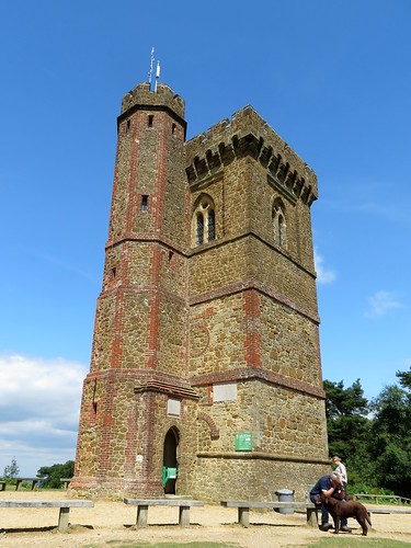
On the slopes of Leith Hill, the highest point in Surrey, we broke clear of the trees and stood between pine trees looking out from the greensand ridge, many miles across the wooded Vale of Surrey and north Sussex, a smoky grey and blue prospect over the Wealden landscape. Up on the viewing platform at the top of nearby Leith Tower the panorama sprang outwards, further and further, south to the South Downs around Goodwood and the trees on Chanctonbury Ring 25 miles off, north to a pale grey smear that might have been the Dunstable Downs a full fifty miles away, and the dream-like spectral towers of the London skyline.
In 1765 Richard Hull of Leith Hill Place built the brick-and-ironstone tower sixty feet tall in order to claim a thousand-foot summit for Surrey. He lies buried here, not arrogantly at the apex of his creation, but humbly beneath its foundations, with the world climbing upon his back to enjoy the sensational view he opened for us all.
Start: Plough Inn, Coldharbour, near Dorking, Surrey RH5 6HD (OS ref TQ 151441)
Getting there: Bus service via Dorking railway station – 433 (Mon, Thur); 50 (Tue, Fri).
Road – Plough Inn is on Coldharbour Lane, 3½ miles south of A25 at Dorking.
Walk (6½ miles, easy, OS Explorer 146. NB: Detailed directions, online maps, more walks at christophersomerville.co.uk): From Plough Inn, cross road; take lane to right of bench (‘Byway’). In ¾ mile pass Wolven Cottage Stables on right (145452); in 100m, left past metal barrier; path inside edge of wood. In 250m, fork left at wooden barrier (142451) and on for 500m, descending to gravel bridleway at Tilling Springs (139449). Right; in 100m, right along Greensand Way/GW. In ½ mile at Mare’s Nest, right along road (135457); fork immediately right and continue on GW. In ½ miles pass entrance to Mandrake House (nameplate); in another 100m, left (135465, stile, yellow arrow/YA) across field, then Tilling Bourne stream.
Up slope, across road (131462) and on past Wotton Estate notice. In 150m, over path crossing (130462, fingerpost/FP) and on. In 400m, steep descent to kissing gate and path crossing with bridge ahead (126462). Don’t cross bridge; turn left with stream on right for 450m to cross road by pond at Friday Street (128458). Ahead to pass Stephan Langton Inn.
At end of road, ahead through barrier and on south (‘public bridleway’). In 700m, left along road (127449). In 100m, fork right and on. In ½ mile (127440) fork right. Cross road above house; follow woodland track to road. Left to bend; left (128438, ‘Broadmoor’); immediately right (‘Bridleway’) on woodland track for ¾ mile to Leith Hill Tower (139432). Follow ‘Coldharbour Common Walk’/CCW signs north-east, descending to go through gate (141433, CCW). In 200m go over crossing path and on (142434, blue arrow/BA). In 300m, at meeting of paths, bear right ahead (144437, BA); in 200m, through gate (146438); on past cricket field for ½ mile to Plough Inn.
Lunch: Plough Inn, Coldharbour (01306-711793; ploughinn.com) or Stephan Langton Inn, Friday Street (01306-730775; stephanlangton.pub). Tea: Leith Hill Tower kiosk (10am-3pm)
Accommodation: Plough Inn, Coldharbour; or Henman Bunkhouse, Broadmoor RH5 6JZ (01306-712711, https://www.nationaltrust.org.uk/holidays/bunkhouse-henman-surrey)
Leith Hill Tower: open daily, 10-3
Stephan Langton pub is currently for sale and closed for the forseeable future.