First published in: The Times Click here to view a map for this walk in a new window


Facebook Link:

A perfect Somerset winter’s day of sharp blue sky. Sunlight gilded the roofs of Rowberrow, nowadays a quiet little village, but in times past a rough mining centre where men dug calamine for the brass-making industry. Martha More, visiting in 1790, judged the locals ‘savage and depraved, brutal and ferocious.’
;)
The long shape of Blackdown, highest point of Mendip, looms on the southern skyline. Today its slopes were trickling with water. With a hollow gushing a stream tumbled into the chilly depths of Read’s Cavern, one of dozens of water-burrowed caves in Mendip’s limestone massif. When Read’s was excavated in the 1920s, a set of Iron Age slave manacles was unearthed, their story untold but ripe for imagining.
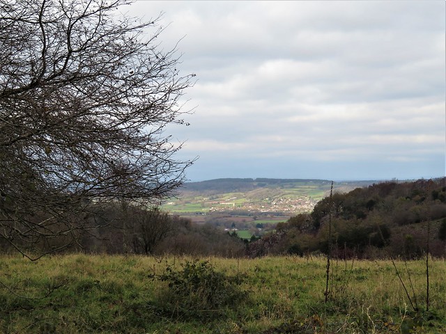
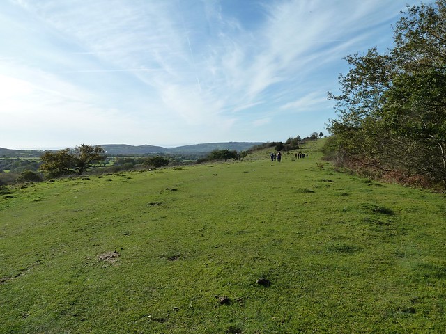
A broad track rises up the flank of Blackdown. We climbed through fox-brown bracken where cattle grazed and thirty-five semi-wild ponies snorted and cantered away in a bunch. From the ridge the view was enormous, from the Quantock Hills and Exmoor down in the southwest to the steely grey Bristol Channel with its twin islands, pudding-shaped Steep Holm and sleeping-dog Flat Holm.
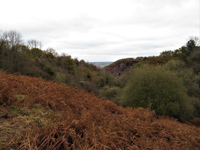
Along the foot of Blackdown the muddy Limestone Link footpath took us sliding and squelching past Burrington Combe. Wild goats were grazing the grey striped cliffs of the gorge, their white coats contrasting with the scarlet berries of cotoneaster.
On the slopes opposite the combe the Reverend Dr Thomas Sedgwick Whalley, rich through a ‘good marriage’ in mid-Georgian times, developed a humble cottage into the Italianate extravaganza of Mendip Lodge, a massive country house with a state bedroom, mile-long terraces and a verandah nearly a hundred feet wide.
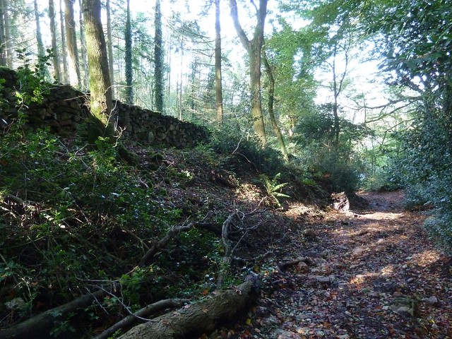
Mendip Lodge, like the good doctor’s wealth, eventually fell into decline. All we found of the grand design was a huddle of ruins behind an archway in Mendip Lodge Woods, beside the winding path that was once a fine carriage drive.
High above on the limestone upland of Dolebury Warren the sloping ramparts of a massive Iron Age hill fort encircle the western end of the ridge. Here we sat to catch our breath and gaze across the channel to the far-off hills of Wales.
Start: Swan Inn, Rowberrow, Winscombe, Somerset BS25 1QL (OS ref ST451583)
Parking: please ask, and give pub your custom.
Getting there: Rowberrow is signed off A38 between Churchill and Winscombe
Walk (8 miles, easy, OS Explorer 141): Left down School Lane. Just after right bend, left down track (453583); in 300m at T-junction, right (454586). In ¾ mile, right (465586, ‘Bridleway, Ride’, waymark post); in 100m, left on path through bracken. In 250m detour left to Read’s Cavern (468584). Resume bracken path, uphill to ‘Rowberrow Warren’ sign (469581); left through gate; right uphill. In 200m fork left (469579), upwards for ¾ mile to track on Blackdown ridge (477573); left to Beacon Batch trig pillar (485573). Left downhill to foot of slope; left (490577, waymark post, Limestone Link /LL) for 1¼ miles. On open ground 350m after crossing West Twin Brook, at crossing of broad grassy tracks, right downhill (473583). In 700m, near Link hamlet, left (475590, fingerpost) on path through Mendip Lodge Wood. In ⅔ mile pass Mendip Lodge ruin (466591); in 150m, left up bridleway. Pass gate/’Dolebury Warren’ sign on right; in 100m right (gate, blue arrow, ‘National Trust’) across Dolebury Warren (LL) for 1¼ miles, down to T-junction by Walnut House (446591). Left (LL) for ¾ mile; right (454586) to Rowberrow.
Conditions: Can be very muddy.
Lunch: Swan Inn, Rowberrow (01934-852371, butcombe.com)
Accommodation: Woodborough Inn, Winscombe BS25 HD (01934-844167, woodborough-inn.co.uk)