First published in: The Times Click here to view a map for this walk in a new window

Facebook Link:

Harlech Castle is a lowering presence, there’s no getting away from it. The great turreted stronghold, one of the seven ‘Ring of Iron’ fortresses sited around north Wales in the 1280s by King Edward I, was planted on its rock above the Dwyryd Estuary to dominate and subdue the rebellious locals.
Dark and ominous-looking, the castle frowned down on us as we left Harlech railway station. Soon enough the Wales Coast Path signs pointed us away across the pasture of Morfa Harlech where shiny brown cattle munched, muzzle to grass.
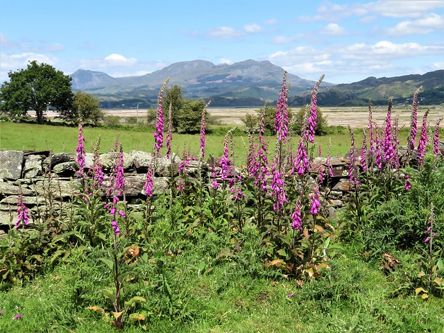
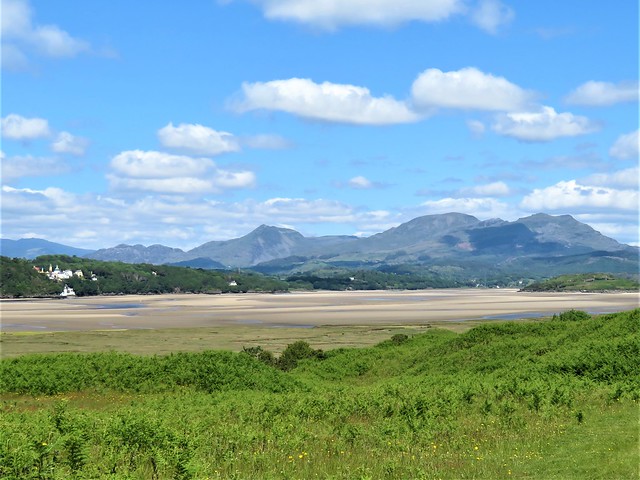
The seaward view was obscured by a line of woodland, but once past the tattered farm of Glan-y-mor the path rose to a most sensational view. Ahead stood the rugged outliers of southern Snowdonia, all scoops and hollows and sharp ridges. Off in the west the mountains declined to the tumbled hills of the Lleyn peninsula lying out on the sea horizon. Sunlight chased dark blue shadows across this dramatic landscape.
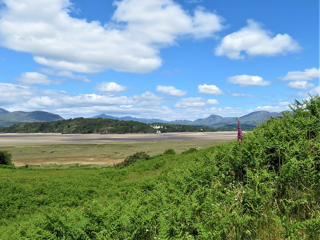
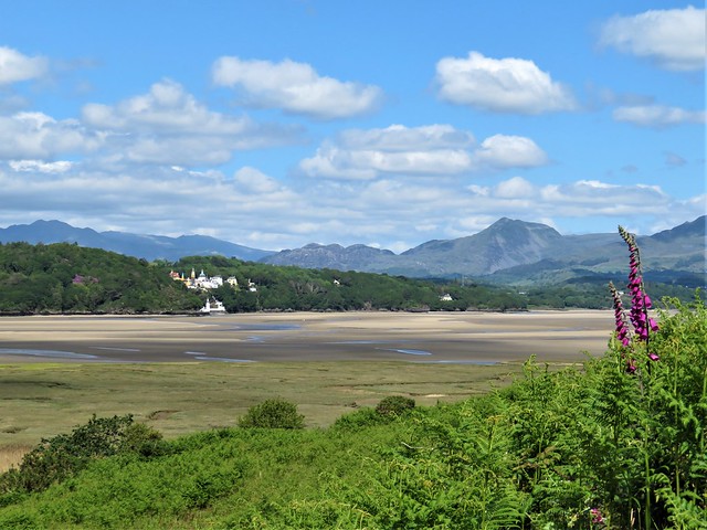
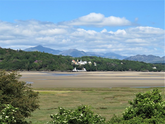
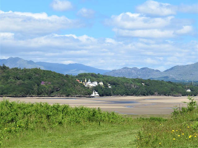
The prospect across the Dwyryd estuary was even better. It was the turn of low tide, the river no more than a glinting coil through wide sandbanks. Just opposite rose the fantasy village of Portmeirion, architect Clough Williams Ellis’s dream collection of towers, turrets, cupolas and campaniles, their pinks and blues thrown into prominence by the backdrop of dark woods.
Far beyond, perfectly placed by celestial hands, the tall grey cone of Snowdon’s peak lifted into a blue sky scudding with clouds. A sensational view to all quarters.
We sat and shared an orange and stared our fill, then went on around the lumpy hill of Ynys Llanfihangel-y-Traethau, the ‘Isle of St Michael on the Shore.’ Round on the far side we found the neat little church of St Michael, Victorian in appearance, but actually built more than a century before Harlech Castle, when this hill was a tidal island and horsemen rode across the sands to worship here.
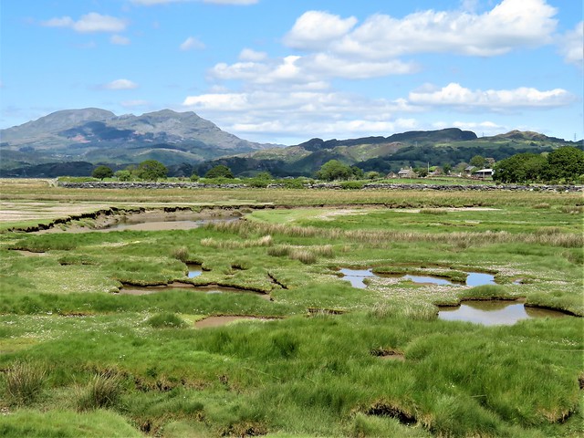
The Wales Coast Path led on towards Llandecwyn Station, dipping down to run north beside the slowly filling marsh creeks through drifts of pale pink thrift. A farmer sheared his ewes under the sea wall, and a sandpiper alighted on the black slate rocks for a moment before dipping its white breast and skimming off on scimitar wings.
Start: Harlech Station, LL46 2UL (OS ref SH 581314)
Getting there: Rail to Harlech. Bus 38, 39 (Dolgellau-Porthmadog)
Road – Harlech station is on A496, just below Harlech Castle. Car park behind station (‘No Through Road’).
Walk (6¾ miles, easy, OS Explorer OL18): From station, right along A496. In 600m, left (582320, ‘Wales Coast Path’/WCP fingerpost) on path to gate. Left along side of housing estate; follow WCP signs. In ½ mile, half left (WCP, 580327); through 3 gates to edge of wood (578332), Right, following WCP. In ¾ mile, approaching Glan-y-mor Farm, half-left across fields to gate by farmhouse (580345). Right along WCP. In 1½ miles at Llanfihangel y Traethau church (595354), anticlockwise round churchyard wall to gate, then right along wall to gate with WCP. Follow WCP to cross road (599355); in 300m, left across watercourse (603353); follow WCP on seawall path for 1¾ miles to cross railway (617373). Left round base of Bryn Glâs hill; in 300m, right through gate (618376, WCP), past cottages, down drive to road (620376); left to Llandecwyn station. Return by train to Harlech.
Lunch: Old Cheese Market, Harlech (07483-316228)
(open)
Accommodation: Crown Lodge, Ffordd Isaf, Harlech, Gwynedd LL46 2PR (01745-817289, thecrownlodge.uk) – characterful stopover with tremendous views.
Info: visitwales.com; walescoastpath.gov.uk
Harlech Castle: cadw.gov.wales; harlech.com; satmap.com; ramblers.org.uk