First published in: The Times Click here to view a map for this walk in a new window


Facebook Link:

Horses in thick winter coats were cropping the paddocks at Berrow Green on a still, cold Sunday morning. Low sunlight crept across the fields, dispersing the last of the early mist, causing the horses’ breath to steam and the post-and-rail fences to cast long skeletal shadows of themselves on the frosty grass.
;)
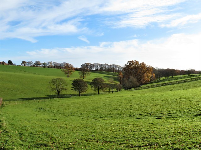
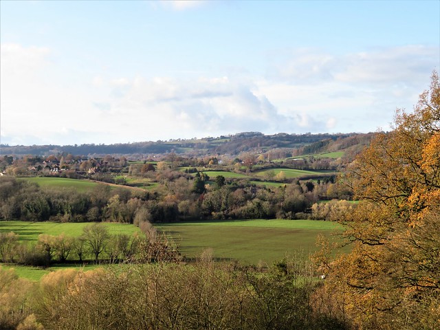
This country to the west of Worcester is all ups and downs, steep little slopes rising to wooded ridges and falling away into stream clefts where the winter sun doesn’t linger. Walking south from Berrow Green we had the Malvern Hills head-on in front of us, the north end of the range forming an unfamiliar hunchback lump in contrast to the usual prospect of a miniature line of mountains, elegantly extended and rising from the Midland plain.
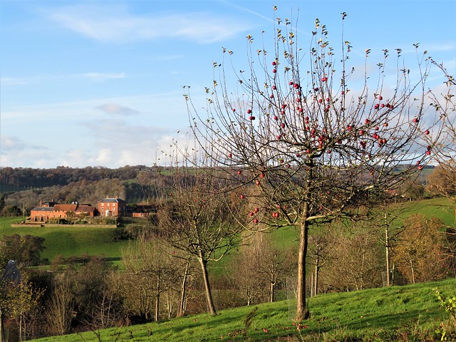
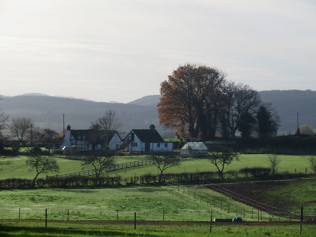
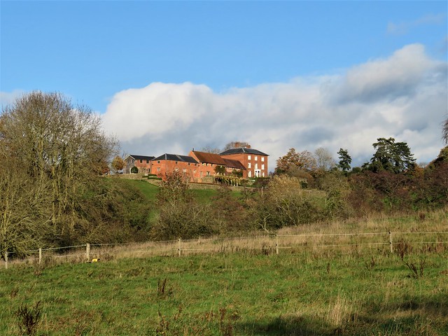
The woods on Berrow Hill were smoky grey, patched with apricot where the last of the leaves had not yet blown away. On a rise of ground Easinghope Farm stood in solid red brick next to its weatherboarded barn. Seventy black-faced ewes in the farm paddock scuttled away, to stop all together and stare as we went by.
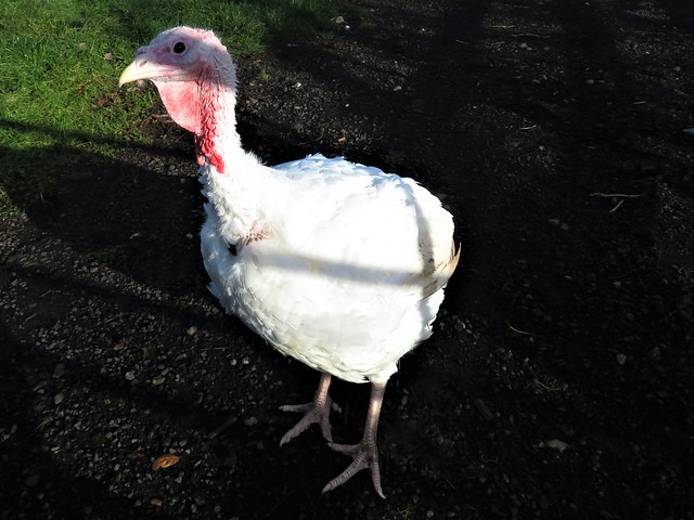
Moss and grass grew in the centre strip of narrow Easinghope Lane. A horse and rider went clopping slowly by. Five fat white turkeys came gobbling and squawking to the gate at Hawksnest Farm, their little pink eyes all agog. We pulled up to admire the eastward panorama over the Worcestershire lowlands, then descended into the steep valley of Bannersbrook.
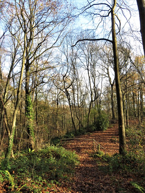
Treecreepers squeaked their needly calls as they searched for insects hidden in crevices of the oaks and sweet chestnut trees. A trickle in a ferny hollow marked the outpouring of the intriguingly named Nipple Well, perhaps a remedy for mastitis in days gone by.
A sharp climb on slippery oak leaves, and we were up on the ridge of Ankerdine Common with a wonderful view west over the sunlit curves of the Terne Valley. Then down again through the trees to scatter the young ewes in the river pastures around Horsham Farm.
Above the homeward path a pair of redwings perched on the topmost twigs of a young oak, displaying the handsome arch of their pale eyebrows, as the short day’s sun slipped down towards the western woods.
How hard is it? 5¼ miles, moderate; field and woodland paths
Start: Admiral Rodney Inn, Berrow Green, Martley WR6 6PL (OS ref SO 748583)
Getting there: Berrow Green is on B4197 (signed ‘Martley’ from A44 Worcester-Bromyard)
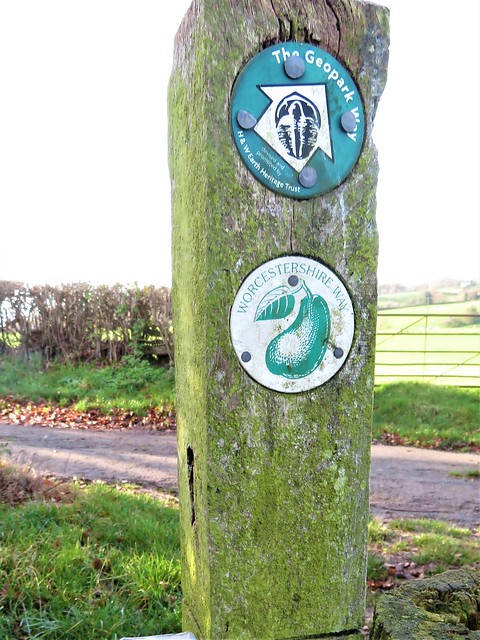
Walk (OS Explorer 204): From pub, right along road. In 150m, left (Worcestershire Way/WW). Follow WW (well waymarked) for 1¾ miles to Ankerdine Common car park (737567) and on down to road (735564). Right uphill. In 200m, left (735566, ‘Sunningdale, Private Road’). In 50m fork left downhill through woods (yellow arrows/YA, green tree markers) to drive (733572). Right to Horsham Farm. Through gate at Lower Horsham Farm (734577); bear right (YA); through gateway (circular ‘public footpath’ waymark). Just past pond, right (gate, YA). In 150m, dogleg right/left (736578, stile, YA); in 15m, right (YA) up hill. In 100m, dogleg right/left (stile, YA). In 150m, through gate in lower field corner (738578). Ahead (fence on left); left at corner of Tinker’s Coppice (740578, YA). Uphill; at top of slope, right (742578, rails, YA) through copse to road (743578). Left; in 100m, right (fingerpost) down fence to stile onto road (745578). Left; right at corner; in 100m, left (fingerpost) across paddock; left (748578) on WW to Berrow Green.
Lunch/Accommodation: Admiral Rodney, Berrow Green (01905-886181, admiral-rodney.co.uk)
Info: Worcester TIC (01905-726311); satmap.com; ramblers.org.uk