First published in: The Times Click here to view a map for this walk in a new window


Facebook Link:

Seen from the escarpment edge of the Mendip Hills, the aspect of the Somerset Levels after weeks of flooding had turned from streaky silver back to green and brown. On a lovely afternoon of early spring, a bit cloudy, a bit sunny, we set out from the Avalon Marshes Centre to explore Shapwick Heath National Nature Reserve, one of several bird-haunted NNRs in these watery West Country moors.
;)
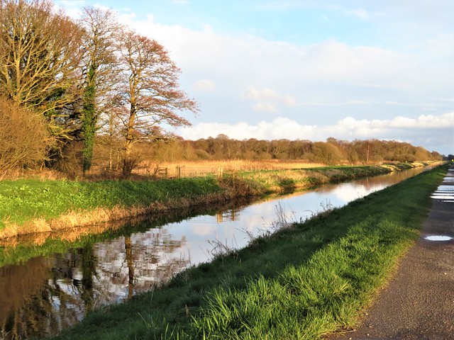
The main spine of the Shapwick Heath Reserve is the old branch railway line across the moors to Burnham-on-Sea. From this ruler-straight track, side paths and boardwalks lead to observation hides (temporarily closed).
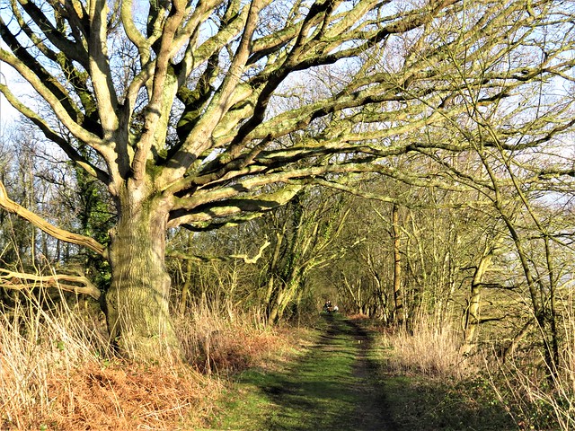
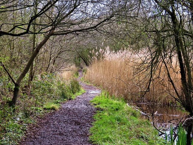
The path we followed led through lush carr woodland of birch, alder and pussy willow stubbled with silky catkins. Sunlight glinted in the wet glades and on the birch trunks. Pollarded willows bristly with stems stood above their own reflections in black mirrors of shallow, peat-stained water. Bracket fungi multiplied their creamy frills, thriving on sodden birch trunks fallen into the water. A lush, marshy, ferny place of luminous green mosses, the surfaced paths springy underfoot, everything permeated by water.
Our ancestors built cunning wooden trackways to get them safely over this treacherous ground. We came across two replicas of these early thoroughfares deep in the carr woods. The Meare Heath trackway of the late Bronze Age had planks laid lengthways in pairs, held in place with wooden pegs. Further into the marsh lay a wobbly section of single planks about eight inches wide, laid end to end, held with pegs and cross ribs – a replica of the Sweet Track that was built over these marshes 6,000 years ago.
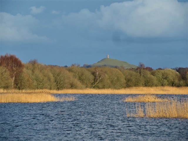
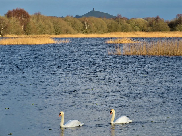
We teetered along the bouncy planks with arms outstretched for balance, conscious of the black water just one clumsy step away, before reaching firmer footing and the path to Decoy Hide. Here we paused, looking out over lake and reedbeds to a sunlit Glastonbury Tor and tower in the distance.
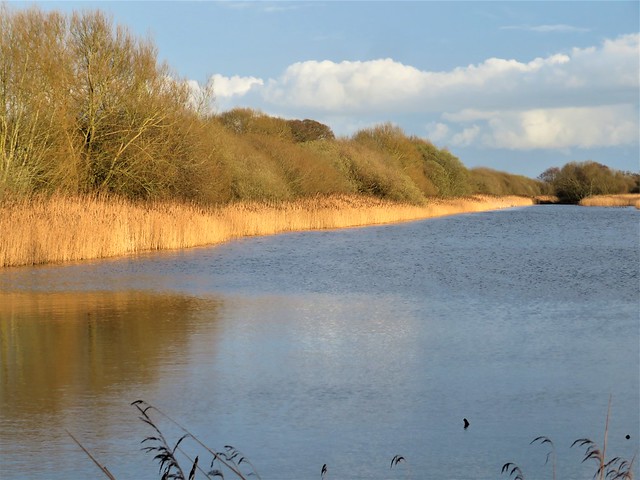
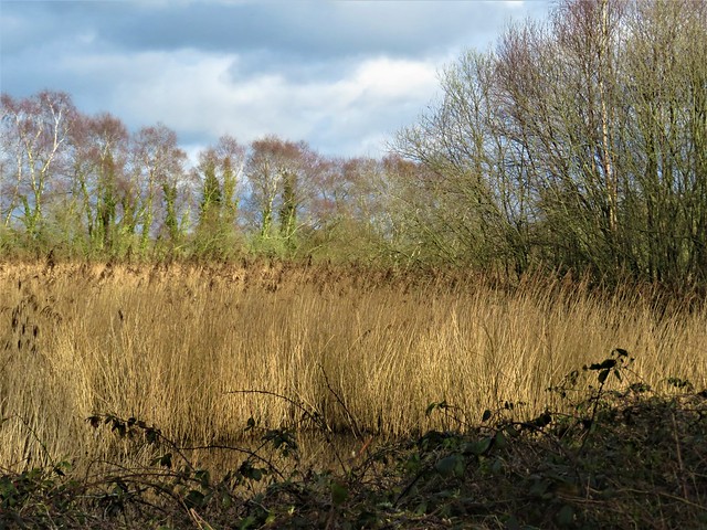
Back on the railway path we followed the old track east past huge reedbeds and lagoons, former peat diggings now flooded and packed with wintering ducks – shovelers with spatulate beaks and iridescent green heads, tufted duck with white side patches and golden eyes, and pochard with pink beaks and scarlet eyes.
As we turned for home, a Cetti’s warbler suddenly emitted a burst of chatter from the scrub, loud enough to make us jump. A marsh harrier went flapping slowly along the edge of a mere, its legs bright yellow, its wings patchworked in buff, white and orange, with long black feather ‘fingers’ at the tips. And a foghorn voice came booming from a reedbed – a bittern, asserting mating season sovereignty over its watery kingdom.
How hard is it? 6½ miles; easy, level walking; some parts can be boggy
Start: Avalon Marshes Centre, Shapwick Road, Westhay, Glastonbury BA6 9TT (OS ref ST 426416)
Getting there: Shapwick Heath NNR is signed from Westhay (B3151, Glastonbury-Wedmore)
Walk (OS Explorer 141; leaflet maps/trail guides available at Avalon Marshes Centre or online at avalonmarshes.org; NB hides are temporarily closed): Left along Shapwick Road; just after bridge, left (423411) along old railway track (‘Bittern Trail’). In 200m right, following ‘Sweet Track’, then ‘Decoy Hide’ for ¾ mile to Decoy Hide (closed at present, but still a great birdwatching spot). Return, following ‘Reserve Entrance’ to old railway (427409). Right for 1¾ miles to Ham Wall Reserve car park (450396); return along old railway to Avalon Marshes Centre.
Info: Avalon Marshes Centre (01458-860120, avalonmarshes.org). Marshes Hub Tea Stop café open for takeaway 10-4.
satmap.com; ramblers.org.uk
More walks info: @somerville_c