First published in: The Times Click here to view a map for this walk in a new window


Facebook Link:

For years we’d been saying to ourselves: ‘Must walk the Dragon’s Back!’ Now the day had come, a cold and misty one down at Pengenffordd. But we could feel a warmer morning waiting in ambush behind the clouds that wreathed the western outliers of the Black Mountains.
;)
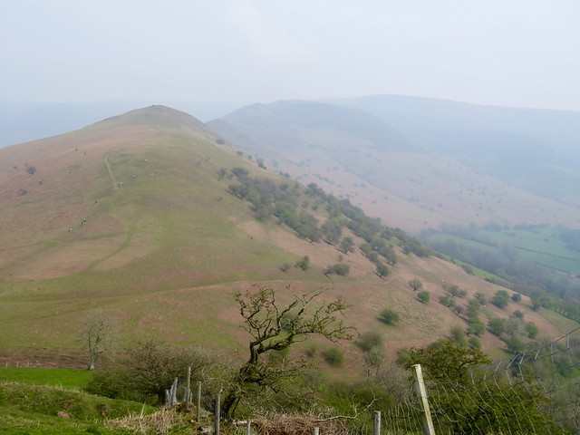
The knobbled ridge of the Dragon’s Back rises quite abruptly from the banks of the Rhiangoll stream. We climbed steeply through sheep pastures where fat lambs ran crying to their anxiously bleating mothers. Celandines spattered the grass, ten thousand miniature suns glittering in the steamy light.
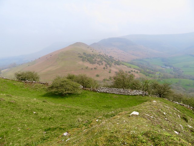
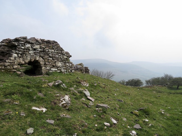
Up on the roughly mounded ramparts of Castell Dinas, it was easy to see why Norman invaders chose this ancient hill fort for their stone stronghold. The castle commands the valley, the road from south to north, and the looming heights of Mynydd Troed beyond.
The dominant aspect of its position proved deceptive however; Castell Dinas was besieged, captured, yielded and recaptured over the course of three hundred years of border strife, till Owain Glyndŵr destroyed it and vanished into the mists of mythology.
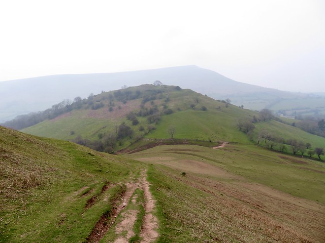
We passed the dimpled hollow of the castle well, and went down to a saddle of ground below. Families out for a hike were climbing the steep spine of the Dragon’s Back, their children gambolling ahead like spring lambs. It was a good old puff up to the stone shelter at the summit, and once up there the prospect into the wildest quarter of the Black Mountains took our breath away all over again.
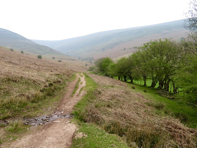
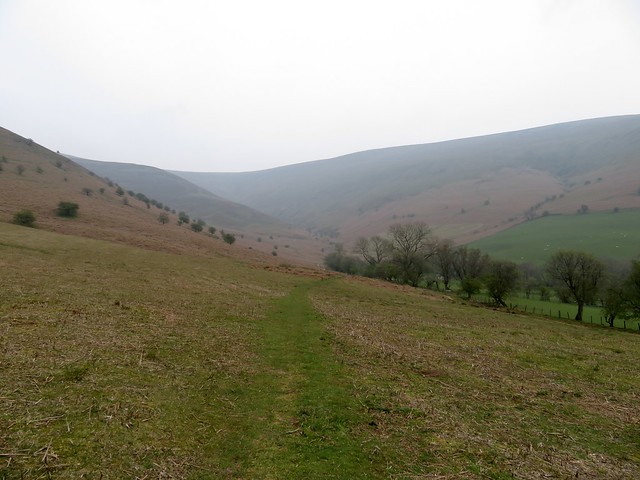
From the pass beyond, a green track sloped away into a silent valley hemmed in by mountain slopes, a secret little corner of these hills. Iridescent oil beetles were excavating egg-laying nests in the loose pink soil of the path. Cuckoo flowers had opened among the boggy sedges where the first leaves of spearmint yielded their distinctive chewing gum scent to our pinching fingers.
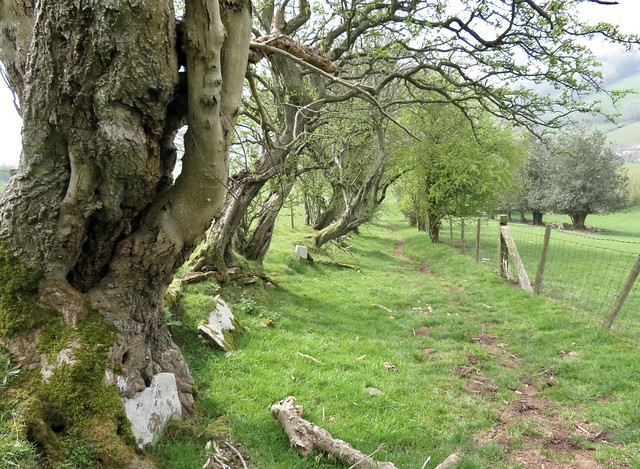
Down at Rhyd-y-car the householder was digging over her raised beds. ‘Beans and onions, a row of potatoes and some nice beetroot,’ she told us. ‘I’ve lived here more than sixty years now,’ and she smiled as though every spring had been a particular gem.
Start: Car park near Dragon’s Back Inn, Pengenffordd, nr Talgarth LD3 0EP (OS ref SO 174297) – £2 honesty box.
Getting there: Dragon’s Back Inn is on A479, Crickhowell-Talgarth.
Walk (4½ miles, strenuous, OS Explorer OL13): Go down steps beside the map board; turn right along path; in 40m, left up steps (yellow arrow/YA). Down the slope to cross the brook; steeply up 3 fields to Castell Dinas fort (179300). Down the north side to gate (180303); ahead up a clear hill path to the summit shelter (185306). On down to Bwlch Bach a’r Grib saddle (187308). Bear half right down a grassy track past trees; on for ⅔ mile to reach a sheep dip (196304). Where the wall turns sharp right, go right across the stream. Follow path to a gate; left up the wall to turn the corner (196302); follow the wall to the right. In 300m, right through a gate (193301); follow green lane to Rhyd-y-car (187300). Ahead along the road; in 500m, right on track (187295, gate). In 50m, bear left, keeping the hedge on your left (yellow arrows) for 500m to the road at Cwmfforest (182291). Turn right up the road; in 250m at left bend (180291), keep ahead on a dirt road for ½ to car park.
Info: Crickhowell TIC (01873-811970)
satmap.com; ramblers.org.uk
More walks info: @somerville_c