First published in: The Times Click here to view a map for this walk in a new window


A cool day of smoky cloud over southern Northumberland. The houses and church at Slaley glowed in green-grey stone as we left the windy ridgetop village and headed west past a string of farms – Palm Strothers, East and Middle Dukesfield.
;)
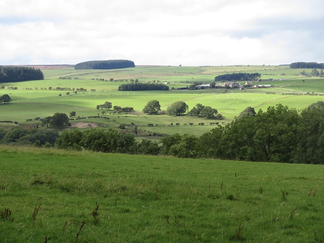
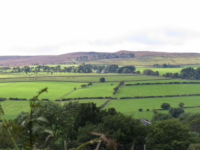
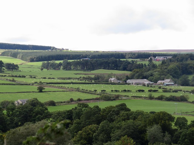
This is all upland grazing country with long views to purple heather moors, sheep and cattle amicably sharing the same fields, farmsteads of longhouses with byres attached, and sturdily built stone barns that would be snapped up as desirable residences if they were situated 400 miles south of here.
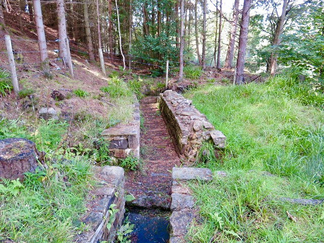
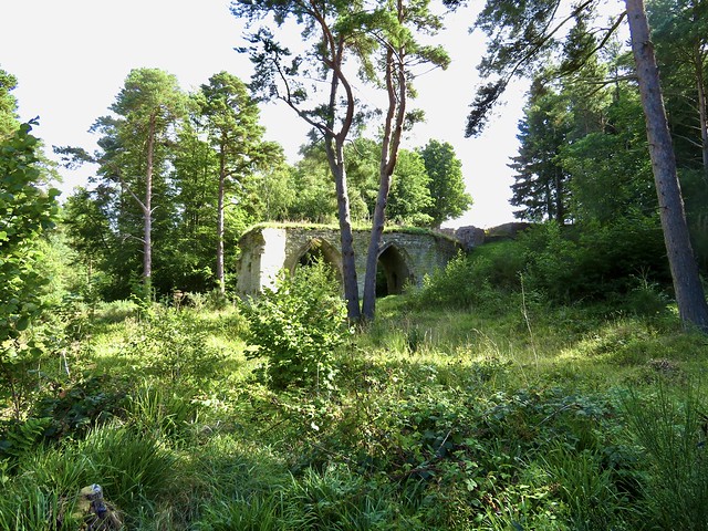
Under the rolling green fields and massed ranks of conifers lie the seams of lead that sustained a major lead mining and processing industry from medieval times till the 19th century. At Dukesfield we passed the handsome 3-storey house of Dukesfield Hall where the mine agent lived, and down in the deep valley of the Devil’s Water beyond we found the two tall Gothic arches by which a stone flue carried the noxious lead fumes away from the smelting mill that once worked day and night here.
Imagination and a couple of helpful information boards had to supply the background of noise, heat, furnace roar, clanging and banging. Devil’s Water nowadays couldn’t be more quiet and beautiful. We picnicked by the river to the splash of clear water over miniature cascades, watching out for dippers and for tiny brown trout that rose to flip the surface with their snouts.
A bracken path lead south past Redlead Mill to a quiet road where the aptly named Viewley Farm commanded a wonderful westward prospect from its ridge, over a wide green valley of scattered grey farms to brown and purple fells far beyond.
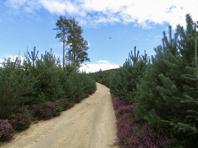
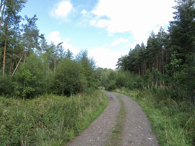
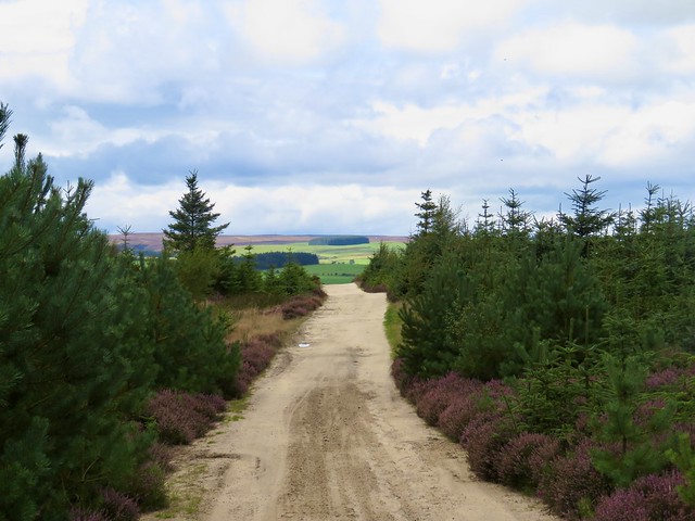
At the farm gate the road declined to a broad sandy track that rose through the dark conifers of Slaley Forest. Fly agaric fungi as tempting as sweeties with their white-spotted scarlet caps lay in wait among the heather for passing witches and the unwary stepchildren of woodcutters’ wives.
Beyond the forest wide uplands spread north towards a distant hint of the Cheviot Hills. Fallen crab apples spattered the lanes, and the hedges winked scarlet with holly berries. We skirted a caravan park that was threating a takeover of the footpath, and followed the sheep pastures back up the hill to Slaley.
How hard is it? 8¾ miles; easy farm and forest tracks
Start: Rose & Crown, Slaley, near Hexham NE47 0AA (OS ref NY 975577). Please ask permission to park, and give pub your custom!
Getting there: Bus 689 (Consett-Hexham)
Road – Slaley is signed from B6306 (Hexham-Stanhope)
Walk (OS Explorer OL43): Left to cross B6306 (‘Byway’), follow ‘Palm Strothers, Dukesfield’ and blue arrows. In 1¼ miles pass Dukesfield Hall (944574); bear right (yellow arrow/YA) down through trees to arches (941580). Left beside Devil’s Water for ¾ mile to Redlead Mill (931573). Pass house, over stile (YA); ahead for ¾ mile to road (930560). Left; at Viewley Farm gate, ahead (933558) on sandy track through Slaley Forest for 1¼ miles to road (955554). Left; in 600m, right (956560, ‘Spring House’). In 250m at cottage (958560, ‘Private Road’), right; in 5m, left (stile, YA) through plantation, across drive, up grass track. In 400m cross track (963560); path ahead to stile; along wood edge to Cocklake (966561). Left through 2 gates; along drive; in 150m through gate (966563). Aim for left end of plantation; waymark/stile to drive (968565); left to Blue Gables (969568). Right to cross road (974569); down drive (‘Well House, Slaley’). Right round back of East Ridley Hall (974571); YAs to stile and footbridge (975573); up 2 fields to Slaley.
Lunch/Accommodation: Rose & Crown, Slaley (01434-673996, roseandcrownslaley.co.uk)
Info: Hexham TIC (01434-652220), visitnorthumberland.com
@somerville_c