First published in: The Times Click here to view a map for this walk in a new window


Arenig Fawr, ‘Great High Ground’, the summit of a curving ridge at 2,802 ft (854 m), stands at the eastern edge of the National Park, some way apart from the more celebrated peaks of Snowdonia.
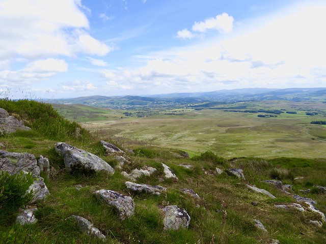
Other than the beauty of Arenig Fawr’s own surroundings, the special attraction of the summit is that from it you can see an unbeatable panorama of the mountains of North Wales spread out all round you. First, though, you need a clear day on those tops, not so common in this part of the world.
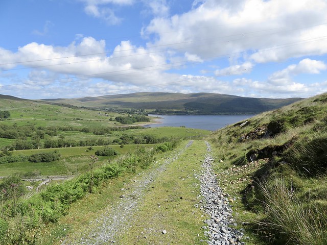
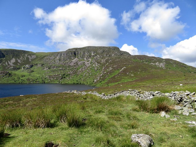
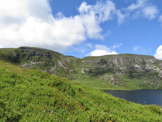
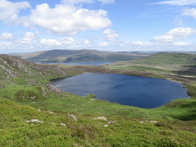
Three times over the years we’d had Arenig Fawr in our sights, and three times we’d been rained off. Now here we were at the foot of the track on a beautiful morning. The well-found track led us across thistly hillsides to our first sighting of Llyn Arenig Fawr, a sheet of wind-stippled water, steel-blue in the shadow of a tall corrie of dark crags with pink screes chuting down towards the lake.
By the dam a little one-room bothy, immaculately clean, offered basic shelter – a wooden plank bed, a fireplace still warm from the previous night’s occupants, a kettle, a broom, a bottle of chilli sauce, and naturally The Bible in both English and Welsh. Judging by the ecstatic comments in the visitors’ book, walkers love this spartan refuge beside the lonely lake.
From the bothy the track steepened beside the corrie, a good old puff upwards on a path whose rocks sparkled in the sunshine. A couple of fences to hop and we were out into a wild upland, the path undulating through boggy patches and curving across slopes before turning up loose screes and rocky steps towards the ridge.
The slope of the climb hid the conical summit of Arenig Fawr till we were nearly there. Up at the trig pillar we found a stone-walled shelter and a poignant memorial to the eight-man crew of a USAF Flying Fortress bomber, killed when their plane crashed here on a night training flight in 1943.
The promised mountains stood clear and dramatic all round – the dinosaur spine of the Clwydian Hills and the four billows of the Berwyns to the east, Cadair Idris looming like a hunchbacked beast in the southwest, and away to the northwest the shoulders and pointed head of Snowdon just brushing the gathering cloud.
How hard is it? 7¼ miles there and back, 1720ft/530m climb. Strenuous mountain expedition for fit, sure-footed walkers, properly clothed and shod.
Start: Car parking space just east of Arenig, near Bala, LL23 7PA approx. (OS ref SH 846395)
Getting there: Arenig is signed off A4212 (Trawsfynydd-Bala). Drive through hamlet; car parking space is another ⅔ mile on left, opposite gate signed ‘Farmland’.
Walk (OS Explorer OL18): Through gate, follow track for 1½ miles to Llyn Arenig Fawr. Cross ladder stile by bothy (850379); follow path, gentle gradient at first, then a rocky and steep climb from 400m at bothy to 600m at fence (‘Y Castell’ on map). Cross fence (842373); up to cross second fence 40m beyond corner where you join it (839374). From here on, path rocky and stumbly – watch your step! Path bears right round rocky outcrops, then makes long leftward curve across slope. In ½ mile path bends right and climbs (832372), a few cairns mark it from here. Near the summit, aim for a prominent post above, then the trig pillar at 2,802ft/854m (827369).
Return same way.
Lunch: Picnic
Accommodation: Bothy at Llyn Arenig Fawr (mountainbothies.org.uk); or Plas Yn Dre, 23 High St, Bala LL23 7LU (01678-521256, plasyndre.co.uk)
Info: walkingbritain.co.uk; snowdonia.gov.wales
@somerville_c