First published in: The Times Click here to view a map for this walk in a new window
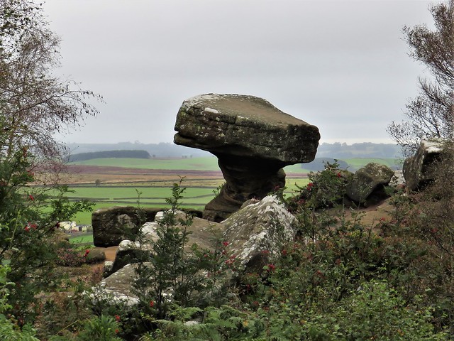
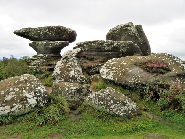
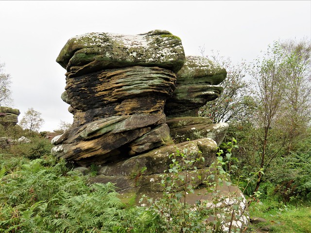
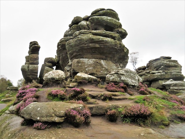
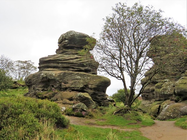

A brooding winter day of rain showers over the Yorkshire moors. Low cloud hung threateningly over Brimham Rocks. The Eagle, the Dancing Bear, Cannon Rocks, ET, the Idol: they stood against the grey sky like chubby monsters, fat stacks of gritstone sandblasted during Ice Age windstorms into fantastic shapes. Some leaned at precarious angles; others were layered like a giant pastry-cook’s mille-feuille, or ribbed as thin as a sword blade and pierced with holes punched through by wind, rain and frost.
;)
As soon as I began to walk among the rocks, imagination took over. A lion, a dwarf, a turban, a bird. An anvil poised on a flat stand. Toadstools. Profiles of grotesque faces that had me glancing over my shoulder in spite of myself.
From the Visitor Centre I followed the Circular Trail through a great shallow bowl at the centre of the knoll, a hollow filled with piles and stacks of rocks, some dramatically undercut, dozens of tons balancing on a pivot the size of a book. The dark rain-soaked rocks were spattered with crustose lichens, pale green and white. There was an irresistible urge to touch and stroke their curves, seeded with crystals of quartz that felt rough and sandpapery under my fingers.
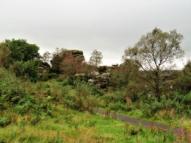
Off the Circular Trail branched a maze of dark sandy paths, some leading away from the main rock groupings to pass outcrops half hidden in the bracken under the silver birches, equally bizarre but out of the limelight.
The coarse sandstone known as millstone grit that formed these rocks was eroded from giant mountains and deposited in a massive river delta some 400 million years ago. That same gritstone underlies all these more easterly of Yorkshire’s moors, lending them a strong and dour character to be savoured in contrast to the softer aspect of the limestone dales to the west.
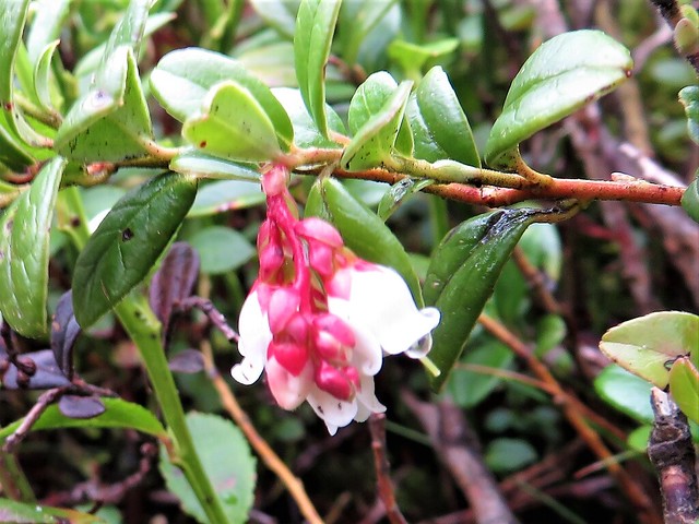
Back at the Visitor Centre I set out along the Boundary Walk around the perimeter of the knoll. Rowan trees in full berry competed with bracken and bilberry leaves for fieriest colours against the pale moor grass and dark heather of this sombre landscape. The path of black peat squelched underfoot, and a sudden flicker of white against the bracken betrayed the zigzag flight of a snipe.
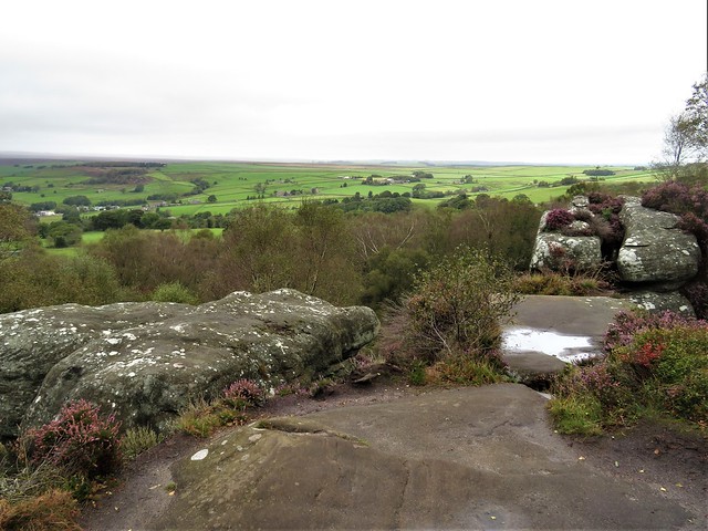
At the edge of the knoll I stopped to take in the view. The mist and low cloud had lifted, and a watery sun was beginning to break through. Down in the Vale of York lay the towers of York Minster, nearly thirty miles off, and out at the edge of sight a fleet of power stations sent out white plumes of steam as they sailed the level horizon.
How hard is it? 4¾ miles (Boundary Walk 3½ miles, moderate; Circular Walk 1¼ miles, easy); defined paths; parts can be wet underfoot
Start: Brimham Rocks car park, Brimham Moor Road, Summerbridge, Harrogate HG3 4DW (OS ref SE 208645)
Getting there: Brown signs from B6165 (Pateley Bridge-Ripley)
Walk: Circular Walk: From car park follow the blue markers clockwise around the Circular Walk to see main attractions. Boundary Walk (anti-clockwise): from car park head south, parallel with road. In 500m, left across road (208640); north-east for 600m to pick up Nidderdale Way. In 400m, left on path (218642) north-west for ⅔ mile to road (214650). Right on track; in 200m, left to road (215652). Right; in 500m left; just before High North Pasture Farm (205654), left to Visitor Centre and car park.
Lunch: Picnic
Accommodation: Wellington Inn, Main Street, Darley, Harrogate HG3 2QQ (01423-780362, wellington-inn.co.uk)
Info: nationaltrust.org.uk/brimham-rocks