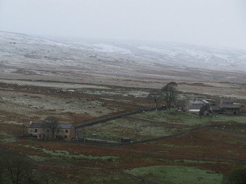
‘There was snow on them thar hills this morning!’ said the cheerful man we passed in the street at Wearhead. He was right, too: we’d woken to what they call a ‘lambing storm’, a sudden late spring fall of snow on a streaming north wind.
First published in: The Times Click here to view a map for this walk in a new window

Facebook Link:
Now though, a couple of hours later, it was all gone, melted away from the fells of Upper Weardale like a dream. West Durham lay in sunshine, though sharp white showers were already regrouping on the northern horizon.
A rough hillside grazed by inquisitive horses brought us up out of the dale bottom to the fell tops where lambs ran crying to the ewes and icy little balls of hail came battering round our ears. The squall whirled away south, revealing a wide bowl of moorland hills with stone-built farms scattered all down the dale sides.
The upland birds were in full nesting flow – lapwings tossing about the sky like paper kites, curlews trilling in the sedges, redshanks called pic! pic!, and golden plover standing with heads held high, piping to mates or rivals, a bright ‘S’ of white feathers outlining their shapes, their backs shimmering gold in gleams of sun.
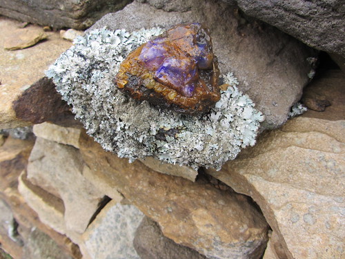
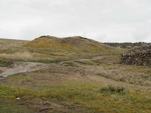
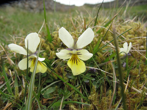
Lark song filled the air directly overhead as we found a high track between banks of mountain pansies, some entirely of rich purple, others with lower lips of yellow, and one or two a creamy yellow all over. The old lane wound among the spoil heaps of Weardale’s long-defunct lead mining industry, hummocks of green and red mosses and lichens where we picked up glittering gems of semi-opaque purple fluorspar. The walled track slanted down the dale side through more humpy mining ground where a young semi-wild foal looked shyly over her mother’s back.
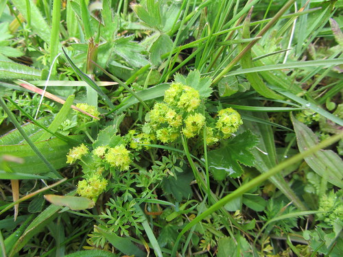
From the grey stone settlement of St John’s Chapel we climbed once more into a succession of unimproved, unspoiled hay meadows. There aren’t many communities of proper hay meadows left in this country, and these – carefully nurtured by the farmers and monitored by North Pennines AONB – are the glory of the dale for their wild flowers. Green froths of lady’s mantle, clovers, mauve heads of wood cranesbill, cowslips going over, yellow rattle not yet come in – there they all were, ready to burst into their full colourful pomp come June. Another snow flurry came whipping across Weardale, and we told ourselves we’d be back.
Start and finish: Wearhead, near A689 bridge (OS ref NY858395).
Getting there: Bus 101 (Cowshill-Stanhope)
Road: Wearhead is on A689 between Stanhope and Alston
Walk (6 miles, moderate, OS Explorer OL31. NB: Online map, more walks: www.christophersomerville.co.uk):
From Wearhead Bridge, head north up A689 (Alston direction). Just before phone box, go right (bridleway fingerpost) along laneway. Bear left over stile (‘Valley Crest’), on up steep path, curving right and aiming for notch in skyline. Through gate at top (861397); aim left of house; stone stile (fingerpost) onto road. Right; in 50 m, left (863397; fingerpost) up stony lane past Newfield and Halliwell House for nearly a mile to crossing of walls by mine spoil heaps (868408). Turn right along Sedling Rake track for 1 mile, past wood to road junction (884405). Right; in ¼ mile, left (882401; ‘bridleway’) down walled moor track.
In ½ mile, at second crossing wall (886394), bear right along wall, down to go through gate (884391). Down beside wall; over next crossing wall (883390; no stile – scramble over wooden barrier); diagonally left aiming right of farmhouse (883388). Through stile left of gate; through gate below; diagonally left down to lane (884386). Sharp right up lane; opposite Top Byre Cottage (880390), right up field path, keeping close to wall on left (path narrow in places) for 3 fields to cross road (878392). On up drive opposite (fingerpost), past Allercleugh farm house and buildings (873394) with hay meadows on your left. In field by High Whitestones, follow permissive footpath diagonally down across field; left down walled lane to Whitestones farm (869394). Through gate (yellow arrow/YA) and down to cross road (869393). Ahead through stone stile (fingerpost) and garden; through gate (YA). Aim half right across field to upper end of wall; behind it, go through stile and gate (YA); down beside wall, then down steps, through stile (YA) and along alley to road in West Blackdene (867391). Cross River Wear; right along Weardale Way to Wearhead Bridge.
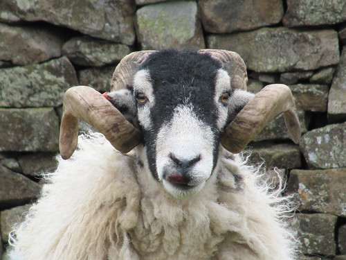
NB. Unsuitable for dogs – sheep country!
Refreshments: Picnic (village shop in Wearhead)
Accommodation: Low Cornriggs Farm, Cowshill, Weardale, Co. Durham (01388-537600; www.cornriggsfarm.co.uk) – fabulous home cooking and warm welcome.
More info: Durham walks/accommodation: thisisdurham.com
North Pennines AONB – events, guided walks, etc: 01388-528801; www.northpennines.org.uk. More guided walks: 0191-372-9100; durham.gov.uk/countryside
Breast Cancer Care’s Pink Ribbon Walks:
0870-145-0101; www.pinkribbonwalk.org.uk. Marble Hill Park, London, 16 June
Subscriber Walks: Enjoy a country walk with our experts. Next walks: Tibbie Shiel’s Inn, Selkirkshire, Scotland, 10 June; Mourne Mountains, Co. Down, N. Ireland, 8 July. Email timespluspartners@newsint.co.uk to book. Tickets £10.
www.ramblers.org.uk www.satmap.com www.LogMyTrip.co.uk