A beautiful day lay spread above the Wye Valley – sunny, blue and crisp as a new sheet.
First published in: The Times Click here to view a map for this walk in a new window

Facebook Link:
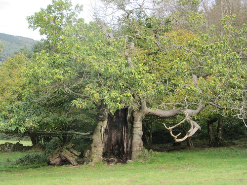
The River Wye ran dimpling through its wooded gorge, viscous with red-brown mud. Ramblers in beanies and thick scarves were setting out from deep-sunk Brockweir with a clink of sticks and crunch of boots. We left our own prints in the carpet of gold and toffee-coloured leaves under the oaks and beeches as we climbed steeply away from the river.
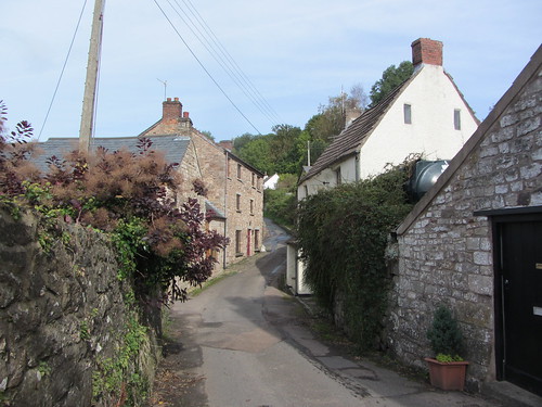
Five hundred feet above the Wye, St Briavel’s Common lay edged with a tangle of narrow lanes and a haphazard scatter of houses, witness to the encroachment of squatters 200 years ago when common land was being enclosed all across the country and poor folk driven away without means of support. However, if a family could build some sort of hovel between dawn and dusk, and get the chimney smoking by nightfall, they’d have the right to remain and scratch a living from the common and woods. Many did so in those tough old days.
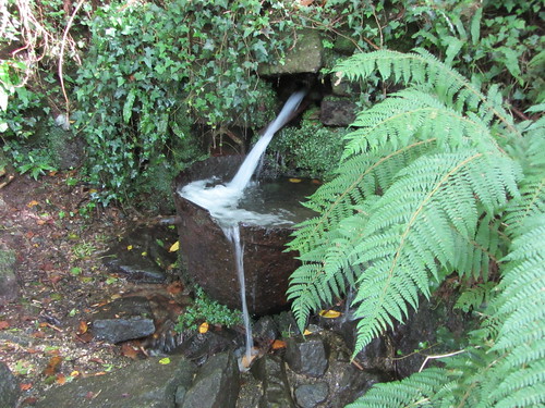
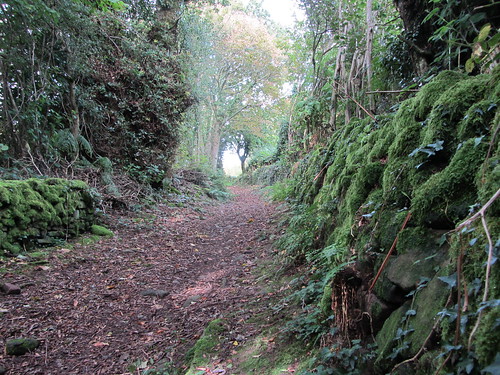
Water trickled and gushed on the rain-sodden hillside. Among the former squatter plots we splashed along a twisting, rough-surfaced holloway, more of a stream than a lane. Close at hand, but smothered from sight under lush ferns and tangles of briar, ran an ancient fortified embankment, one of the component parts of the great 8th-century earthwork built along the Welsh Marches by mighty Offa, much-feared king of Mercia. Was Offa’s Dyke constructed to keep the warlike Welsh at bay, or to keep them under surveillance, or as a boundary marker? No-one knows – its builder didn’t bother to hand down his reasons to posterity. But the great Dyke endures in the Border landscape, and Offa’s name along with it.
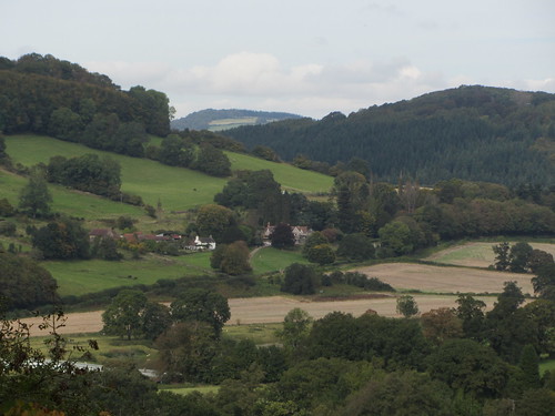
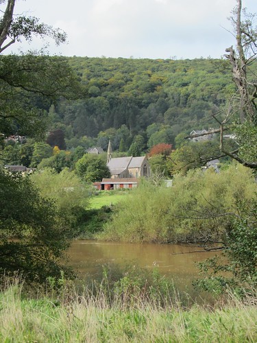
Across the leafless treetops there were glimpses down the winding Wye, its woods steaming, tree trunks dully glinting under a cold milky blue sky. Then a long, steep descent down a slippery woodland path brought us to a wonderful prospect up the valley, the sides sloping more widely back as soft sandstone replaced the harder, cliff-forming limestone. Bigsweir Bridge spanned the Wye at its tidal limit, a delicate ice-green lattice bow among the trees.
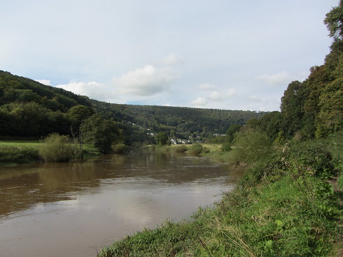
Down at river level we sat on a log pile, tindery with age, to munch a sandwich of oatcake and chocolate mint (don’t knock it until you’ve tried it), and then turned back downriver along the blood-red Wye. The river was famous in times past for its locally built sailing barges, known as trows. When wind or tide were against them, the trows would be dragged along on ropes by bow hauliers, the pick of those Wye Valley men whose muscles were equal to the task. What a sight and sound that must have been.
Start & finish: Brockweir Inn, near Chepstow, Glos, NP16 6NG (OS ref SO 540012)
Getting there: Brockweir is signposted off A466 Chepstow-Monmouth road, 1 mile north of Tintern
Walk (6 miles, moderate, OS Explorer OL14; click on Facebook “Like” link to share this walk with Facebook friends): Opposite Brockweir Inn, down ‘No Through Road’. In 400m, right up lane by Orchard Cottage (538015; ‘Restricted Byway’/RB). At top of rise, dog-leg right and left across lane (539018, RB) and on. In 50m, left to road (539021). Right to T-junction, where you join Offa’s Dyke Path/OD (OD waymark arrow on white post beside ‘The Paddock’. Left along road for 200m; right (540023; OD, RB). In 100m path runs between Chapel Cottage and Hilgay Cottage, then on up slope. In ⅓ mile at T-jct, left (540029; OD; yellow arrow/YA) up walled path. In 100m at T-jct, left downhill (539030; OD, YA). At house gate, right (OD, YA); through kissing gate, and follow YAs down across fields to road (537031). Right (OD); in 200m, left (538033; RB, OD) down stony lane for 300m to T-jct (538036). RB and broken fingerpost point left here, but go right along surfaced lane to tarmac road (539037). Left (OD); in 250m, left by Birchfield House (541039, OD) down gravel track, then steeply down through trees by paths and walkways (very slippery!) to gate (541043). Down across 3 fields (OD, YA) to driveway (540049). Left; skirt right of Bigsweir House entrance; continue beside River Wye for 3 miles back to Brockweir, keeping close to river all the way.
Lunch: Brockweir Inn, Brockweir (01291-689548; www.thebrockweirinn.co.uk)