Well lathered in Avon Skin-So-Soft (kind to your skin, but also a proven defence against the bluidy midgies), Jane and I set out from Glen Nevis Visitor Centre on one of those West of Scotland mornings when the high tops have shawled themselves up in misty cloud after days of stair-rod rain, and only a fool, or a walker with X-ray Spex, is headed for the summits.
First published in: The Times Click here to view a map for this walk in a new window

Facebook Link:
Ben Nevis would have been a temptation in any other conditions, but what’s the point of getting all the way up there if you can’t see your hand in front of your face, let alone the view from the highest point in the British Isles?
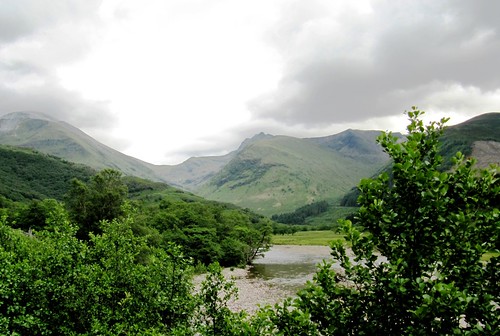
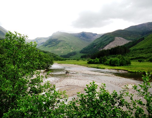
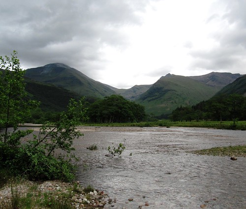
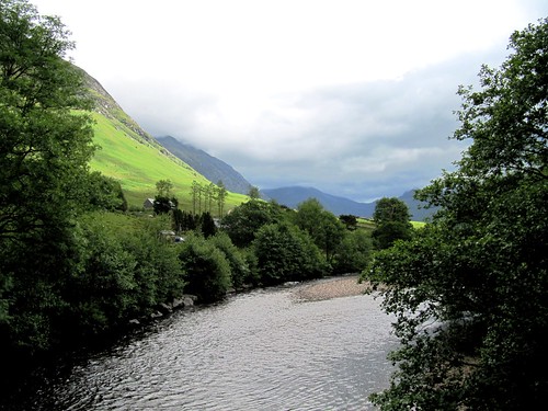
Luckily for us there was a tasty alternative at hand, a low-level circuit of the glen where the River Nevis pours seaward at the feet of the mighty Ben Nevis range from the mountainous heart of Lochaber. The river ran dimpling over pebbly shallows and round bushy islets in a tunnel of alder, sycamore and ash. Sandpipers darted upriver with silvery calls and a flash of white rump.
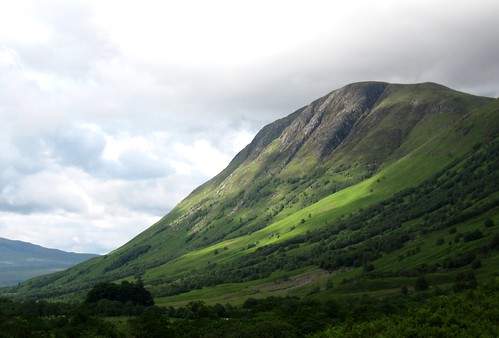
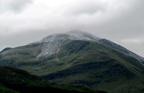
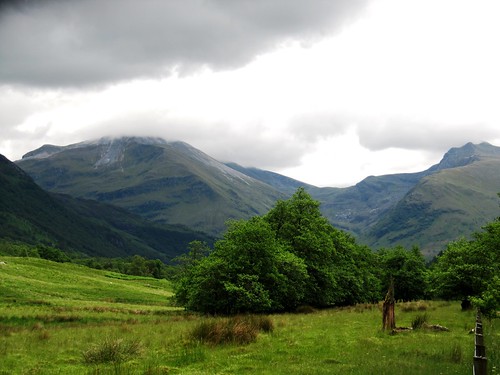
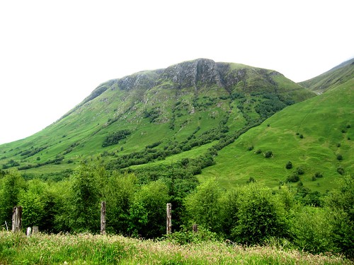
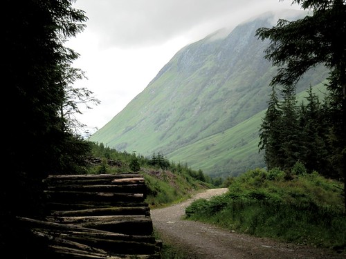
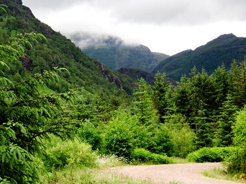
On our left hand the flank of Ben Nevis rose into smoking grey cloud, great purple buttresses cut with gullies where white strings of rain-swollen torrents came tumbling – Red Burn, Five Finger Gully, Surgeon’s Gully. The forward view showed the river winding from its gorge under twin rugged peaks streaked with pale quartzite – Sgùrr a’ Mhàim and Stob Bàn. This must be one of Scotland’s greatest low-level prospects.
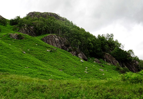
We passed an ancient graveyard, a square of immaculate sward inside mossy walls, guarded by wonderful old beech trees, silent and peaceful. The squelchy path dipped past Highland cattle with ferocious horns and mild manners.
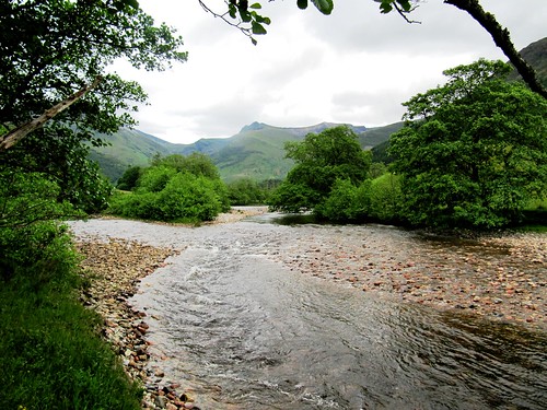
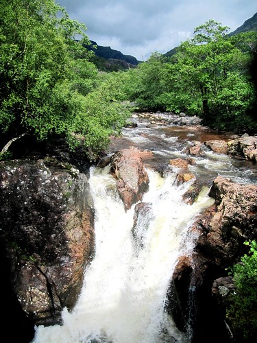
We crossed the roaring Lower Falls of the River Nevis and hit the homeward stretch – a forest track running north, its verges thick with heath bedstraw, crimson and emerald sphagnum, and lime-green rosettes of insectivorous butterwort, the royal blue flowers nodding above on hair-like stalks. Good smells of wet rock, water, earth and pine resin followed us back up the glen, as sunlight broke through across the northern hills and Ben Nevis shrugged its high shoulders free of the clinging cloud shawl at last.
Start & finish: Glen Nevis Visitor Centre, Glen Nevis, near Fort William, PH33 6ST (OS ref NN 123730) – NB car park £3 in pound coins
Getting there: Rail (thetrainline.com) to Fort William (1½ miles). Bus 41 from Fort William (summer). Road: A82 to Fort William; follow ‘Glen Nevis’ signs.
Walk (8 miles, easy, OS Explorer 392): NB: online map, more walks: christophersomerville.co.uk): From Visitor Centre follow river downstream to cross suspension bridge (123731). Right upstream along left bank of river. In 1 mile pass bridge to youth hostel (128718); keep on by river for 2½ miles to pass cottages at Polldubh (142687). In 350m pass sheep pens; bear right to road. Right to cross Lower Falls (145684); along road for 300m; left by bus stop opposite cottages (143684) on broad forest track. Follow it for 2¾ miles to pass West Highlands Way/WHW spur descending on right (122717). In 350m join main WHW route (121721; thistle symbols). Follow it to road; left, then right to Glen Nevis Visitor Centre.
Conditions: Riverside path is rocky, stumbly and muddy in places. Many streams to ford.
Lunch: Snacks in Visitor Centre; Ben Nevis Inn (01397-701227, ben-nevis-inn.co.uk – above Achintee House, across river)
Accommodation: Glentower Lower Observatory, Achintore Road, Fort William PH33 6RQ (01379-704007, glentower.com)
Information: Glen Nevis Visitor Centre (01397-705922, ben-nevis.com/visitor-center); visitscotland.com
www.satmap.com www.LogMyTrip.co.uk visitengland.com