First published in: The Times Click here to view a map for this walk in a new window


Facebook Link:
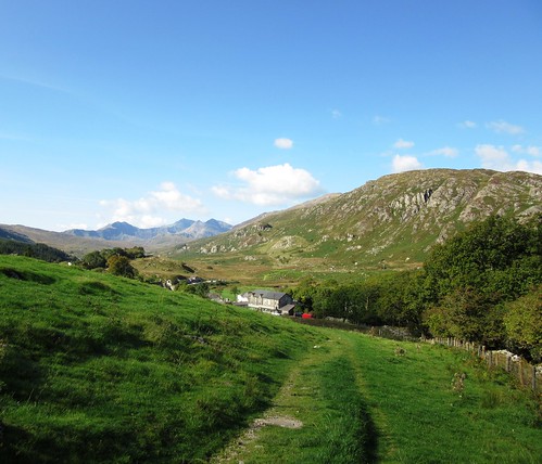
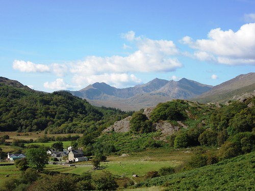
Capel Curig on a cloudless morning, the sky upturned like a blue porcelain bowl above Snowdonia, the air as fresh as spring water, full of light and clarity. In the west Snowdon thrust up its crown of peaks round a shadowy hollow. Moel Siabod rose like a rocket to the south. What a morning for exploring the rugged uplands that lie north of Capel Curig, the walkers’ and climbers’ mecca in the mountains.
We crossed the stile by the chapel and were away up the fields with tumbled rocks and hillocks rising all round. A well-trodden path led through a mossy oakwood and out into a patch of sun-warmed bog myrtle. We picked a handful of the olive-shaped leaves and sniffed their sweetly spicy fragrance as we climbed on round a great bog in a rocky hollow, northwards towards the pass under the peak of Crimpiau.
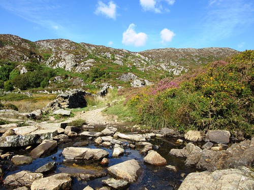
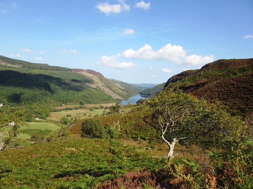
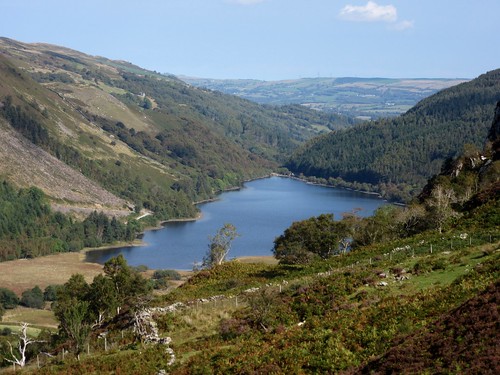
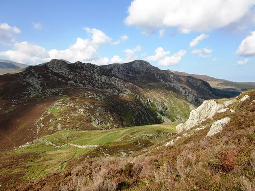
‘Go on a bit down the other side, there’s a great view,’ the man in Capel Curig’s Moel Siabod café had urged us. We did so, and were rewarded with a wonderful prospect north-east over the blue waters of Llyn Crafnant framed in a cleft of hills. Back up to the pass, and a meandering climb up to the pale quartz rocks of Crimpiau’s summit. Snowdon stood up dramatically in the west, with Tryfan’s stegosaurus back arched to the sky alongside.
Mountains and uplands were all lit as though by a stage designer granting the dearest wish of every walker out in the hills today. ‘Tryfan,’ said a cheery man as we sat drinking it all in like thirsty travellers in a bar. ‘Up there yesterday, and couldn’t see a thing. Wayfinding was… interesting.’ He smiled. ‘Back to Bedfordshire tomorrow – worst place in the world if you love hills!’
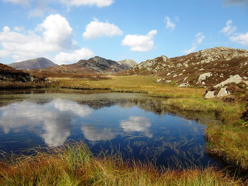
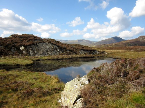
A very rugged and rough path led south off the ridge and down past Llyn y Coryn gleaming in its dark peaty bed like a splash of mercury. A pair of mating dragonflies flew away, banking like biplanes. We descended through heather and gorse, with Snowdon and its cohorts beyond the double lakes of Mymbyr a feast for eyes and soul the whole way down.
Start: Car park behind Pinnacle Stores, Capel Curig, LL24 0EN (OS ref SH 721582)
Getting there: Bus – Snowdon Sherpa S2 (Llanberis to Bettws-y-Coed), S6 (Bangor to Bettws-y-Coed)
Road – Pinnacle Stores is at crossroads of A5 (Bettws-y-Coed to Bangor) and A4086 (Llanberis).
Walk (4½ and a half miles, strenuous, OS Explorer OL17. NB: online maps, more walks at christophersomerville.co.uk): Cross A5; stile beside chapel (‘Crafnant’ fingerpost). In 200m, between trees, ahead on stony path. Gate/stile into wood (725582); out of trees to gate/stile (729581); on to cross wooden footbridge (732581). Left (‘walking man’ waymark); on (stiles) for 1¼ miles, up to pass beside large boulder (738596). On downhill for 200m to Llyn Crafnant viewpoint (738598). Back to pass and boulder; right up path to Crimpiau summit (733596). Path descends south along ridge, aiming for figure-of-eight lakes (Llynnau Mymbyr). Llyn y Coryn soon in sight; keep left of lake (731591) to fence on saddle beyond (731590). Keeping fence on right, down to cross stile (730587). Steeply down to cross stile by stone wall in hollow (729586). Turn right between fence and stone wall; follow fence to cross 2 more stiles (727583). Steeply down to path (727582); right to Capel Curig.
Conditions: steep and rough in places
Lunch: picnic
Accommodation: Tyn-y-Coed Hotel, Capel Curig, LL24 0EE (01690-720331; tyn-y-coed.co.uk) – comfortable, helpful, walker-friendly
Info/maps/walk directions: www.eryri-npa.gov.uk; visitsnowdonia.info/walking-85.aspx
Snowdonia Walking Festival, 25/6 Oct: snowdoniawalkingfestival.co.uk
Beautiful looking walk Christopher.