First published in: The Times Click here to view a map for this walk in a new window

Facebook Link:
The twin cherubs on St Arvans’ village fountain have been discharging streams of water – dried up these days – from their cast-iron urns for well over a century now. Distinctly underdressed, on this cold St David’s Day they looked and felt half frozen. We left them to their invisible pouring, and followed a wide grassy ride west across the fields to where the barns of Rogerstone Grange overlooked stud farm paddocks of horses in thick winter coats.
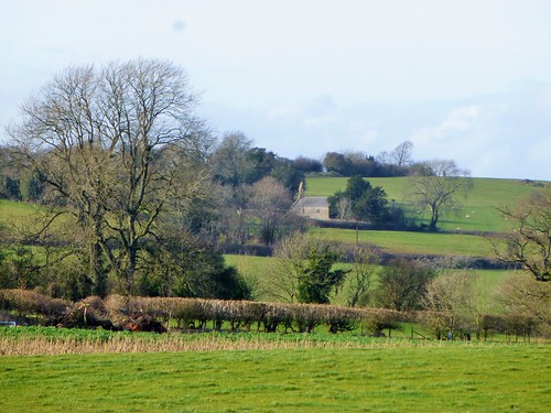
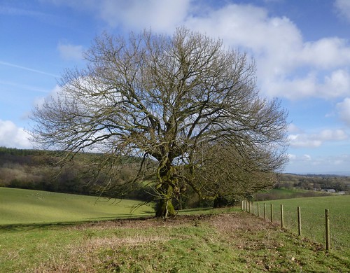
Field paths led us on through a broad, undulating landscape typical of these southernmost Welsh Borders. In the margins of Chepstow Park Wood a buzzard mewed like a frightened kitten as it side-slipped the dive-bombing attacks of a pair of angry crows. Turning back east through the conifer wood, all was still and windless, though the tree tops roared a hundred feet above our heads.
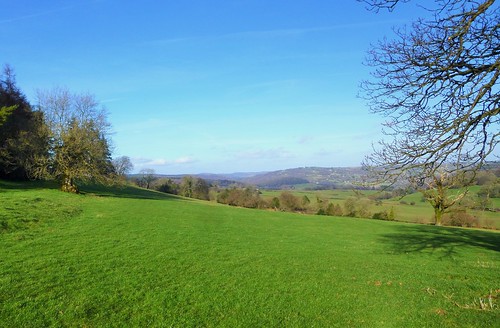
At the forest edge we sat on a bench and looked out across sunlit slopes and the first yellow-green buds of this year’s daffodils to a wide silver streak of the Severn Estuary. Then we plodged on along puddly lanes and paths to Gaer Hill, trenched with the concentric ramparts of a magnificent Iron Age hill fort. It was built by the Silures, dark-complexioned, curly-haired and famous for fierceness in battle.
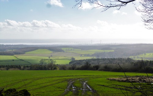
With the flat, tree-encircled crowns of the Forest of Dean ahead we dropped downhill and went west to where the Wye Valley’s sheer limestone cliffs walled in their gorge. From the Eagle’s Nest lookout on Wyndcliff there was a spectacular view over the deserted village, ruined church and working farm of Lancaut, cradled in a great meander of the flood-reddened Wye. Then we plunged down the steep metal stairways and slippery, worn-away stone treads of the 365 Steps, a 19th century tourist attraction (I counted 306).
At the foot of the cliffs a last stretch through sunlit meadows brought us back to St Arvans, where the wintry afternoon sun had brought a touch of warmth to the fountain cherubs’ cold iron limbs, if not a rosy glow to their green-painted cheeks.
Start: The Piercefield Inn, St Arvans, Chepstow, Monmouthshire NP16 6EJ (OS ref ST 519963)
Getting there: Bus 69 (monmouthshire.gov.uk), Chepstow-Monmouth
Road – St Arvans is on A466 Chepstow-Monmouth road
Walk (8 miles, moderate, OS Explorer OL14.): From The Piercefield, left along A466. At right bend, ahead along Devauden Road. Left along Church Lane; right round east end of church; left and on through kissing gate (516965) and down hedged ride (yellow arrows/YA). At kissing gate in valley, ahead on broad grass ride. At Rogerstone Grange’s barns (507965), right along track to farm road. Right; immediately left (fingerpost, ‘Tewdrig Trail’/TT). In 200m, left through gate (506968, YA); on along edge of wood; through next gate (502968) and over stile beyond (499969, YA). Follow fence down to ford stream (496968, stile, YA). Follow hedge on right. At far end of field, right over stile (YA); left down hedge to ford another stream (492968, stile, YA). Aim right of Park House; cross stile into lane (489966, YA).
Along lane, then road. In 300m, right (488964, ‘Devauden’ fingerpost) into Chepstow Park Wood through metal barrier, and up forest road. In 100m fork right; follow forest road for 1½ miles. At sharp left bend (502974), bear right past 2 benches and leave wood to follow sunken lane to road (507978). Left; in 70m, right (fingerpost, YA), following TT across fields. In 700m, at third fence/hedge (513981), don’t go through gate ahead (YA), but go through gate on right (unwaymarked) and follow fence on left. Through gates on left of barn (515980, TT); on along drive. Opposite Gaer Hill Farm, left through ‘stepthrough stile’ (516979); bear right (anticlockwise) round field, following hill fort rampart on your right, to cross stile (518979, YA). Downhill by fence on right to cross road (520979). Ahead up ‘No Through Road’. In ¼ mile, right (522982) up drive, past Porthcasseg Farm and on (YAs) along grassy drive. Cross stile (529981, YA) and follow right-hand hedge to cross stile (YA) into Black Cliff Wood. Right here (531980, ‘Wye Valley Walk’/WVW) along upper edge of wood.
In ⅓ mile path bends right; in another 250m, at waymark post (528975), turn left downhill to Eagle’s Nest lookout. Return to WVW; left along it for 200m; at bend, turn left at waymark post (527974, YA, footprint symbol), steeply down the 365 Steps. At the bottom, bear right (fingerpost), following WVW past old quarry and on along track, with A466 50m below on left. In ¼ mile at waymark post (525972), WVW, footprint and yellow triangle all point uphill to right; don’t follow these, but fork left and continue on path parallel with A466 for 200m to cross minor road (523971, stile, fingerpost, YA). Aim up slope opposite to tall tree; on to road by cottage (519972). Left into St Arvans; left (516969) to Piercefield PH.
NB: 365 Steps have handrails but are steep, slippery, uneven!
Lunch: The Piercefield, St Arvans (01291-622614; piercefieldgwent.co.uk)
Info: Chepstow TIC (01291-623772)
visitengland.com; www.satmap.com; ramblers.org.uk; LogMyTrip.co.uk