First published in: The Times Click here to view a map for this walk in a new window
Facebook Link:
Tam-o’-shanters off to the Forest Community Trust at the tiny scattered hamlet of Abriachan on the hillside above Loch Ness. Nearly 20 years ago they bought a chunk of their local forest and moorland, where they’ve laid out, waymarked and maintained a superb network of footpaths that connect some fascinating sites and viewpoints over the surrounding hilly landscape. The start of the walk to Cairn na Leitire’s rocky peak is a forest play area complete with big wooden fort, tree house, bird hide, loos and playground – ideal for junior adventurers.
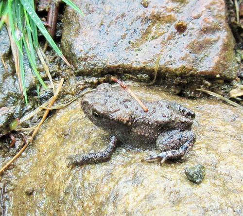
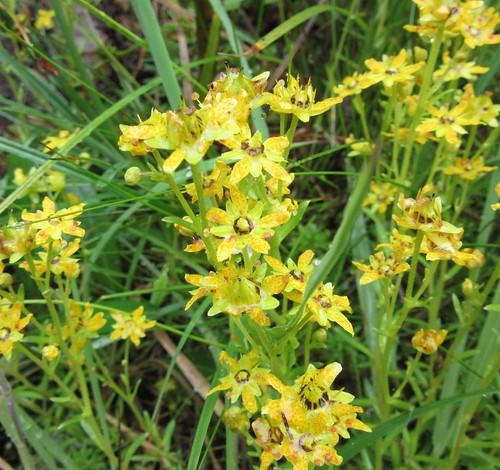
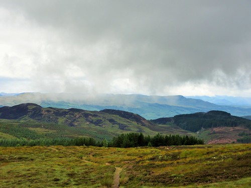
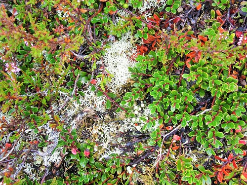
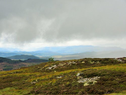
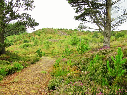
On a still, cool morning with a hint of rain in the air we left the play area and set out on the climb through pine forest and silver birch. A tiny toad as long as my little fingernail squatted on a rock, hoping in vain to avoid the sharp eyes of Jane. We crossed an undulating moor of bilberry with mats of pale green lichen and purple heather tufts. From the cairn on Carn na Leitire the views widened across the hills as far as the broad shoulder of Ben Wyvis rising into cloud some 25 miles to the north.
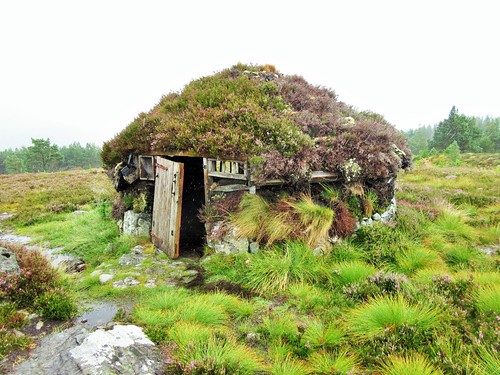
Thick curtains of rain rippled through the valleys parallel with our patch of upland, but miraculously seemed to be avoiding us. Then they changed course, and smacked us with all they’d got. Dripping wet, we took shelter in a shieling, a reconstruction of the kind of hut that local cattle-herders would have used in the summer months – circular, tiny, with stone foundations and turf sod walls under a heather-thatched roof. How smoky, smelly and conversational it must have been in there, with five or six people crammed tight together and a good peat fire blazing away.
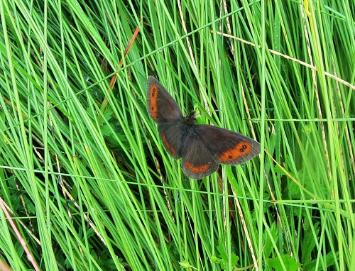
We lingered in the shieling till the rain marched away eastwards. Then it was out and down into the forest, pressing on through downpours and bright sunshine interludes, with the stacked pine logs exuding pungent smells of resinous sap. The sun drew out the male scotch argus butterflies, chocolate brown with fiery orange embellishment to the trailing edges of their wings. Suddenly the tall damp grasses were full of them, restlessly fluttering, never perching for long, a brilliant display of colour and movement to brighten the homeward miles.
Start: Abriachan Forest Trails car park, near Drumnadrochit IV3 8LD approx. (OS ref NH 540353)
Getting there: A82 south from Drumnadrochit; in 6 miles, hairpin left (‘Abriachan’ – use turning circle on right). In 1½ miles pass Abriachan village hall on right; in 250m, fork left (‘Abriachan Forest Walks’). Pass Loch Laide; in 400m, by ‘Abriachan Forest Trust’ sign on left, left onto dirt road; in 350m, left into car park.
Walk (5½ miles, moderate, OS Explorer 416): Follow ‘Wee Tree House, Loch Laide’ sign past playground. At boardwalk junction, left to Tree House; return along boardwalk to T-junction. Left to hide on Loch Laide. Return past left and right turning; take next left. Beside wooden play fort, left to Bronze Age hunt reconstruction. Just beyond, left at junction. In 300m trail forks; go left (footprint waymark). At 542346 pass carved bench; at another carved bench, left (542344, ‘Carn na Leitire’). In 300m, at fork with ‘posts’ sculpture on left, bear right. Path swings anticlockwise round hillock. Pass post on left; in 50m, ignore path on right (544343) and continue on main path to cairn on Carn na Leitire (547345).
Continue on clear path across moor. At successive junctions (551341 and 554341) go left (‘Balchraggan’ fingerposts). In 800m pass The Shieling hut (558342); continue to T-junction. Right on forest track for ¾ mile to meet Great Glen Way (549337). Right along GGW for 1¼ miles to T-junction by forestry store (536345); right for ¾ mile to car park.
Refreshments: Picnic
Accommodation: Bridgend House, Village Green, Drumnadrochit, IV63 6TX (01456-450865, bestbandb-lochness.co.uk) – very friendly and obliging B&B.
Abriachan Forest Trust: 01463-861259, abriachan.org.uk
Abriachan Trails: Download map/instructions at walkhighlands.co.uk
visitscotland.com;satmap.com; ramblers.org.uk; LogMyTrip.co.uk