First published in: The Times Click here to view a map for this walk in a new window

Facebook Link:
All the birds in Warwickshire were singing their little heads off as we climbed away from Upper Brailes up Gilletts Hill. Ben the black labrador barked an unavailing plea from behind his gate to be taken walkies: ‘Oh come on, have a heart…!’ But his owner shouted him down and waved us through with a smile.
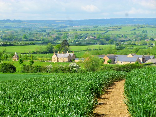
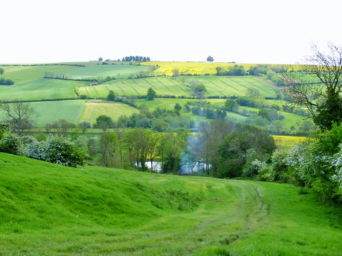
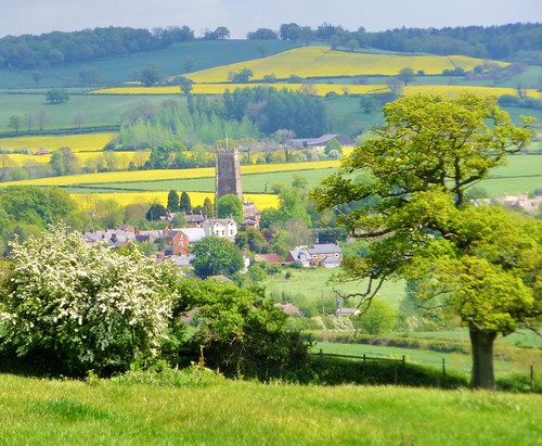
On top of Gilletts Hill a great swathe of green bearded barley glistened in the sunlight. Silver and dove-grey clouds were gathering on the western skyline, but we paid them no heed as we dropped down through Ashen Coppice to a wonderful westward view – cornfields, rape fields, hedges, pastures and red roofed farms stretching away for 15 miles or more. Cloud shadow darkened the nearer ground, but a single pale church spire rose to the north-west, brilliantly lit in a ray of sun.
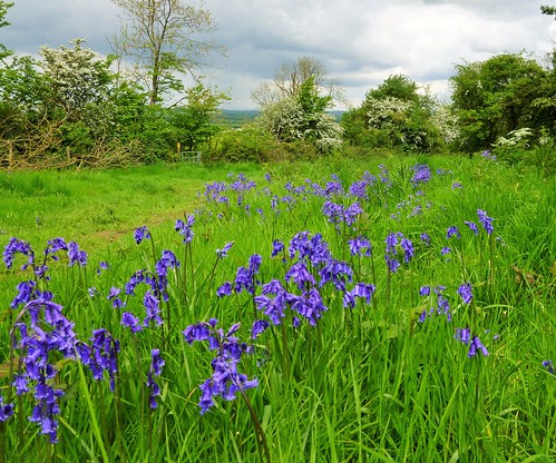
Chiffchaffs, whitethroats and blackbirds warbled fit to beat the band. We skirted above handsome old Famington Farm and climbed the wooded south-westerly flank of Brailes Hill. On the hill’s upper slope an old cart track ran by pastures full of bouncing black and white lambs. We followed it down to Lower Brailes, looking out between veteran sycamores towards the church tower and its zigzag backdrop of green and yellow fields rising to the long ridge of Mine Hill.
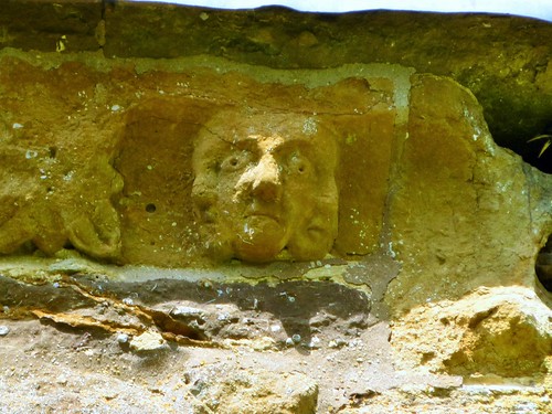
St George’s Church in Lower Brailes is a glorious confection of dark gold limestone, its cathedral-like interior dim and scented with age. The 14th-century masons had massive fun with the grotesques they fashioned under the eaves – a mad nun, a bearded demon, a man with three faces, a wolfman with pricked-up ears – some of them blurred with weathering as though breaking half-born through the stone. Inside, overlooking the nave, I found an old friend, the Green Man, with tendrils sprouting from his mouth and bursting into leaf around his cheeks.
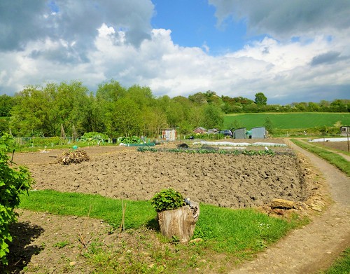
Out in the fields north of St George’s we climbed Lower Brailes’s famed ’99 steps’, shallow stone treads in a bank, some of them formed of recycled grave slabs. On across medieval ridge-and-furrow farmland, a circuit of the ramparted mound of Castle Hill, and we were threading our way back into Upper Brailes between neat allotments of beans, peas, radishes, cabbages, onions, showy globe artichokes and humble spuds.
Start: Gate Inn, Upper Brailes, Warwickshire, OX15 5AX (OS ref SP 305398)
Getting there: Bus service 50A (stagecoachbus.com), Stratford-on-Avon to Banbury.
Road – Upper Brailes is on B4035, 3 miles east of Shipston-on-Stour.
Walk (6 miles, moderate, OS Explorer 191): From bus stop outside Gate Inn, left down road. In 100m, right up Gilletts Lane (‘Gillett Hill’). Through gate; between house and garage; beyond, through gate; bear right (303397, yellow arrow/YA) up grassy bank, then up steps. At top, at T-junction, right; in 50m, fork left on path 58b. In 100m cross grass track, then stile (300398); follow path 58 across field, down through Ashen Coppice. At foot of steps, diagonally left (298399, YA) down slope; at bottom left corner of wood, left (296399, blue arrow/BA) along lower edge of wood. In 150m, right along gravel roadway (path 57a) and follow BAs.
In 300m, at gate (292396, ‘Private’), fork right (BA, yellow-topped post/YTP) along field edge and down, aiming for Farmington Farm. At bottom of slope, left along hedge (285393, YA). Pass through cross-hedge; in 100m, left (295389, YTP, YA) across field to go through gate (288387). Diagonally right uphill through trees (YTP, YA). Near top, bear right at YTP (289386, YA), anticlockwise round the upper hill (YAs). Go through 2 gates; after 2nd one, left through side gate (292382, BA) on bridleway for 1 mile (BAs), passing New House Barn (301383) to road at Grove End (306390). Left; in 20m, right over stile (YA); over next stile, and follow path 60 (YAs) to road (310391). Across into Jeffs Close; left at end; follow road round to right, to B4035 in Lower Brailes (312393).
Right along road. Opposite George Inn (314393), left up Butcher’s Lane. In 100m, left through gate; fork left on path 52. Cross footbridge (314396, YTP, ’52’); keep ahead up The 99 Steps; on across 2 fields. In 3rd field, diagonally left; halfway across, fork right (310397) to cross Castle Hill Lane (309398). Through kissing gate/KG; fork right (’52g’) and follow path across field and over stile (’52g’) to Castle Hill. Return over stile; right along hedge; in 70m, through KG (307399) and follow path (’51’). Dogleg right/left through allotments (YAs) to road; left to The Gate PH.
Lunch: The George, Lower Brailes (01608-685223; georgeinnbrailes.com)
Accommodation: The Gate, Upper Brailes (01608-685212; thegateatbrailes.co.uk) – clean and friendly village B&B.
Information: Warwick TIC (01926-492212);
satmap.com; ramblers.org.uk; LogMyTrip.co.uk