First published in: The Times Click here to view a map for this walk in a new window


Facebook Link:

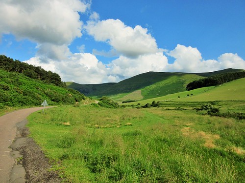
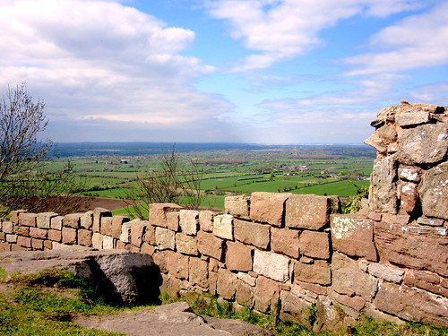
As we left the Pheasant Inn at Higher Burwardsley, a Sunday cavalcade of veteran tractors was spluttering up the hill – red, blue, orange, green and yellow; Fordson, Ferguson and Field Marshall. It was a salutary reminder that here is working farming country. Walkers exploring this beautifully kept, beautifully ordered corner of Cheshire have a great wooded ridge at their elbow, sheltering a scatter of lovely old half-timbered farmhouses, and a view sweeping west into Wales and the distant blue line of the Clwydian Mountains.
The cattle at Wood Farm were frisking in their pastures. Bull calves shoved their blunt little heads together in play-fights, then kicked up heels and tails as they went bucketing away at the gallop.
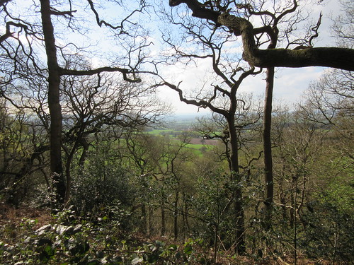
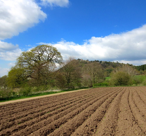
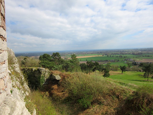
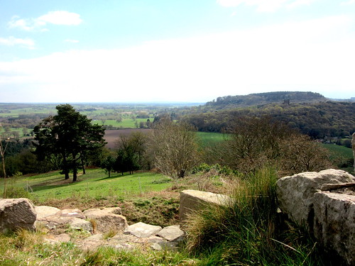
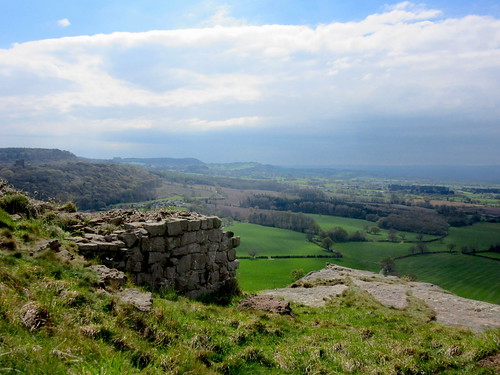
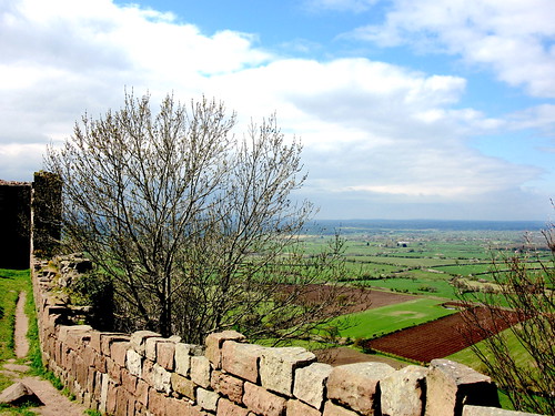
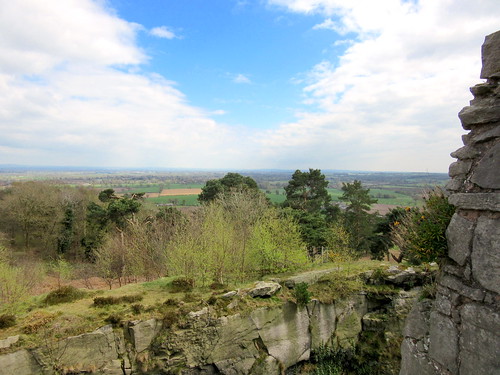
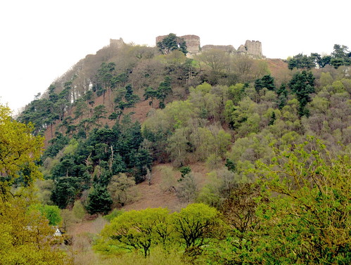
Walking the walled lane at the foot of the Peckforton Hills, we found crinkle-edged harts’-tongue ferns sprouting from chinks between the sandstone blocks. It’s sandstone that shapes this landscape, particularly the great ridge that undulates north to its outermost crag where Beeston Castle stands. The castle occupies one of the most sensational sites in England, right at the lip of a 330-ft crag, with a superb prospect across 30 miles of country in all directions.
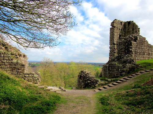
We looked round the exhibition down at the castle gateway (bronze axe heads, stone spinning weights, Normans and Plantagenets, Civil War bullets and drinking flagons), then climbed through the massive sandstone gatehouse and wall towers of the outer ward, and on up through pine trees to the inner ward gatehouse and the tiny, lumpy stronghold at the peak. Pennine and Welsh hills, Liverpool Cathedral, the Wrekin and Chester – all lay there in open view, with the Victorian folly of Peckforton Castle rising on its crag a mile away southward.
It’s claimed that in December 1643 eight royalist desperadoes forced the surrender of the Roundhead garrison after they climbed the western crags. Some say the treasure of King Richard II lies at the bottom of the castle’s 330-ft-deep well. Whatever about all that, it’s certainly a hauntingly beautiful spot. Walking back to Burwardsley I kept turning round to gaze at the castle on the crag, an image to fix in the inner eye and carry away with me.
Start: Pheasant Inn, Upper Burwardsley, nr Tattenhall, Cheshire CH3 9PF (OS ref SJ 523566)
Getting there: Burwardsley is signed from A534 between Ridley (A49 junction) and Broxton (A41 junction)
Walk (6½ miles, moderate, OS Explorer 257. NB: online map, more walks at christophersomerville.co.uk): Right out of Pheasant car park; along lane. In 300m, left down field (524568, fingerpost, yellow arrow/YA) with hedge on left. Over stile (‘Eddisbury Way’/EW); down to road (522571). Right; follow EW round Outlanes Farm; on across fields. Approaching Wood Farm, cross double stile (519577, EW); half left across stile by gate; right along field edge. Over stile at far end (522578); half left across field, through boggy dell (YAs). Half left across field beyond, to fingerpost at far top left corner (527580). Follow lane to join Sandstone Trail/ST (533583). Ahead on ST for 1 mile, crossing road (539588), to reach next road (540590). Ahead to Beeston Castle (537593). Return along ST for 2¼ miles to road just east of Higher Burwardsley (529567). Right to Pheasant Inn.
Snack: Sandstone Café near Beeston Castle gatehouse
Lunch/accommodation: Pheasant Inn, Upper Burwardsley (01829-770434, thepheasantinn.co.uk) – efficient, comfortable, very popular inn.
Beeston Castle (EH): 01829-260464, english-heritage.org.uk/beeston
Walking Cheshire’s Sandstone Trail by Tony Bowerman (Northern Eye Books); sandstonetrail.com
Information: Chester TIC (01244-405340); visitcheshire.com
satmap.com; ramblers.org.uk