First published in: The Times Click here to view a map for this walk in a new window


Facebook Link:

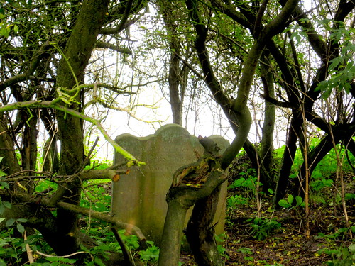
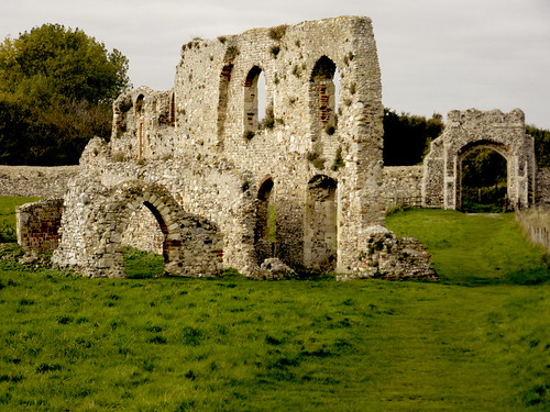
A tangle of trees has almost smothered Dunwich’s famous ‘last grave’. But still the solitary curly-topped headstone of Jacob Forster clings to the cliff edge above the hamlet on the Suffolk coast, the last relic of the church of All Saints that toppled to the beach in 1922. Just inland, the grand flint walls and gateways of Greyfriars priory enclose an empty square of grass.
These remains are all that speak to us today of medieval Dunwich, the great trading port whose churches, hospitals, squares and houses were utterly consumed by the sea. A model of Dunwich in the village’s excellent small museum shows the extent of what was lost, and it made a sobering image to take with us as we set out across the green hinterland of Dingle Marshes.
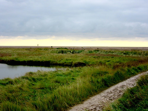
A brisk wind pushed us along the flinty tracks through copses of old oak and pine trees. The grazing meadows, dotted with black cattle, stretched away east towards a dun brown line of brackish marshes below the long straight bar of the shingle-banked sea wall. There’s a feeling of country walked by many, but known by very few.
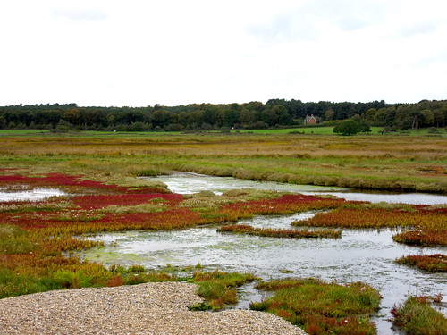
Beyond Dingle Stone House stretched the great reedbeds of Westwood Marshes, burnt orange and green, whispering in a million scratchy sibilants. A flock of a hundred pinkfooted geese lined the edge of a fleet of still water. Tiny bearded tits bounced and flitted through the reed heads, trailing their long tails low behind them and emitting pinging noises like overstretched wire fences. Over all floated the kingly black silhouette of a marsh harrier, circling with deliberate flaps of its wings as it scanned the reeds for mice and frogs.
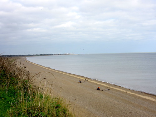
We crossed the Dunwich River and came up on to the shingle bank. An instant switch of view and perspective, out over a slate grey sea and round the curve of the bay to Dunwich under its sloping cliff and the distant white sphere of Sizewell nuclear power station. Sea inundations are increasingly common hereabouts, overtopping the shingle bank and flooding the freshwater marshes behind – part of the ongoing dynamism of this coast and its all-devouring neighbour the sea.
Among the shore pebbles a flat black stone caught my eye. It was a worked flint tool, dark and ribbed, snugly fitting in my palm, its edges scalloped by some ancient maker. Dunwich Museum has it now – one more stage on its journey from hand to hand through the millennia.
Start: Dunwich car park, Suffolk, IP17 3EN (OS ref TM 478706)
Getting there: Dunwich is signed from A12 between Yoxford and Blythburgh
Walk (6¾ miles, easy, OS Explorer 231. Online map, more walks at christophersomerville.co.uk): At car park entrance, left up footpath (fingerpost, ‘Suffolk Coast Path’/SCP arrow). Just past ‘last grave’ on left (479704), turn right through Greyfriars wall, across monastery site, through archway. Right along road; in 100m, left down footpath (fingerpost) to road with Dunwich Museum on right (477706). Left; fork right at church (‘Blythburgh’). In 150m, right past Bridge Farm (474707) along SCP. In 1½ miles, leaving Sandymount Covert (483728), fork right along marsh path. In ¾ mile, just past windpump ruin (487737), right down steps, over footbridge, along boardwalk. In ⅔ mile, right across footbridge (495742, SCP) to shingle bank; right to Dunwich.
Condition: Final 2½ miles is on shingle.
Lunch/Accommodation: Ship Inn, Dunwich, IP17 3DT (01728-648219, shipatdunwich.co.uk) – cosy, friendly village inn.
Dunwich Museum: Open March-October, varying times; also for parties by arrangement. 01778-648796, dunwichmuseum.org.uk).
Info: Southwold TIC (01502-724729); thesuffolkcoast.co.uk, touchingthetide.org.uk
visitengland.com satmap.com; ramblers.org.uk