First published in: The Times Click here to view a map for this walk in a new window


Facebook Link:

On a bright winter afternoon we studied the big OS map in the hall of the Castle Hotel at Bishop’s Castle. We were looking for a short, sharp walk, something to shake down some excellent bangers and mash. Churchtown, a few miles west, looked just the job – the rollercoaster ups and downs of Offa’s Dyke for exercise, and the ancient Kerry Ridgeway for the views.
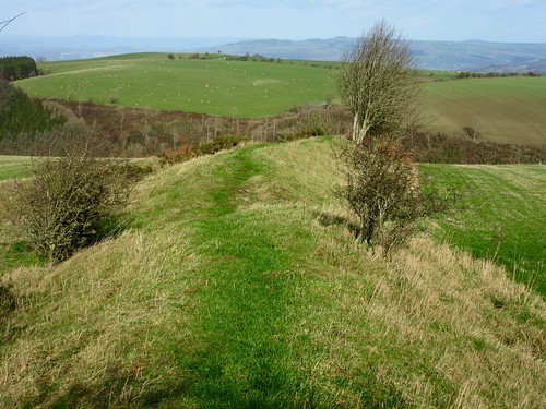
There’s no town at Churchtown – just a church and a house or two sunk in a deep valley. We headed north up the knee-cracking rampart of Offa’s Dyke, a good stiff puff uphill. When Offa, 8th-century King of Mercia, ordered the great boundary built between his country and the badlands of the wild Welsh, he meant it to last, and it has – a solid raised bank and attendant ditches, running north and south like a green scar across the face of the Welsh Border.
We plunged into the Edenhope Valley, crossed the stream and plodded up another steep stretch of dyke to where the Kerry Ridgeway ran along the crest of the hills. Sunlight and hail showers chased each other, the wind roared in the holly hedges, and the view northwards swung from the distant whaleback peaks of the Berwyns and the green knuckles of the Breidden Hills round to the craggy Stiperstone outcrops of the Long Mynd and the radar globes on Titterstone Clee. A fifty-mile view under sun, storm and a rainbow.
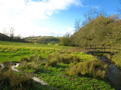
This is tumbled country, overlooked from on high by the Kerry Ridgeway. We followed the former drover’s road to the few houses of Pantglas, then headed south across sheep pastures and steeply down to where the neat slate-roofed farm of Lower Dolfawr lay tucked out of sight in its roadless valley.
Across the little rushing stream, up around the silent farmhouse and sheds, and up again along a holloway all but choked with gorse and broom, to the broad pastures on Edenhope Hill. A last battering from the wind, a scud along a rutted trackway, and we were descending into Churchtown down King Offa’s mighty landmark and memorial.
Start: St John’s Church, Churchtown, near Bishop’s Castle, Salop SY9 5LZ (OS ref SO 264873)
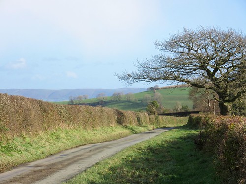
Getting there: From A488 Clun road, 3½ miles south of Bishop’s Castle, turn right, following ‘Bryn’, ‘Cefn Einion’, ‘Mainstone’ and then ‘Church Town’.
Walk (4½ miles, strenuous, OS Explorer 216): From car park, cross road; follow Offa’s Dyke Path north for 1½ miles to Kerry Ridgeway/KR (258896).
Left along KR. At Pantglas, fork left (247896, KR); in 150m, just past Upper Pantglas cottage, left (fingerpost) through gate. 100m up track, right over stile (yellow arrow/YA); left along fence; left over stile at far end (248892, YA); right along fence past pond. Through gate at field end (not right over stile); down slope through next gate (249889). Left (YA) downhill; in 300m, hairpin right to bottom of track (251887), to cross river.
30m after crossing river, before farm buildings at Lower Dolfawr, right up bank. Through gate (YA); skirt to left around farm and along conifer hedge. Right up bank, through gate (251885, YA). Up hollow path to gate (YA). On up hollow path among broom and gorse bushes through felled plantation. At top, through gate (255884); keep same line across field to road near pump house on Edenhope Hill (258881). Left; in 50m, at left bend, keep ahead on green trackway for 600m to meet Offa’s Dyke (263878). Right to Churchtown.
Conditions: Steep ascents/descents on Offa’s Dyke; path through felled plantation above Lower Dolfawr rather overgrown.
Lunch: Picnic
Accommodation: Castle Hotel, Bishop’s Castle, Shropshire SY9 5BN (01588-638403, thecastlehotelbishopscastle.co.uk) – friendly, characterful, very help.
Info: Church Stretton TIC (01694-723133)
visitengland.com; satmap.com; ramblers.org.uk