First published in: The Times Click here to view a map for this walk in a new window


Facebook Link:

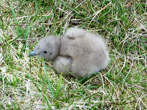
Foula, the Isle of Birds, lies twenty miles west of Shetland’s main island. If you want remote, this is it – a hilly green Atlantic isle of some 30 inhabitants, served by occasional planes and ferries, where thousand-foot cliffs screaming with seabirds fall sheer into the sea.
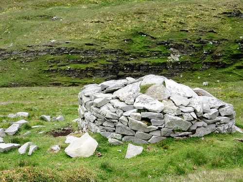
‘Soft rush,’ said our guide, islander Sheila Gear, stripping out a length of pith from a rush stem on the hillside above North Harrier. ‘This was the wick the islanders would use in their lamps of fish oil or seal blubber.’
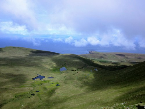
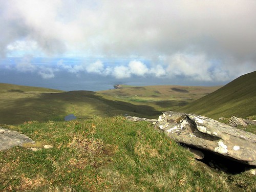
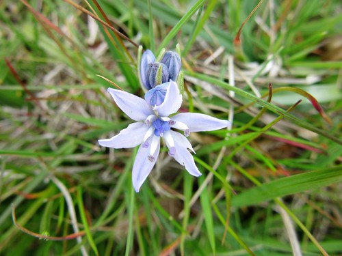
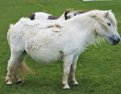
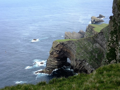
A long rising upland, bright with sphagnum moss and star-like blue flowers of spring squill, led up to the green promontory of Summons Head. A herd of tiny pot-bellied ponies grazed there. We sat and gazed in wonder at the cliff face of Da Kame, 1200 feet of drop, seamed with nesting ledges round which fulmars were drifting like snowflakes.
On our way up the steep hillside to the crest of Da Kame we came under attack by great skuas – ‘bonxies’ to Shetlanders – fierce and piratical seabirds that dive-bomb any intruders in their nesting territory. The summit peak towers over the ocean, but the great cliff itself is out of sight beneath one’s feet. ‘We’ll go down to Wasta Hoevdi,’ Sheila decided, pointing south to where a green tongue of land licked out into space. ‘That’s where they’d pasture the cattle for the summer in the old days.’
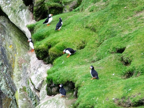
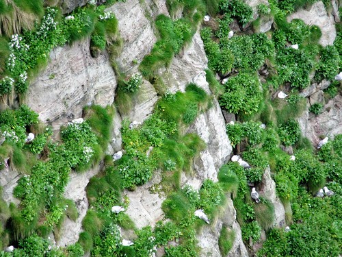
The view from Wasta Hoevdi to the cliffs of Nebbifield was mind-blowing, too, a giant leg of rock standing in the sea. Guillemots perched upright and shoulder to shoulder along the ledge like commuters on a platform, with puffins peeping from burrows at the cliff edge. ‘That’s where I’d go and sit with my dog when I was young,’ said Sheila, laughing with glee at her defiant teenage self. She indicated a narrow, precarious tongue of rock thirty feet below us, a seat in the void. ‘My parents never knew!’
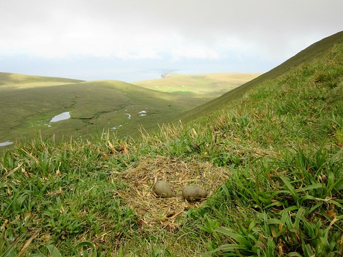
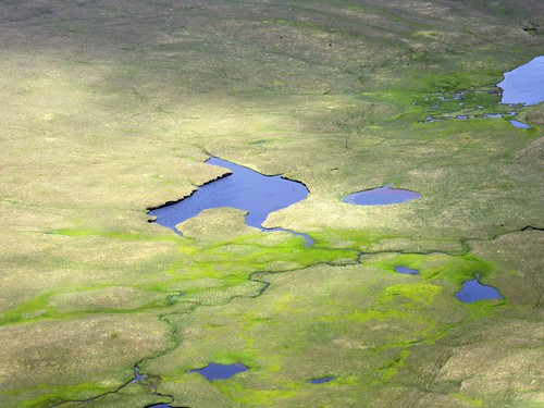
Our homeward path slanted down the Oxna Gaets, the ancient track by which the grass-fattened cattle were driven down from the ridge to lower grazing for the winter. ‘See the Sand Loch?’ Sheila pointed out an upland loch far below. ‘That’s where the red-throated divers are nesting – I don’t know if they’ve any chicks yet.’
They did – we saw them for ourselves. But that was on another day in this mesmerizingly wild and beautiful Isle of Birds.
Start: North Harrier, Isle of Foula, Shetland, ZE2 9PN (OS ref HT 957406)
Getting there: Fly Aberdeen-Sumburgh (flybe.com)
Ferry (07781-823732) from Walls (2 hrs), or fly from Tingwall (SIC Directflight, 01595-840246). North Harrier is at northern end of Foula’s road.
Walk (4 miles, variable, strenuous; OS Explorer 467. NB: online map, more walks at christophersomerville.co.uk): Just before last house, keep ahead (west) uphill with Blobers Burn on left for three quarters of a mile to Summons Head promontory (947407) for view of Da Kame cliffs (danger! See below). Left (SW) along cliffs. Zig-zag steeply up to summit of Da Kame (940400). Continue down along cliffs to Nebbifield (939397) and Waster Hoevdi (939391) for cliff views. Return to saddle between Da Kame and Da Sneug (945397). Diagonally right, steeply down Oxna Gates slope. Cross Da Burn o Da Craig (952401). NE to North Harrier.
Conditions: Some steep ascents/descents. Unguarded cliff edges, unpredictable gusts of wind – keep well back! Guided walk – contact Foula Ranger Service (01595-753236).
Lunch: Picnic
Accommodation: Ristie self-catering (01595-753207, fran.dysonsutton@googlemail.com); Leraback B&B, evening meals (01595-753226).
Info: Foula Heritage (foulaheritage.org.uk).