First published in: The Times Click here to view a map for this walk in a new window

Facebook Link:

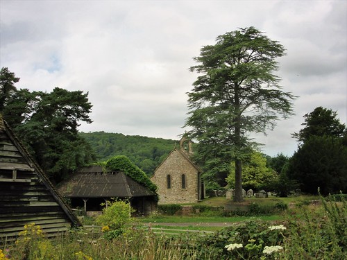
A breezy, hazy summer’s day on the West Sussex downs, with the stubbles of the recently harvested wheat crop crunching beneath our boots as we crossed the fields from Sutton’s old White Horse Inn to Barlavington Farm. Behind the weatherboarded barns we found St Mary’s Church, plain and graceful under its rafters. A plaque inside commemorated Amy Louisa Bragg, ‘a pioneer in the backblocks of New Zealand,’ and another in the churchyard was marked simply: ‘Stan Mayes, 1917-2014 – A Countryman.’
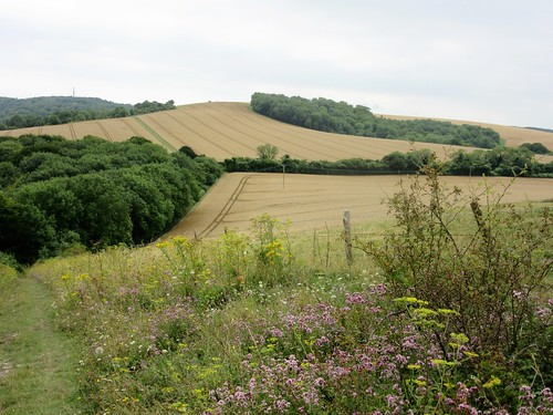
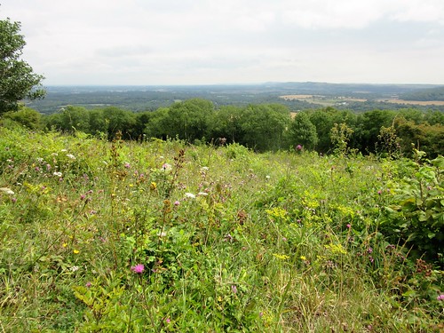
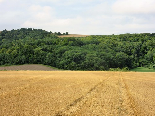
It was Sussex countrymen, generations of them, who coppiced the ash trees by the sunken holloway up the wooded slopes of Barlavington Hanger; and countrymen who ploughed up the sheep pasture across the heights of Barlavington Down for wartime crops. Gold tides of wheat and barley still roll across the downs. Up there we found a sloping haven of old-fashioned flowery sward grown long and ungrazed – field scabious, yellow-wort, eyebright and harebells, yellow rattle and agrimony. Common blue butterflies flickered among the yellow plants, the males all a dusty blue, the females with orange and black scallops to the edge of their wings.
We sat down to admire the view along the downs, perching on a stone inscribed in memory of Sir Ian Anstruther of that Ilk, local squire, writer and splendid gentleman (he drove an Aston Martin DB5, was once stopped by the police for driving too slowly, and always dressed for dinner in velvet slippers with bells on the toes). Then we followed flinty tracks that dipped and rose to Bignor Hill before wriggling away down the holloways to West Burton and the field path to Bignor.
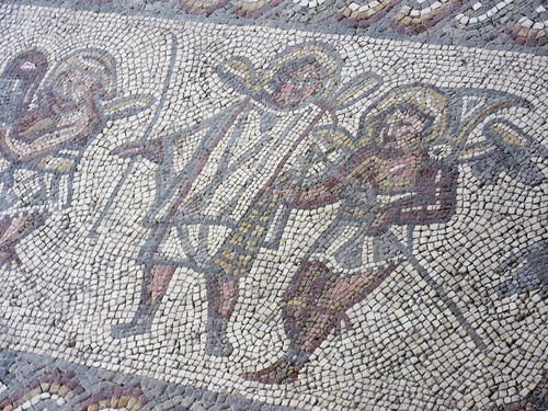
‘When my great-great-great-great grandfather George Tupper struck a large stone whilst ploughing on the 18th of July 1811…’ begins the foreword of the guidebook to Bignor Roman villa. The Tupper family owns the site today, as they did two centuries ago when the villa with its tiles and statues, its lead water pipes and wonderful mosaic floors was unearthed at the clang of George Tupper’s horse plough.
It was the mosaics, so skilfully and sensitively crafted, that caused us to linger in the villa until closing time. Ganymede in the embrace of an eagle, child-like gladiators tumbling and sparring, a bathing beauty naked to the waist – and as a chill corrective to the luxurious life, a cameo of Winter with pinched white cheeks and hollow eyes, clutching a leafless twig. The Romans, too, had intimations of mortality.
Start: White Horse Inn, Sutton, West Sussex RH20 1PS (OS ref SU 979152)
Getting there: Bus 99 (Chichester-Petworth).
Road – Sutton is on minor road between A29 at Bury and A285 near Duncton.
Walk (8½ miles, moderate, OS Explorer 121): Up path beside White Horse car park. At ‘Private’ gate sign, right through adjacent gate. Up steps; right (yellow arrow/YA) past barn and on through garden into field. Half left across field; cross bridleway (976155, fingerpost/FP) and on to cross footbridge (975158). Half right across field, up to cross stile; left up hedge, then green lane to Barlavington Farm. Opposite barn, left (973161, FP) to chapel.
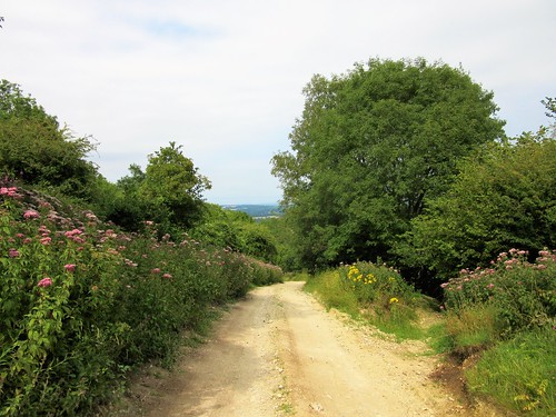
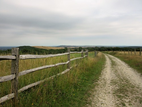
Follow path through churchyard to far corner; left (YA) along lane. In 100m (971161), right up gravel path and on (YA) along green lane to cross road (970162, FP). Up steps, along field edge; cross stile beside gate; on to cross road (968164). Through pedestrian gate, up green lane into woods of Barlavington Hanger (966162). In 400m, at fork of bridleways (963160, 3-finger FP) keep ahead uphill. Path rises, then falls to cross green lane at corner of Northcomb Wood in valley (963152). On south up path across field; on through Access Land. Through gate at south end of Access Land (963144); on in tunnel of trees. In 450m, at T-junction (962140, 3-finger FP), bear right; in 20m, arrow points uphill along chalk track. In ½ mile, pass NT ‘Bignor Hill’ sign (966133) and keep ahead along track for 900m to car park (974129).
Cross road; on up hedged track over Bignor Hill along South Downs Way (SDW). In ⅔ mile pass Toby’s Stone (983132); in another 400m, left (SDW), descending for 400m to T-junction of tracks at 3-finger FP (989132). Left (SDW) to another T-junction with barns to your right; left here; immediately right; then immediately fork left on grassy path through trees. Descend for ⅔ mile to road junction in West Burton (996139). Left (‘West Sussex Literary Trail’/WSLT); path beside stream, then along field edges, following YAs for ¾ mile to road (986144). Right for 100m; left to Bignor Roman Villa (988147).
Back at Roman Villa car park entrance, turn right through tall deer gate (unwaymarked) along path to road in Bignor (984146). Right (WSLT); round left bend; opposite church, left (982146). In 100m, right through gate (WSLT); on across a lawn; on along grassy path, then beside stream to Bignor millpond. At T-junction of paths (981148, FP), right to cross footbridge; cross 3 fields to Sutton.
NB: Detailed directions are recommended. Download them with online maps, more walks at christophersomerville.co.uk.
Lunch/accommodation: White Horse Inn, Sutton (01798-869221, whitehorse-sutton.co.uk) – smart, well-run inn.
Bignor Roman Villa: Open 10-5, March-Oct; 01798-869259, bignorromanvilla.co.uk
Info: Chichester TIC (01243-775888)