First published in: The Times Click here to view a map for this walk in a new window


Facebook Link:

The Earl’s Palace frowns out over the Bay of Birsay, strong, stark and harsh, a fortress reflecting everything that’s known about the man who created it.
Robert Stewart, Earl of Orkney and illegitimate son of King James V of Scotland, was a high-handed and brutal ruler of the Orkney isles. The great stronghold he built with forced labour in the 1570s stands in ruin at the outermost tip of Orkney Mainland, still massively impressive with its jagged gables and tall dark chimneys stacks.
Looking down from the green trackway behind the Earl’s Palace at the jumble of buildings and the crashing sea beyond, I pictured these wretched sprigs of the Stewart family tree. Nasty Earl Robert died in his bed, but his even nastier son Patrick – ‘Black Patie’ by nickname – and rather pathetic grandson Robert both came to bad ends at the hands of the king’s executioner. Those were wild times, and there were few places wilder than the Orkney archipelago, remote in its northern seas.
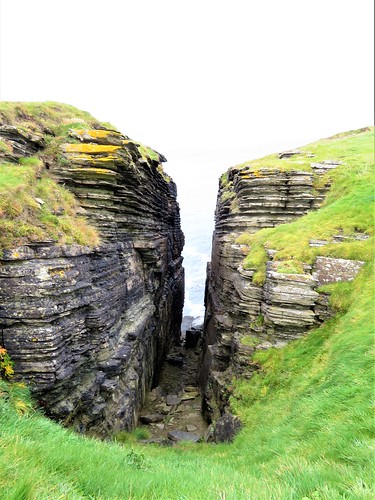
The trackway led up onto dark sandstone cliffs, where the wind whipped the short turf and whirled the fulmars past in stiff-winged flight. I put my head down and trudged north, with the Earl’s Palace looming inland.
Luckily Orkney has known better men than Black Patie and Earl Robert. Past the ruin of their citadel runs a newly opened pilgrimage route, St Magnus Way, a 55-mile trek that celebrates Orkney’s much-loved local saint and miracle worker. It was in Birsay’s ancient kirk that Magnus Erlendsson’s bones resided after his martyrdom 900 years ago. They were soon translated to their final resting place in Kirkwall’s St Magnus Cathedral, terminus of the new pilgrim path.
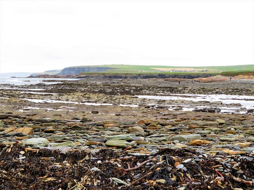
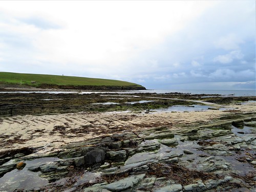
At the outer end of the road from Birsay lies the zigzag causeway to the tidal island of the Brough of Birsay. The sea was just receding from the isthmus as I crossed it, the ebbing water forming tiny sucking maelstroms beside the causeway.
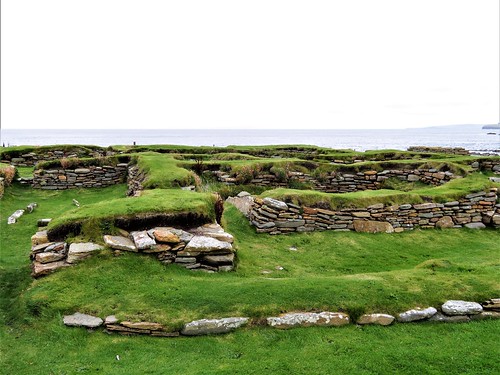
The landward slope of the Brough of Birsay presents a fabulous jumble of stone walls, half-formed windows and house foundations. Pictish settlers were succeeded by Norse ones between 600 and 1200 AD, each wave of islanders building on top of its predecessors’ dwellings. Pictish round houses, Norse long ones and a tiny compact Romanesque church can all be made out.
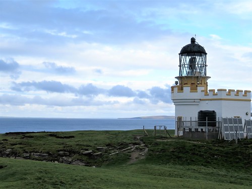
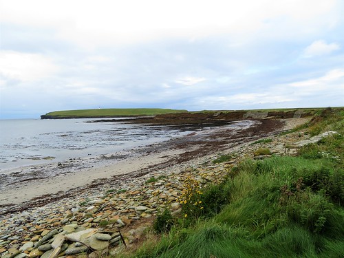
I climbed the back of the island to the little castellated lighthouse, and looked out from the puffin-burrowed summit. Tall cliffs fell sheer into the sea on all sides, and on the northern horizon other islands floated in evening light, as grey and distant as breaching whales.
Start: Earl’s Palace car park, Birsay, Orkney Mainland KW17 2LX (HY248277)
Getting there: Bus 7 (Kirkwall-Birsay).
Road – From Kirkwall, A965 through Finstown; in 1 mile, right on A986 through Dounby; from Twatt, A967, A966 to Birsay.
;)
Walk (4½ miles; easy; OS Explorer 463): From car park, left up road. Cross Burn of Boardhouse; follow road past Birsay Bay Tearoom, then grass track to cemetery and road (248268). Right; in 300m, at left bend, right (245268). Follow St Magnus Way (waymark) north down track to rejoin road (248275). Left, following road to causeway (242284). Cross to Brough of Birsay; walk round island; return across causeway.
Conditions: Causeway is open for 2 hours either side of low tide. Check times – magicseaweed.com
Lunch: Birsay Bay Tearooms (01856-721399; birsaybaytearooms.co.uk) – check for opening times
Accommodation: Ferry Inn, 10 John Street, Stromness KW16 3AD (01856-850280; ferryinn.com; 20 mins drive) – friendly, lively, clean
St Magnus Way: stmagnusway.com
Info: visitorkney.com
visitscotland.com; satmap.com; ramblers.org.uk