First published in: The Times Click here to view a map for this walk in a new window


Facebook Link:

The first swallow of the year came dipping through the arches of Aymestry Bridge, flitting low over the River Lugg. We watched it draw a line through the still air as we sat pulling on our boots and looking forward to a long day’s hike in the Herefordshire hills.
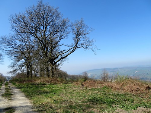
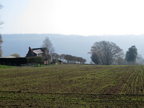
Looking back from the slopes under Beechenbank Wood, we saw the early morning mist lying as thick as bonfire smoke along the Lugg Valley. Overhead the milky blue sky gave promise of beautiful warm weather. The pigeons on the ploughed field near Mental Cottage seemed as lazy as the day, until we came closer and saw that they were decoys. Two fresh-faced lads grinned out of the hedge nearby where they knelt and waited for the real thing, shotguns at the ready.
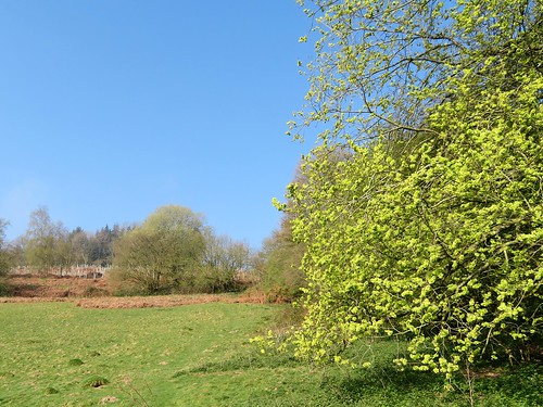
We dipped down to Covenhope Farm by its reservoir lake to pick up the Mortimer Trail long-distance path. It lifted us up and over the long spine of Shobdon Hill among conifers and oak glades. Holly blue butterflies flashed their brilliant blue underwings as they hunted moisture in the boot ruts of the path. A flash of movement drew Jane’s attention to a clearing, where a lesser spotted woodpecker swooped from tree to tree.
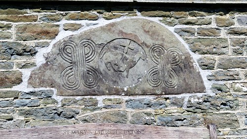
The view was enormous and hazy, out over the hills of the Welsh borders. We skirted the precipitous bank of Byton Common, and came down to St Mary’s Church at Byton. Built in the south wall we found a semi-circular stone, carved almost a thousand years ago, depicting the Lamb of God holding a cross, and interlaced carving either side that remarkably resembled the Woolmark logo.
An orange and a sip of water apiece, and we took the road to Lower Kinsham. A muddy bridleway shadowed the Lugg in its sinuous windings among damp meadows awash with cuckoo flowers. At Lower Yeld a small boy was riding his tricycle in the ford, absorbed by the splash and sparkle of the water. If it hadn’t been for the four miles or so we still had to go, we’d have sat for hours and watched the ford ourselves.
Start: Riverside Inn, Aymestry, Herefordshire HR6 9ST (OS ref SO 425654)
Getting there: Aymestry is on A4110 (Hereford-Leintwardine). Park at Riverside Inn (please ask permission, and please give inn your custom!)
Walk (12¼ miles, long but easy underfoot, OS Explorers 203, 201): From car park, right up A4110. Right up side of Riverside Inn (gate, fingerpost). Up garden slope to gate (yellow arrow/YA). Uphill with hedge on right to gate (423654, YA). Left, and follow YAs through plantation to top of rise; left (422653) along field edge. Below Mental Cottage (421650) cross drive; through gate (YA); right, round field edge to stile (419650, YA).
Cross field to top left corner; ahead to left of shed (417650). Through metal gate; half left to top left corner of field (415649, stile, YA). On along field edge (stile); follow hedge into Church Wood (412647). Fork left down slope to forest track (412646); left for ½ mile to road (413638). Right to Covenhope Farm (408642). Opposite farm, left by barn; fork right up track; in 100m, left along forest track (Mortimer Trail/MT; 406643).
In 350m, track forks left (403645); keep ahead here uphill on grassy track. In 350m track forks right at bench (400647); keep ahead here (left branch) uphill and on across Shobdon Hill. In 1½ miles descend to left bend (380640); right here (MT waymark post). In 200m, left (MT) through kissing gate. Don’t fork right downhill on track, but cross it and keep on path at top of steep slope of Byton Common. In ½ mile at fingerpost (372636, MT), right downhill. At bottom of Park Wood pass cottage on right (372639); right up steps to stile (MT). Cross field to road; right to St Mary’s Church car park and path to church (371642).
Just beyond church car park, right down green lane to road. Right for ¾ mile to cross River Lugg at Lower Kinsham (363646). At left bend, right (east) on path by river for 1¼ miles. Nearing Lower Yeld, track curves away uphill from river; follow it to hedge, and bear right along hedge to gate (378654, blue arrow). Left into lane, right through gate; ahead to ford and road at Lower Yeld.
Bear right; round left bend; follow road for 1 mile to Lye Corner (395658). Right (‘Covenhope’) down lane to Lyepole Bridge (398654). Just before bridge, left (MT) along lower edge of Sned Wood. In ½ mile, round left bend (414661), in another 350m, right over stile (MT); cross field to road (414664, MT). Right for 1 mile to A4110 (426656); right to Riverside Inn.
Conditions: Path along Byton Common is narrow, with steep slope.
Lunch: Picnic
Accommodation: Riverside Inn, Aymestry (01568-708440, riversideaymestry.co.uk)
Info: Leominster TIC (01568-616460)
visitengland.com; satmap.com; ramblers.org.uk