First published in: The Times Click here to view a map for this walk in a new window

Facebook Link:

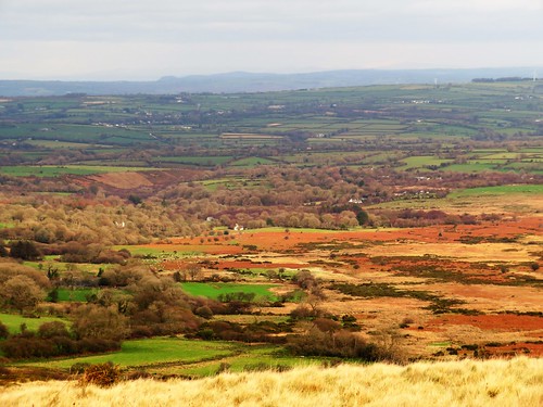
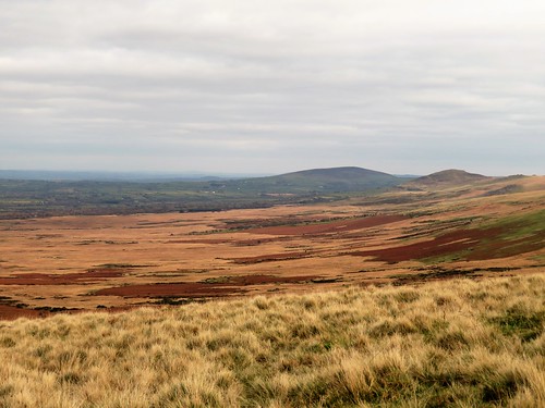
The Preseli Hills march east to west across the heart of West Pembrokeshire, and the Golden Road marches with them – an ancient drove road and highway that hurdles their peaks. Out at the western end of the range the Golden Road climbs gently up the flanks of Foel Eryr, the Eagle’s Peak, and we climbed with it, peat and soakwater squelching underfoot.
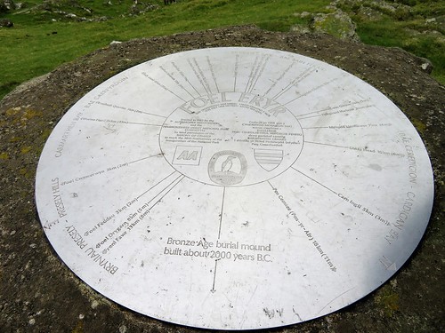
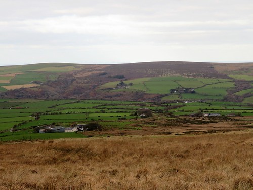
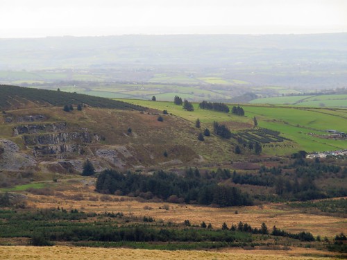
By the summit cairn a topograph specified places in view and their distances, but these cold facts and figures could never catch the splendours of this extraordinary view. Lundy lying like a sleeping sea-dog 50 miles off in the south, with a faint hint of the North Devon coast beyond Exmoor’s long spine; the shadowy shapes of the Cambrian mountains far to the north; west to Skomer and Ramsey islands; and in the east the dragon humps of Worm’s Head promontory.
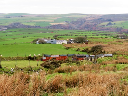
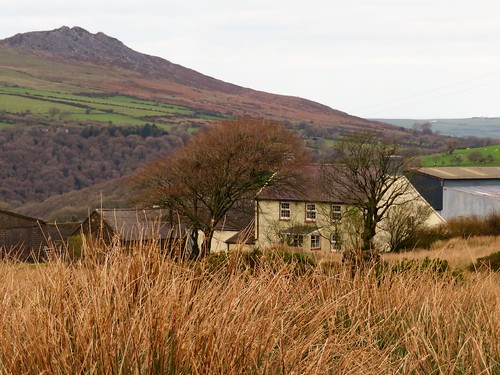
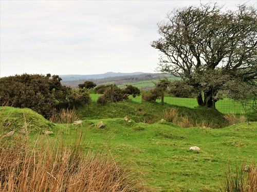
We stood and marvelled, while the mountain ponies of Foel Eryr cropped the grass nearby and nibbled the itches out of one another’s necks. Then it was down over sedgy ground to the lonely farm of Pen-lan-wynt, where wind-bent thorn trees lined the hedges.
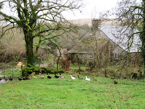
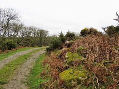
This is the land of small farms and smallholdings – Pentrisil, where the fine rich savour of a freshly opened silage clamp wafted across the lane; the stone cottage of Gernos Fawr in a watery dell full of runner ducks; the hillside farm of Gernos Fach, where a young sheepdog leaped gymnastically between the high bars of a gate to fawn on us and lick our hands in welcome.
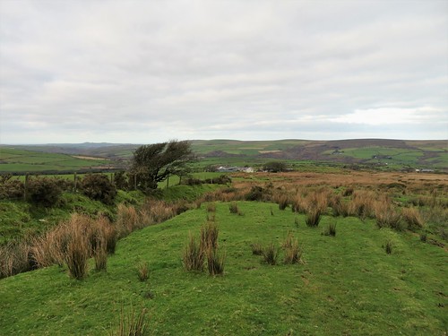
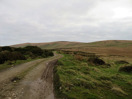
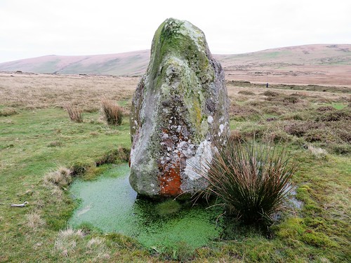
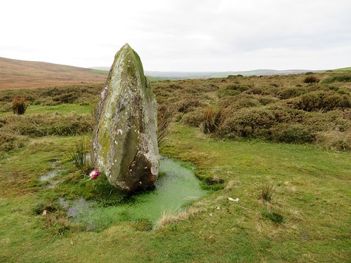
Beyond the farm a moorland track led away, the cold cloudy sky reflected in its peaty pools. A little way off the track, standing stones stood in the heather – a hip-high pair sloping close together, and a short distance away a fine solo stone of man height, crusted with lichens, upright in a little circular moat of water. A posy of wild flowers had been laid at its foot.
We crossed the road and climbed a boggy old path that snaked up the wet hillside of Rhwngyddwyffordd. Ponies with tangled manes moved reluctantly off the track as we followed it to the saddle. Here we turned for a final stare over bog and hillside, coasts, islands and distant mountains, before a last homeward stretch along the miry ridgeway of the Golden Road.
Start: Bwlch-gwynt car park, near Tafarn-y-Bwlch, Pembrokeshire SA66 7RB approx. (OS ref SN 075322)
Getting there: Bwlch-gwynt car park is on B4329 (Cardigan-Haverfordwest), between Tafarn-y-bwlch and Tufton
Walk (6½ miles, moderate, OS Explorer OL35): Cross B4329; path to Foel Eryr summit (066321). Keep same line descending. At fingerpost with arrow (061321), right on path. In 300m at another fingerpost with arrow (061324) fork left, soon bearing downhill to wall. Right to 4-finger post (060327); follow wall to Pen-lan-wynt farm (058330). Follow blue arrows/BA to track (057333), then road (055337). Right; 250m beyond Pentrisil, right (062342, ‘Tafarn Bwlch, Pembrokeshire Trail’). Follow track past Gernos-Fawr (069341, BAs); up green lane to gate (069344); right (bridleway fingerpost) to Gernos Fach (075343). Right (fingerpost) on track to B4329 (084337). Right; in 350m, fork left (082333, BA) up hill track for ¾ mile to fence at Bwlch Pennant (085321). Don’t go through gate; turn right along fence to car park.
Conditions: Very wet and boggy in parts
Lunch: Tafarn Sinc, Rosebush SA66 7QU (01437-532214, tafarnsinc.co.uk) – 3 miles
Accommodation: The Harp Inn, Letterston SA62 5UA (01348-840061, theharpatletterston.co.uk)
Info: Fishguard TIC (01437-776636), visitwales.com; satmap.com; ramblers.org.uk