First published in: The Times Click here to view a map for this walk in a new window

Facebook Link: 
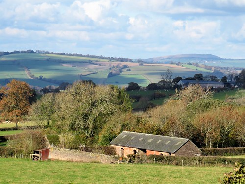
Abdon’s little red church of St Margaret stands within the bank of a circular graveyard, the sign of a very old, probably pre-Christian site. People have been working and living for many millennia here in remote rural Shropshire below the Clee Hills – and on top of them too, in the steeply ramparted hill forts that crown their basalt peaks.
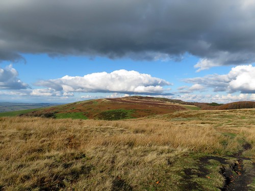
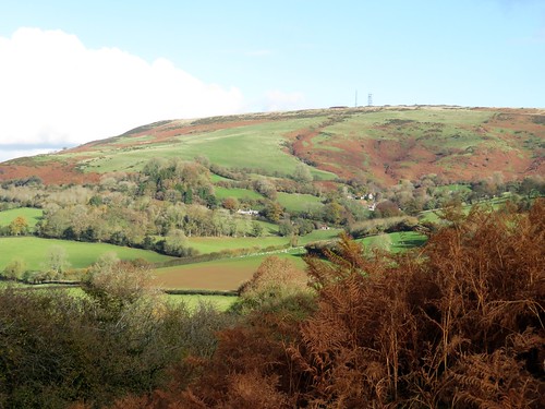
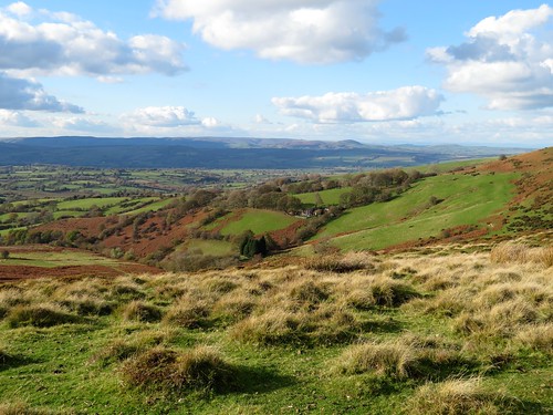
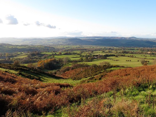
Looming at the back of Abdon is Brown Clee, at 1,770ft the highest peak in Shropshire, a great weighty whaleback of green, purple and red that rises in the east to blot out half the sky. On this bright winter morning big clouds came bustling across from the sunlit uplands of Wenlock Edge out to the west.
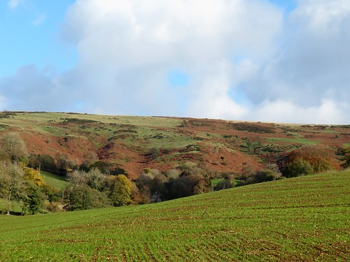
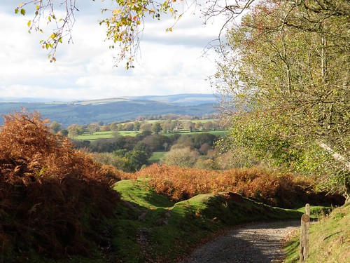
A field path led us from the straggling houses of Abdon down to Cockshutford where the cocks and dogs combined to give us a loud welcome. Clee Liberty Common beyond lay pitted with the hillocks and holes of former coal pits and quarries. Above stood the neat oval ramparts of Nordy Bank, rare among hill enclosures hereabouts in having been left undamaged by the quarrymen.
Twisted old silver birches flanked the sunken track that meandered up across the common to the radio mast at Clee Burf. From this great ringfort we had a fine view south to the stepped profile of much-quarried Titterstone Clee.
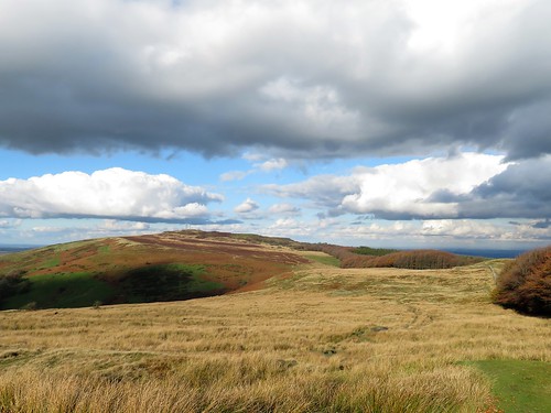
We sat in a rushy hollow out of the wind, eating tangerines and listening to the sigh and rustle of a beech hedge. Then we headed north on the Shropshire Way along the spine of Brown Clee, passing the poppy-strewn memorial to flyers, both Allied and German, killed nearby in plane crashes during the Second World War. Weather and conditions can be treacherous up here, and the Clee Hills claimed the lives of more flyers than any other hill range in these islands.
Up at the topograph on Brown Clee’s summit rampart we stood and marvelled at an incomparable prospect, 300 miles all round the circle of the horizon from Cader Idris and the Berwyns to the west and Brecon Beacons to the south, to the Peak District hills in the north-east and Birmingham’s towers in the east. The Wrekin, the Malverns, Cannock Chase and Wenlock Edge. All drenched in sun under a china blue sky, a once-in-a-lifetime view on such a winter’s day.
Start: Abdon Village Hall, Abdon, Craven Arms, Shropshire SY7 9HZ (OS 576868)
Getting there: B4368 (Craven Arms – Much Wenlock); at Beambridge, turn off for Tugford; from here, follow signs to Abdon.
Walk (7½ miles, moderate hill walk, OS Explorer 217) From village hall car park, left down road past church (575866). Left at junction (574863); in 600m, opposite last buildings on right, turn left off right bend (577862), and fork right along level track between hedges (yellow arrow/YA, blank fingerpost). Follow YAs through fields south for ¾ mile to cross lane at Cockshutford (579851).
Up steps opposite, through kissing gate; right (YA) with hedge on right for ½ mile (stiles, gates) to stile into green lane (573852, YA). Left to road, left past Clee Liberty Common notice on right. In another 150m, right through gate at another notice (573850); up gravelly track past Nordy Bank hillfort (577848) for 1½ miles to Clee Burf radio mast 593843).
Left along Shropshire Way/SW with wall on right. In Five Springs Hollow go through right-hand gate (596864, ‘SW main route’) and on past flyers’ memorial (596855). In ¾ mile, with gate on left, bear right (591863) to topograph on Abdon Burf (594866).
Back to go through gate (blue arrow); follow grassy trackway downhill; in 150m it turns right and descends for ½ mile to road (586869). Right to junction; left (‘Abdon Village Hall’). In 100m, left on bridleway (584870, fingerpost). Follow it across fields with hedge on left. In 400m pass Marsh Farm on your right; in another 200m, right to cross stile (578867). Up fence to stile into road beside car park.
Lunch: Tallyho Inn, Bouldon SY7 9DP (01584-841811, thetallyho.co.uk) – 3 miles.
Accommodation: The Crown, Munslow SY7 9ET (01584-841205, crowncountryinn.co.uk) – 5 miles.
Info: Ludlow TIC (01584-875053); shropshiretourism.co.uk; ramblers.org.uk; satmap.com