First published in: The Times Click here to view a map for this walk in a new window


Facebook Link:

The wind blew, great gusts of cold fresh air from the southwest across the coasts and cliffs of County Derry. The map said ‘Windy Hill’, so that seemed fair enough.
;)
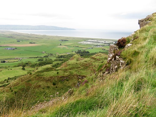
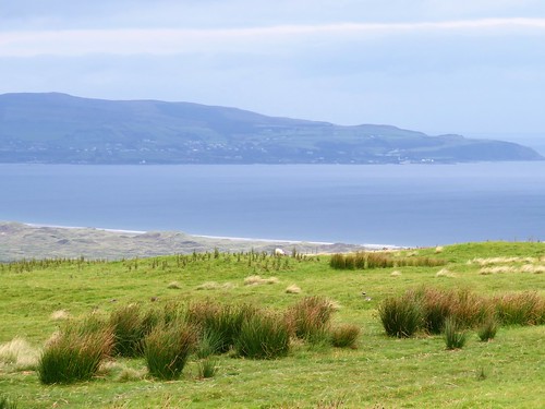
We stood at the brow of the hill looking over Lough Foyle to the cloudy peaks of County Donegal in the Irish Republic. Behind us a romantic statue depicted a handsome chieftain, or maybe a druid, standing in a boat. Arms upraised, he was casting gold into the ocean to placate the sea god Manannan MacLir. That was fair enough, too. In 1896, in the townland of Broighter just round the bend of the cliffs, two ploughmen had unearthed Ireland’s greatest ever hoard of ancient gold, including a beautiful little boat complete with tiny, delicate oars.
Today the sea god had roughened Lough Foyle and scored the sea with lines of wavelets. He’d also hidden from sight the distant Paps of Jura, sixty miles away in Scotland but sometimes glimpsed across the northern sea from this high viewpoint.
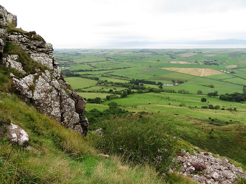
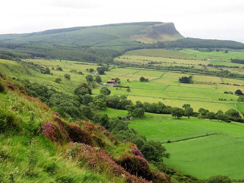
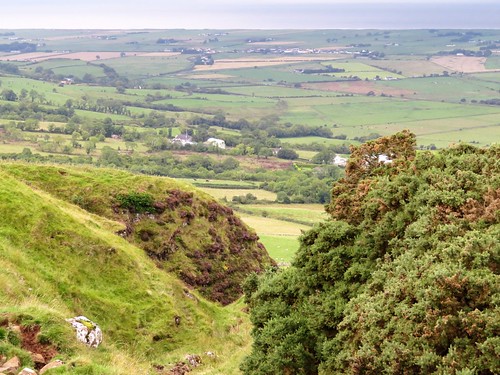
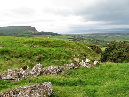
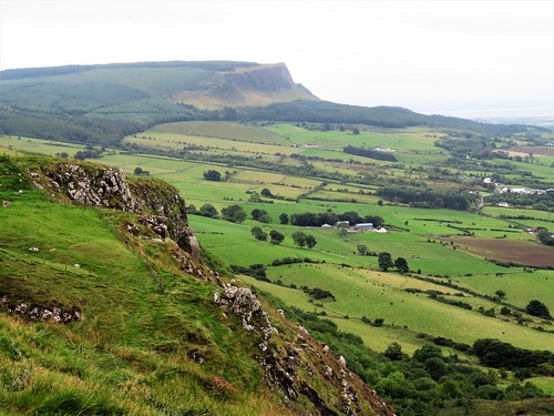
We set off south along the mountain road. Ahead rose the dark face of Binevenagh, its basalt cliff falling into the arms of rock pinnacles, then a gentle tree-smothered slope shelving to the plain below.
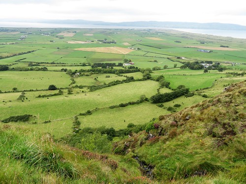
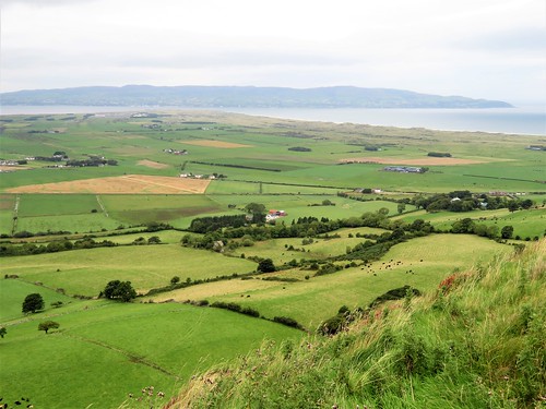
Enormous flows of lava formed the famous cliffs of the Antrim coast further east, but these western Derry outposts are just as dramatic. They stand breathtakingly rugged and steep over the great flat littoral of the tomahawk-shaped Magilligan Peninsula that shapes the eastern shore of Lough Foyle.
We left the road to reach the rim of the steep jagged cleft called Hell’s Hole, then set back north along the edge of the escarpment. The green and brown quilt of the Magilligan cattle pastures stretched away below to a coast of ancient sand dunes and a seven-mile strand, curving off to where a ferry ploughed a furrow between Magilligan Point and the little harbour town of Greencastle opposite on the Donegal shore.
Tiny frogs scrambled among the moor grasses, horned ewes bounced off like affronted dowagers, and a meadow pipit preened its striped breast, quite unafraid, on a fence post ten feet away.
As we gazed and stumbled, our eyes on the view rather than the rough ground we were walking, a big bird came sailing overhead on long dark wings – a marsh harrier, lordly enough to suit the prospect, turning and circling against the grey clouds until entirely lost to sight.
Start: Gortmore Viewpoint car park, Bishop’s Road, near Downhill, Co. Derry BT49 0LQ (OS ref C716342)
Getting there: Bishop’s Road is reached from B201 (Coleraine – Limavady), or A2 at Downhill.
Walk (5 miles, mountain road and rough field paths, OSNI Discoverer map 4; map/instructions downloadable at walkni.com): From car park, south along Bishop’s Road for 1 mile. At stone bridge, right (712327; stile, arrow) down fence. At bottom of field, right along fence, and follow escarpment edge north for 1 mile (stiles) to pass car park, then on for another 1½ miles along escarpment edge (stiles) beside fence, then stone wall. Above a waterfall (732356, ‘Umbra Bridge’ marked on map), stone wall curves inland; follow it with stream on left uphill for ⅓ mile, passing farm buildings, to ladder stile onto Bishop’s Road (731350, ‘North Sperrins Trail’). Right along road to car park.
Lunch: Anglers Rest, 660 Seacoast Rd, Benone BT49 0LG (028-7775-0600)
Accommodation: Hegarty’s Corner, 33 Glebe Road, Castlerock BT51 4SW (028-7084-9617, hegartyscorner.com)
Info: Two walks (Gortmore to Hell’s Hole, Avish to Eagle Hill) downloadable at walkni.com.
discovernorthernireland.com; satmap.com; ramblers.org.uk
Ships of Heaven – The Private Life of Britain’s Cathedrals by Christopher Somerville (Transworld) is published on 11 April