First published in: The Times Click here to view a map for this walk in a new window


Facebook Link:

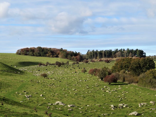
The sun had broken through at last, rolling away a cold blanket of mist to reveal the Wiltshire Downs and their subtle undulations. We stepped out under a blue sky, hearing horse hooves pounding along an unseen gallop in the hollow where Manton Stables lay hidden.
;)
This wide open downland is horse and cattle country, the gallops tending to stretch along the tops, the cattle grazing the dry valleys below. A very fine Charolais bull, contentedly recumbent, kept a lazy eye on us as we passed on our way to the Devil’s Den.
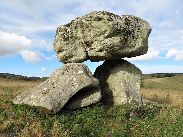
Neolithic men raised the huge stones that form the structure of this passage grave. After the end of the last glaciation, these sarsens – ‘saracens’ or foreign stones – lay scattered all across the downs, easy pickings for the builders of Stonehenge and other ancient monuments.
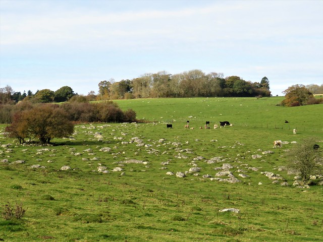
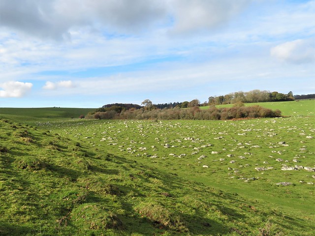
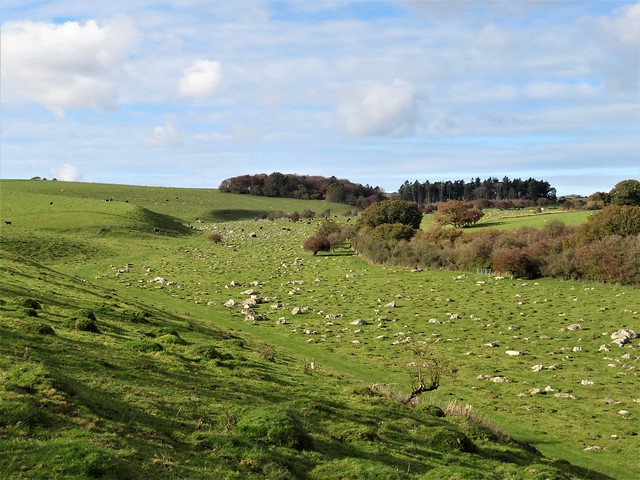
We followed a wide path west through a shallow valley where a great congregation of lichen-stained sarsens delineated the curve of the hollow. Local people, seeing their resemblance to an enormous flock of sheep in bedraggled fleeces, named these clustered stones the Grey Wethers. Cows moved slowly among them, and a handsome ginger-and-white Simmental bull licked one ruminatively for the minerals it contained.
Sarsen stone is composed of sandstone bound together with a glassy silica. In his book ‘The Stonemason,’ Andrew Ziminsky calls it ‘diamond-hard, tougher even than granite.’ Nonetheless, three centuries ago in his ‘Palaeographia Britannica,’ antiquarian William Stukeley warned masons not to build with sarsen; ‘It is always moist and dewy, and rots the furniture.’
We shadowed the river of stones up the valley, then took to the ancient downland tracks that are the pride and joy of Wiltshire’s walkers. The Herepath (a Saxon word for ‘warpath’) led to the Ridgeway, a high road of braided ruts with a stunning view westward over many miles of downs and wooded valleys gilded by the afternoon sun.
Sarsens lay alongside the Ridgeway, and sarsens bounded the White Horse Trail, another venerable downland track that led us homeward between leafless hedges. A yellowhammer perched high on a bush, its breast sulphurous in the sunlight, and fieldfares flew over with vigorous wing thrusts, flocking together for protection and company in obedience to an age-old winter instinct.
How hard is it? 7½ miles; easy; downland paths and tracks
Please only walk within your Tier area, or enjoy this as an armchair walk till restrictions lift. And please consider others when you park.
gov.uk/government/publications/the-countryside-code
Start: Gravel Hill car park, Downs Lane, near Fyfield, Wilts SN8 1PL (OS ref SU 159700)
Getting there: Follow ‘Manton House & Hollow’ on A4 (Calne-Marlborough) between Fyfield and Manton. Car park 1 mile on left.
Walk (OS Explorer 157): Follow gravelled trackway west. In 700m left through gate (153703); on through field, with fence on left. In 500m, left (149701) down slope beside fence; left through gate (150698) to Devil’s Den stones (152697). Return to gate; on along grass track through Grey Wethers valley. In 1 mile path curves right to metal gate (137706). On with fence on right to corner of Wroughton Copse (138711); left down slope; left along Wessex Ridgeway/Herepath (133710). In 300m cross gallop (130709); bear right for 550m to stile onto Ridgeway National Trail (127714). Right for 1 mile; right onto White Horse Trail/WHT (125729). In ⅔ mile fork right at copse (132723), cross track and on (WHT). Through wood (135720), then grassy track (WHT). In 600m, left on Wessex Ridgeway/Herepath (143714); in 100m right (‘Byway’) to car park.
Info: uksouthwest.net/wiltshire/fyfield-down; satmap.com; ramblers.org.uk
The Stonemason by Andrew Ziminski (John Murray)