First published in: The Times Click here to view a map for this walk in a new window

Facebook Link:

It’s an ironstone landscape here on the borders of Northamptonshire and Warwickshire, and the many handsome villages are the beneficiaries in terms of the beauty of their building stone.
;)
On a glorious day of blue sky, with everything near and far standing out as clear as glass, the houses of Upper Boddington glowed the colour of dark honey. Rusty-looking streaks in their walls showed where nodes of iron lay embedded in the stone.
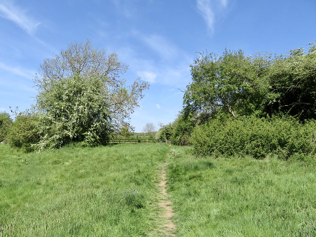
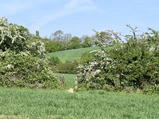
On the outskirts of the village we crossed a brook among milky blue bells of comfrey and a froth of cow parsley newly opened. Buttercups made golden drifts in the meadows by the stream. The path led us north across fields of young wheat, the pale crumbly soil free of stones and already cracked and drying under the sun.
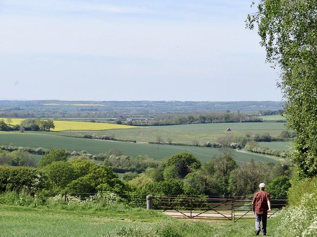
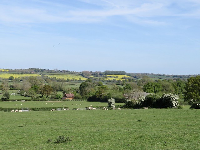
Ahead the land heaved up into the long wooded billow of a ridge. From the top we had a wonderful view west over a great green disc of Warwickshire lowlands.
Lumps and hollows in the slope at our feet betrayed the site of the medieval village of Stoneton, abandoned in early Tudor times when its arable land was converted to more profitable sheep grazing. And the sheep are still here. Ewes called for their lambs, who were playing ‘I’m-the-king-of-the-castle’ on a hollow tree stump with maximum glee.
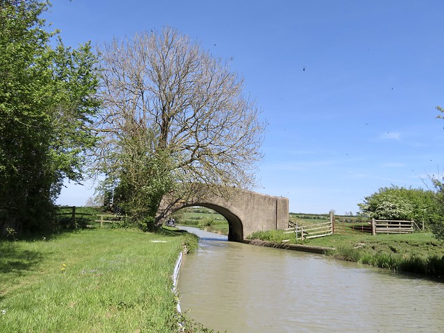
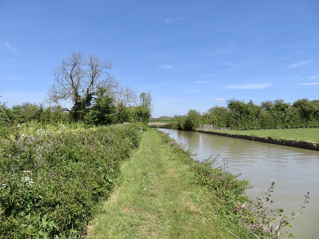
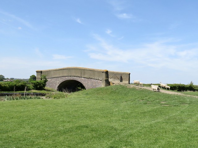
We made our way down past the rushy moat of Stoneton Manor, across the sheep pastures to the grassy towpath of the Oxford Canal. Walking north along its sharp curves, it was hard to believe that this clay-coloured waterway meandering inconsequentially across the plain could once have been the main communications link between London and the Midlands.
A bare-chested man in a kayak came past in a flash and splash of paddle blades. Narrow-boats cruised by, roof-boxes fragrant with basil, thyme, and rosemary, their freshwater admirals raising cans of beer in cheery salute.
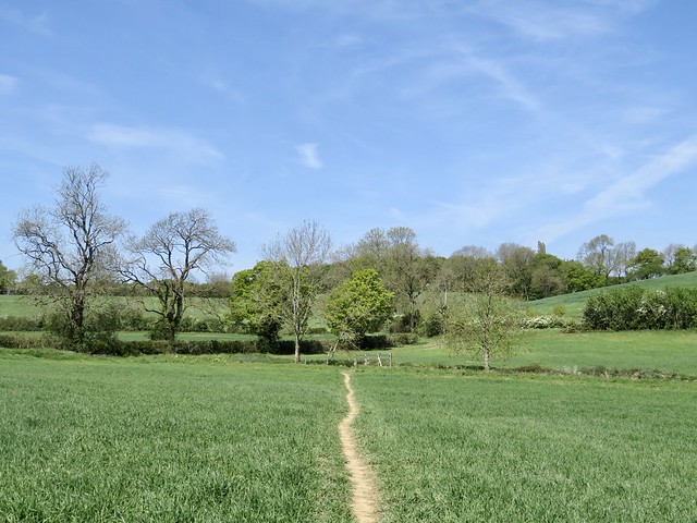
From Priors Hardwick, a picture of perfection in sun-kissed ironstone and immaculate gardens, the homeward path ran above sheep pastures whose medieval ridge-and-furrow showed the patterns of vanished agriculture. Dandelions dotted the fields, their miniature yellow suns all gone into the globular seed heads that children blow to tell the time.
As I leaned on a gate to stare, a fine red fox came across the path twenty feet ahead, low-slung and intent. It stopped dead still, held me at gaze for a few seconds, and then turned tail and raced away to safety in the hedge.
Start: Plough Inn, Upper Boddington, Daventry, Northants NN11 6DH (OS ref SP 483534)
Getting there:
Upper Boddington is signed from Westhorp on A361 (Banbury-Daventry)
Walk (8 miles, easy, OS Explorer 206):
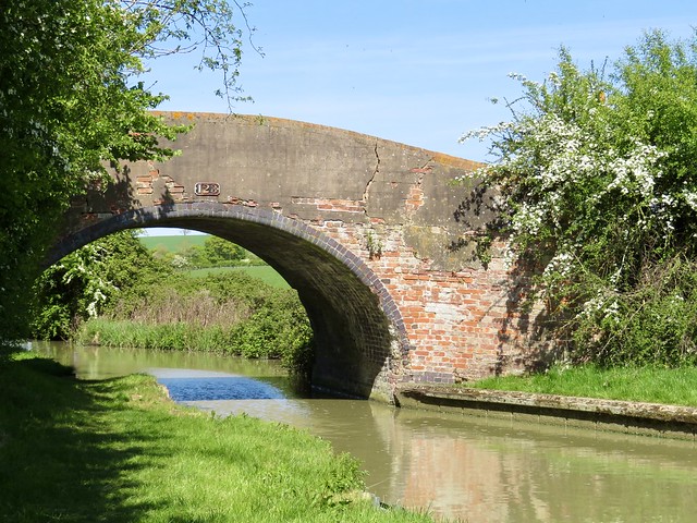
From Plough Inn, left along road; right up Frog Lane. Fork right by Hillside View; follow Millennium Way/MW waymarks north-west for 1 mile. From woodland strip (470547) dogleg right/left to Berryhill Farm; left along drive to road (464545). Right; in 600m, sharp left (466550) across field to drive (463547); in 100m, right to cross canal (458551). Right on towpath; in 1½ miles at Bridge 123 (461568), right (SE) across fields for ¾ mile to road in Priors Hardwick (472563). Right past church and Butchers Arms; right at road; in 150m, left off bend (470559, ‘Hill House’). Immediately left (yellow arrow/YA) across fields (occasional YAs and black arrows), heading SSE for 1¾ miles back to Upper Boddington.
Lunch: Plough Inn, Upper Boddington (01327-260364, ploughinnboddington.co.uk) – a very friendly village inn
Info: Banbury TIC (01295-236165)
satmap.com; ramblers.org.uk
More walks info: @somerville_c