First published in: The Times Click here to view a map for this walk in a new window


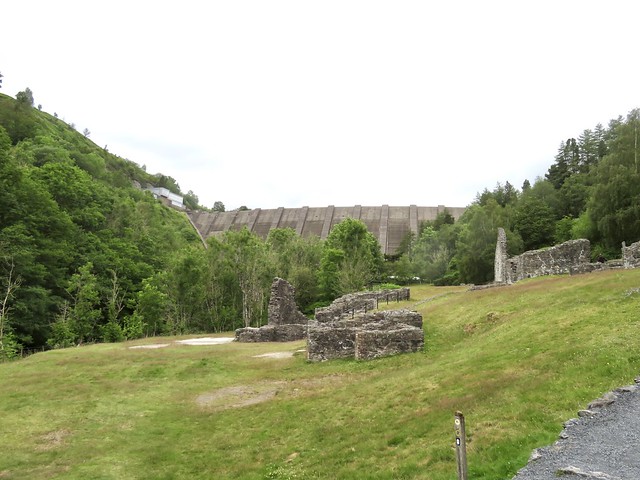

Forty years had passed since last I looked on Llyn Clywedog’s great dam wall. My father had figured in the sketch I made in my notebook that day, a slim 60-year-old in a checked shirt and walking boots, contemplating the enormous concrete structure that seemed to bulge outward as it towered above him.
;)
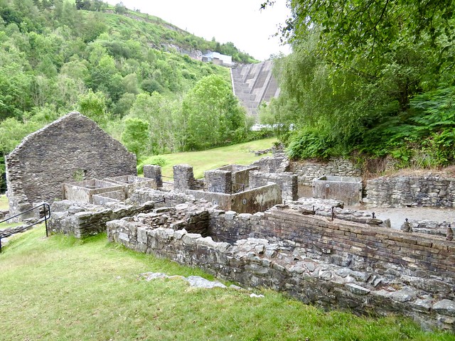
Nothing much had changed since then, though the dam, like me, had got older and greyer. Seen from the close-grouped ruins of Brintail lead mine at the foot, I could see the ominous bulge was an optical illusion that made the buttressing ribs appear to converge nearly 300 feet overhead. Just as well, since this massive barrier is all that prevents 11,000 million gallons of water roaring down to Llanidloes and the River Severn.
I wandered round the shattered old structures of the lead mine – ore processing mills, crushing houses, square tanks and a deep stone-lined slot where a waterwheel once revolved. By the time the Brintail mine closed in 1884 the miners had worked four seams, each one deeper than the last – sweaty, hard and dangerous labour.
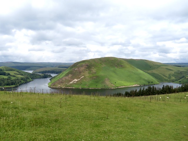
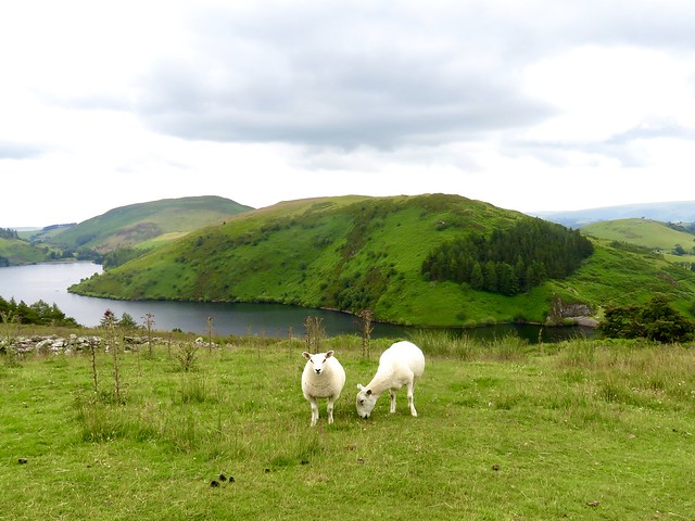
Up the winding road at the dam viewing wall a couple of hundred school children craned over and exclaimed. It was a splendid view, for sure, the dark water snaking between tall green hills and the arc of the dam curved below.
Glyndŵr’s Way led up a hillside of bracken to where a signpost to the Scenic Trail caught my eye. ‘So there you are,’ said a man with a lurcher. ‘You can get along here easy, and it’s a nice view across the water to enjoy. Well, I never tire of it, anyway.’
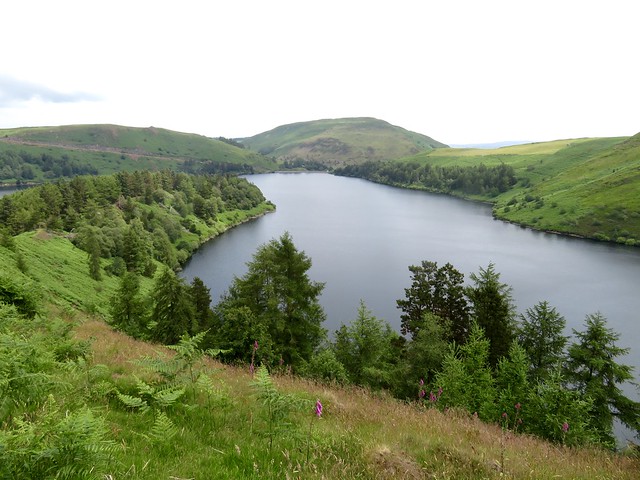
I followed the path along a hillside, then through a crest of tattered larches and along the narrow nape of a wooded promontory, its brackeny flanks falling sharply to the lake on either side. Out at the point the water lapped in shallow wavelets on a tiny beach of fine grey shingle that looked across to a crumpled spine of hills.
The return path ran along the north shore of the promontory through larch groves where the trunks were sheathed in moss and crusty grey lichens, with globules of sap glinting among their roots. A paddleboarder came by, absorbed in conversation with his partner and dog in a kayak alongside. I let them drift ahead, content to hear their splashes and banter fade slowly out to silence.
How hard is it? 5 miles; easy; hill and lakeside paths
Start: Brintail Mine car park, Llyn Clywedog, Llanidloes SY18 6NU (OS ref SN 914867)
Getting there: Llyn Clywedog and Brintail Mine are signed off B4818 near Llanidloes (A470, Newton-Llangurig)
Walk (OS Explorer 199): From Brintail Mine car park, follow Glyndŵr’s Way/GW downhill, cross river to Brintail Mine (914869). Return to car park; up road, and follow GW for ⅔ mile up zigzag road to café and viewing wall (911869). In another 300m GW forks right on left bend (909871); follow it uphill to cattle grid (907871). Right (kissing gate/KG, ‘Scenic Trail Alternative Start Point’), following hill path. At end of larch grove on crest, left downhill (909876); path along promontory spine to far point (916882). Return along north shore. In ⅔ mile at fingerpost and kissing gate fork right (907878, ‘Long Trail’) along lake shore. In 600m turn left up steps (901875, GW). Follow GW up bank to road at Ty Capel (904872). Left to cattle grid (907871); retrace GW route to car park.
Lunch/Accommodation: Unicorn Hotel, Long Bridge Street, Llanidloes SY18 6EE
(01686-411188, unicornllanidloes.co.uk)
Info: llanidloes.com, visitwales.com
@somerville_c