First published in: The Times Click here to view a map for this walk in a new window

Facebook Link:
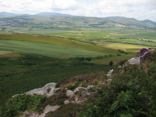
A fantastically blowy morning in Northumberland, with a light milky fret over the vale of the River Till. Across the sunlit farmlands the Cheviot Hills stood up proud on the southern skyline, rounded and bosomy, fold behind fold, an eye-catching patchwork of green and orange. Climbing the country lane from Doddington up to the moors, I kept turning round for another stare.
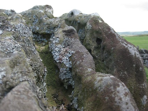
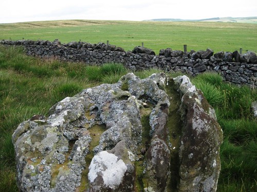
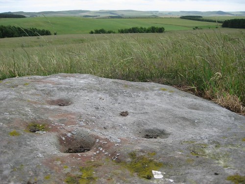
A noble view; perhaps that was why our distant ancestors chose Doddington Moor as the site for so many of their stoneworks. Practical ones such as field enclosures and settlements, ritual creations in the form of stone circles, and most notably a scatter of mysterious cup-and-ring markings, rounded depressions the size of a tea-cup surrounded by a doughnut ring, gouged in the surface of flat rocks. Northumberland is rich in cup-and-ring sites; and Doddington Moor is one of the best places to find them.
I followed a hill track past Wooler Golf Club, and on past a congregation of droopy-horned bullocks who jostled up to stand and stare like rude young men in a pub. The path led me around a vast field of oats that sung and hissed in the wind, and then by map, compass and the pricking of my thumbs to stumble suddenly on a fine cup-and-ring marked rock, a sandstone slab dimpled with man-made hollows that looked east towards the coastal hills. Was it sited here to face the rising sun? There’s no telling now; but the slab still holds its power and presence.
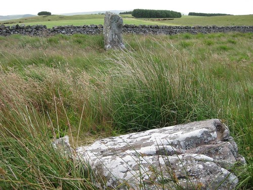
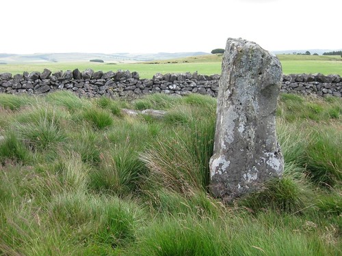
Harebells trembled in the wind, which fought me like a foe past the tattered, seething firs of Kitty’s Plantation. ‘Stone Circle (rems. of)’ said the map, and here it was: a big rough king-stone the size of a man, crusted with lichens and deeply grooved by rain and weather, lording it over a circle of recumbent stones. Once again, no why or wherefore; once more an unqualifiable potency in this high bleak place.
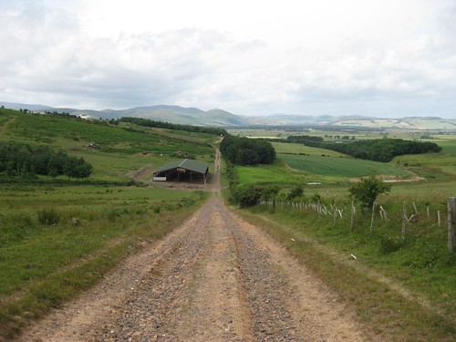
I followed an escarpment path, smacked and elbowed by great blasts of wind. Before descending into Doddington village once more, I sheltered by lonely Shepherds Cottage on the brink of the moor and tasted that mighty Cheviot prospect to the full. Whoever lives here is monarch of what must be one of the finest views anywhere in Britain.
Start & finish: Parking place on B6525 in Doddington, Northumberland (OS ref: NT 999324).
Getting there: Bus Service 464 (Wooler – Berwick-on-Tweed) – www.glenvalley.co.uk
Road: A697 to Wooler; B6526 to Doddington. Parking for 3 cars just beyond foot of lane marked ‘Wooler Golf Club’.
Walk: (4 miles, moderate, OS Explorer 340): Climb lane. At ‘Welcome to Wooler Golf Club’ notice, ahead along dirt road for 3/4 mile. Left through gate (NU 016334; ‘Weetwoodhill’); path south to crossing of fences (015327). Through gate; left over stile; left through gate; aim for right corner of plantation to find cup-and-ring stones in 250 yards, beyond lip of slope (018327). Return to cross stile; left past Kitty’s Plantation (013322) and stone circle (013317) to reach gate (012313). Don’t go through; right by fence for 350 yards. By gate (009313), bear right uphill on track. Left along escarpment to fence. Descend to cross stile; path to Shepherd’s House (005316). Don’t follow track behind house; keep ahead on path along escarpment, soon aiming for large farm below. Cross stile (001320); yellow arrows downhill to lane. Left into Doddington.
NB: Last section from 012313 (gate beyond stone circle) is through thick bracken. This walk is for confident walkers with map, compass, GPS.
Online maps, more walks: www.christophersomerville.co.uk
Lunch: Picnic
More info: Wooler TIC, The Cheviot Centre, 12 Padgepool Place (01668-282123); www.visitnorthumberland.com
www.ramblers.org.uk; www.satmap.com.