First published in: The Times Click here to view a map for this walk in a new window


Facebook Link:
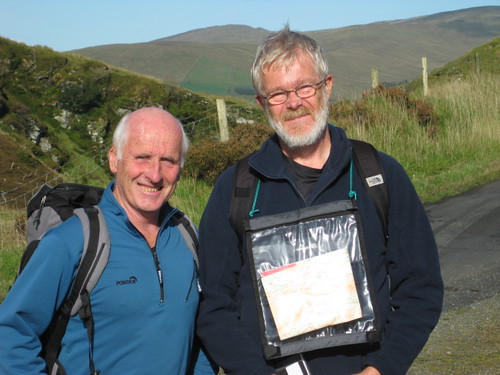
Martin McGuigan is exactly the man you want with you in the Sperrins Hills of Northern Ireland. This wild range of fells, straddling the waist of County Tyrone, is his native ground.
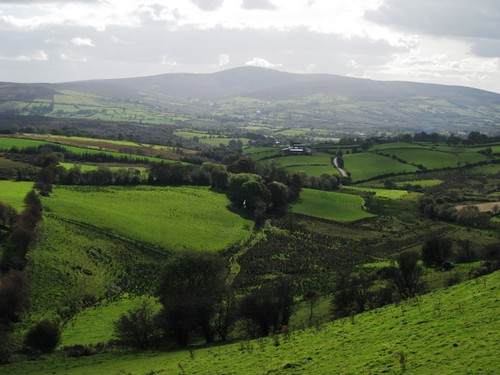
‘We’d never have had this view if it wasn’t for the Ice Age,’ said Martin, pointing out the landscape features of the Sperrins from the heights of the narrow Barnes Gap. ‘The glaciers scraped and shaped all the hills you can see; and then when they were melting they formed a huge lake, and when that overflowed it just burst through a weak spot in the rock and formed the Gap itself.’
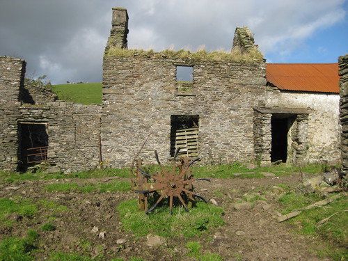
A landscape with dynamic origins, and an exceptionally beautiful one. An old stony road, part of the new Vinegar Hill Loop walk that we were following, winds like a scarf around the upper shoulders of Gorticashel glen. We looked down into a silent bowl of fields. Abandoned farmsteads lay dotted across the slopes, each rusted roof of corrugated iron an orange blob among tattered shelter trees – eloquent testimony to the hardships faced by small country farms these days.
On Vinegar Hill stood a tumbledown cottage, its rafters half smothered with fuchsia and Himalayan balsam, its fireplace choked with tendrils of ivy that were feeling their way blindly, like pale tentacles, out into the room among the wrecks of chairs and dresser. Martin fingered the balsam, ruminating. ‘These flowers were a big thing in my childhood. The bees would go crazy for them, and we’d see how many we could catch in a jam jar before we got stung!’
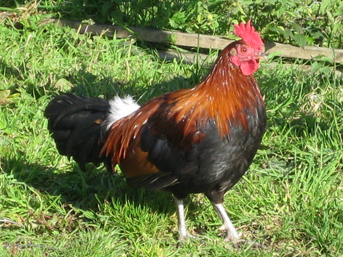
Down where the Gorticashel Burn ran under a bridge, a ferny old mill house stood hard against the bank, with an ancient potato-digging machine on its mossy cobbles. Sparrows went flocking through a cotoneaster bush on a farmhouse wall. At Scotch Town we found the crossroads guarded by a handsome rooster in a tippet of gleaming ginger feathers. Near Garvagh, as we turned for our homeward step, a great roadside shed stood provisioned for the winter with dried sods of turf.
This whole glen speaks eloquently of the life and work of family farms, present and past. Now, with the opening of the Vinegar Hill Loop, cheerful voices will be heard around the abandoned steadings and boots will tread the forgotten green roads of Gorticashel once more.
Start & finish: Barnes Gap car park/toilet/picnic area at foot of Mullaghbane Road (OSNI ref. H 551905)
Getting there: From B74 between Plumbridge and Draperstown, follow brown ‘Barnes Gap’ tourist signs to car park at foot of Mullaghbane Road by ‘Plumbridge 5’ sign.
Walk (7 miles, moderate, OS of Northern Ireland 1:50,000 Discoverer 13; www.walkni.com; purple arrow waymarks): Walk up the higher of the 2 Barnes Gap roads (‘Craignamaddy Circuit/CC, Ulster Way’ sign) past farm (barking dogs!). Right along Magherbrack Road for 1/3mile; left (552896; CC) along dirt road. Follow it round Gorticashel Glen for 2 miles to road near Irish Town (558873). Right for 2/3mile to crossroads in Scotch Town (548875; ‘Gortin’ left, ‘Plumbridge’ right). Straight across here and over next 2 crossroads (544875 and 538880) for 1 mile, to pass turning on left (536883 – tarmac stops here). Ahead for 300 yards; at stand of conifers, right (534885; ‘Vinegar Hill Loop’) on stony lane. Follow it for 1 1/3miles to road (550892). Forward to Barnes Gap road; left to car park.
NB – Online map, more walks: www.christophersomerville.co.uk
Lunch: Picnic
Walk On The Wild Side: walks with Martin McGuigan (024-8075-8452 or 07714-835-977; www.walkwithmarty.com)
More info: Tourist Information Centre, Strule Arts Centre, Omagh (024-8224-7831); www.discovernorthernireland.com