First published in: The Times Click here to view a map for this walk in a new window
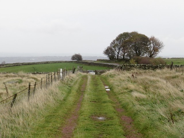

After a day of torrential rain, a cold blowy morning had broken over the Dark Peak. Grey clouds rolled east like cannon smoke, and there was a muted light over the moors of the South Yorkshire/Derbyshire border. Neatly built walls of chapel-black gritstone lined the green lane we followed uphill between sheep pastures.
;)
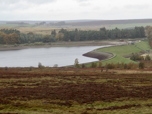
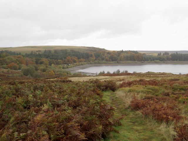
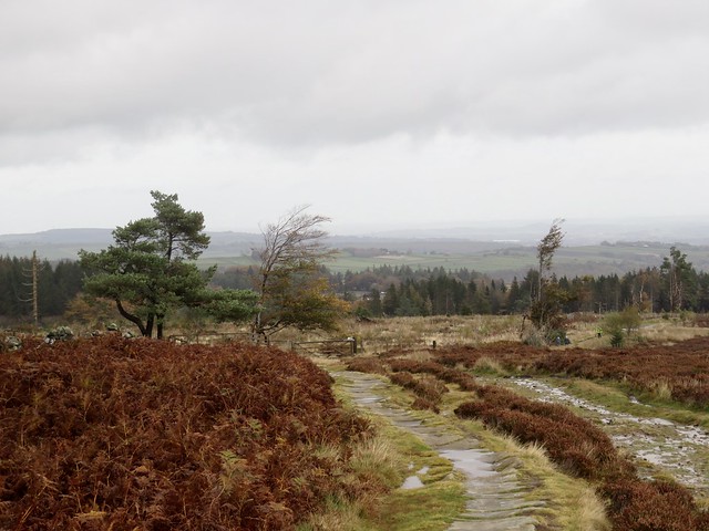
A gate led onto the open moor at Rud Hill, the winding path a glinting trickle of water among bracken and rocks as the moors disgorged yesterday’s rain. There was something bracing and exhilarating about tramping this watery path with the blustery wind in our faces and the three slit-grey eyes of the Redmires Reservoirs coldly winking below.
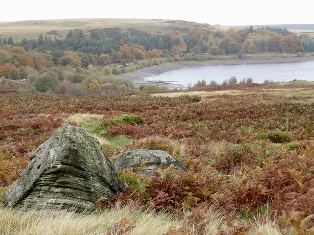
Down beside the reservoirs it was astonishing to note how far their water levels had fallen during the past summer of drought. These water stores were built up here in the 1830s and 40s after an outbreak of cholera in nearby Sheffield had claimed more than 400 lives. Drinking-water unpolluted by sewage was desperately needed in a city that had doubled in size since 1800 but still relied on medieval drainage.
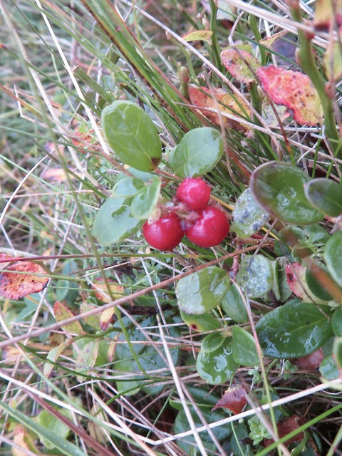
We stopped to watch a flock of fifty mistle thrushes descend to strip a rowan of its orange berries, then turned along the stony upland track of the Long Causey. Roman soldiers laid it out, packmen and their horses crossed the moors along its cobbled roadway. Today it was runners and walkers who passed the trackside verges where the bright scarlet fruit of cranberry added a dash of colour to the sombre grey of the stone and the foxy brown of the moors.
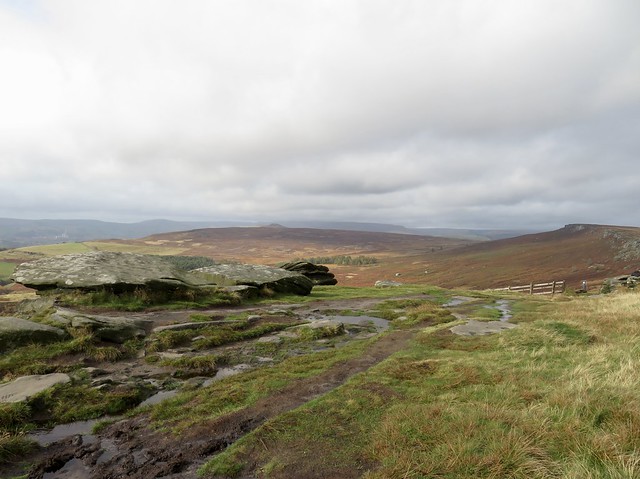
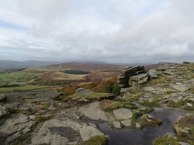
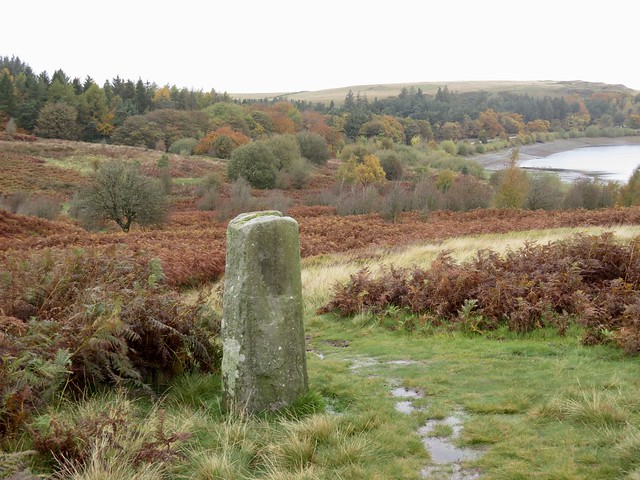
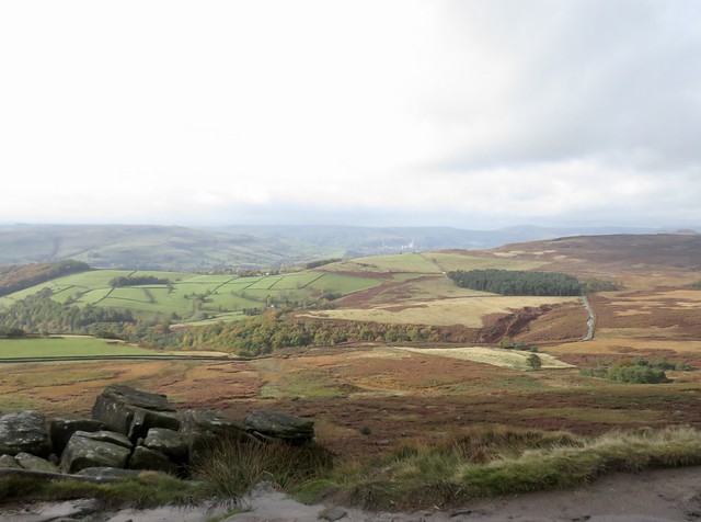
Stanage Pole stood tall among its rocks, a waymark for travellers since medieval times. Here we crossed from South Yorkshire into Derbyshire. The Long Causey dipped to Stanage Edge and a tremendous southward view across an undulating green valley to where the landscape rose towards the limestone uplands of the White Peak.
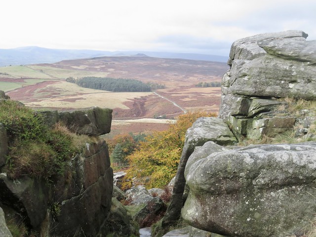
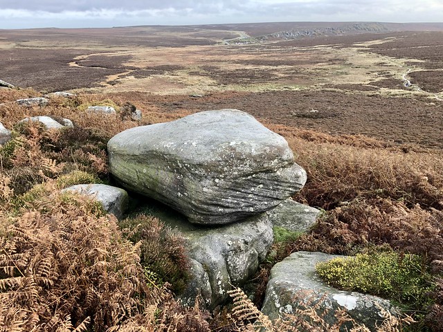
The homeward way led along Stanage Edge, a gritstone cliff filled with landscape dramas in its own right. The finely layered rocks had been weathered into faces, towers, animal shapes, stacks of pancakes. Helmeted climbers’ heads popped up over the edge, children jumped yelling off the rocks, and the wind blew everyone inside out. What a wonderful natural playground, halfway between the earth and the clouds.
How hard is it? 7½ miles; easy gradients, but watch your step; stumbly rocks, boggy patches, rough moorland paths.
Start: Fulwood Lane car park, near Norfolk Arms Hotel, SN10 4QN (OS ref SK 285840)
Getting there: Bus 258 (Sheffield)
Road – Fulwood Lane is beside Norfolk Arms, Ringinglow Road, S11 7TS
Walk (OS Explorer OL1): Right along Fulwood Lane. In ⅔ mile at right bend, ahead (277845, ladder stile) on green lane (permissive path). In 400m, through gate onto moor (273845); boggy but clearly trodden path with occasional waymark posts. In 1 mile descend from White Stones (261845 approx) to stile (258849). Left across bridge; left up stony Long Causey (257851). In ¾ mile pass Stanage Pole (247844); in 500m, left along Stanage Edge (241843 – watch your step!) for 1¼ miles to trig pillar (251830). Bear a little left; in 200m drop down through rocks on right (253830); left on path to Upper Burbage Bridge (259830). Left along road (path on left verge). In 1¼ miles opposite forestry plantation on right, left (279834, gate) on moor path. In 400m, just past white ‘gate’, fork right (278838, waymark post) to wall stile (280840). Diagonally across field; stile; across field, keeping right of wall, to Fulwood Lane (285842). Right to car park.
Lunch/Accommodation: Norfolk Arms, Ringinglow Road (0114-230-2197, norfolkarms.com)
Info: peakdistrict.gov.uk