Up on the border between Co. Tyrone and Co. Donegal we parked the car and set out – Martin Bradley, Jane and I. Martin, Tyrone’s countryside officer and a man who knows his bog myrtle from his sphagnum moss, had told us of an ancient path he thought he’d spotted, unsuspected and little walked, hurdling the high bogland of this western corner of Northern Ireland.
First published in: The Times Click here to view a map for this walk in a new window


Facebook Link:
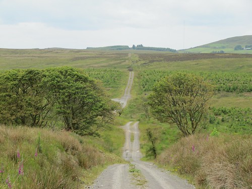
As soon as we’d cleared the plantations and were walking north in open country, there was no mistaking The Causeway – a broad strip of trackway running straight as a die out of the Donegal uplands and into those of Tyrone. There’s nothing quite so enticing as the sight of an ancient track making a bee-line from one horizon to the other. It beckons you to follow where millennia of feet of hooves, cart wheels and sled runners have forged the straight way.
;)
Huge views unfolded as we walked The Causeway, east to the rounded profile of the Sperrin Hills, north-west to the hills of Donegal and the faint and far blue shark-tooth of Mt Errigal, 30 miles off. What was The Causeway, in Martin’s opinion? A pilgrim path or a trade route? ‘Well, I think it could be at least two thousand years old, maybe older – perhaps Iron Age. See how well kept it’s been in the past, with stone culverts and proper ditches? It’s always been well used.’
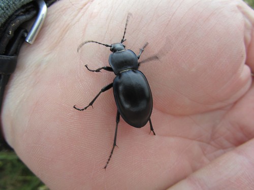
It certainly has. Stories from the Second World War tell how the ration-hit farming families of West Tyrone were kept supplied with milk, meat, butter and other delights, courtesy of illicit cross-border consignments along The Causeway from the Republic of Ireland. Now the bog is invading the old track, spreading it with bedstraw, orchids and tormentil.
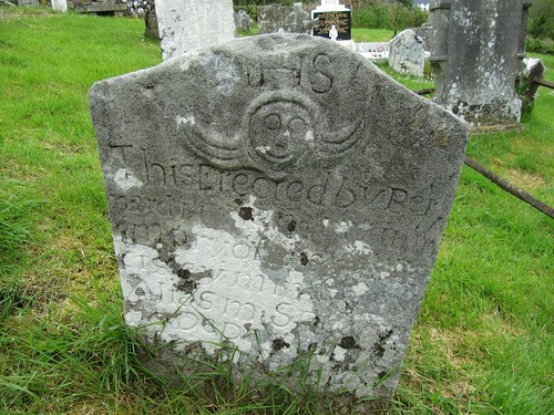
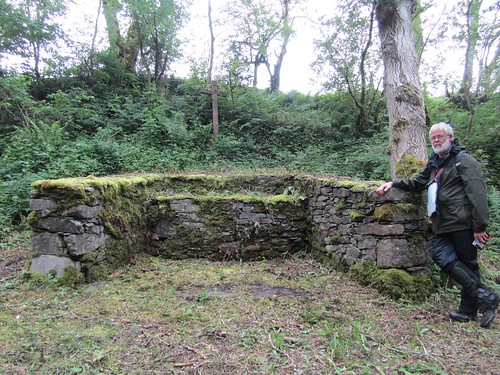
Down in the valley below we turned along a country lane to find a clandestine Mass Altar in Mellon’s Glen, the ancient church and graveyard of St Caireall, and the gently bubbling holy well where St Patrick once stopped to refresh himself. The wild uplands and small valleys of Wet Tyrone hold a secret round every corner; all you need to find them is a good pair of boots and a wealth of curiosity.
Start: Causeway Hill, Shanaghy Road, near Killeter, Co. Tyrone (OS of Northern Ireland ref: H163750)
Finish: St Patrick’s Well, Magherakeeel
Getting there: (2 cars): From Castlederg (B72 or B50) follow Killeter signs. From Killeter, follow ‘St Patrick’s Well, St Caireall’s Church’.
Leave one car opposite holy well; continue in other car to T-junction; left on Shanaghy road for 3 miles (5 km). Opposite small quarry with double gates on right, turn left along rough track past ‘Give Way’ sign. In 150 m park on bend by barrier (‘Causeway Hill’ waymark).
WALK (6 miles/8 km; easy but boggy; OS of N. Ireland 1:50,000 Sheet 12):
Yellow arrow points right, but you go left past barrier. Follow The Causeway for 3 and three quarter miles (6 km). At foot of lane (yellow arrow), left along country road. At ‘Mellon’s Glen’ signboard, detour left through gate. In 50 m, right at cross-inscribed stone to Mass Altar. Return and continue along road. At T-junction, left and left again up Magherakeel Road. Pass lime kiln and St Caireall’s Church to return to St Patrick’s Well.
LUNCH: Picnic
ACCOMMODATION: Marian McHugh, Glen House, 30 Aghalunny Rd, Killeter BT81 7EZ (028-8167-1983) – offers drop-off and pick-up at start and finish of walk.
GUIDED WALKS: Martin Bradley (028-7131-8473; 079-2678-5706; Martin 839@btinternet.com)
MORE INFO: Omagh TIC (028-8224-7831); www.discovernorthernireland.com
www.ramblers.org.uk www.satmap.com www.LogMyTrip.co.uk
Click on Facebook “Like” link to share this walk with Facebook friends.