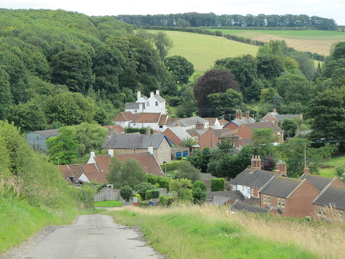
In a cleft of the north Lincolnshire wolds sits Rothwell, a neat little village of estate houses with tall gables and fancy brickwork.
First published in: The Times Click here to view a map for this walk in a new window


Facebook Link:
You could drive past on any of the nearby main roads and never know Rothwell was there at all, so low and modest is its stance in this wide-rolling landscape of sheep pastures and iron-rich ploughlands.
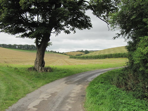
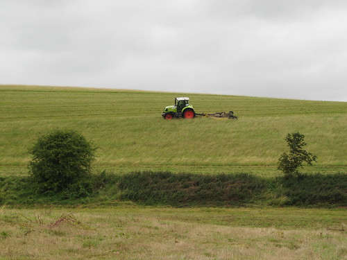
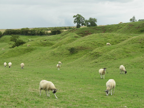
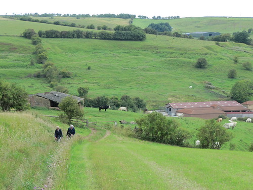
As I left Rothwell and began the gentle climb to the high wolds, sparrows chattered in the hedges and an amorous pigeon in a copper beech insisted, in a throaty murmur, ‘I lo-o-ove it – do you?’ The long driveway to Rothwell Top farm was fenced with traditional wooden palings. Fat white sheep cropped the fields that rose to a crown of woods sighing and tossing in the strong westerly wind. The slopes of the valley folded one beyond the other, giving the land a billowy look – neat, ordered, settled country. Shooting country, too. Partridges rocketed low over the grass, and young pheasants ran away with a rocking and rolling gait like a file of drunken sailors on speed.
Rothwell Top sits on the crest of the wolds, solid and brick-built round its farmyard. The path led on through big fields sibilant in the wind – tangles of oilseed rape crackling, thistles and docks whispering, barley heads rustling together. Great curtains of dense rain moved grandly across the wolds a mile or two north, but none fell on me.
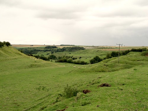
At Acre House I turned aside down the hidden cleft of Nettleton Beck. All that’s left of the valley’s former ironstone mining and chalk quarrying is lumps and bumps, distorting the smooth grass of the valley sides like trolls’ knees under a green blanket. In a tangle of trees half-way down I found a series of arched tunnel mouths, filled in with bricks, driven into the soft hillside – poignant memorials to a once-thriving local industry.
I turned east, up and out of the valley, through a bog where water mint lent a pungent smell to my pinching fingertips. Up an old cart track, across the roof of the wolds once more, and down to Rothwell – church tower, then red roofs and white houses coming into view until the whole deep-sunk village lay spread at my feet.
Start: Blacksmith’s Arms, Rothwell, nr Caistor, LN7 6AZ (OS ref TF151996)
Getting there: On eastern outskirts of Caistor, take B1225 (‘Rothwell’). In ¾ mile, left to Rothwell.
WALK (8½ miles, moderate, OS Explorer 282):
From Blacksmith’s Arms, cross road, right up Beckside. In a ¼ mile, right through gate (151992; bridleway, blue arrow/BA). Follow tarmac drive (BAs, ‘Footpath’) for 1½ miles to Rothwell Top Farm (139978); on to B1225. Left for 300 m; right (134972; BA, fingerpost) on field path for 1 mile. At gate near Acre House, right (117969; ‘footpath’ fingerpost; ‘Viking Way’/VW). Aim diagonally right, down and across Nettleton Beck valley. 50 m before first cross fence/hedge, VW at corner of hedge on right points to kissing gate (120971, VW). Follow VW down valley on right bank of beck, into woodland (123982, VW). Pass mine entrances; follow VW and yellow arrows for another ¾ mile. Pass reservoir; right (117995; ‘bridleway’) up track, passing ruined farm. On to cross B1225, then Rothwell Road (133001); on for 4 fields/nearly 1 mile. At wooden gatepost in hedge gap on right, turn right (147009; 4-finger post; bridleway, ‘Lindsey Loop’) for nearly a mile to Rothwell.
LUNCH: Blacksmiths Arms, Rothwell (01472-371300; www.blackiespub.co.uk) – friendly folk, filling food.
ACCOMMODATION: Advocate Arms, 2 Queen Street, Market Rasen LN8 3EH (01673-842364; www.advocatearms.co.uk) – cheerful restaurant-with-rooms.
INFORMATION: Lincoln Visitor Information Centre, 9 Castle Hill (01522-545458); www.visitlincolnshire.com
www.ramblers.org.uk www.satmap.com
www.LogMyTrip.co.uk