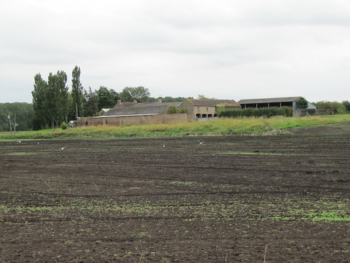
The flatlands of East Yorkshire, south of Driffield around the River Hull, are really tremendously flat – former ‘carrs’ or wet lowlands, now drained and intensively farmed, but retaining the bleak and magnetically compelling atmosphere that large tracts of level wet country always seem to possess.
First published in: The Times Click here to view a map for this walk in a new window


Facebook Link:
Nineteenth century drainage made this a fertile arable region, and 20th-century intensive agriculture reaped the rewards. Farms lie scattered across the carrs, which still obstinately continue to flood in some winters.
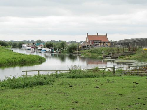
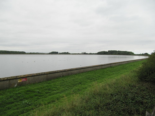
This superabundance of water feeds the city of Hull to the south, courtesy of Tophill Low Water Treatment Works, handsomely built with its two big reservoirs after the Second World War. The twin fleets of water at Tophill Low, and the scrub woodland and grassland that have been developed around them, make a superb resource for bird-watchers – and walkers too.
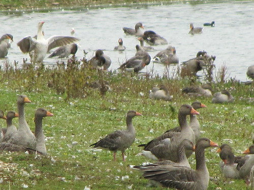
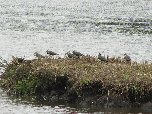
I started my walk in the Tophill Low Nature Reserve, making a leisurely circuit of the ‘O’ and ‘D’ reservoirs, ducking in and out of the hides to scan the waterfowl through binoculars – cormorants with wings akimbo, greylag geese flapping their wings in mid-preen, peewits with crests erect and wheezy complaining calls, tufted duck anchored in line astern. The waterworks gave off a strong whiff of old-fashioned industry with their cast-iron control wheels, tanks, sluices and stern admonitory labels – ‘Raw water bypass valve – must not be operated without written authorization from the Director of Operations.’
Musing on raw water, an image at once potent and sinister, I let myself out of the reserve through a gate and entered the wide, flat landscape of Watton Carrs. Fields of wheat and grass, heavy dark woods, drains, ditches and lonely farms. I passed the walled barnyard and poplar-sheltered house of Standingholme Farm, and the big battery sheds at Decoy House. Here wildfowlers once lured wild duck to the catch-net with the cries of tethered decoy birds, back when the carrs were a floody fenland and their inhabitants struggled for a hand-to-mouth living.
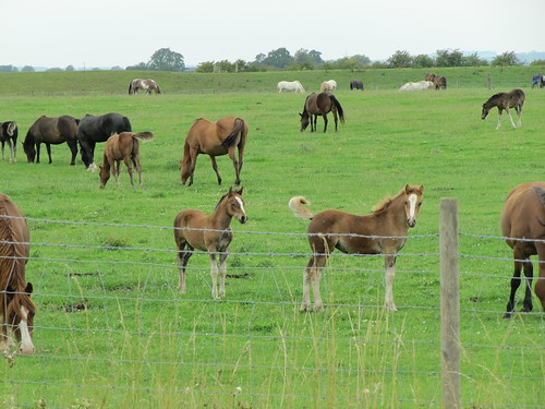
South to Easingwold Farm along the edges of bean and potato fields, on through thistly sheep meadows to find dozens of horses cropping the pasture around Wilfholme Landing. The River Hull sinuated north and south, a slow green flow edging the perimeter of Tophill Low Nature Reserve. I petted the soft muzzle of a chestnut mare, passed the time of day with a couple of young riders, and made my way back up a tunnel of trees where a sparrowhawk in brilliant orange, black and white flickered like a dream of beauty and wildness before me.
Start: Tophill Low Nature Reserve car park, near Driffield, E. Yorks YO25 9RH (TA073485)
Getting there: Tophill Low is signposted from A164 (Driffield-Beverley) at Watton. Follow ‘Nature Reserve’ signs to car park.
WALK (6 ½ miles, easy, OS Explorer 295):
Facing parking/permit ticket machine, go left through gate, then right round ‘D’ Reservoir. At north end (077495), right; in ¼ mile, through gate (079499, yellow arrow/YA); left over footbridge (YA), along field edge. In ⅓ m, at corner of poplar plantation, left through kissing gate (073501, YA); right along farm drive. Pass Decoy House farm (064497), in 250 m, left (fingerpost) down 3 field edges to cross road (065485). Up Easingwold Farm drive (fingerpost); over stile; bear left, then right between barn and farmhouse, over stile and on with fence on left. In 100 m fence curves gently left; in another 50 m, it turns sharp left; keep ahead here, curving right to go through gate near pylon (063478). Left along Starberry Drain. At top of slope at Wilfholme, through gate (062473); immediately left through gate (blue arrow); left along River Hull. Through gate; in 100 m, fork left at Nature Reserve sign (064473), away from river along right bank of drain. Continue for ¾ m to road (070483). Right into Tophill Low water treatment works. Right along road (brown ‘Tophill Low’ Reserve sign). Round left bend; in 100 m, by wheel on concrete plinth, right across footbridge. At ‘O’ Reservoir embankment, right (070481) to make circuit of reservoir and hides. Back on waterworks road, right to car park.
LUNCH: Picnic
ACCOMMODATION: Star Inn, Nafferton, near Driffield, YO25 4JW (01377-255548)
TOPHILL LOW NATURE RESERVE: www.yorkshirewater.com/tophill
Information: Beverley TIC, 34 Butcher Row (01482-391672); www.visithullandeastyorkshire.com
www.LogMyTrip.co.uk
www.ramblers.org.uk www.satmap.com