Llanarmon Dyffryn Ceiriog – The little village with the big name lies in a cleft of the Berwyn foothills, a corner of north-east Wales not exactly unknown, but out of the main tourist stream by quite a long way.
First published in: The Times Click here to view a map for this walk in a new window

Facebook Link:
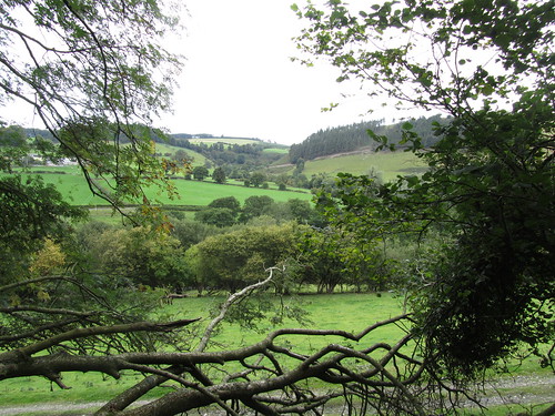
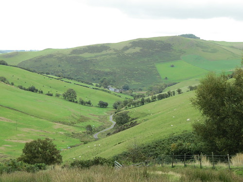
Leaving The Hand Inn, we found a sky of luminescent silver patches and grey clouds drifting over Llanarmon Dyffryn Ceiriog. The little village with the big name lies in a cleft of the Berwyn foothills, a corner of north-east Wales not exactly unknown, but out of the main tourist stream by quite a long way. The valley of Afon Ceiriog winds between bulgy slopes of sheep pasture and high moor tops, with forested ridges marching against the sky – wonderful walking country, especially on a bright and blustery day such as this.
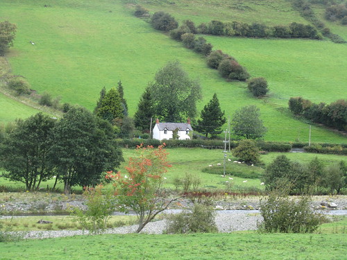
They would have flooded the valley in 1923, drowning Llanarmon DC and its neighbouring villages, if ex-Prime Minister Lloyd George hadn’t headed a massive Welsh protest against a scheme the locals saw as being for the benefit of foreigners, specifically the brewers of Warrington. ‘The English are taking the Water out of Wales and turning it into Ales,’ was the clunky, but effective, slogan that helped kill off the scheme. We gave thanks for that as we halted at a gateway in the long lane leading up to the hilltops and looked down over Tregeiriog village nestling deep and dry at the foot of a wooded cleft, picturesque Wales encapsulated in one perfect view.
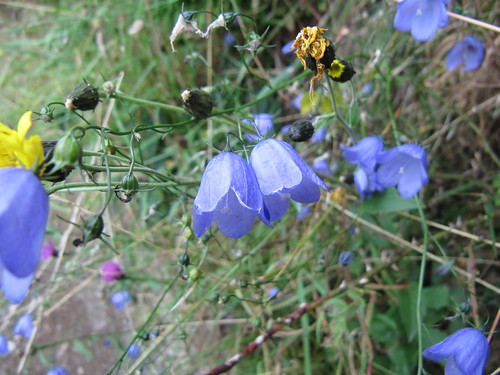
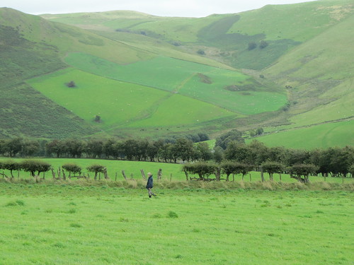
Harebells trembled in royal blue clumps, yarrow’s tiny white blooms massed in wide flowerheads. A clutch of young pheasants scuttered ahead, wheezing plaintively. Up near the ridge we turned west into the wind along the Upper Ceiriog Way, a rutted and puddle old track surfing the uplands. Ahead stood the crests of the Berwyn Hills, a sombre brown wave breaking from the west in a wall of 700 ft cliffs revealing themselves slowly as we advanced – Moel Sych and Cadair Bronwen flanking Cadair Berwyn, the summit of the range at 2,723 ft (830 m). The last time I was up there it had been in a rainy mist so thick I’d had to turn back. Today the cloud army was marching north-east, well clear of the peaks.
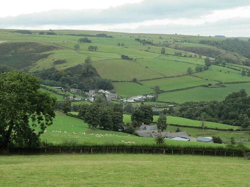
We stopped in a sheltered hollow for a cup of tea, and then went down the old hill track to the farm at Cyrchynan-Uchaf. House and barns lie sunk into the head of the valley in a very lonely spot. Two chained dogs barked us in and out, their sore-throat complaining soon overlain by the bleating of sheep as we topped the hill beyond and looked down on Llanarmon DC once more.
Start & finish: The Hand Inn, Llanarmon Dyffryn Ceiriog, Clwyd LL20 7LF (OS ref SJ157328)
Getting there: Bus: Service 60, 64, 65 from Oswestry and Chirk (01978-266166)
Road: A5, A483 to Oswestry, B4679 to Glyn Ceiriog, B4500 to Llanarmon DC
WALK (6 miles, moderate, OS Explorer 255):
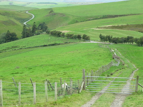
From The Hand, right along road (‘Oswestry’). By plantation on right, fork left through gate (161326, yellow arrow/YA). Track past stone building (YA). Through gate, across hillside, over stile, across field and through gate (165328). Ignore ‘footpath closed’ notice; right over stile, left along fence above Ty’n-y-fedw. At gate (166329) white/red arrow (WRA) points right. Don’t go through gate; keep fence on your left, into and along lower edge of wood (WRA), then across field to gate (176335). Right up lane. In 100 m, tarmac forks left; but keep ahead up stony lane. In ½ mile cross road (171327); on up lane. Cross stream with wood on left (172323), in 100 m, right along broad rutted Upper Ceiriog Way track for 2 miles to road (146309). Left; over stile by gate; diagonally left over field to gate. Boggy stretch joins track curving right along hillside. Through gate (144310); descend track to Cyrchynan-Uchaf farm (145314). Bear right across road-head, up through farmyard (vociferous but chained dogs!); right round barn, through gate (145315), up cart track. It rises through gates (follow YAs) to join another track at hill crest (151320). Follow YAs down hill slope. At bottom, through left-hand of 2 gates (155323), down green lane to road. Left to Llanarmon DC.
NB: No dogs – sheep country. Online map, more walks: www.christophersomerville.co.uk
Lunch and accommodation: The Hand Inn, Llanarmon DC (01691-600666; www.thehandhotel.co.uk) – a warm, friendly inn, very helpful to walkers, with own walks booklet for sale.
Information: Llangollen TIC (01978-860828); www.visitwales.co.uk