It’s not often that I have the pleasure of a weekend’s walking with my London-dwelling daughter Ruth.
First published in: The Times Click here to view a map for this walk in a new window


Facebook Link:
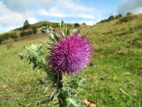
We’d fixed our sights on Shropshire and the Caradoc Hills, and today was exactly the kind of bright day we’d been hoping for, with a buffeting wind sending cloud shadows and floods of sunlight chasing across the land.
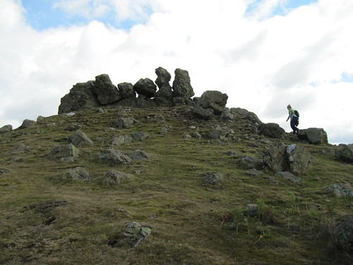
Climbing the steep slope to Three Fingers Rock from the secret valley under Helmeth Hill was all sweat and effort, but once we’d got up there it was as though we had been lent the keys of Heaven. How else to describe the pure exhilaration of this moment when the view and the wind burst on you in a single instant? We scrambled up to perch on the rocky Fingers and gaze round, gasping.
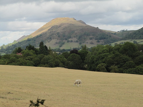
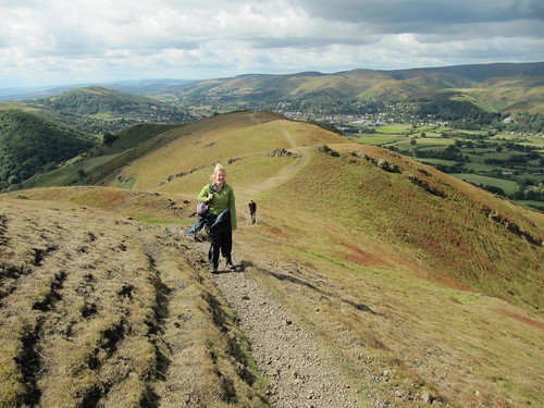
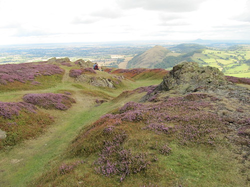
The ancient volcanic upthrust of the Caradoc Hills with its naked rock outcrops stretches north like a recumbent dinosaur, the double-humped back of Caer Caradoc and Little Caradoc dropping to a low neck before rising again northward into the long domed head of The Lawley. A mile to the west rolls the great rounded whaleback of the Long Mynd, and squeezed between them lies Church Stretton, Shropshire’s own alpine village. Up on the breezy spine of the Caradocs you feel you could lob a pebble straight down the chimney of Dudgeley Mill a thousand feet below.
We strode north on the short mossy turf of the ridge. Near the summit of Caer Caradoc the marbled wall of a volcanic dyke merged with the ramparts of an Iron Age hill fort, fabled scene of the last stand of Prince Caradoc or Caractacus against the all-conquering Romans.
A last linger over the immense view – the roll of the Long Mynd, the sharp cone of the Wrekin rising out of the Shropshire plains, The Lawley a mere hummock in the foreground – and we were bowling downhill over Little Caradoc. The homeward path was a tangled and a squelchy one by lost orchards, abandoned coppice groves and the mossy yard of tumbledown Hill House where abandoned dishes lay among wind-tumbled roof tiles. A climb over the bracken-smothered common of Hope Bowdler Hill among witchily twisted elder trees, and a descent to Hope Bowdler with the Shropshire fields and woods spread out for contemplation at our feet.
Start & finish: St Andrew’s Church, Hope Bowdler, near Church Stretton, SY6 7EN (OS ref SO 476924)
Getting there: Train to Church Stretton (1½ miles – www.thetrainline.com; www.railcard.co.uk). Road: A49 to Church Stretton; B4371 to Hope Bowdler. Park (neatly, please!) near church.
Walk (6 miles, hard grade, OS Explorer 217): Right along B4371; in 100m, left up driveway (475925; yellow arrow/YA). In 30m, bear left (‘Church Stretton, Gaerstones’) on path under trees and through fields for ⅔ mile, to kissing gate on left onto B4371 (468932). Right for 40m; right up farm track (‘Hope Bowdler, Gaerstones Farm’) past Gaerstones Farm. In ⅓ mile cross stile (472937; blue/orange arrow); in 50m, left over stile (YA), left along fence, then down track through wood for ⅓ mile. At bottom, right along track (471943). In 50m, bear left up green track; immediately sharp left, and straight up steep slope, crossing kissing gate (471944) to reach Three Fingers Rock (471947). On along spine of hills for ⅔ mile to Caer Caradoc summit (478954).
Steeply down, on over Little Caradoc (481960) and down to turn right along fence (483963). In ¼ mile, where it doglegs right and left (484960), cross stile (YA); ahead through bracken, aiming halfway down fence on far side of field, past YA post. Turn left past ruined Hill House (484957) to roadway below. Just before reaching it, turn right past ‘footpath’ post; on along grass path with hedge on right. In ¼ mile, over stile (484953; YA), and on with fence on left. At cross fence, over stile (483951; YA) and cross track, aiming towards Battle Stones rocky peak ahead. Descend with fence on left; at bottom, cross stile (484948; YA); down through trees and over stream. Up path, then over brackeny wet hillside, aiming for Battle Stones. Cross wired-up stile (485946; YA, ‘Access Land’); turn right along grass track, with hedge on right and brackeny Willstone Hill on left. In ¼ mile cross stile (481945); in 200m, sharp left at ‘Ride UK1’ post, diagonally left up hillside, aiming for rock outcrops. At saddle (482942) don’t go left, but keep ahead on grassy bridleway through bracken across Hope Bowdler Hill for 1 mile, down to B4371 in Hope Bowdler (478927). Right to church.
NB – Click on Facebook “Like” link to share this walk with Facebook friends.
Lunch: Royal Oak, Cardington SY6 7JZ (01694-771266; www.at-the-oak.com)
Accommodation: Raven Hotel, Much Wenlock TF13 6EN (01952-727251; www.ravenhotel.com) – comfortable, friendly hotel in the heart of walking country
More info: Shrewsbury TIC (01743-281200); www.shropshiretourism.co.uk
Walking With Offa: 12 walks with pubs in Shropshire AONB. Info/booklets – 01588-674095;
www.shropshirewalking.co.uk/walking-with-offa; Twitter @ShropHillsAONB
www.ramblers.org.uk www.satmap.com www.LogMyTrip.co.uk