They’ve seen a few winners at the Hollow Bottom; a few losers, too. The walls of this famous horse-racing pub in the north Gloucestershire Cotswolds are hung with jockeys’ silks, snapshots of grinning owners, racing mementoes and photos of our four-legged, long-faced chums in action.
First published in: The Times Click here to view a map for this walk in a new window


Facebook Link:
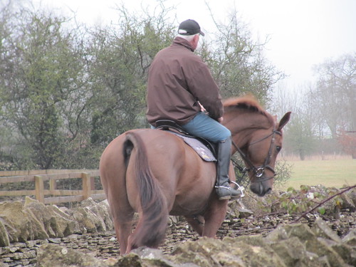
It’s a great place to stay the night if you’re after local atmosphere, because this is horse country nonpareil. If we saw one horse on our walk through the Cotswolds’’ most delectable corner, we saw a hundred.
After a night of rain the woods were full of cold mist above the valley where Naunton lay, a dream of rich gold stone houses and snowdrop gardens. Horses in blue blankets cropped the paddocks. Every hawthorn twig held a line of raindrops suspended, each drop reflecting a miniature world of inverted trees and walls. Up on the roof of the Cotswolds it was a wintry scene of sombre beauty, all bright colours leached away by the mist. A group of bullocks grazing at a mountain of silage in an isolated barnyard turned their muddy faces towards us as we walked by. ‘Hey, hey!’ soothed a hawk-faced little man leading a nervously shying colt along the lane, gentle authority in each of his gestures.
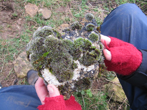
The sky began to clear as we came down towards Upper Slaughter. The view broadened to reveal wide upland fields dipping to hidden valleys. The horizons rolled with smoking cloud, and a weak sun came through to frost the lichen-encrusted ash trees with cold silver light.
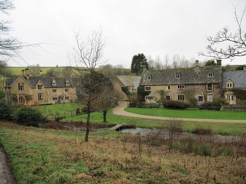
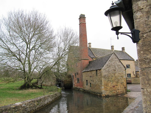
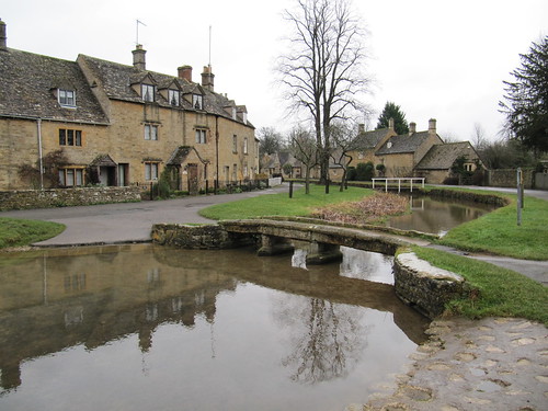
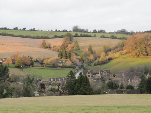
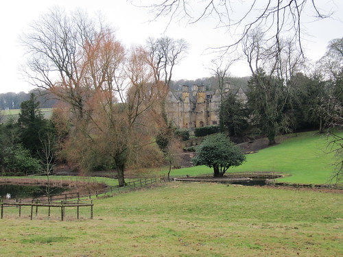
Upper Slaughter is everyone’s Cotswold dream made manifest – a gorgeous manor house with peaked gables, mullioned windows and tall chimneys, the church high on a bank like a ship on a billow, the whole village scented with apple wood smoke, a mellow fantasy. In Lower Slaughter the channelled waters of the River Eye ran under a diminutive stone footbridge. The plain red brick chimney of the old mill came as a relief to the eye after so much beautiful gold stone.
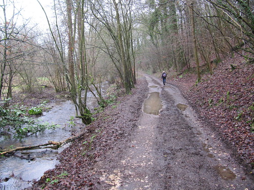
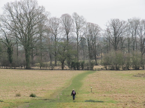
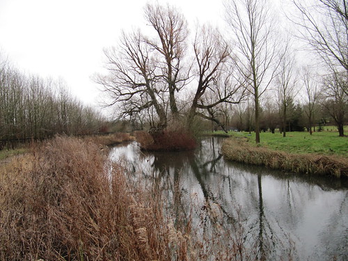
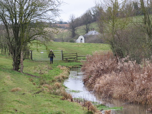
In a green lane beyond we stopped to hear a song-thrush fluting his twice and thrice repeated phrases from the hedge. The lane took us twisting down to follow the River Windrush in its tightly curving valley. Goldcrests swung in the treetops – gold seemed to be the theme today. We skirted the skittish horses beyond Lower Harford Farm, and came up over the hill and down towards Naunton with evening blackbird song echoing through the valley below.
Start and finish: Black Horse PH, Naunton, Glos GL54 3AD (OS ref SP119235)
Getting there: Road – M5, Jct 11a; A40, A436, B4068 towards Stow-on-the-Wold, Naunton signposted on left. Park in village street.
Walk directions (9 miles; easy/moderate; OS Explorer OL45): From Black Horse PH, right; in 50m, right up lane; in 150m, right (‘Wardens Way’/WW) on bridleway for ¾ mile to road (126243). Turn right through gate (WW) along field edges next to road. At T-junction (133242) continue along hedge; at field end, left to cross road (134241, WW). On along track opposite; in 300m, right through gate by barn (136243; blue arrow) and on (WWs) for ¾ mile to B4068 beside houses (149241). Left (WW – take care!) for 350 m; right (152242, WW) along driveway for ⅔ mile to Upper Slaughter. Follow road to The Square; left down to road; left (155232) for 150 m; right (156232, WW) down walled path. Follow WW through fields to Lower Slaughter. At road, right (164226) past mill; cross stone footbridge, up lane opposite.
At T-junction, cross road and keep ahead along green lane (161222; ‘Macmillan Way’/MW). In ⅓ mile cross road (157219); on across field (MW); through hedge, left (153218); follow MW into Windrush Valley. At path junction, right (151213; ‘Windrush Way’/WiW). Cross river; in 150 m, right (148213; WiW) through Aston Farm and on through fields and woods for ¾ mile. Leave wood (139220); in 250 m, through gate (138221); take left fork downhill. WiW for ¾ mile to road by Lower Harford Farm (129225). Left (WiW); in 100 m, right through gate (WiW). At foot of slope, left along valley bottom. At end of 3rd field, through gate (119226); right across brook; up slope to waymark post; on through gate (118227). Ahead to cross B4068 (117231). Down track opposite; in 100 m, right down path by fence; cross river, pass dovecote; right along lane to Naunton village street (116234). Right to Black Horse.
Lunch: Picnic; or Black Horse Inn, Naunton (01451-850565; www.theblackhorsenaunton.co.uk)
Old Mill, Lower Slaughter (01451-820052, oldmill-lowerslaughter.com) – really good tearooms; scrumptious flapjack!
Accommodation: Hollow Bottom Inn, Guiting Power, GL54 5UX (01451-850392; www.hollowbottom.com); famous horse racing pub, refurbished rooms, warm and friendly – especially around Cheltenham Festival races (13-16 March this year).
Info: Stow-on-the-Wold TIC (01451-870083); www.visitcotswolds.co.uk
www.ramblers.org.uk www.satmap.com www.LogMyTrip.co.uk
A terrific walk, thank you. We kept this from the Times in March 2012 but only walked it today. Fabulous directions from your web-site. One addition you might make is to mention the tea shop at the mill in Lower Slaughter. Being half way round it is ideal for a snack or lunch. They serve delicious flapjack! Thank you again. Paul