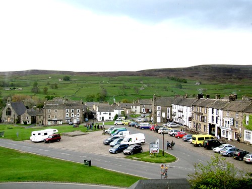
As we drove into Reeth at seven in the evening the quoits players were out on the village green in front of the Black Bull, getting in their game before the forecast rain arrived. First published in: The Times Click here to view a map for this walk in a new window

Facebook Link:
The solid clink of the hefty horse-shoe quoits, the joking voices of the players and the sunset view beyond the pubs and houses of Reeth to the high bare bulk of Harkerside Moor were just as Dales as could be.
Next day, looking out of the big windows in the Burgoyne Hotel above the green, we saw that the weatherman had got it plumb to rights – mizzling, drizzling rain moving through Swaledale. But what the hell? Jane opted for a coffee pot and laptop morning, and I got into everything waterproof I could find and went out into the damp day. The rain didn’t deter the blackbirds from doing their Eleanor Farjeon stuff among the wet gardens of Reeth, nor the hatless, coatless, careless schoolchildren carrying out a survey of the village with incredible cheerfulness in the drizzle.
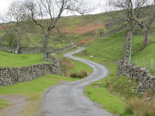
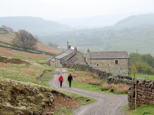
In the meadows along the River Swale, rain-pearled Swaledale sheep watched me go by, their curly horns twisted each side of their heads like a wartime telephonist’s hairdo. Swallows dipped low over the wide Swale, and the barking of a dog up at Riddings Farm high on the fellside came clearly down to me. I found a lane in the hamlet of Healaugh that took me up round the back of Calver Hill, out onto the moor where everything except the creaky-voiced lapwings was silent and still in the rain seething in from the west.
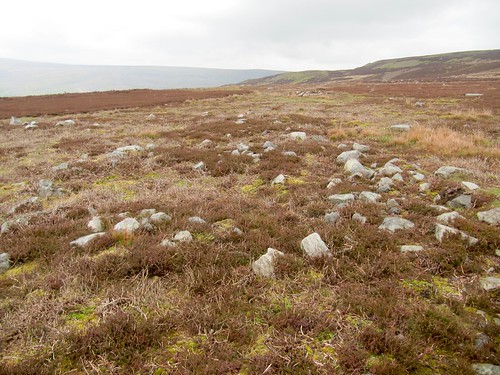
Out on the moor an ancient hut circle lay pinpointed on the Explorer map with the OS’s customary accuracy. It measured just seven strides across. Who knows how many inhabitants it sheltered from the rain all those thousands of years ago?
The path dipped over the saddle and wound down into remote Arkengarthdale, the dale sides scarred with creamy mounds of lead-mining spoil, the moor tops empty and magnificent. By West Raw Croft and East Raw Croft I found the homeward path, through narrow stone stiles and along the rushing Arkle Beck. It never stopped raining all day; and I wouldn’t have missed one moment of it.
Start and finish: Reeth village green, near Richmond, N. Yorks DL11 6SZ (OS ref NZ 039993).
Getting there: Bus Service 30 (Richmond-Keld).
Road: A1; A6136 or A6108 to Richmond; A6108 (‘Leyburn’), B6270 to Reeth.
Walk (8 miles, moderate, OS Explorer OL30. NB: online maps, more walks: www.christophersomerville.co.uk):
From Reeth village green, take alleyway just to right of chapel, beside Holmlea. At T-jct opposite Heatherdale Bungalow (038991), right along lane. In ¼ mile, left down walled lane (034991, ‘Harkerside & Grinton’). At River Swale, right (034990) along bank path. Pass end of Reeth swing bridge (032989 – don’t cross!); on along north bank of Swale. In ¾ mile, right (021988; ‘meadowland, single file’) to B6270 (020991). Left into village.
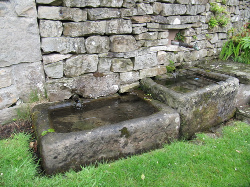
By three stone troughs, right up lane (019990). Steeply up to Thirns farmhouse (012995). Tarmac end; forward on stony lane. In about 200 m, fork right uphill (010996) on a clear stony track. In 150 m, wall on right makes right-angle turn uphill. In another 50 m (008997) look for small cairn of stones on right; fork right here up grassy track between angle of wall and lower stony track. Follow grassy track (fairly clear, occasionally cairned) for 1 mile, over saddle (004004), past hut circle (005006 – detour) to meet a stony track (004009). Right for ½ mile to road (010015). Right; in ½ mile, left down gravel track (018012; fingerpost) to West Raw Croft farm (023016).
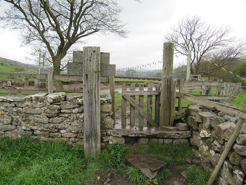
Don’t follow stony track in front of house, but keep right of wire fence, through gate. Bear half right up field, aiming for right end of line of trees. Through stone stile (yellow blobs/YB); follow stone wall on your left. At end of field go through gate (025012); over stream, past rock with YB; on through 2 more stiles, then left down farm track (027008, ‘Fremmington’ fingerpost) to cross Arkle Beck. Up farm track; bear right to go through gate just to right of Castle Farm House (030008; YB). Cross garden in front of house; through opposite gate/stile; on through fields by stiles (YB).
In ¼ mile, nearing Arkle Beck, follow ‘bridleway’ sign uphill (035005). In 250 m go through stone wall (037004); in another 250 m, through another wall (039003) and slant right downhill to track below. Turn left along it, through gate; follow fence on right downhill above Arkle Beck. At bottom, right through stile (040997; fingerpost); left along field path parallel with Arkle Beck. Through wall gaps and stiles for ½ mile to B6270 (042992); right across Reeth Bridge into Reeth.
Conditions: Moor path over Calver Hill is not advisable in mist
Refreshments: Picnic: many pubs, cafés in Reeth
Accommodation: Burgoyne Hotel, Reeth (01748-884292; theburgoyne.co.uk) – immaculately kept and run
Information: Reeth National Park Centre (01748-884059); yorkshire.com
www.ramblers.org.uk www.satmap.com www.LogMyTrip.co.uk